I am glad I will not be young in a future without wilderness — Aldo Leopold, scientist and author, New Mexico Forester, and architect of the modern Environmental Ethics movement.
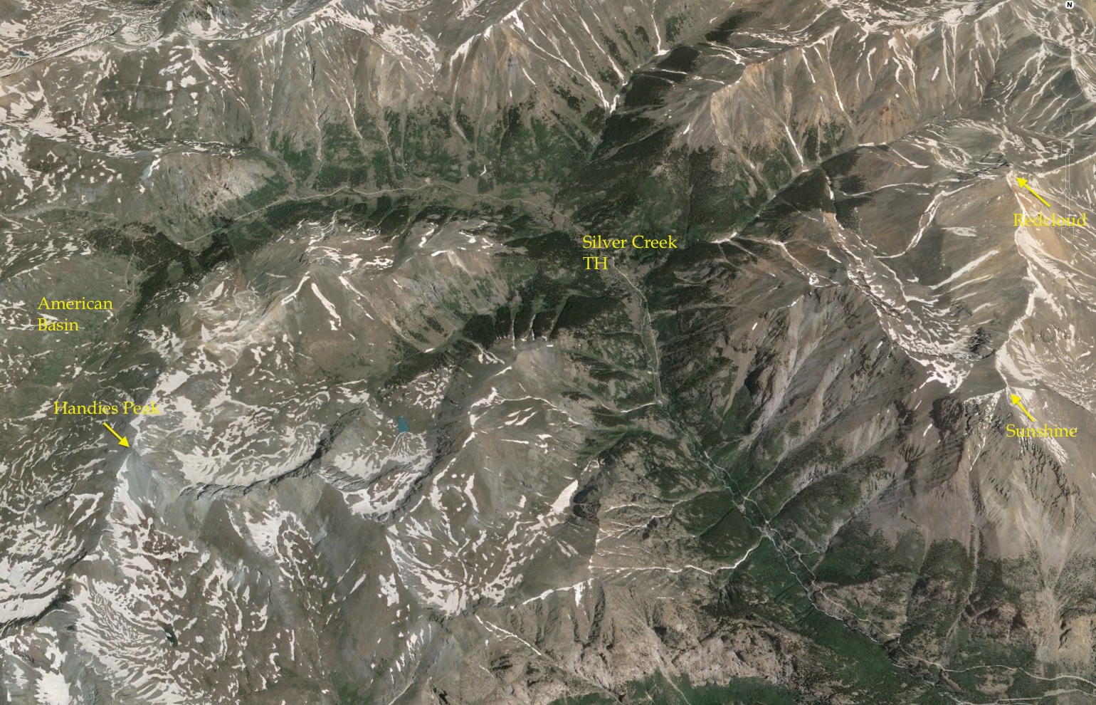
A romp through the San Juans – three 14ers and a collapsed caldera. The run started at the Silver Creek Trailhead, up to Redcloud, over to Sunshine, back to the Trailhead and then looped around Handies Peak. A figure-8 course of high altitude bless. click on pictures to make them large format
“Why do you like to run?” – a question I often get asked. I usually make up some answer to steer the conversation back away from emotional strands to more comfortable analytic themes. In fact, I don’t like to just “run” – I am not really very good at it (if being good is measured by being speedy), and although I run most every day, my joy is found ON the run, especially along rough and rocky wilderness trails where the enormity of nature overwhelms prosaic modern life. The irresistible forces of geology, the incredible delicate touch of nature that can make even the smallest flower bloom with perfectly symmetry, winds that carry no smells made by man – these are the things that unleash astounding joy. At the end of the day I like having accomplished something difficult in a run, but that is more about being a driven personality; it is the joy of nature that makes running so essential to me.
Most any trail can unleash nature, but there are some very special places for me that are beyond the pale. The San Juan Mountains are my personal enchanting wilderness; not only are the mountains and geology stunning, but rich history of minerals and rugged miners are backdrops to a place that I have visited for more than a half century. The wilderness here is stark – miles and miles of exposed ridges and peaks far above timberline. But surprisingly, there is evidence everywhere that prospectors touched and turned over rocks in the most inhospitable places; nature is supreme, but the San Juans have been a siren for hundreds of years for people like me.

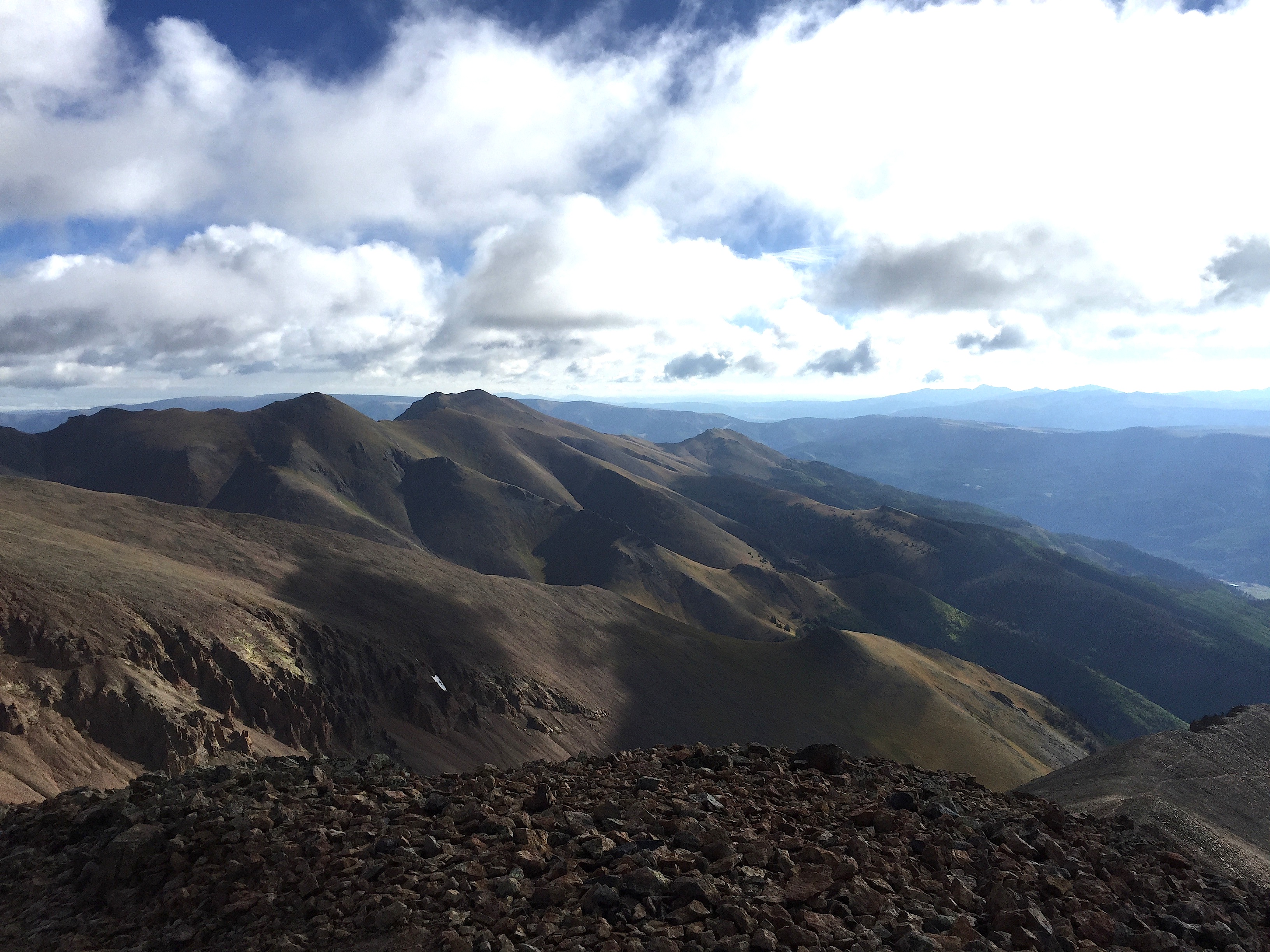
Top of Handies Peak (9/6/15) looking north after a brief storm. The San Juan Mountains have miles and miles of rugged peaks above tree line. Near Lake City, the Red Cloud Wilderness Study Area is nearly 40,000 acres with 34 peaks above 13,000 ft.
Despite my motivation of joy of running in nature and an espoused aversion to “racing”, I do seek out and enjoy organize ultra trail runs. I choose interesting places – mostly based on geology or history – and toe the line on a half dozen 50+ km races per year. I try to run fast, but in reality, I am a jogging geoscientist. I am happy with that, but hate failure nevertheless. Earlier this year I stumbled and fell during a glorious race in the San Juan Mountains known as the San Juan Solstice 50 miler (SJS50). I have unfinished business with this race, and have focused training around next year’s event. Of course, this means “training” by returning and running often in the San Juan Mountains.

Summiting Red Cloud, day II of the Heart of the Caldera. This picture is about 35 minutes after first sunrise, and about 13,500′ in elevation. Fantastic terrane!
The Runs: Familiar mountains, but a long journey
I decided to set up a trail run(s) within the Lake City Caldera and enjoy the high San Juans before winter once again shroud the peaks in impassable snow. Labor Day weekend traditionally marks the change in session in the San Juans – although it is quite common to have great weather into mid-October, it is also not usual to get freakish September snows, making running above 13,000 feet a Darwin-Award type event.
Day I of the Heart of the Caldera was a modest 16 miler in the northeast part of the Lake City Caldera. The route was inspired by the San Juan Solstice 50 M; the path follows Alpine Gulch (a major north-south drainage into Henson Creek) to a pass between Red Mountain and a peak known as 13,881 (many unnamed peaks are only denoted by their elevations). From the pass, which has an elevation of approximately 11,770 ft, the route climbs and then follows a ridge line to 13,811. It is a scrabble of about 700 feet to the smooth summit of 13,881 – it is also incredibly peaceful and isolate. No trail, no people! From the summit of 13,881 the route is a backtrack with a side scrabble up another prominent peak, Grassy Mountain (elevation 12,821 ft).
The weather forecast for September 5, called for significant rainfall starting at about 11 am. There had been plenty of rain the previous couple of days in the area, and when I started the run at 6:30 am it only took 1 mile or so before I was soaked to the bone from the dew provided by the heavy growth of the underbrush. Compared to the SJS50 in late June, the Alpine Gulch Trail was barely passable (or even visible!) due to the summer growth. The stream was running with less volume than in June, but the 7 crossing required during the climb still meant wadding in ankle deep water. About 2 miles up Alpine Gulch the drainage splits into an East and West Fork; the East Fork leads to the pass and peaks beyond. Somewhere around 10,000 ft elevation, there is no sign of the trail, but a runner knows that you must keep heading upward. There are a number of mines (mostly small spoil mounds) along the valley that I did not notice during the SJS50. The stream meanders through the spoils, and obviously collects discharge from the old underground workings. The water is crystal clear, but the channel has a thick orange mud coating.

East Fork of Alpine Gulch. The water is clear, but there is a mud that probably represents iron minerals that flow out of the old underground workings of mines in the area.
Above 11,000 feet elevation it is possible to rediscover the trail, and running is easier (actually that is a mis-statement, running is never easy above 11,000 ft). Clouds begin to roll in, and I fear that storm is due any moment (my fear is for lightning, not rain – I can get no wetter…). A mist descends, and lowers the visibility, but no heavy showers or hail. I pass the saddle, which serves as the first aid station in the SJS50 at 1 hr and 40 minutes (4.8 miles). I had hoped for views, but all horizons look gray and wet.

A view of Red Mountain, home of some of the richest mines near Lake City. The view is from the ridge line on 13,881 looking due north. The iron stains are eponymous hero – signaling that hydrothermal solutions surged through the collapsed Lake City Caldera 5-8 million years ago.
The mists – or clouds – temporarily rose about 13,000 ft as I climbed up the ridge to peak 13,881. Still no great views, but I could at least gaze upon Red Mountain to the north (and know that Lake City was only a couple of thousand feet below). The picture above is taken about 5.5 miles into the run, and sense of isolation settles on me with great comfort. The clouds soon dropped to surround me with a thick gray curtain. It remained with me even as I summited 13,881 – I think the visibility was less than 20 yards. I quickly retraced the path way back, and headed for Grassy Mountain (or where I thought the peak was!). This is beautiful running county – all above timberline, and alpine grasses.
A few hundred ft below the summit of Grassy Mountain. The clouds shrouded the peak, giving the sense that perhaps this was Mt. Doom in Mordor.
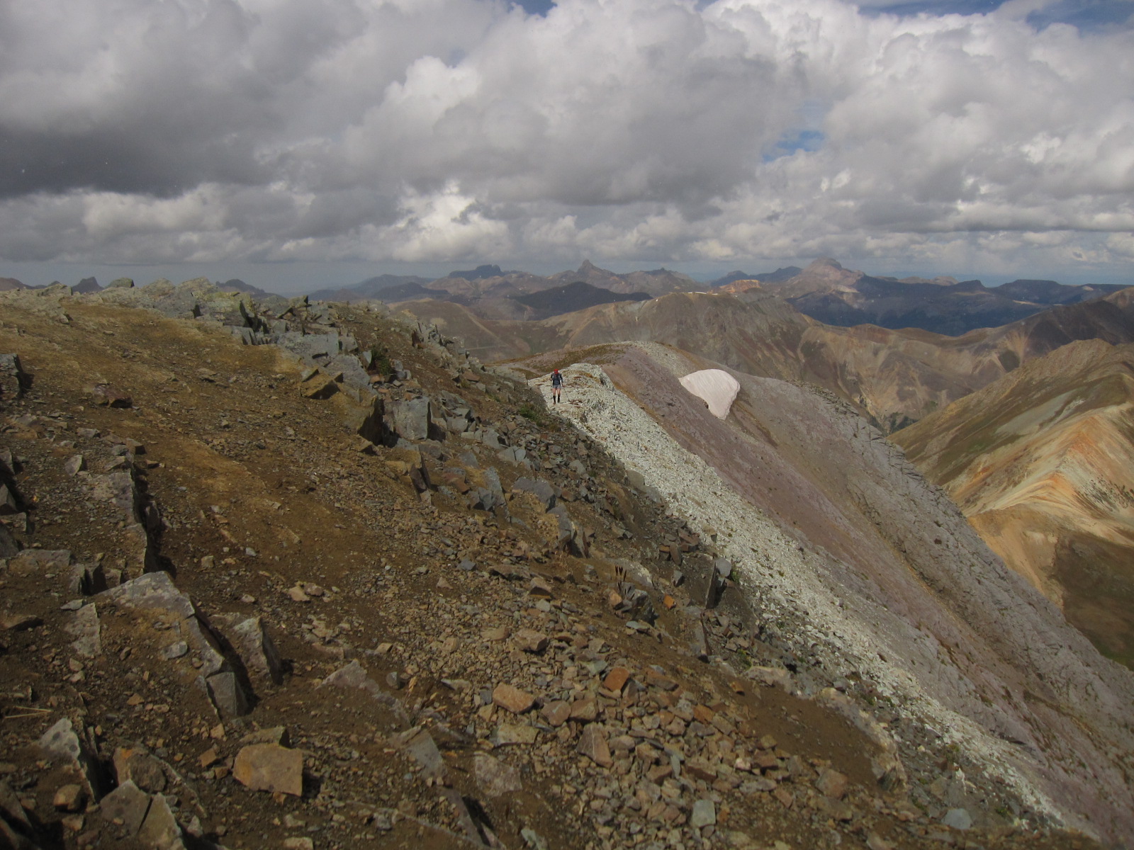
I climbed up Grassy Mountain – sort of strange name for a peak in the San Juans. On the flanks are alpine grasses, but in the clouds I only see crags. When I reached the summit I was surprised to find a peak register. I opened the log, and saw only 4 people had signed the register in the last 3 years. I guess Grassy Mountain is not on the beaten path. I was now at mile 9.2, and decided to eat some food before running back down the Gulch. I was rewarded with a temporary rise of the cloud, and captured a panorama of 13,811 and the ridge line defining its northern shoulder.

Panorama from the crest of Grassy Mountain towards peak 13881 (on the left hand side of the photo). The distance from Grassy to 13,881 is about 1.3 miles as the crow flies.
The descent back to the Alpine Gulch Trailhead was uneventful; for day one the mileage was just over 16 miles, and the elevation gain was 4,200 ft. I finished in 5hrs and 50 minutes, assuring that I could brag about a trail run with an average pace of under 3 miles and hour…but that would seem fast compared to day II of the Heart of the Caldera!
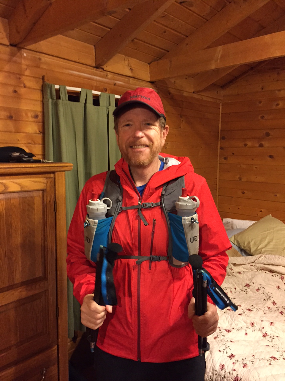
The second day I had advertised through the Mountain Trail Series, an excellent resource for trail runners in Northern New Mexico. I had proposed a run to the top of 3 14ers in the western edge of Lake city Caldera: Red Cloud (14,041 ft), Sunshine (14,006 ft) and Handies (14,058 ft). The trails connecting these peaks are straight forward, and is quite “runnable” although there is major elevation gain along the 24 mile route. Labor Day weekend is a great time for a trail run – but that also means there are LOTS of trail runs, and the interest in what I call the “Figure 8 of fun” was mostly cheer leading. We started and finished the run at Silver Creek Trailhead, which is located in the center of the “figure 8”. Silver Creek TH is at an elevation of 10,400′; we started the run at 5:45 am on September 6, and quickly run (an exaggeration…) up the first couple of miles of Silver Creek in the dark. The temperature at the start was 34 degrees, which is pretty nice when it is dry and there is no wind. We pass about 10 groups of hikers that had an even earlier start on the day than we did. Silver Creek gets its name from the stain it leaves on the rock – not from any great silver deposits in the surrounding peaks. There are some molybdenum deposits in the valley, and these deposits carry some easily dissolved aluminum which precipitates out on the stream boulders giving them the look of the moon when it is full.
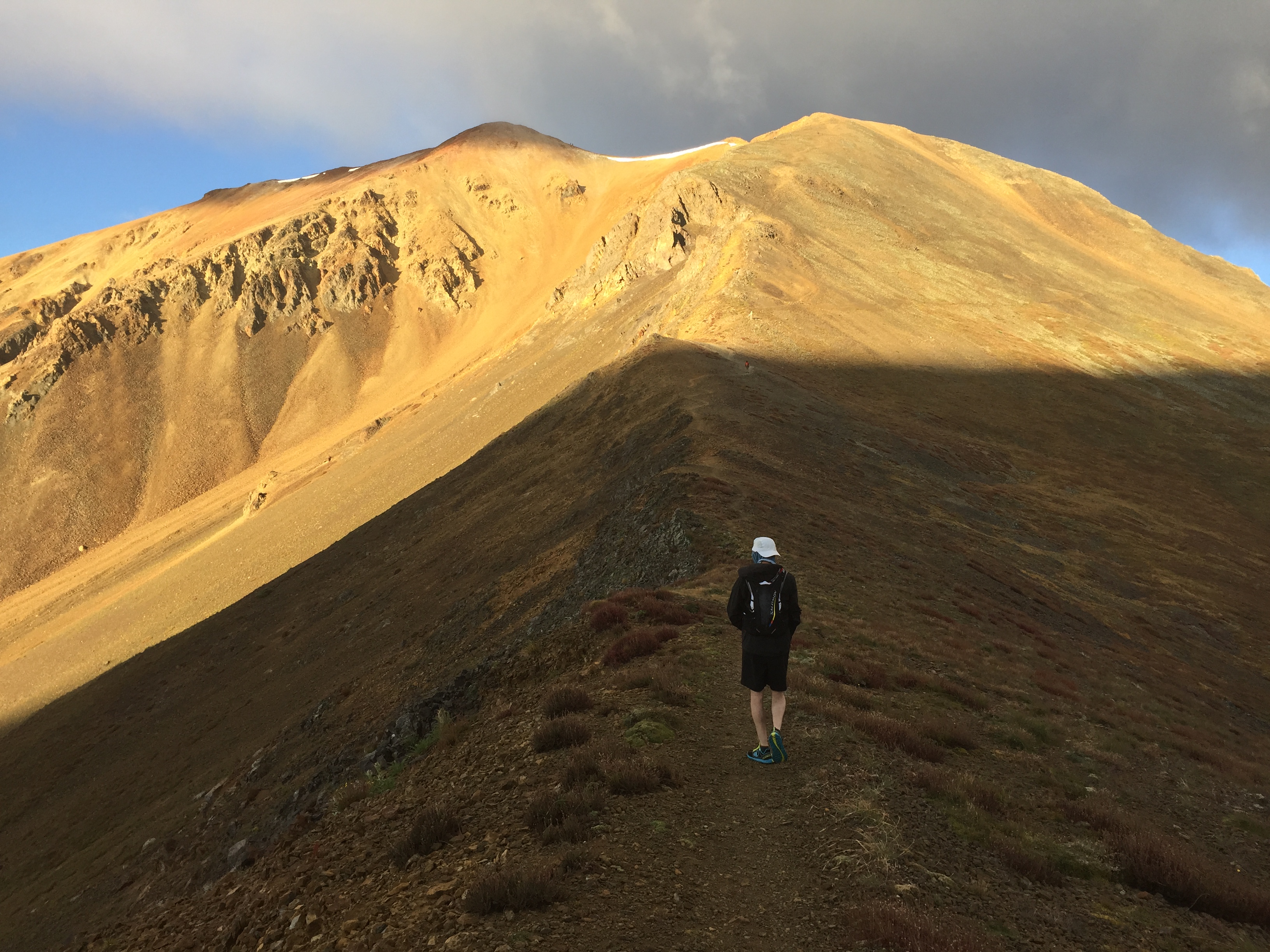
1000 ft below the summit of Red Cloud. The sun has risen in the east (the left hand side of the photograph), and there is a fresh dusting of snow barely visible on the summit. This photo reminded me very much of my last visit to Red Cloud with my good friend Dave Bunk, who made his first 14er summit. He was carrying an old school backpack, and plowed up the steep trail with grit and determination!
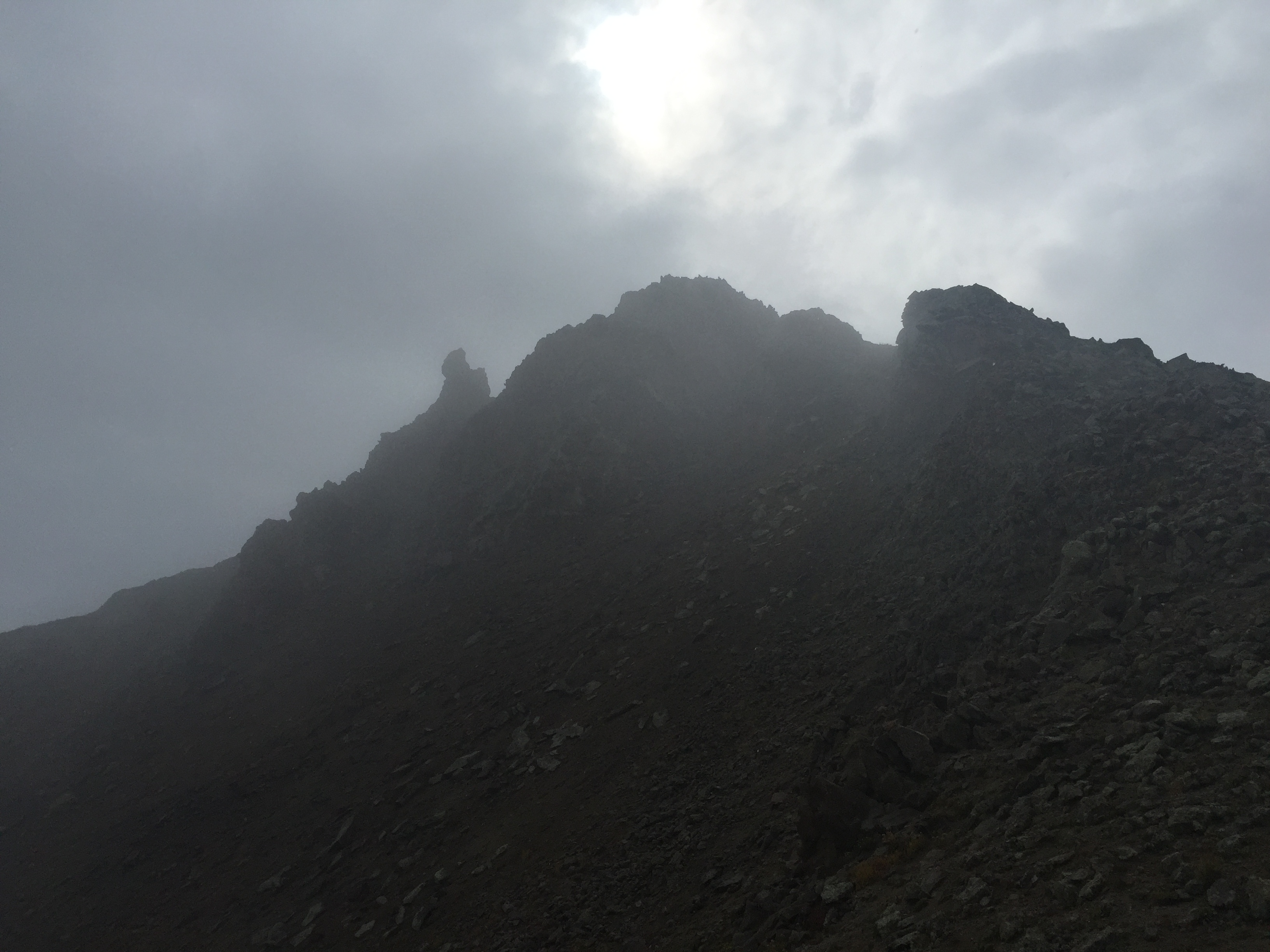
There is nothing difficult about the trail to Red Cloud, but the last mile is quite steep, and our pace slows to 40 minutes per mile. The previous days clouds had dusted the top of Red Cloud with snow, and the trail rocks was coated with ice. Hoka running shoes and ice are a comical mix, but with care and luck, we arrived at the summit in 1 hr 50 minutes (the distance is 4.5 miles).
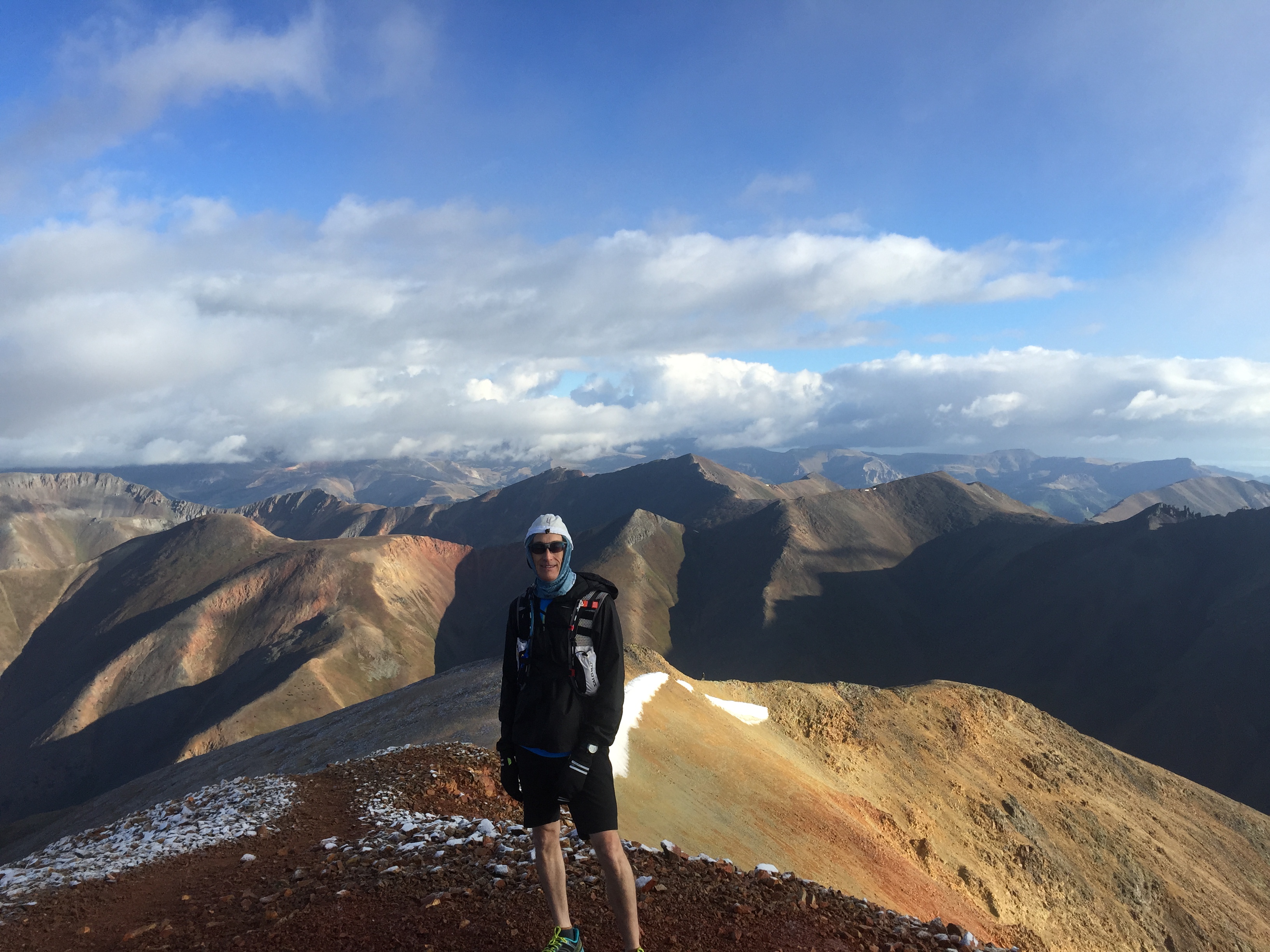
Dave Dogruel at the summit of Red Cloud at about 7:30 am. View is to the north.
It is only 1.5 miles running along a ridge to the south to reach Sunshine Peak. However, the icy conditions meant it was a bit of slog. Sunshine peak is the lowest of Colorado’s 14ers, and the prominence along the ridge line is only 450 feet. However, this in no way diminishes Sunshine, and in fact, is one my very favorite peaks. Once a runner arrives at Sunshine the views in all directions are stunning; but most hikers and runners just stop at the summit – a little further journey, perhaps 30 yards, leads to a most amazing view. Sunshine towers above the Valley of the Lake Fork of the Gunnison River. There is a nearly vertical drop of 4500 feet!

View from the summit of Sunshine into the Valley of the Lake Fork of the Gunnison. The path of green in the left-center of the photo is the former sight of the mining town of Sherman – only 1.1 miles away as the crow flies, but 4500′ lower in elevation!
The view down to Lake Fork of the Gunnison River spies a flats at the intersection of two drainages. It is green from vegetation, but even from this elevation, it looks like a great place for flash floods. Never to be deterred by geologic disasters, miners built on that exact spot when a rich silver deposit was discovered in 1876.
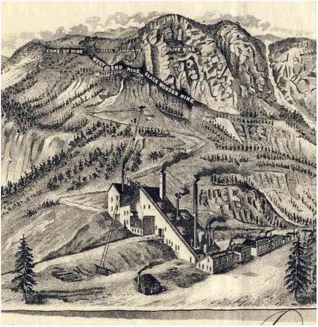
The Black Wonder Mine and Mill, from a stock certificate issued in the late 1890s. The mine was high up on the ridge, and ore was transported down via a tram to the mill built on the river.
There is not much to be seen at Sherman today, but I did spend time in my youth picking over the dumps of the Black Wonder. I don’t have anything to show for it today, but the view from Sunshine floods my mind with happy memories.

Photograph of the Black Wonder Mill, and the general store next door in the late 19th century. It was totally destroyed in a flood shortly after this photo. Today this is the site of an aid station in the Hardrock 100.
The total distance from the TH to Sunshine is 6 miles, and we made the summit in just under 3 hours. The views in all directions are wonderful, but we see lots of clouds building, and know that time is short to assure a safe Handies summit.
A view from Sunshine to the northeast. The highest ridge-peak in the center of the photograph is peak 13,881. The right of 13,881 is a lower peak in the very center of the photograph, which is Grassy Mountain. Day I of the Heart of the Caldera meets Day II.
The sun has melted the ice on the rocks, and the descent back to the trailhead is pretty fast. We retrace our steeps are reclimb Red Cloud. One of my favorite views is to the west, and looking across the southern fork of Silver Creek. Some hikers choose to bush whack down the steep talus, but it is strongly discouraged – both for safety reasons, and also the erosion that it promotes. The picture below shows the steep walls of the valley and the long stringers of rockslides.

Looking across the South fork of Silver Creek.
We arrive back at Silver Creek TH in 5 hours, and have the lunch of trail running champions – cold pizza and cheetos. 12 miles into the run, and about 12 to go. Right across from the Silver Creek Trail is the Grizzy Basin Trail, heading west-southwest up Handies. This 4 mile trail is on the Hardrock 100 course, and is a relentless climb that averages 18% grade. Not really runnable by the likes of me – I am in total awe of my friends like Dave Coblentz and Blake Wood that run this in the Hardrock year after year.

Mile 2 on the Grizzly Gulch trail looking up towards the summit of Handies. The trail follows the ridge on the right shoulder of the peak.
The climb up Grizzly brings our first taste of real weather. We have hail and wind, intermixed with sunshine. The trail is nearly empty of hikers – most day hikers chose the much shorter route from west side of Handies (which will be our descent route). We arrive at the summit and the wind is spectacular. Handies is a broad summit, and there is little cover from the wind. The summit is 16.5 miles into the run, and we arrive at 7 hrs elapse.
Summiting Handies – the last push before getting to the broad top.
I have been to the top of Handies many times, but never I have been there with not another hiker/runner in sight. All around is wilderness, and although I can see the road to Cinnamon Pass far below I feel far removed from “civilization”. Many people see marvelous vistas from Handies, but when you ask about the rocks, they shrug and mention that they are all gray and not descript. That is not what I see – I see exploding volcanoes, the mid-Tertiary ignimbrite flare-up that shaped Colorado and New Mexico, and collapsed calderas that would someday host some of the richest mines in America.

Geology of the area around Handies Peak. Most people see gray nondescript rock, but I see the colors of dozens of volcanic eruptions and the erosion of those rocks.
I don’t see grays – I see colors of the different flows and episodes, like a geologic map. the picture above is the geologic map of the area around Handies, and the colors represent rocks that came from different volcanoes. A collage of violence.

View back down Grizzly Gulch towards Sunshine – which is behind the vail of moisture falling in the distance. As a crow flies the distance is about 3 miles, but much longer when you run!
The descent down Handies is one of the best runs known to trail lovers – about 3 miles of pretty smooth trail, only a few rock glaciers crossing, and a drop of 2500 feet. We run those three miles in about 50 minutes, and fell great coming into the upper TH in American Basin.

View from Handies into American Basin. In the center of the photo is Sloan Lake, a cirque basin.
We arrive at the TH in a little less than 8 hrs total elapse time. However, all the fun is now gone. We have 4 miles of running along Hinsdale County road 30 to get back to the Silver Creek TH. It should be fast because in that distance it there is an elevation drop of more than a thousand feet. We spend about 30 minutes talking to various people in American Basin – a surprising number saw us on Red Cloud and after their climb had driven over to American Basin. I was shocked that they recognized us, but most said it was easy to remember the crazy guys running at 14,000 ft. One person said that they remembered my shoes (Hokas) and wondered if I had a foot problem…
Hinsdale Co. RD 30 back to the Silver Creek TH. 4 miles of hard packed rumble….
We left the American Basin TH having run 19.5 miles in 8 hrs and 30 minutes – about 30 minutes slower than I expected. We still had 4 miles to go, and realistically, it should have taken us an hour. However, all the chatting – and even more likely the running 16 miles the day before – meant that I was not really able to convince my body to get going. It took an hour and 20 minutes to get to the finish line.
The Heart of the Caldera runs were a great adventure. The solitude of the first day was perfectly blended with the challenge and struggle of the climbs of three 14ers on the second. The total distance covered was just under 40 miles, and the elevation gain was about 12,500 feet. But, the benefit of breaking the ultra into two days meant that I got to eat at Bruno’s in Lake City between runs! Bruno’s is a fantastic restaurant run by Frederika & Chef Bruno with some of the best food I have ever eaten. We always go to Bruno’s and it is so unexpected in a remote corner of the San Juans like Lake City, that it brings joy to my heart. The downside of multi-day events – several days of 4 am starts!
4 am starts are the norm. Not sure if this is evolution or illness.
Running Fast?
The Redcloud-Sunshine-Handies loop is a challenging run – a geologist’s dream to be sure, but still, it is a true physical test. I have many friends from Los Alamos that have done this loop and I am always amazed how fast they can cover this geologic gauntlet. I can’t help but wonder why are my friends and colleagues so much faster? Do I have a poor training regiment? Am I even less coordinated than I appear in everyday conversation? Or, am I genetically predisposed for last place in a trail run? Mostly on a lark I decided to have a genetic analysis based on a blood sample for “athletic genes” a few years ago.
Beginning in the 1960s a group of physicians began to look at genes as indicators of human performance – either in the classroom or on the athletic pitch. There have been huge data bases complied that provide a statistical framework to investigate the “nature vs nurture” arguments of why some excel in particular fields. Athletics is one of the richest data basis; there are about 20,000 human genes, and through statistical analysis there are approximately 100 that seem to be related to athletic performance. I say “seems” because although we can understand the rudimentary functions of genes the complex interplay between all the genes is not even poorly understood. However, in the last 4 Olympic Games, every single male medalist in distance running races shared some specific alleles! An allele is a variant form of a gene – inherited – and there can be specific variations that are quite rare.
I had analysis done on 30 genes; I had some strange vision that a secret would be unlocked by having this analysis. However, I was mostly unsurprised. I found a genetic makeup that statistically suggests I have a higher BMI and less VO2 max than endurance athletes (I am slightly stocky, and not quite as good a delivering oxygen to my blood as I would hope), Further, I have a “more efficient deposition of fat leading to higher BMI when consuming a high fat diet”, meaning my love for cheese should be reflected in my choice of swim ware. But I also found a statistical cadre with powerful muscles, and a quick recovery time. All my indicators of endurance fell in the vast middle of expected performance – I guess pretty much what I show in every race.
What the genetic markers don’t measure is will power. Nor do they measure joy. The lesson learned from this academic excursion – which I am prone to do – is that the mind is the organ that matters. It is complex; but it is our mind that lets us truly experience joy and happiness. For me, trail running unleashes something in my soul (mind), that makes life an adventure.

Thoroughly enjoyed your write-up of some of my favorite hiking areas. I have done the “figure 8” but started and finished at Mill Creek.