The Serenity of Big Volcanoes: Recovery Running around Kilauea

The greater part of the vast floor of the desert under us was as black as ink, and apparently smooth and level; but over a mile square of it was ringed and streaked and striped with a thousand branching streams of liquid and gorgeously brilliant fire! It looked like a colossal railroad map of the State of Massachusetts done in chain lightning on a midnight sky. Imagine it – imagine a coal-black sky shivered into a tangled network of angry fire! Mark Twain, on his visit to Kilauea in June, 1866.

Halemaumau

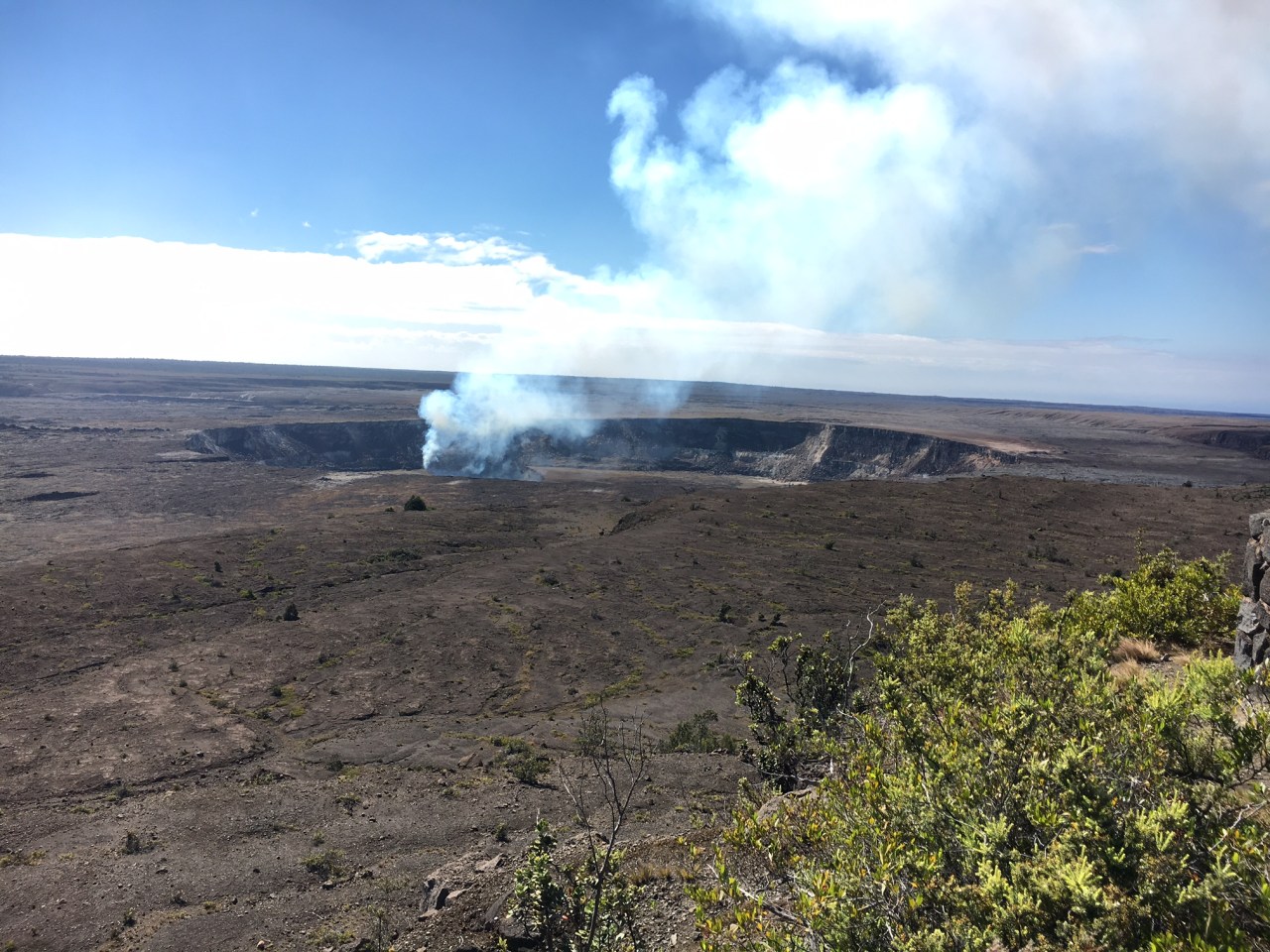
Halemaumau – a crater within a crater. Halemaumau is a crater within the large summit crater of Kilauea, and has been active with lava lakes rising and falling in the last 2 years. This photo is from about a mile away and 1,500 feet above Halemaumau. The smoke is one of the main reasons the crater trail is closed. Click on any photo for full sized view.

Few things are more inspiring to a geoscientist, and disappointing to the average visitor, than the volcanoes of the Big Island of Hawaii.  In the last three quarters of a million years volcanic activity has built one of the largest mountains on Earth; in geologic terms this is almost a quantum time unit! Hawaii has 5 volcanic centers (and a sixth is waiting to emerge above sea level southeast of the island) which built a land mass with a surface area of over 4000 sq miles above sea level and has two summits topping 13,600 feet (Mauna Loa at 13,680′ and Mauna Kea at 13,800′ above sea level).  However, the average person that visits the Big Island is disappointed because these giants don’t have the crags and steep elevation gradients of stratvolcanoes like Mt. Rainier or Mt. St. Helens. True to their name, Hawaiian shield volcanoes the are shaped like the overturned shallow bowl shields of ancient Roman warriors.

firstsight

First glimpse of Hawaii on a flight from the mainland. On the left is the summit of Mauna Kea, and in the distance is Mauna Loa. The distance between the coastline in the picture and the summit of Mauna Kea is only 20 miles – making for spectacular prominence! But, alas, for most this view does not captivate.

These gentle giants are formed by thousands of eruptions that pour out basaltic lava that has the viscosity of hot syrup – and when it cools it leaves a simple layered stack of black rock.  Rarely are Hawaiian eruptions violent – no towering clouds of hot ash reaching 50,000′ above the surface of the Earth, or decapitating the tops of mountains like the 1980 eruption of Mt. St. Helens.  We like our geology violent…hence, the oft repeated comments at Volcanoes National Park, “is this all there is?  where is the lava?” When Mark Twain visited kilauea in 1866 he professed to being very disappointed.  He eventually warmed to the volcano, but was surprised at its “bland character”.

However, to the geoscientist, the enormity of Hawaii is spellbinding.  So much melted rock gives witness to the dynamics of a young and hot planet.  This is one of the wonders of the world that is so much bigger than mankind.  I have to frequently travel to Oahu for business, and I was able to stitch together a brief vacation on the Big Island which is coincident with the recovery period after running the Antelope Canyon Ultra.  There is no better way to experience geology than to run along the rocks;  recovery means sore legs (and in my case very tender feet), so the runs have to be short and slow (even slower than usual).  I planned a couple of short runs around Kilauea and long naps next to the wonderful beaches of the Kona Coast.  Running rejuvenated my body, but Kilauea soothed my soul.

Geologic map of the State of Hawai'i [Plate 8: Geologic map of the island of Hawai'i [scale 1:250,000]]

Geologic Map of the Big Island (scale 1:250,000).  The colors are largely related to age since all the rocks are pretty damn similar – basalt.  From the north (top of the map) the volcanoes are Kohala, Mauna Kea, Hualalai, Mauna Loa and Kilauea (all the red colored units).

Kilauea – Erupting since 1983!

The geology map of Hawaii resembles the tee-shirts seen at a Grateful Dead concert.  Colorful and vaguely psychedelic, the map is mostly stripes delineating lava flows.  The figure above shows the slow and steady march of the volcanoes to the south and east.  Kohala is now extinct, and Mauna Kea’s last eruption was more than 4500 years ago.  This volcanic trend, extending to all the Hawaiian Islands and the Emperor Seamount Chain located to the northwest, was one of the most mysterious geologic observations, and awaited the paradigm of plate tectonics for an explanation.  In 1963 J. Tuzo Wilson proposed that a “hot spot” caused all these volcanic islands – this hot spot was an upwelling of very hot mantle material  that melted through the cold oceanic plate (the Pacific Plate) as it moved to the northwest.  Imagine a blow torch beneath a piece of slowing moving tar paper.  The torch will melt the tar and leave a linear scar depicting the direction of motion of the tar paper.  Although Wilson’s hot spot model was a huge intellectual leap forward during the formative days of plate tectonics, it is now considered to be a gross simplification of a very complex process.  No matter, the theory does capture the fact that huge amounts of molten rock have reached the surface and built the Hawaiian Islands – and provides insight that Hawaii will continue to grow for millions of years into the future, with land masses emerging to the southeast of today’s Big Island (a far more benign process than what the Chinese are doing in the Spratly Islands….).

thelongclimb

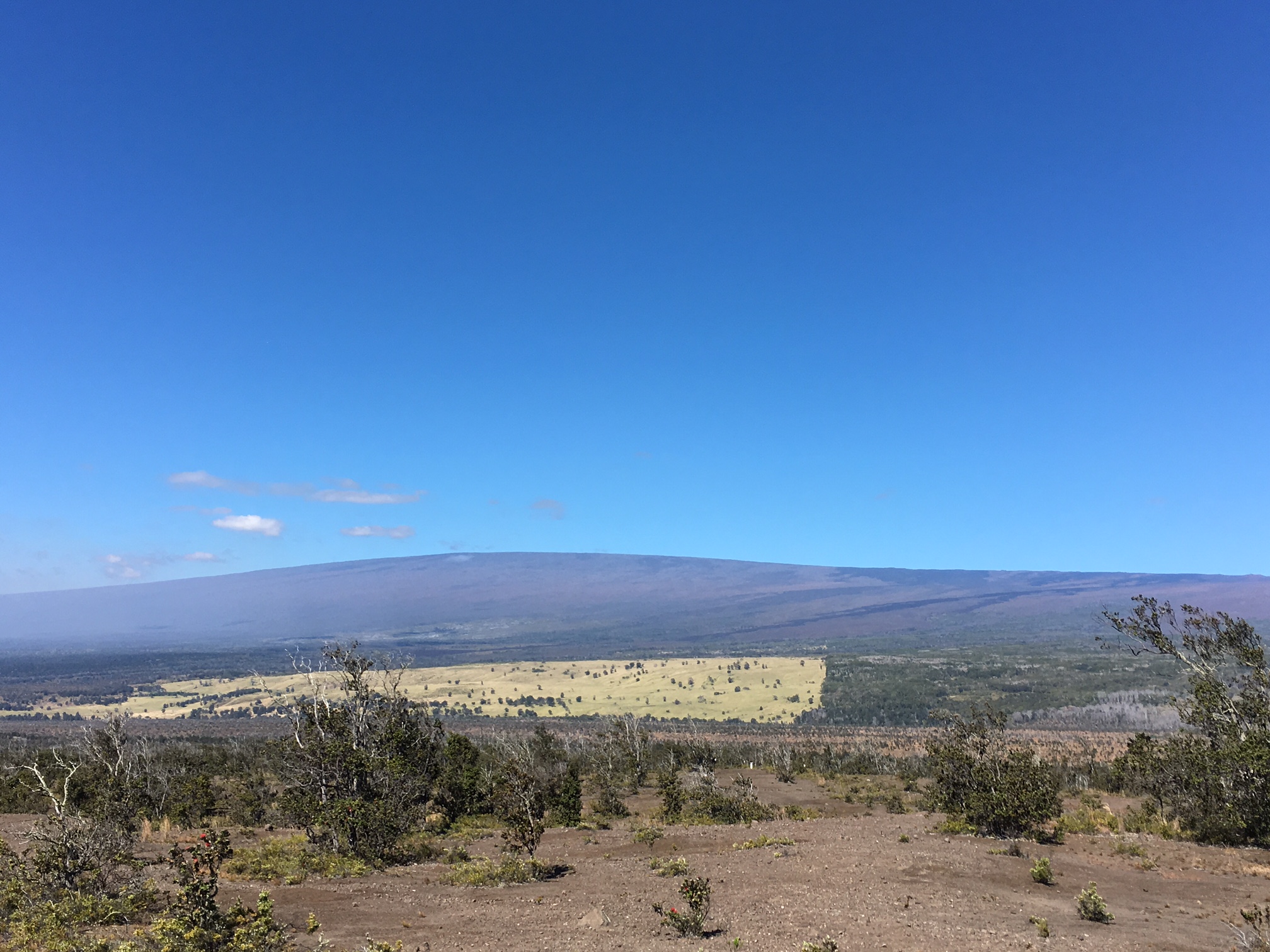
The summit of Mauna Loa from the crater of Kilauea. The passing of the guard – Kilauea is now the most active volcano in the world, and sits some 9000 feet between the summit of Mauna Loa.

Kilauea is now the center of volcanic activity on Hawaii.  Eruptions might still occur on Mauna Loa (likely), Hualalai (plausible) and Mauna Kea (probably not), but Kilauea is spewing out basalt at prodigious rate, and in a few hundred thousand years will have a summit about 13,000 feet.  I first visited Kilauea in 1984 as a relatively new faculty member on a boondoggle (field trips are one of the main reasons scientists choose “geology” as a profession).  My visit corresponded with the one year anniversary of the an eruption on Kilauea – an eruption that has continued to today!

halemaumaufromdistance

Peering into Kilauea Crater from smoking cliffs. The view is disconcerting – below the grassy lip of the crater there is a 1500′ drop and then a nearly flat parking lot like layer of basalt. In the distance is a second crater, Halemaumau, which presently has a lave lake 300’below its crater lip.

On that first visit I got to hike through the Kilauea Crater, and right up to Halemuamau.  The 1983 eruption was producing lava several miles to the southeast of the crater, and there was little activity to indicate molten rock was ascending from some 60 km beneath the surface and collecting in shallower magma chambers.  Once the lava erupted it flows down the slopes of Kilauea into the sea. The focus of volcanic activity then was along what is called the southeastern rift zone; there were occasional fountains of lava out of a crater called Pu`u `Ō`ō, but it was not visible from the Kilauea Crater.

kilaueacaldera_geo

Eruptions near Kilauea crater. Although only a few of the eruptions of Kilauea surface in the crater, there are numerous flows that constantly remake the landscape. Recovery Trail Runs were in Kilauea Iki, a path along Chain of Craters Road, and Keanakakoi Crater.

I have visited Kilauea many times since 1984, mostly because my wife had a post doctoral stint (1992-1994) with the USGS and worked on the geodetics of Kilauea.  Although it is common to think of Kilauea as a shield volcano, therefore, like its older brothers Mauna Loa and Mauna Kea, it is in fact very different at this stage of its development.  The magma being erupted from Kilauea most closely resembles the magma erupted from Mauna Kea.  So despite appearances – and being located high on the flank of Mauna Loa – Kilauea is the southwestern extension of Mauna Kea.

riftzone.better

A tectonic map of Kilauea. There are three important features: the summit crater, the southwest rift and the east rift zone. As Kilauea builds on the slope of Mauna Loa the weight of eruptive lava flows “pull away” from the summit and slide towards the sea opening up the rift zones.

Every time Kilauea erupts and lava pours out, it travels down hill towards the Pacific ocean.  As the lava cools it places a load on the Mauna Loa slope; this load eventually is too much for the slope to support and a wedge is “torn” away.  This wedge is defined by the summit crater, southwest rift zone, and east rift zone.  This “tearing” is really the odd shaped pie piece sliding downhill.  The tearing opens up creates other pathways for the magma stored beneath Kilauea to erupt on to the surface.  Until Kilauea grows tall enough to minimize the elevation head of Mauna Loa the rift zones will continue to have eruptions.

lavaflowsinarow

Picture a lava flows exposed on the Chain of Craters Road. This is actually a tilted stack of basalt sheets. I took this picture on the Chain of Craters run.

This means that the volcano is not growing in a simple way – it builds, slips, and starts a new cycle of building that could be anywhere along the rift zones or the summit.  What is remarkable about the present eruption is that every part of the volcano has been active at one time or another; it started in east rift zone 10 miles from the summit and over a five year period 1 cubic mile of lava poured out.  In the 1990s the Pu`u `Ō`ō crater collapsed and numerous other new, smaller craters located northwest of Pu`u `Ō`ō opened up. Eventually, the volcanic center returned to Pu`u `Ō`ō, and by 2005 another couple of cubic miles of lava had flowed forth. In 2011 the volcanic activity shifted to the Kilauea Crater and southwestern rift zone, and on April 24, 2015, lava overflowed  Halema’uma’u crater within Kilauea.  It was this event that ultimately led to the closing of the trails and hiking near Kilauea.

volume

Volume of lava erupted from Kilauea in the last 200 years. The strong uptick in volcano growth on the right hand side of the chart is due to the present ongoing eruption.

It is difficult to fathom the rapid nature of the changes on Kilauea.  For a geoscientist it is like watching a movie at 100 times normal viewing speed.  The rocks may all look the same – black basalt – but face of the volcano is changing a rate that is similar to the changes in my own face (sags here and there, some age spots, and teeth falling out).  Running on rocks younger than me – way younger in some cases – is a unique experience!

runningonKilaueasIki

Running on the floor of Kilauea Iki. The basalt beneath my feet is from the 1959 eruption. Ever so slowly, trees are trying to reclaim the landscape.

Running on Rock Younger than Me

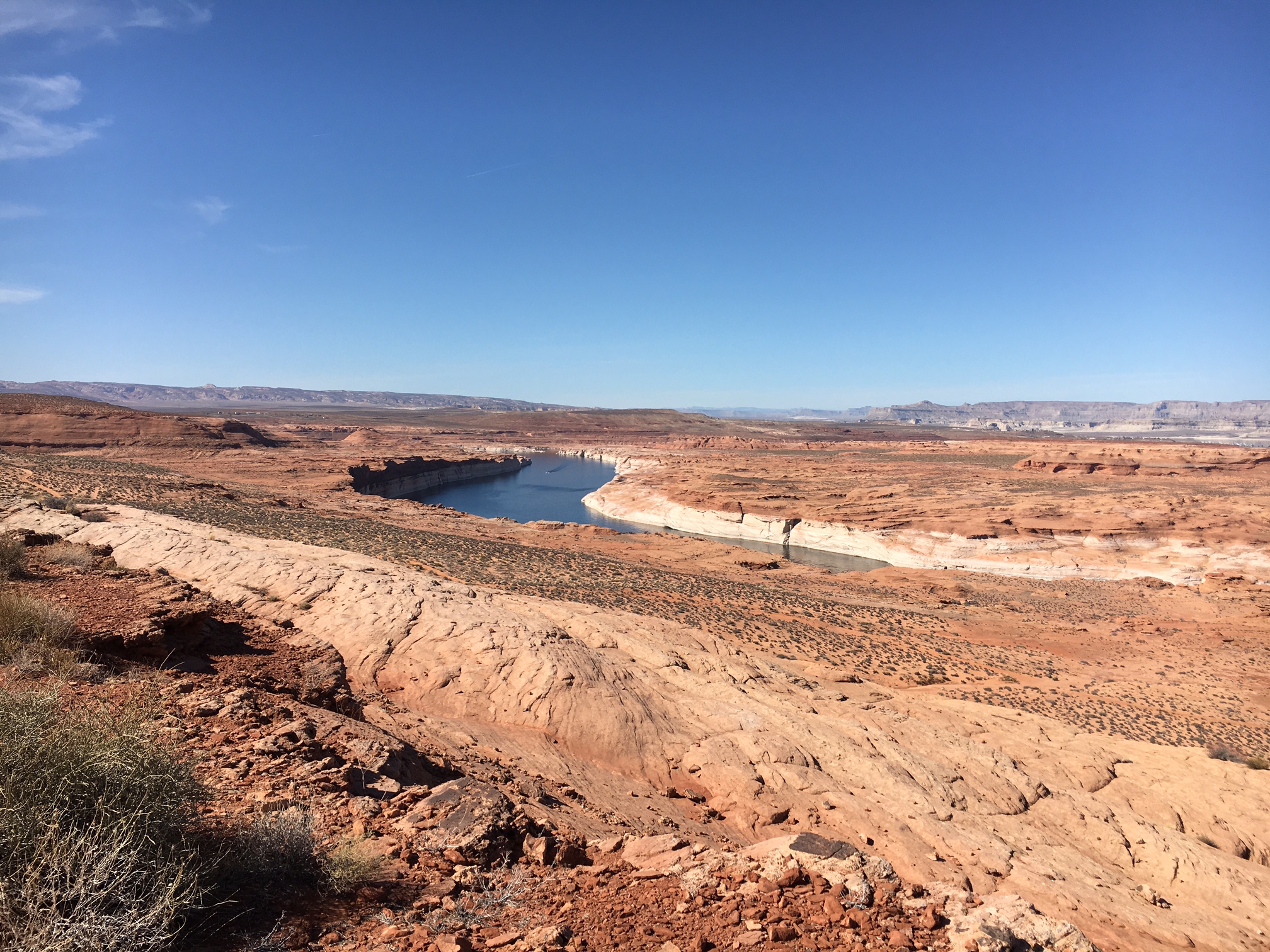
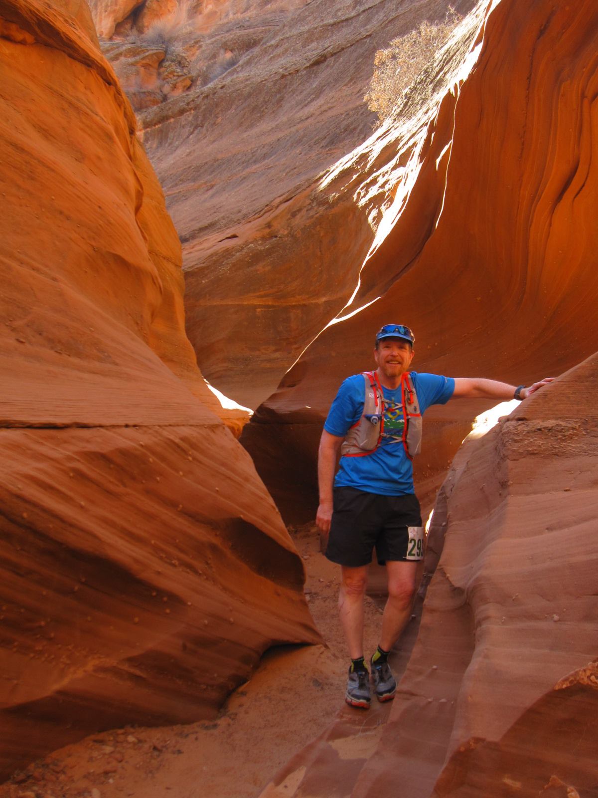
When I first envisioned this mini-vacation on the Big Island I thought I would try the ultimate volcano trail run — up to the summit of Mauna Loa from a trail head located near Kilauea.  The run starts at 6,000′ and over 19 miles climbs 7,500′ with traverses of rough lava flows interspersed with clumps of forest.  However, a 38 mile round trip — unsupported — was a total pipe dream.  Especially after running a 55 km ultra only days before arriving in Hawaii.  My next plan was to run through Kilauea Crater and recreate the hikes I experienced on my first visit. However, the plan was foiled when I found that the crater was off limits since the Halemaumau lava lake rose, and there was a significant increase in SO2 emissions (a very toxic gas!).  This meant that I was on to plan C, the best idea anyway.  I spent 2 days on 3 runs of modest distance (4-8 miles), and just enjoyed the rocks.

kileauaIka2

The trail across Kilauea Iki. The view is approximately 1 mile to the southern rim.  A pathway can be made out streaking across the center of the frame.

The first run was down and across a crater located just southeast of Kilauea Crater, Kilauea Iki (see the map above – it is the green colored crater).  The trail is well maintained but rocky and challenging for a run.  Over a mile the path way drops 600 feet from the trail head to the Iki floor.  The Iki floor is a smooth surface, occasionally interrupted by fissures and blowouts. The age of the floor is easy to calculate – it is the 1959 eruption!  The rock is 3 years younger than me.  The race across the crater floor is easy and relatively fast (although fast is a relative term). The run from south to north in the crater took about 14 minutes – but then there is a long climb back up towards the rim.  The climb up is through thick vegetation – Iki is located right between the wet and dry side of Hawaii, and mists are a constant running companion.  The total trip is 4.5 miles; but the rain and mist meant that we had the crater nearly to our selves!

treestump

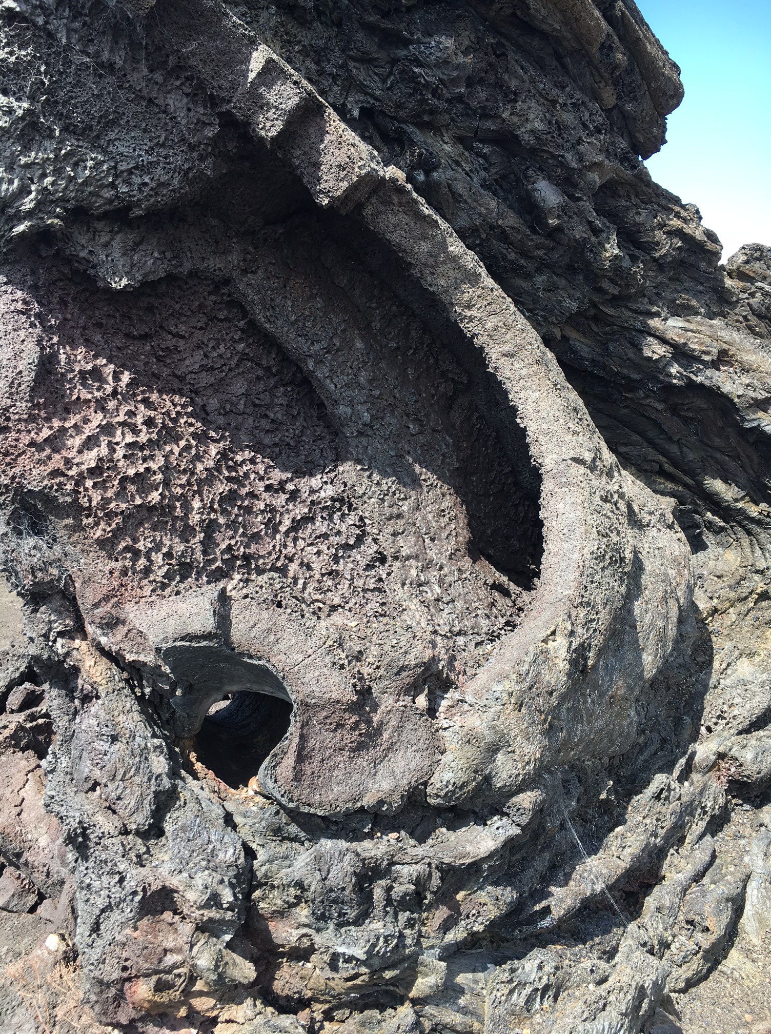
One of the many bizarre basalt structures in the 1974 flow. The hole in the lower left of the figure is where the lava surrounded a tree – it eventually burned the tree away leaving a tunnel behind, and a lava clump to mark the former timber stand.

The next day I completed two other runs along the east rift zone (or more accurately, along the Chain of Craters Road).  The trails here wander from small crater to small crater.  Any crater older than about 30 years is being reclaimed by the vegetation.  The landscape is eery and strange.  Long sheets of basalt, but occasionally these sheets are covered with mounds – it sort of looks like volcanic acne.  These mounds are monuments to former stands of tall trees.  As the lava flowed downhill the trees impeded the progress, some lava chilled and became solid around the burning tree trucks.  These chilled regions built up mounds – and today the mounds have perfect holes throughout where tree trucks where eventually burned away.  The figure above is one of these basalt pimples, and you can see the round “tube” of a former trunk in the lower left of the photo.  The most impressive flow on the run was from an eruption in 1974 (the same year I graduated from high school).  The lava is remarkable smooth, and easy running.  However, once you step off the flow it is extremely difficult running.  The total distance covered was just under 8 miles.  The run ends near a truly spectacular view of the ocean across a series of high cliffs, known as Pali.

napaliII

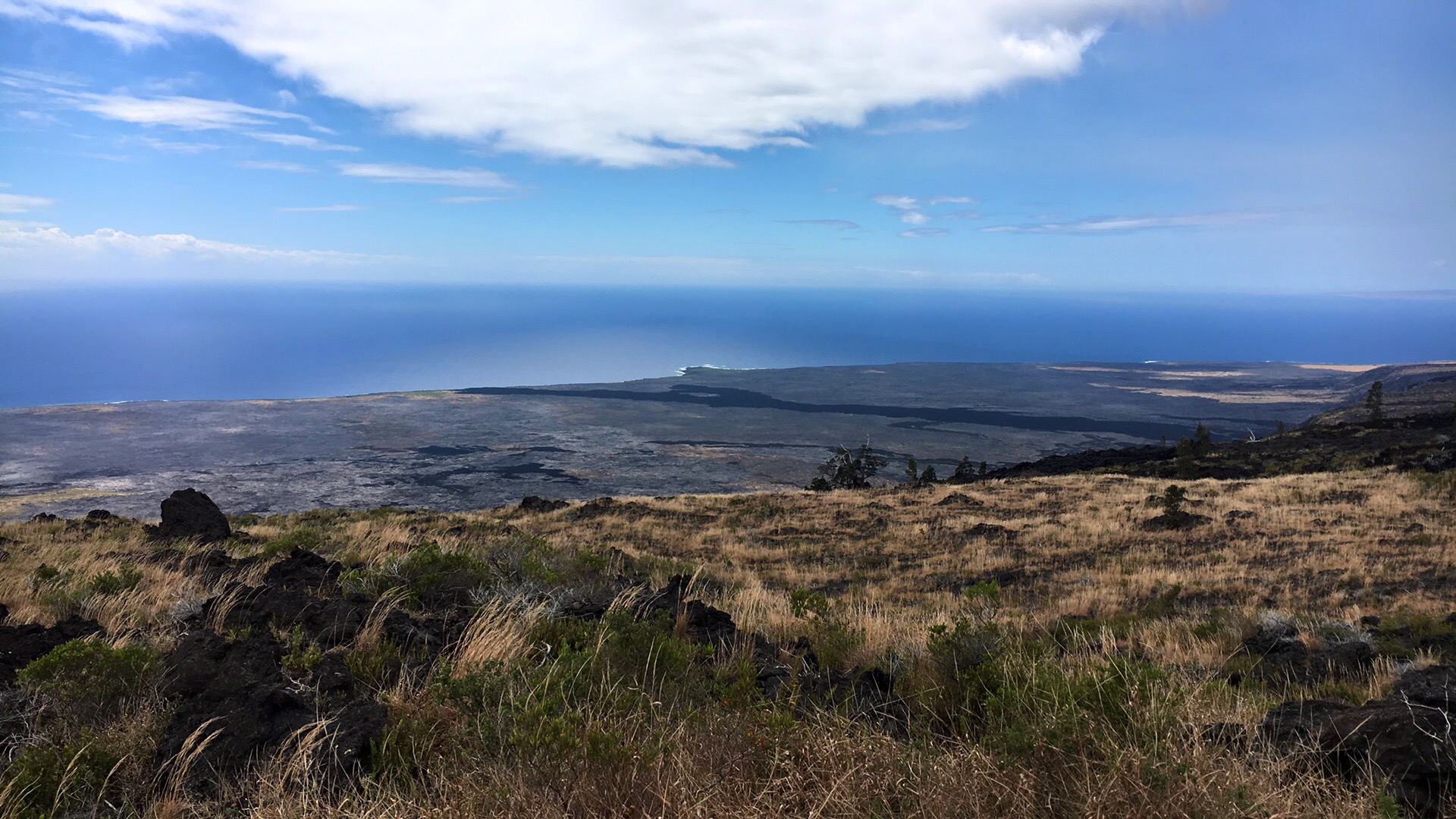
Looking down towards the sea – 4 miles away, and a 2000′ drop. There are a series of steep cliffs, known as the Pali, that mark the breaking and sliding away of the stack of lava flows.

The Pali are fault scraps cutting across the lava flows – these scarps are the weak zones that fail once the load of basalt becomes too large.

faults

Fault map of the southeastern side of Hawaii. The faults represent breakaway regions sliding the load created by the basalt towards the deep ocean. Each of the faults has a significant scar – a large cliff known as “pali” in Hawaiian.

Running down the scarps is easy work except the views are run-stopping.  This trail run is all on the dry side of Hawaii, so no pesky trees to obscure the view.  I was a graduate student at Caltech when seismologist began to model the seismograms from exotic sources, and the 1975 Hawaii earthquake, with an epicenter within the Pali, proved to have a source mechanism that it is consistent with a large landslide.  The 1975 event is the largest Hawaiian earthquake (or, more precisely, landslide induced earthquake), and had a magnitude of 7.2 and caused a 12 m high local tsunami.

intoseaII

The edge of Hawaii – although the flows and pali continue far out to sea.  The total elevation of Mauna Loa, as measured from the sea floor, is about 56,000 ft.  Nearly twice the height of Everest, but no high camp or oxygen is required to summit.

At the ocean my runs end – sort of trivial in terms of distance, but perfect therapy for recovery from an ultra run.  Actually, the real recovery was to my soul.  Immersed in the geologic equivalent to a black hole, all the trials and tribulations of the last 2 months seem like back ground noise.  Relaxed.

sunset1

Sunset on the Kona Coast. Waves framing a sun disappearing behind Maui off in the distance.


Paradise Lost: Running on the edge of Lake Powell

Light. Space. Light and space without time, I think, for this is a country with only the slightest traces of human history. In the doctrine of the geologists with their scheme of ages, eons and epochs all is flux, as Heraclitus taught, but from the mortally human point of view the landscape of the Colorado is like a section of eternity—timeless, Edward Abbey, in Desert Solitaire (1968).

covershot

Horse Shoe Bend, on the Colorado River below Glen Canyon Dam. It is this narrow canyon that provided the geologic framework for a dam built in the early 1960s that flooded hundreds of canyons upstream. Click on any photo to get fill sized views.

On May 24, 1869, John Wesley Powell and 9 other men pushed four boats into the Green River and began one of the most challenging and legendary geologic adventures in history. Over the course of a little more than 3 months, Powell explored one of the last great unknowns – the course of the Colorado River and depths of the Grand Canyon.  The journey is mostly known for its harrowing traverse of the Grand Canyon, but along the way Powell’s expedition also found many amazing geologic features of the Colorado Plateau.  On August 3, 1869 Powell entered a series of meandering canyons in carved sandstone.  From his journal: “On the walls, and back many miles into the country, numbers of monument shaped buttes are observed. So we have a curious ensemble of wonderful features — carved walls, royal arches, glens, alcove gulches, mounds, and monuments. From which of these features shall we select a name? We decide to call it Glen Cañon. “

powell3

J.W. Powell’ carved his name Navajo Sandstone at Music Temple in Glen Canyon on the second expedition. Music Temple was (it is underwater now!) a large amphitheater or grotto in a side canyon that was said to echo musical notes with great fidelity.

Powell’s adventure captivated the nation, but from a scientific standpoint it was beset with difficulties – lost data, lost instruments, and deserting crew.  This motivated Powell to retrace the journey again in 1871, this time funded by a congressional appropriation, and he included a photographer. The photographs offer a glimpse into a magical landscape – one that man has dramatically altered, first with the Glen Canyon Dam, and now with a large power plant that dominates the skyline.

marblecanyon

Entering Marble Canyon (about 5 miles south of Glen Canyon), Powell expedition 1871. John K. Hillers photograph.

John Wesley Powell is a true hero to me.  I greatly admire the naturalists and geoscientists of the 19th century that traveled to the far corners of the world and invented a new science – geology.  Along the way these intellectual giants invented deep time, theories of the formation of the Earth and solar system, and applied mathematics, physics and chemistry to all the processes in nature; they brought rationale and order to what had previously been a mystical world. But J.W. Powell was far more than a wandering scientist – he was a leader among men, and overcame tremendous physical challenges to conquer extraordinary adventures. Powell was only 5′ 6″ tall, but projected authority and leadership.  He was born in 1834, and was exploring the Mississippi river valley by the age of 18. In 1861 he joined the Union forces and quickly became a captain; in the battle of Shiloh he was wounded in the right arm, and had to have it amputated below the elbow. However, even one armed, he continued to serve the Union. After the war he lectured on geology and mineralogy, and became the secretary of the Illinois Natural History Society. Shortly after that, the short, one-armed, middle aged man began to explore the American West.

John_Wesley_Powell_with_Native_American_at_Grand_Canyon_Arizona

John Wesley Powell on the shore of the Colorado River north of Glen Canyon in 1871. With Powell is Tau-Gu, a Paiute guide.

The Ultra Adventures team first introduced an “Antelope Canyon” race in 2014 on the shores of Lake Powell.  The UA team envisioned a race that captured the unique setting on the Glen Canyon – sweeping desert vistas, slick rock running along the edge of Glen Canyon below the dam (with 800 feet shear drops!), and running in slot canyons (twisting, narrow slices in the Navajo Sandstone created by flash floods). The first two years of the race the number of runners was quite modest – less than 120 in 2015.  I wanted to run the race as soon as I heard about it – and saw the jaw dropping photographs of the course.  The extra attraction was to be able to run where Powell had explored nearly 150 years ago.  Although I have extensively explored the Colorado Plateau, I had only spent fleeting moments around Lake Powell (the giant reservoir behind Glen Canyon dam…it is unlikely that Powell would have approved of the name).  I convinced a couple of others from my home town to join me for an early season ultra, and prepared to run along a intellectual precipice; the cliff between paradise and encroachment of man.

lakepowell3

Lake Powell is one of the largest man-made reservoirs in the world, and is capable of storing nearly 25 million acre feet of water. The “lake” is a long and twisting body that is the flooding of canyons that had been cut through the sediments of the Colorado Plateau by the Colorado and San Juan Rivers. GoogleEarth image viewing from the southeast (the town of Page, and site of the Antelope Ultras is on the far left hand side of the image).

Carving a Canyon

The Colorado River Basin stretches from the Wind River Mountains of western Wyoming to the Gulf of California, draining nearly a quarter of million square miles.  Snow that falls on the southern half of the Wind Rivers or the western part of Rocky Mountain National Park eventually collects into streams, and then rivers, ultimately merging into the mighty Colorado River. End-to-end, some water travels 1,400 miles only to be emptied into the sea some 75 miles south of Yuma, Arizona.

OLNotes6_Map_Powell1

The Colorado River Basin covers an area larger than France. It includes most of Arizona and Utah, and large sections of New Mexico, Colorado and Wyoming. The Colorado River Basin became part of the US after the war with Mexico in 1846, but remained “unexplored” until J.W. Powell floated from the Green River to the western end of the Grand Canyon in 1869. Although the Grand Canyon is rightfully the jewel of the Powell expedition, they also discovered and mapped many other spectacular canyons, including Glen Canyon.

The Colorado Basin is a geologic marvel.  Over millions of years rain and snow have fallen on the high peaks of the Rocky Mountains; this moisture from the atmosphere collects and is pulled by gravity down hill – from the high peaks at 14,000 feet elevation towards sea.  Along the way the water picks up particles and alters the minerals in the rocks that it passes by, slowly eroding that rock.  Ultimately that erosion carves canyons of extraordinary architecture. The time scales are geologic, and difficult for humans to fathom; however, gravity and water always win, and wear away the most resistant rock.

The story of how each of the canyons formed along the course of the Colorado River is complex – and in fact, each “canyon” is unique.  Glen Canyon is mostly carved in a red to white sandstone that is know as the Navajo Sandstone. The Navajo Sandstone is a remarkable geologic deposit – it is present over nearly 220,000 km2 of the Colorado Plateau today (a larger area than numerous Eastern US states!), and is the petrified remains of a vast ocean sand that once was on the edge of a super continent, Pangea, during the Jurassic Age. 190 million years ago this ocean of sand probably covered an area three times as large as the present day deposits; larger than even today’s Rub’ al Khali, the Arabian Peninsula’s vast Empty Quarter.

crossbedding1

An outcrop of the Navajo Sandstone near Horse Shoe Bend. The unique layering structure – like a stack of cards that have different angles – is fossilized crossbedding from Jurassic aged sand dunes.

The vast sand dunes moved by blowing sand from one side of the dune to the other – always with the prevailing direction of the wind. This results in a tilted layer cake structure within the dune.

Formation_of_cross-stratification

A graphic depicting the formation of cross bedding – where the “fluid flow” is wind carrying or pushing sand grains. Figure from Wikipedia.

The Jurassic aged dunes became “fossils” for a couple of reasons: first, the great sand ocean was within a basin which slowly subsided.  The sand blew in, and was slowly buried.  Secondly, the buried dunes were exposed to ground water that interacted with the sand grains – in the case of the Navajo dunes these grains were pure quartz – and started slowly chemically altering the grains into a hard, concrete like material.  Finally, and perhaps most remarkably, these frozen dunes were left undeformed for tens of millions of years, providing the vast expanse that we see today for the Navajo Sandstone.

The slow erosion of the Navajo into the present geography of Glen Canyon took at least 20 million years.  Along the way, other events occurred – like flash floods.  These flash floods pick up the quartz sand that had already been eroded and swept those hard quartz grains across the soft rock surface scouring out impossibly narrow slot canyons.

Lowerantelope

The narrows of Lower Antelope Canyon – a slot canyon formed by flash floods. Picture taken the day before the race.

The fate of Glen Canyon was sealed in a deal struck only 25 miles from my Los Alamos, New Mexico home.  In 1922 representatives from the western states that bordered the Colorado Drainage Basin met and divided up the water flowing down the Colorado River at Bishop’s Lodge located near Santa Fe.  The states were thirsty  for water to spur development and the northern states (Utah, Colorado and Wyoming, along with some interest from New Mexico) wanted their “rights” in law before Californians drank up all the flow downstream.  The Colorado River Compact was signed, and the Basin was divided into two sections – a northern and a southern.  The dividing line was Lee’s Ferry, at the very end of Glen Canyon.  The die was cast – the northern states would argue for a dam near or in Glen Canyon to hold “their water”.

lee'sferry

Lee’s Ferry, located at the terminus of Glen Canyon (photo taken the day before the race). This is the dividing line between the upper and lower Colorado River Basin.

The story of how the dam was built is worthy of volumes – and certainly beyond anything I would write for a trail running blog.  Despite a heated debate, congress appropriated money for the Dam in 1956, and the lake began to fill in 1963.  What was delicately carved canyons became the playground of boaters, and the water was used to spur population expansion in Arizona.  It is likely that the dam will eventually go away – maybe in a millennium or two, but short in geologic time – but for now, the canyons are a place of human engineering.

start&finish

The start and finish of the Antelope Canyon ultra, separated by 9 hours. I ran much of the course with Dave Zerkle and Dave Dogruel. Carolyn Zerkle photo.

The Antelope Canyon Ultra

The 2016 version of the Antelope Canyon Ultra was actually 3 races; a 50 miler, a 55 km, and a half marathon.  Despite the name, only the 50 miler traverses Antelope Canyon, which is the most famous of the Colorado Plateau slot canyons.  Every year thousands of tourists visit Antelope Canyon and take stunning photographs of shafts of light dancing on carved red sandstone. However, despite the mis-epithet, the 55 km was every bit as spectacular as the 50 miler, and the run included a much less well known, but equally stunning slot canyon, called Waterholes Canyon.  So, really, when we lined up to run the ultra we were running the “Waterholes Canyon Ultra”! The biggest surprise to me when I arrived in Page, Arizona the day before the start was that the race had grown in size exponentially.  Between the three distances, there were more than 700 runners! Page is a small town, and February is not boating season, but it was still amazing how runners were apparent everywhere – from Subway to Safeway, people wearing Garmin watches was the norm.

The start of the race was somewhat surreal – out in the desert there were two huge and dusty “parking lots” filled with runner’s automobiles. The starting area was congested with colorful technical running clothes, more than a few plaid shirts and lots of trucker hats.  However, once the start occurred — with a casual countdown from 4 somewhere around 7 am — the carnival atmosphere subsided. The first two miles were a harbinger to come; the course was along a trail that was sand, and not sand like on a beach, but red, microscopic grained quartz sand.  Within the first two miles we were able to maintain a nice pace, but it was obvious muscles were being used to propel us that were seldom used in trail running in Los Alamos.  There was no real way to find hard packed regions, both because so many runners were ahead of us, but because the nature of the sand. Plodding forward was the mantra of the day.  We made good time to “Horse Shoe Bend Aid Station” (should have been named Band-Aid Station) about 5 miles from the start.  We arrived in 55 minutes, and in the back of my mind I was thinking “My training paid off! I must of gotten in shape!”.  Alas, when we arrived at this same aid station 12.5 miles later (at mile 17.5, or a little over the halfway point), I was thinking “I probably should improve my swimming”.

HorseShoeBendrun

About mile 5.5 we arrive at Glen Canyon and shear cliffs above the clear-green Colorado River below. The sun is up, but not high enough to capture the magnificence of Horse Shoe Bend. This is why trail running is so fun – great views, and you just stop and take pictures.

From the aid station to the overlook of the Colorado River is only a half of a mile.  It was spectacular to be running on the edge of the canyon, and I thought about what J.W. Powell must have imagined as he rowed on the river and looked up at the cliffs where we were now running. After leaving Horse Shoe bend the course is out of the cursed sand, and on slick rock – bare Navajo Sandstone – for about 5 miles.  The running is technical, and there are many hops and climbs up carved rock ravines.  The slick rock was most welcomed after the sand, although it can not be considered “a fast track” – at least for us.  The views down the canyon are marvelous, and at about mile 10.5 we come to the overview of the inflow from Waterholes Canyon – simply stunning.

slickrock

Dave Zerkle and Dave Doggrel running on the slick rock near the edge of Glen Canyon. Every step is different than the last.

The course follows the Waterholes canyon drainage to about mile 12.7 where there is a well stocked aid station.  This marks the beginning of the absolute best part of the course – a running experience that can best be described as ecstasy.  After fueling, runners carefully descend about 150 feet down into the bottom of Waterholes.

waterholecanyon

Waterholes Canyon – near the Aid Station at mile 13. The canyon is alternatively narrow (so narrow that you have to turn sideways occasionally) to somewhat broader.

waterholes2

The light dances off the carved faces of Waterholes – it is a sublime experience to run in nature’s artwork.

The run through Waterholes is about 1.6 miles – it is not fast, but it is beautiful.  Along the way there are steep passages that require ladders.  These ladder climbs cause bottlenecks, and it is actually more difficult to climb the metal rungs than I thought it would be. Just before I exited the canyon I was passed by the first 50 miler – he had an hour head start on us (the 50 milers started at 6 am) but he had run 16 miles further than I had. Humbling!

The climb out of the canyon is up a steep sandy hill, which marks the worst part of the course! From here there is 8 miles of running on sand.  Sometimes 3 inches deep, sometimes only an inch, but sand nevertheless.  The sand slows you down, and even more insidious, it fills your shoes.  The first 3 miles of the great sand slog is along a dirt road that was built to service the great power lines coming out of Glen Canyon Dam.  The road is straight, but the sand is soft. Upon arrival at the Horse Shoe Aid station for the second time, we have reached the half way point of the journey.  I have to sit down and pour sand out of my shoes – and even before I can put my shoes back on the fabric of my Hokas sheds more sand into the shoe.  It takes three dumps after shaking before I put the shoes back on – but the real impact of the sand is the rub it has induced on my toes and heels.

halfway

Zerkle and I coming into the aid station at the halfway point. The sand at our feet is everywhere – and the sun is bright, and no shade of any kind will come our way for the next 17 miles.

After the aid station I have to stop twice more and empty my shoes; I put band-Aids on the blisters that are forming, and tape on my toes.  However, by mile 20 it is clear that my feet are going to be torn up by race’s end.  We are much slower in our pace now, and dealing with the sand becomes a ritual. Finally, at mile 21.5 we climb up a steep trail to the butte that is home to Page, Arizona.  At mile 22 we reach an aid station and empty the sand one last time, and prepare to run the last section of the course, which is a sweet single track trail that is called “Page Rim Trail”.  It is absolutely perfect for speedy running!

mile27

View from the Page Rim trail at mile 27. The water is a branch of Lake Powell, and to the right of the water is Antelope Island, created by the flooding of Glen Canyon. The vistas are sweeping – but also apparent from the picture is that there is no relief from a bright sun!

I run the first mile of the Rim trail pretty fast, but my feet are killing me.  I start to try and adjust my stride to take pressure off where I think my toes are blistering.  This really slows me down, and ultimately led to the onset of cramping in my legs.  At about mile 27.5 I begin to cramp in both legs, and then, suddenly my right leg twists up in the mother of all cramps and I fall down!  I am a bit concerned that I will be paralyzed with pretzel leg, but eventually get the leg to upwind.  I decide to walk for a while….and in fact every time I start to run, I start to cramp.  Disaster – I end up walking the last 5 miles of the ultra.

crossingfinishingline2

Finish line – about 8:55 for the entire run. Given the long walk at the end, I am happy to have survived. Dave Dogruel photograph.

It is disappointing to be so slow, but the course is simply stunning.I expected the Antelope Canyon Ultra to be both interesting and challenging…it was both.  I was unprepared for the sand, and I was amazed at those runners that seemed to think the sand was fairly pedestrian.  My friends and I thought otherwise.  But, despite the sand, probably the biggest challenge was staying hydrated.  By my estimation I drank nearly 2 gallons of fluid from just before the race start to the end; yet I never eliminated any of that fluid during the run.  I sweated – well, I suppose that is an understatement.  All that water went somewhere.  I wonder if Powell sweated to exhaustion during his expeditions?  It is not in his journals, but he was a polite and reserved man.

salt&swag

My salty hat after I arrived home – there were some free standing salt crystals, which in retrospect, is kind of cool. The finishers award is also shown.

Paradise Lost

The vast region of bluffs and canyons around Page is beautiful today – but it looks nothing like it did when Powell first floated by in 1869.  The building of Glen Canyon Dam – which was authorized by congress only a few weeks before I was born in 1956 – changed both the landscape, but also the national psyche about conservation.  Edward Abby wrote about the enormity of Glen Canyon and how it appeared that no human had even touched the great work of art geology had wrought.  By 1963 that had changed – the lake began to fill, erasing the canyons, and bringing tourism, boaters and power plants to the barren red rocks.  It erupted a sense within the country that perhaps manifest destiny, as defined by huge engineering projects, was not the only or best use of our land.  It is too late to debate the past – it is done.  Boaters are happy (Lake Powell boasts the largest house boat in North America….can that be bad?), but I personally mourn the loss of something monumental.

navajogenerating

Navajo Generating Station, just east of the Antelope Canyon Ultra course. This is a 2250 megawatt coal-fired power plant and the third largest source of CO2 emissions in the US.

I fully realize that nature will win in the end – no dam will survive geology epochs, the coal will run out, and plants will be shut down and removed – but even the most isolated vista now feels polluted with humanity (including me).  It is a paradise lost – but it is also a huge classroom about the Anthropocene, the age of Man.  Running in the slot canyons reminds me of the enormity of geology, but the aluminum ladders that I climb over the steep sections reminds me we always tame nature.

wallaceslotcanyon

Entering Waterholes Canyon – this is a mystical land. Photo by Dave Dogruel, and to me, this is what trail running is all about.