Beneath all the wealth of detail in a geological map lies an elegant, orderly simplicity — J. Tuzo Wilson, Scottish Canadian geophysicist that laid much of the framework for modern Plate Tectonics.

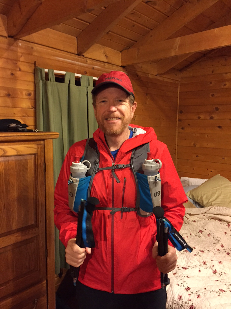
Sunrise in the Hengladir Valley, near Hengill Volcano, Iceland. Running with Michelle and looking at a boiling hot spring. Elísabet Margeirsdóttir photograph. Click on any figure to make it full sized.
4.5 billion years is a long time — even for a geoscientist. The age of the Earth is known with remarkable precision (the error in age is less that +/- 1 percent), thanks to radiometric dating of Earth and Moon igneous rocks and meteorites from other parts of the solar system. The Earth has been an evolving planet for about one third of the existence of the universe; despite this “old age”, the planet is a dynamic and HOT planet. The heat flow from the Earth’s interior is a little less than 50 terawatts, which drives the constant reshaping of the surface — raising mountains, erupting volcanoes and causing earthquakes. The source of this geothermal energy is fairly well understood, and is due to the decay of radioactive elements and primordial heat (the heat left over from the original formation of the planet). However, how the heat is transferred from the Earth’s interior to the surface is less well understood. The details of the heat transfer matters — it is the driver of plate tectonics.
In the early part of the 19th Century Charles Lyell, a great British geologist, proposed that the Earth had to be at least 300 million years old based on the slow rates of geologic processes. This ancient age for the planet not only infuriated the religious order of the day, but it annoyed the growing global physics community because it was based on speculation and logic arguments instead of models and calculations. Lord Kelvin expressed this contempt simply: “When you measure what you are speaking about and express it in numbers, you know something about it, but when you cannot express it in numbers your knowledge about is of a meagre and unsatisfactory kind.” Kelvin went on to calculate the age of the Earth assuming cooling through conduction, and arrived at an age of between 20 and 90 million years. I used to assign this problem as homework in my course on mathematical methods in geophysics. The calculation is straightforward and stunningly incorrect. Kelvin’s calculation had almost nothing to do with the Earth’s heat flow – it had the wrong heat transport model by ignoring convention and did not account for continuing heat production through radioactive decay. In 1919 Arthur Holmes — another great British geologist — suggested that the high temperatures in the Earth’s interior meant that rocks could “flow” in convection, and mass movement was the primary mechanism for moving heat from the deep interior to the surface.

Arthur Holmes used his idea of convection in the mantle of the Earth to propose a mechanism to drive plate tectonics in 1928. It took another 30 years before the Earth science community began to understand it as the unifying theory in geology.
It took another 30 years before a later generation of geophysicists took Holmes ideas and connected them with observations of ocean bathymetry, volcanic chemistry, and the geography of earthquakes to understand Plate Tectonics. However, there were some still some very odd observations that defied explanation with the plate tectonics paradigm. One of these was the idea of “hot spots” – large volcanic complexes that seemed to be located totally independent of plate tectonics. J. Tuzo Wilson — a Canadian geophysicist — showed that Hawaii was a long chain of volcanic islands that could be explained as a “hot spot” that melted the overlying plate as it passed by on its path determined by the driving forces of plate tectonics. The nature of these hot spots was a subject to great debate (during my graduate school career it was the regular topic of daily coffee discussions), with most scientists believing that they were thin columns of hot mantle that came from depths near the Earth’s core. Today, the concept of “thin” plumes is largely rejected in favor of broad convection plumes.
There is one place on Earth where a hot spot and a mid-ocean ridge coexist – Iceland. This is a truly strange and marvelous place. The hotspot has created an island about 1/3 the size of New Mexico; the center of the island is constantly being pulled apart as the mid-Atlantic ridge grows and the North America plate moves away from Eurasia at a rate of about 2 cm per year.
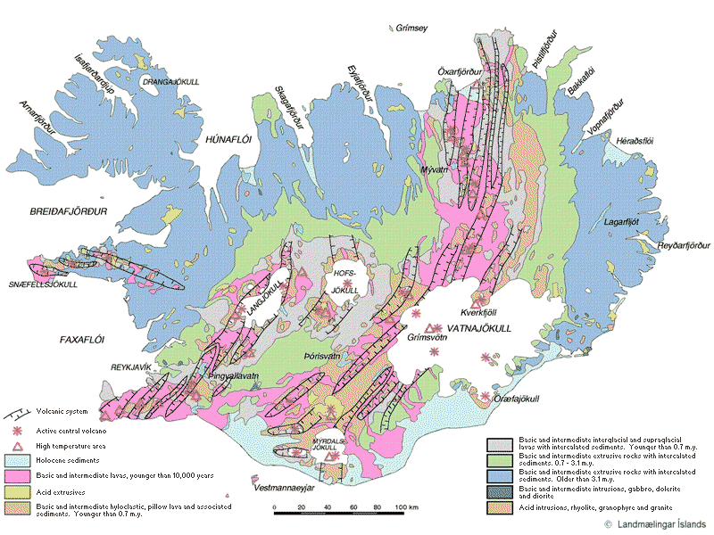
Geologic Map of Iceland. The “pink” zones show the recent volcanic activity that includes both the spreading center that travels across iceland through the Reykjavik Peninsula in the southeast to Husavik in the north as well as the center of the hotspot.
I have always wanted to visit Iceland and see with my own eyes the most impressive expression of the Earth’s heat engine. The physical location of Iceland — centered about 66 degrees north latitude — adds an extra wrinkle to the heat. The climate demands snow and ice…the geology demands volcanoes and lava flows. Finally the opportunity arrived to visit Iceland arose, and I planned to run from North America to Eurasia, and from glaciers to geysers.
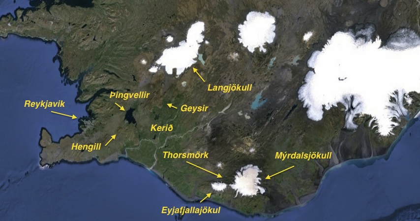
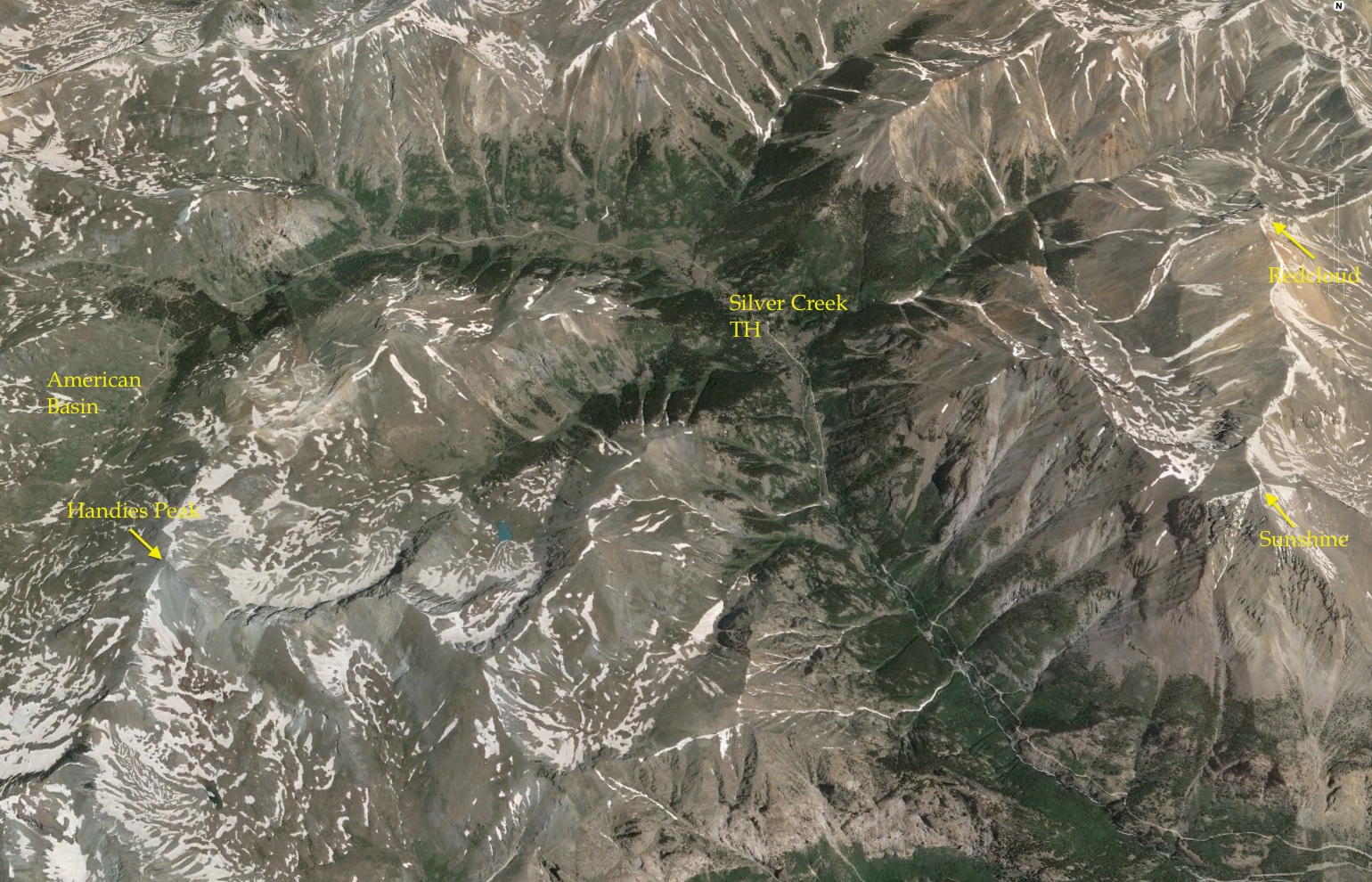
Map of southwest Iceland, and the locations of our various runs, treks and geology visits.
Running in the Rift
I planned a late September trip to Iceland, and arranged to see the geology the only way it is meant to be seen — underfoot. I had the fantasy of the ultimate trail run; running from one major tectonic plate to another. The mid-Atlantic ridge comes ashore in Iceland along the Reykjavik Peninsula (see the geologic map above), and the splits the island from north-to-south. The plate boundary is not a single, simple fault. It is more diffuse; however, geodetic measures clearly delineate that it is possible to run from North America to Eurasia with a good geology map.
About 25 miles east of Reykjavik sits Hengill Volcano. Modest by volcanic measures, Hengill is a row of craters aligned along a NNE trend, and has erupted material that now covers about 100 km2. The last eruption was about 2000 year before the present, but today is a major source of geothermal electrical production. The climb up the volcano offers wonderful views even though its maximum elevation is only 2200 ft.
We (my wife and I) planned a run from the west side of Hengill, up towards the summit craters, and then down Reykjadalur Valley, which is also known as the Smokey Valley due to its large number of fumaroles. We used a running tour guide from Arctic Running (Elísabet Margeirsdóttir) to lead us over the 10.5 miles of very varied terrain.

Running on the flank of Hengill Volcano. This rocky hills are called “borgs”.
After a brief climb up the flank of Hengill, the run is across a moonscape of cinders and volcanic bombs and cobbles. The run is challenging because of the surprises in footing, but is mostly slow paced because there is so much to see. After about 6 miles the trail crosses a pass that allows a view 40 km to the north.

Smackdab in the middle of the Mid-Atlantic Rift – North America to the left of the photo, Eurasia to the right. In the distance is the large lake Þingvallavatn, which is in the rift valley (usually marked on maps for the culture center Thingvellir).
In the distance is Þingvallavatn, the largest lake in Iceland. This lake is located within the rift valley separating the plates. On another day we visited the lake and the numerous basalt flows and dozens of grabens.

Þingvallavatn and the rift valley. There are numerous fissures in the basalt that are expressions of dozens of pull-apart grabbens. These grabens are an markers of the plate boundaries. However, despite the advertisements that you can “stand on both plates”, the boundary is more diffuse – probably 2-5 miles across. The view is to the southeast, and on the horizon is Volcano Hengill, source of the previous pictures.
Þingvallavatn is partially within Þingvallir National Park, which is quite popular with the tourists. The original Icelandic Parliament was established here in 930 (about 60 years after Norsemen arrived on the Island), and remained here until the beginning of the 19th Century. Despite the crowds, a short hike will allow one to explore the geology in relative solitude.

Another graben at Þingvallavatn. The sides of the grabben form the channel for a river.
The trail run turns to the south from the pass on the flanks of Hengill and enters Reykjadalur. Every hillside is alive with fumaroles – the mountains are literally smoking. At about mile 8 the warm waters of the all the springs drain into a modest river which runs along a short plain. The river here is famous for bathing, and indeed we stopped and soaked a bit before running on to the end of the trail. The water in the various natural pools is about 100 degrees – a warm bath.

Running down hard scoria into Reykjadalur – The Smokey Valley.
The final part of the run has a challenge that is unlike any I have faced. There are two spots that have warning signs advising hikers not to breath in the milky clouds coming from some of the springs. The warning talks of health hazards – and it clearly related to the release of H2S.

A special hazard of running the lower Smokey Valley – clouds of steam that are rich is H2S. Signs warn to hold your breath….really.
At the first of the these warning I attempted to hold my breath, but clearly I was not running fast enough, and had to take a deep gulp of air right in the middle of the cloud. The rotten egg smell is enough to cause one to knell over, but the total exposure is pretty limited.

Kerið crater — just beyond the completion of the Smokey Valley trail run. A 3000 year old scoria crater filled with water.
A short distance beyond the end of the trail run is a series of “cinder cones” that have erupted in the last few hundred years. The best preserved of these is Kerið crater, which is filled with a deep blue lake. The contrast in colors – the red of the scoria and the blue of the lake make for a striking geologic panorama.

Glacier on mountains mean flowing water everywhere. Starting up the the washout plains to Thorsmork, and one of the scenic waterfalls.
Trekking Across a Volcanic Complex
A short jog across the plate boundaries serves only as a reminder that the geology of Iceland is immense! The Hengill area is dominated by the dynamics of the spreading center. Further to the east are a series of very large volcanic complexes – not really volcanoes, but a series of vents and craters that have a strong fingerprint of the deeper mantle chemistry indicative of the Iceland hotspot.

Glacial outwash on the road to Thorsmörk. On the horizon is another volcano, Tindfjallajokull.
Only a few 10s of miles east of Hengill sits the most famous Iceland volcano, Hekla. Hekla is a stratavolcano that is about 4900 ft in elevation, and has had 20 significant eruptions since the first occupation of Iceland. There are numerous deposits in Ireland and Scotland of tephra from Hekla eruptions. A large eruption conjured a vision of hell, and a monk wrote: “The renowned fiery cauldron of Sicily which men call Hell’s chimney … that cauldron is affirmed to be like a small furnace compared to this enormous inferno”. Hekla is one of only two Icelandic words that made it into common English language. “Heck” is a shortened version of Hekla, and “what the heck” literally means “what the hell”.

Abraham Ortelius’ 1585 map of Iceland showing Hekla in eruption. The text translates as “The Hekla, perpetually condemned to storms and snow, vomits stones under terrible noise”.
A few miles southeast of Helka is one of the treasures of Iceland, Thorsmörk (Thor’s Valley). This valley is bounded by glaciers to the north and south (Tindfjallajokull and Eyjafjallajökull respectively), and blocked by a third major glacier, Myrdalsjokull in the east. I planned to hike between the Eyjafjallajökull and Myrdalsjokull glaciers (adding the word glacier is redundant since jokull means glacier, but Icelandic words are very difficult!) through a pass known as Fimmvörðuháls. The second part of my jog across Iceland was trek on the edges of the hotspot.

The beginning of the trek – Thorsmörk, looking up at the glaciers of Myrdalsjokull and across the wide plain of a flood basin and the river Krossa. The Myrdalsjokull glacier sits atop the Katla volcanic complex – one of the largest in Iceland.
We hired a ride to the Thorsmörk, and hoped for about 35 km of walking. Along the way we visited one of the small valley glaciers that connects to Eyjafjallajökull, Gigjokull. Eyjafjalla erupted in 2010, and caused significant ice melting that caused Gigjokull to surge, and released a great outwash of debris destroying the jökulurð (terminal moraine).

Gigjokull glacier; The toe is about 50 m across.
A few miles beyond Gigjokull we begin our trek climbing along the flanks of Eyjafjalla. The soft volcanic tephras and modestly welded tuffs are deeply eroded by the constant rainfall. The trek is up and down, intermixed with stunning views.

On the trail, looking up at Myrdalsjokull. The elevation on the trail is 1600 feet, and glacier line is 2200 feet. Scenic hike, but the volcanic terrain has been eroded with endless canyons, so lots of climbing and descending.
The last climb of the day is up a hill called Rettarfell. Coming down the trail there is a view across the Krossa river. The fall colors are tremendous – delicate red flows intermixed with yellow grasses offset the harsh black and gray volcanic rumble. In the picture below the end of journey is in sight – a hut across the river in the center of the photograph.

Descending off the flank of Eyjafjalla into the hut for the evening. Fall colors are spectacular.
The first day has been perfect weather wise, and the trekking was quite enjoyable. However, the weather forecast for the next day is ominous.

Descending into the valley for the end of day one.
One of the most challenging aspects of the trek is actually crossing the Krossa. The river is braided with many strands, and the main sections have channels flowing several feet deep. In the hut there is a “book of shame” that documents all the jeeps that attempted to cross the river only to become mired, and then flooded. Various hiking clubs in Iceland have built portable bridges that can be wheeled from one location to another as the river changes its course. From high up on the ridges at Rettarfell I can see the bridges, but they look like they are just stuck out randomly on the flood plain – we joke that Iceland, like American, has its bridges to no where. Fortunately, the bridges are in the right spot and traveling across to the hut for the evening is uneventful.

Early in the morning of day 2 in Thorsmörk – a short night because we waited for a meager northern lights.
The hut is comfortable – and a light sleeping bag on a foam mattress is more like probation than a life sentence in prison. Although the clouds began to come in around 10 pm, we held out hope that the total darkness of the remote area would reward us with a glimpse of the northern lights. Indeed, as predicted by the Iceland Aurora Watch, the lights appeared at 10:30. However, they were quite weak and fleeting. The was a chance that they would reappear at midnight, but all we got for that wait was sleep deprivation. On the other hand, the night sky was filled with stars I seldom get to see, and the Milky Way splashed across the horizon like a haphazard paint stroke.

First morning’s light. Clouds moving in, but barely indicated the steady rain to follow.
The plan for the second day was a 22 km trek with a descent along the Skógá River, ending with a spectacular water fall, Skógafoss (foss means “falls” in Icelandic, so Skogafoss waterfall is also a wonderful redundancy!). However, by 10 am the rain was falling in buckets, and the wind had gusts in which it was impossible to remain upright. We shortened the hike – but covered distances along the trail on both sides of the pass. By 2pm it was clear that this trek would mostly be noted for the fact that we did not drown.

Skógafoss falls, along the Skógá River, draining both Eyjafjallajökull and Myrdalsjokull. The drop across the basalt cliff is about 60 m, and produces a persistent mist. This mist is famous for strong rainbows…however, there are no rainbows in the driving rain.
The end of the trek comes with the realization that Michelle’s rain gear is no longer certified…everything leaked.

End of the trek – and the 20 year old quality raincoat that can now be best used as a sponge.
After the trek we made a short trip to Reynisfjara, which is famous for its black sand beaches. The beaches are indeed beautiful, but it is interesting that if you say “black sand beach” to an Icelander they will reply – all our beaches are black sand, and there are too many miles to count.

Black sand beaches of Reynisfjara. The “sand” is actually pebbles of basalt.
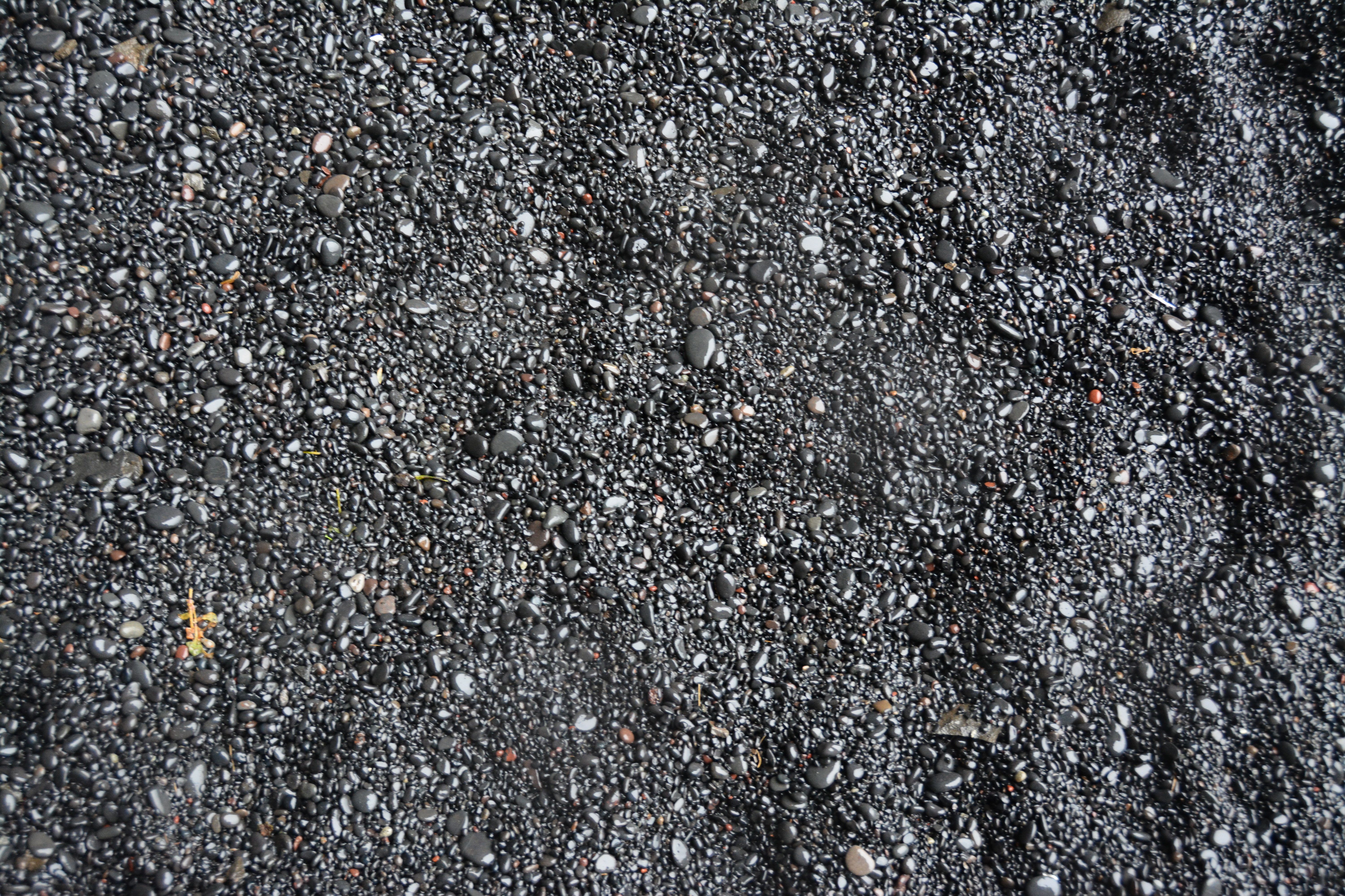
A close up of the “black sand”. The image is about 2 feet across. I tried running on the beach, and it was quite difficult!
The purpose of the trek was to visit the glaciers and volcanics of the hotspot. Although the scenery was amazing, it was difficult to see uniqueness in the volcanics; it is clear that the stratavolcanoes are broad and much larger than the modest structures along the extension of the Reykjavik Ridge. However, the changes in rock type is subtle – at least to the eye.
Dotting the i – Visiting Geysir and Langjokull
No visit to the volcanoes of southwest Iceland would be complete without a journey to Geysir and then on to the second largest Icelandic glacier, Langjökull (strictly speaking, Langjökull is an “icecap” – meaning it flows in all directions from its summit). This particular journey is not amenable to running (or trekking), so we hired a driver.

The pool of hot water over The Great Geysir in the Haukadalur Valley. The valley sits in a structural embayment within a rhyolite dome, and the meteoric waters that fall on the dome descend through cracks and are heated by a shallow magma body. The Great Geysir no longer erupts, but that probably is a temporary condition.
The Haukadalur Valley is about 50 km northeast of Þingvallavatn. There are a half dozen large, boiling hot springs in an area roughly the size of two football fields. Presently there is only one of these that erupts with regularity – Strokkur – which has a periodicity of about 8 minutes. The Great Geysir was the first boiling fountain described in literature, and was adopted into the English language as “geyser”. In the past the Great Geysir had eruptions that reached 170 m in height. The plumbing of the system of hot springs appears to be highly influenced/connected to the occurrence of earthquakes in the area. Moderate sized quakes appear to turn on and off the eruptive cycles of the various springs.
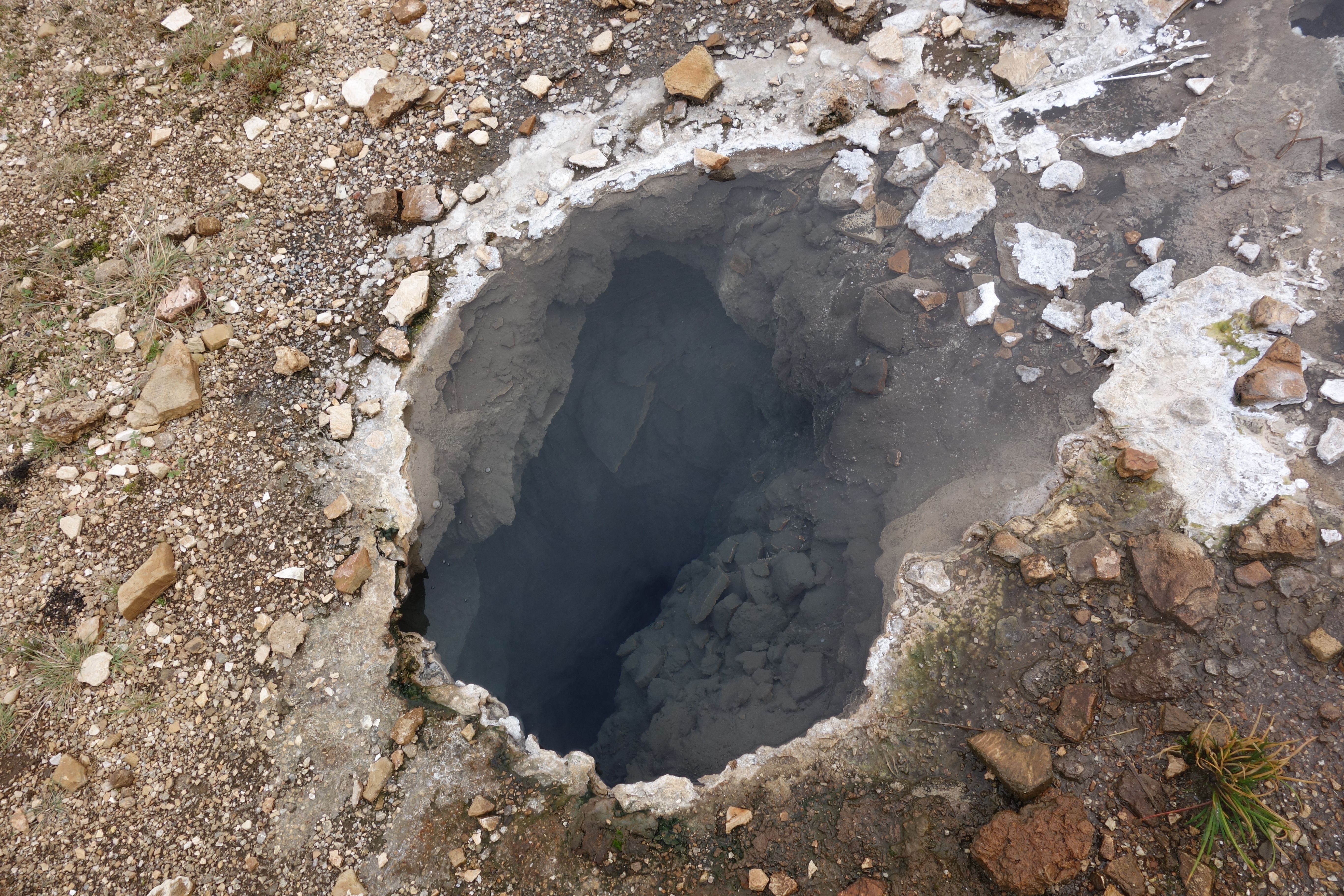
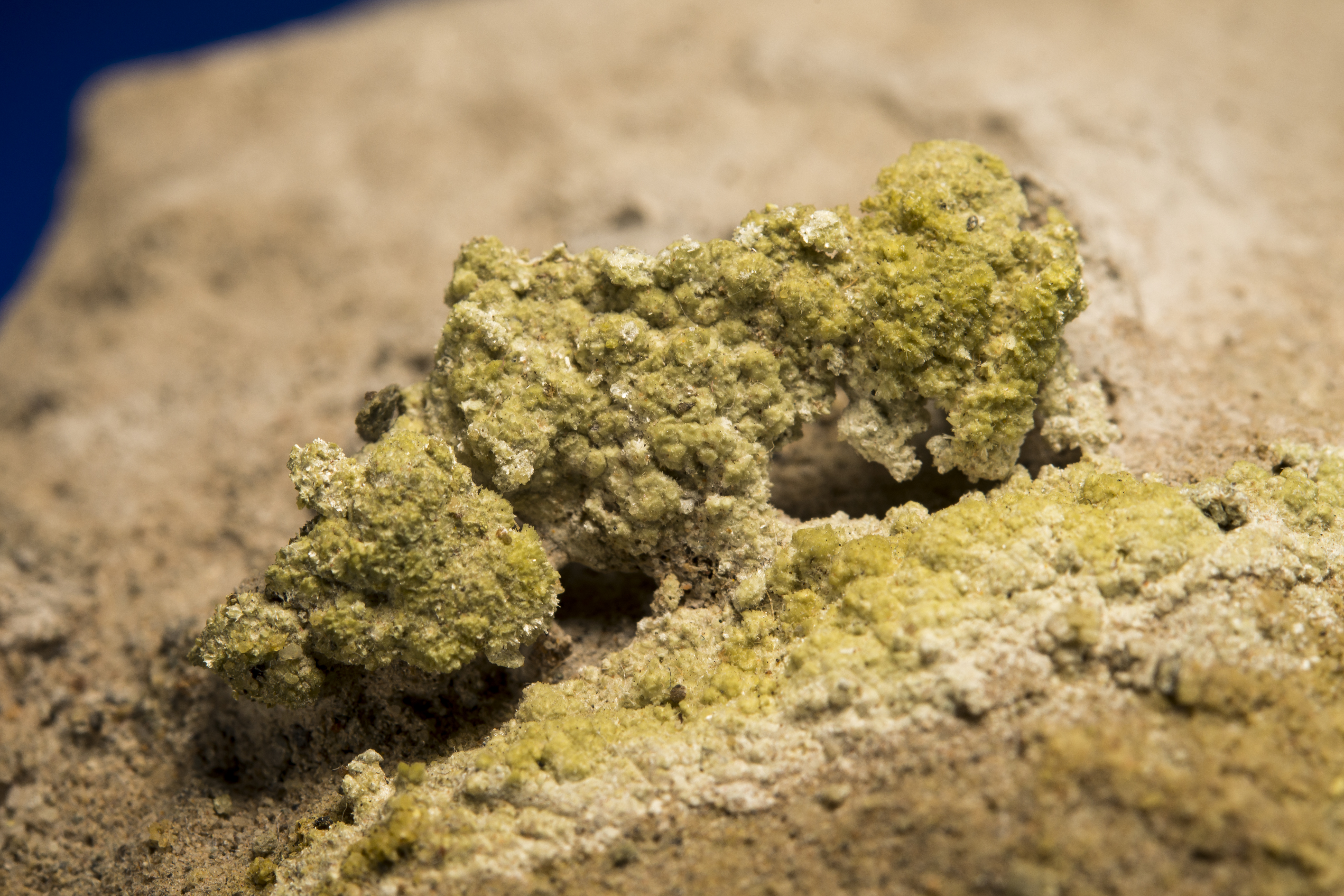
Crystal clear water in a boiling hot spring. Looking down this conduit one can see approximately 2 m (or so the sign says). Although the water is crystal clear, every few minutes a cluster of bubbles ascend releasing pungent H2S gas.
Haukadalur Valley suffers from inevitable comparisons with Yellowstone and Old Faithful. The modest sized region is thick with tourists – but most of these are loaded and unloaded in large buses that follow a loop called the “Golden Circle”. We did not spend much time at Geysir, but it was on the way to Langjökull so the stop is worthwhile. The massive glacier Langjökull is visible from Haukadalur, and frames a horizon as an imposing block of snow and ice.

Langjökull – a massive ice cap glacier. The glacier has a volume of ice that is approximately 200 km3. Late in the season – like the 3rd week in Sept — the lower reaches of the glacier is covered with black mounds that resemble giant ant mounds.
Langjökull covers a highlands that is actually two active volcanic systems. The glacier is about 50 km long in the north-south direction and 20 km wide (east-west); at its thickest the ice is 580 m. The large size of the glacier makes it easily seen from space (see the location map at the top of the blog section on the Hengill run). Unfortunately, the glacier is in rapid retreat. Using 1990 as a baseline, Langjökull has lost 15% of its ariel extent, and models project it will disappear by the middle of next century.
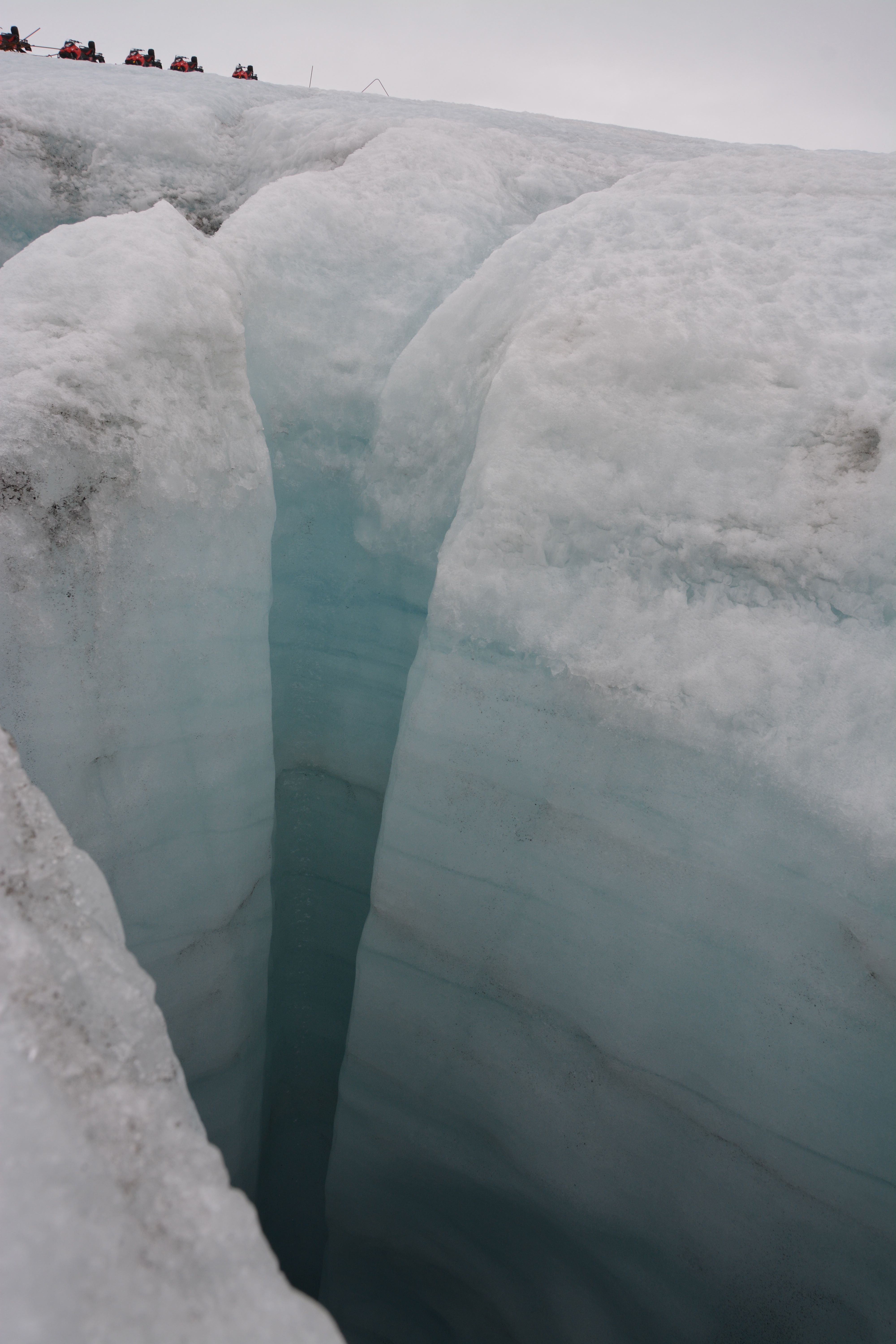
A large moulin – vertical hole or shaft in the glacier that serves as a plumbing system within the ice mass. Our line of snow mobiles are in the upper left for scale.
We toured the glacier via snowmobile. As advertised, driving the snowmobiles was no more difficult than driving a bicycle. I ride my bike a lot, so my thought was “this will be really easy”. Well, Michelle and I sharing a snowmobile means that we had to coordinate our leans with every sharp turn. Our coordination was not world class. However, the tour allowed us to see the scale of the glacier, and certainly observe the obvious signs of ice retreat.
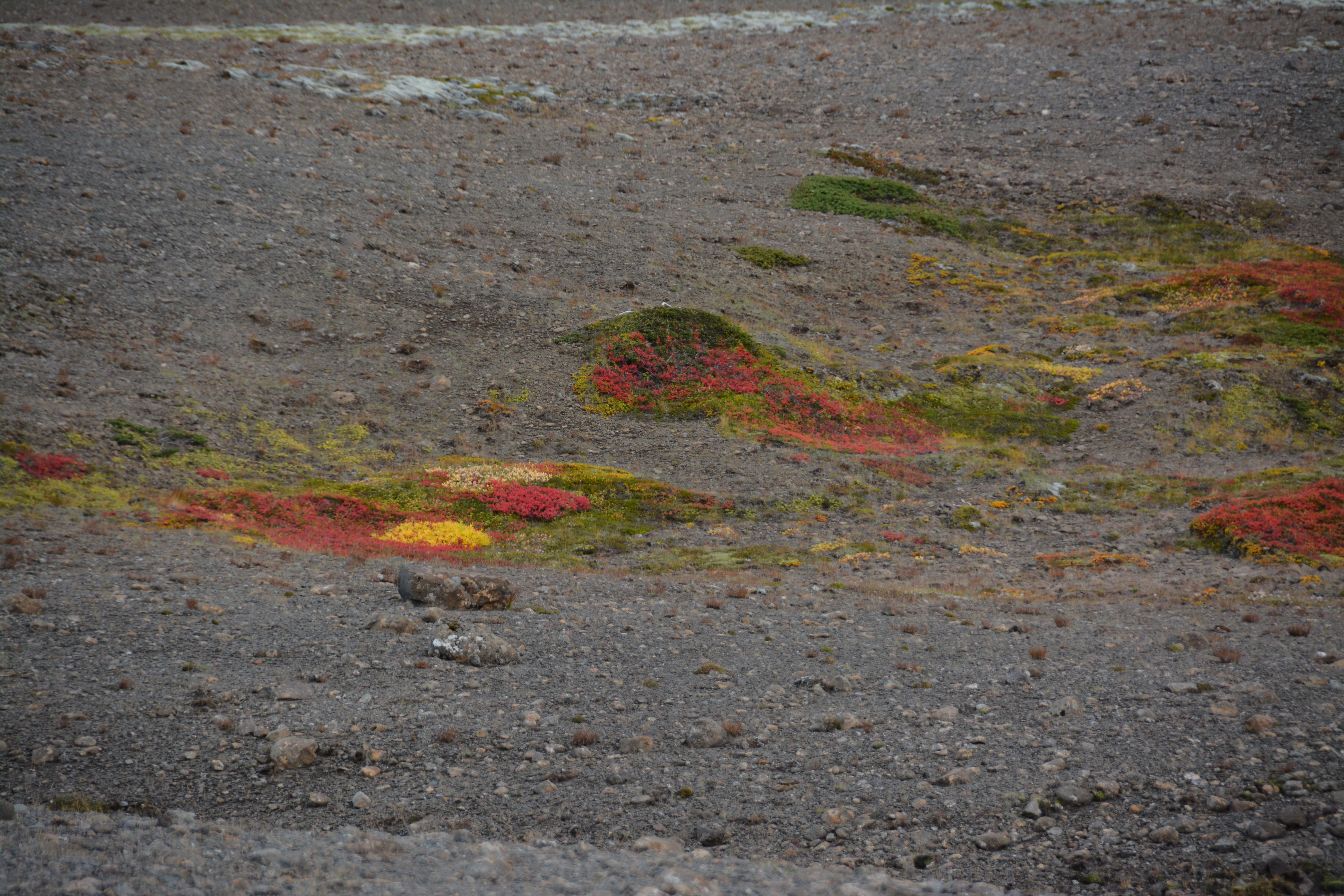
A spot of color in the volcanic highlands. The fall season gives texture to the otherwise monotonous gray of volcanic rubble.
The journey to, and away from Langjökull is a winding dirt road through barren volcanic badlands. However, late in the fall the sparse vegetation is alive with bright color. There is something majestic about survival of these plants even in the most hostile environments.

The most famous water fall in Iceland – Gullfoss.
The drive back to Reykjavik follows the Hvítá river for a short distance. Along this route the river tumbles over a 3 step staircase creating a beautiful waterfall. Gullfoss, like Geysir, is on the tour bus route for the Golden Circle so the area is always crowed with camera clickers (okay, I was also a camera clicker).
Hotspots require more time
The geology of Iceland is wonderful – and although the southwestern portion of the island is relatively compact, it is clear that a series of runs and treks hardly do justice to the remarkable tectonic processes that are going on here. The evidence of volcanism is everywhere, but strangely mysterious in that it is also hidden. The forces of water, ice and erosion are also everywhere. Nothing about the landscape of the island seems permanent; wait a hundred years, and eruptions and floods will change the view shed. It is clear that a real visit to Iceland requires far more than a few days…but it is a great place to run!

Urridafoss falls – the largest VOLUME waterfall in Iceland, and totally off the beaten track. Waterfalls here a ubiquitous, and perhaps a bigger signature of the geology than even the volcanoes.