The difference between Metric and USCU: Crashing and burning the Jemez Mountain Trail Runs 50 miler

The woods are lovely, dark and deep, But I have promises to keep, And miles to go before I sleep, And miles to go before I sleep, Robert Frost, Stopping by Woods on a Snowy Evening (1923).

Star Tracks above the JMTR course. This wonderful photograph by Jim Stein (a magnificent Los Alamos photographer) shows the night sky above the track of the JMTR 50 miler and 50 km course between the Ski Hill and Pipeline Aid Stations. Click on thumbnail photos to get larger images.

On December 11, 1998, NASA launched the Mars Climate Orbiter from Cape Canaveral. The orbiter was approximately a 2 meter cube that contained several instruments designed to map the details of the Martian atmosphere, and cost approximately 330 million dollars. Nine months after launch the satellite began maneuvers to assume an orbit around the red planet – but almost immediately NASA realized something had gone wrong. The orbiter was much closer to the surface of Mars than planned, and it ultimately disintegrated in the weak Martian atmosphere.  An ensuing investigation found that there was a software incompatibility in the orbiter – NASA had assumed metric units in its calculations, and controlling software supplied by Lockheed Martin used USCU (United States Customary Units). Miles vs Kilometers. Marvelous engineering, but the orbiter was lost because a kilometer is much, much different than a mile!

My home town trail ultra run, the Jemez Mountain Trail Runs (JMTR), has gained considerable fame as a challenging set of races – 50 miles, 50 km, and 15 miles (use to be a half marathon, but 13.1 miles is really just a warm up run, so it had to be stretched to 15 miles). I have run the 50 km race several times, and this year took the plunge and switched over to the 50 mile course (which is actually 52.7 miles long – ultra races have a strong culture of not wanting to “cheat” the runners and so usually run long).  It is obvious to even the most causal observer, 50 miles will be a more difficult run than 50 km.  But, it is not just miles (the JMTR 50 km race is 32.8 miles instead of the expected 31 miles – again, “more miles for the dollar”) that make the difference in a 50 km and 50 mile race – it is also time on one’s feet.  For slower runners, like myself, the body goes through stages of trauma when you run for 13 or 14 hours (or even 8 to 10 hours for a 50 km race); these include how your body processes fuel, the cumulative impact of 10s of thousands of joint jarring strikes on the ground as you run along the trail, and blood chemistry changes as muscle tissue breaks down.  A 50 miler becomes a set of different races within the overall run.  Elite runners can complete the JMTR in a little over 8 hours; very talented runners can run the course in 10 to 11 hours. Plodders like myself are several hours after that, and the extra time on the trail has significant consequences that are not intuitive (i.e., just being in the sun for an extra three hours has a tremendous impact on runners).

topofpajarito

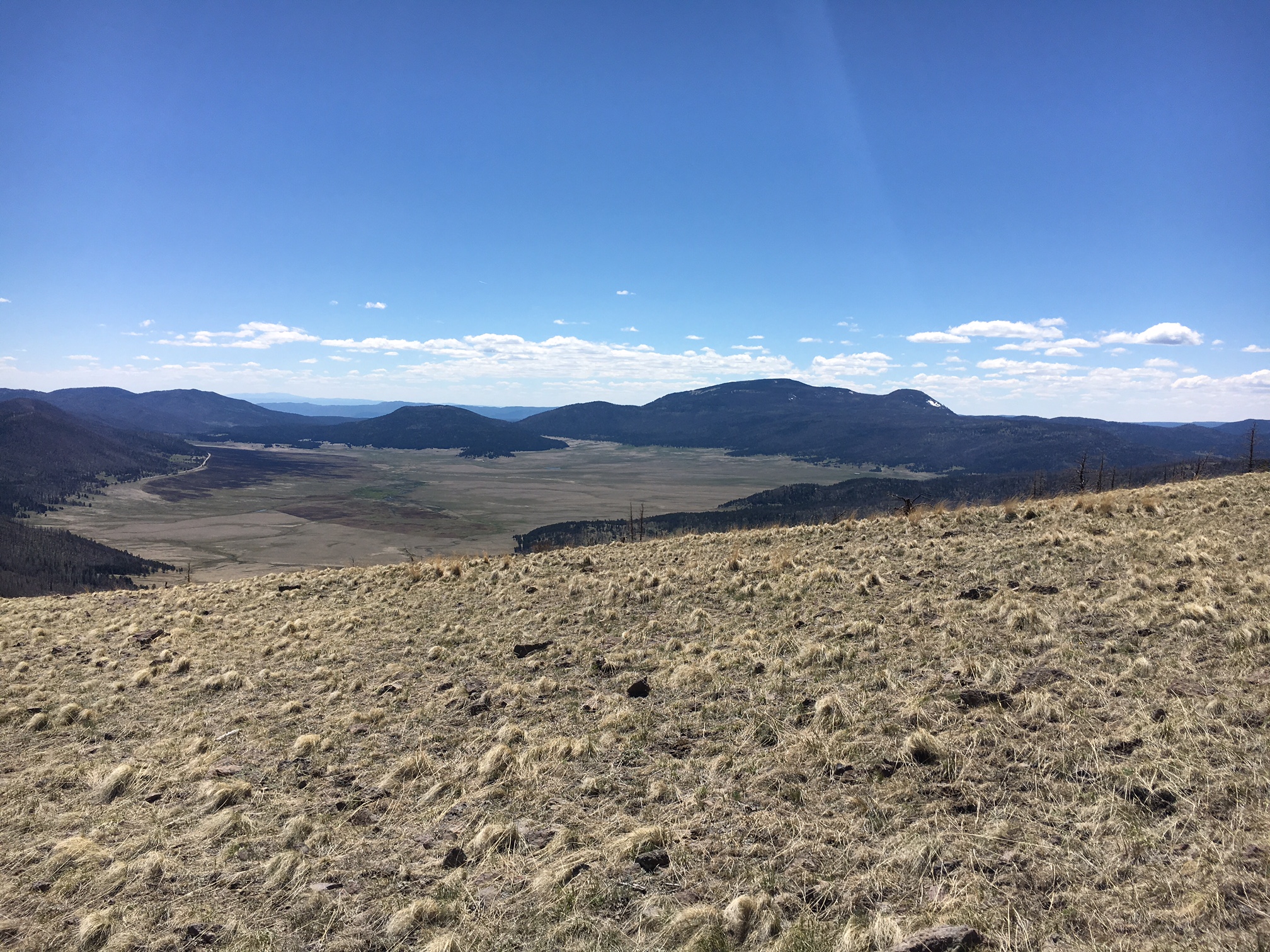
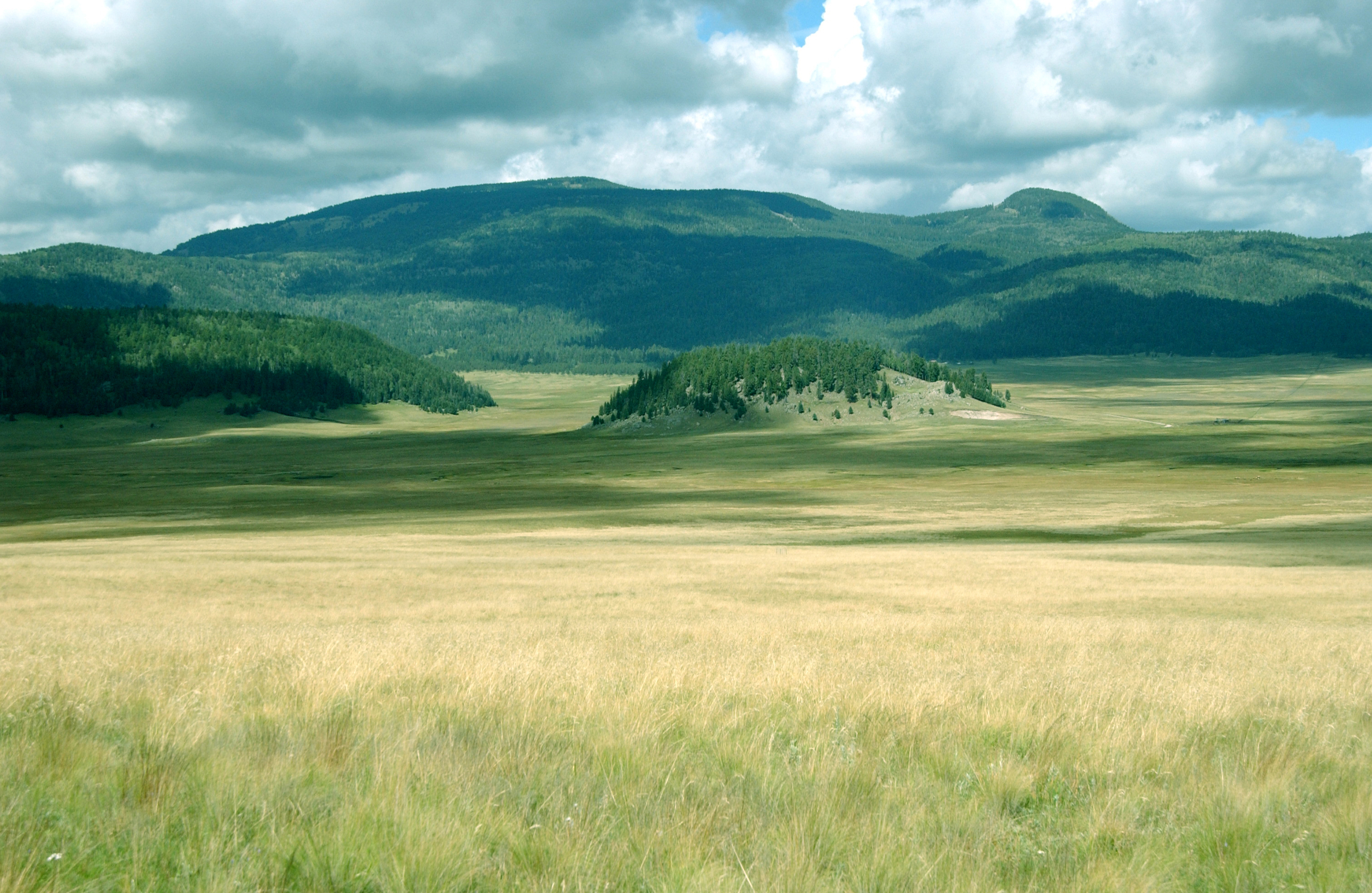
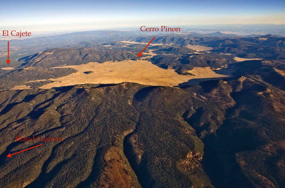
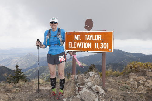
Top of Pajarito Mountain, the high point of the JMTR course at 10,440 feet (photo taken the day before the race when I was practicing the descent to the Ski Hill Aid station). The climb to the top is relentless and long – and for 50 milers the climb is done twice. View to the west across the Valle Grande.

I have run about 20 trail ultras of 50 or 55 km length.  Each of these races are unique – terrain, elevation, sand (which is the single worst running surface), weather – so it is difficult to characterize what a “typical” trail race is like.  However, there are some generalities that can be made.  I have run all these races in times between 6hrs and 50 minutes and 8hrs and 55 minutes (so, on average, it takes me about 8 hours to run a trail 50 km ultra). Experience has taught me when to hike and not run, how to fuel during the race, how often I need to drink, and perhaps most importantly, how to mentally deal with being on the trail for 8+ hours. It is fair to say that 50/55 km trail runs no longer intimidate me, nor do I expect to require more than a week or two to recover from a race. But all is not necessarily well: in the last 18 months I have had a noted decline in my expected performance in 50 km races.  I have been slowing, and begun to cramp more often, and walked long sections of the course.  The leap from metric to USCU is huge – those extra 18-20 miles, at the end of a 50 mile race, are much harder than the first 50 km.  The JMTR is very known territory to me, and there is no part of the course that I have not run dozens of times. But putting those segmented runs into one long journey is a true test. 52.7 miles with 11,300 feet elevation gain (and then descent!) is a wild ride.  I will turn 60 years old in a few weeks after the 2016 JMTR – and I figured “what a way to celebrate!).  Unfortunately, NASA Mars missions and my ultra running have some things in common…….

cover1

Running an ultra is unlike any other athletic endeavor – there are parts physical, mental, and luck. Understanding which of these categories is making you miserable is essential. Plus, being a scientist, athletic misery allows infinite analysis!

Running Long: What Happens to the Body

There is a large body of scientific work on optimizing performance in marathons.  For example this paper is a classic: Noakes, T.D., K.H. Myburgh, J. Du Plessis, L. Lang, M. Lambert, C. Van Der Riet, and R. Schall. 1991. Metabolic rate, not percent dehydration, predicts rectal temperature in marathon runners. Medicine and Science in Sports and Exercise 23(4):443-449 (yes, the investigators convinced some runners to put a thermometer up their rectum….). One is tempted to use this catalogue of studies to understand what is happening to your body during an ultra marathon in the mountains.  However, except for elite runners – the best of the best – the marathon analysis are almost irrelevant.

Metabolic-Efficency-Crossover

Running a marathon, even in a modest 4 hour time (and I say modest 4 hour with respect because it is really very difficult to run a 4 hour marathon!), is an intense athletic endeavor.  Heart rates are typically at 80 percent max or higher, the body is relying on fast twitch muscles, and those muscles are fueled by glycogen which is stored in the muscles and liver.  Typically, marathon runners store enough glycogen to run about 18 miles (and then hit the dreaded “wall” and bonk when unprepared).  Ultra runners of the run-of-the-mill variety typically run at heart rates of 60 or even 50% max.  My maximum heart rate is calculated to be about 165; when I run a competitive 10 km race on the road my heart rate is about 150.  When I run an ultra my heart rate is usually in the 120s.  This means that my body is using more slow twitch muscles, and I am burning less glycogen per mile and more fat.  The figure above is a notational comparison of fuels the body utilizes as a function of intensity of exercise.

Fueling is actually one of the lesser issues for the average ultra runner.  Consuming “real” food every 5 or 10 miles is much different that trying to get sugars into your system like a marathoner does.  The larger issues are hydration, the general breakdown of muscle tissue and the pounding joints take with 10 hours on the trail.  The impact of the muscle tissue breakdown is two fold – the muscle stop performing at their peak, and the byproducts of breakdown enter the blood stream and cause the certain internal organs to work much harder than would be expected for other forms of exercise.

cortisol

Cortisol is a glucocorticoid hormone – it is often called the “stress hormone – and is responsible for the stress response within the body.

There are many different things that happen with muscle breakdown – and joint pounding – but one of the most important responses in the body is the production of cortisol. Cortisol is a powerful regulator of immune response; it is a hormone controlled by the adrenal cortex.  Cortisol is absolutely necessary for normal metabolic functionality.  However, under stress — like hours into an ultra – cortisol becomes elevated. Elevated cortisol levels resulting from physical stress triggers the ‘fight or flight’ response. This can be good –  however, over time the high levels of cortisol leads to a state of constant muscle breakdown and suppressed immune function, and a decay of things like “running efficiency”.  One of the biggest differences between marathon runners and average ultra runners is the time the body is exposed to elevated levels of cortisol.  Although every person responds uniquely, all humans degrade in performance over time when exposed to stress.  This is not something that easily translates from one ultra runner to another.

Hydration is an essential element of metabolism.  In general, ultra runners think of hydration as a response to sweating, but in fact, it is mostly a response to heavy breathing, especially in very dry climates. A small number of studies have been performed on ultra runners and they show that on average male runners will loose about 4.4 pounds during a 50 mile run lasting 12-15 hours.  That weight loss is largely water.  Runners probably sweat away about 8 pounds over the same run, but are able to replace about 4 of those pounds by drinking (that equates to 1/2 of a gallon of water).  The rest of the loss effects other facets of the metabolism including the ability to process food and most importantly, cool the brain.  Long runs always generate what is called “central fatigue” which is a gradual decline in the nervous system’s ability to contract muscles.  In other words, your legs stop listening to the signals your brain sends them.  “Run Forrest Run” is a pipe dream at the end of a run not only because your muscles have broken down, but also because your brain is too tired to force the issue.  If your brain gets “hot” due to lack of cooling, the fatigue is greatly accelerated.

Given all these nasty things that happen during an ultra, why run?  Good question, but not one that is easily answered.  For me, more importantly, is “how do I understand WHY I am running the way I am” given the complexity of the human system.  Running an ultra is not a controlled experiment.  Every human is different – but thoughtful analysis can help understand “what happened”.

zerkleandwallace

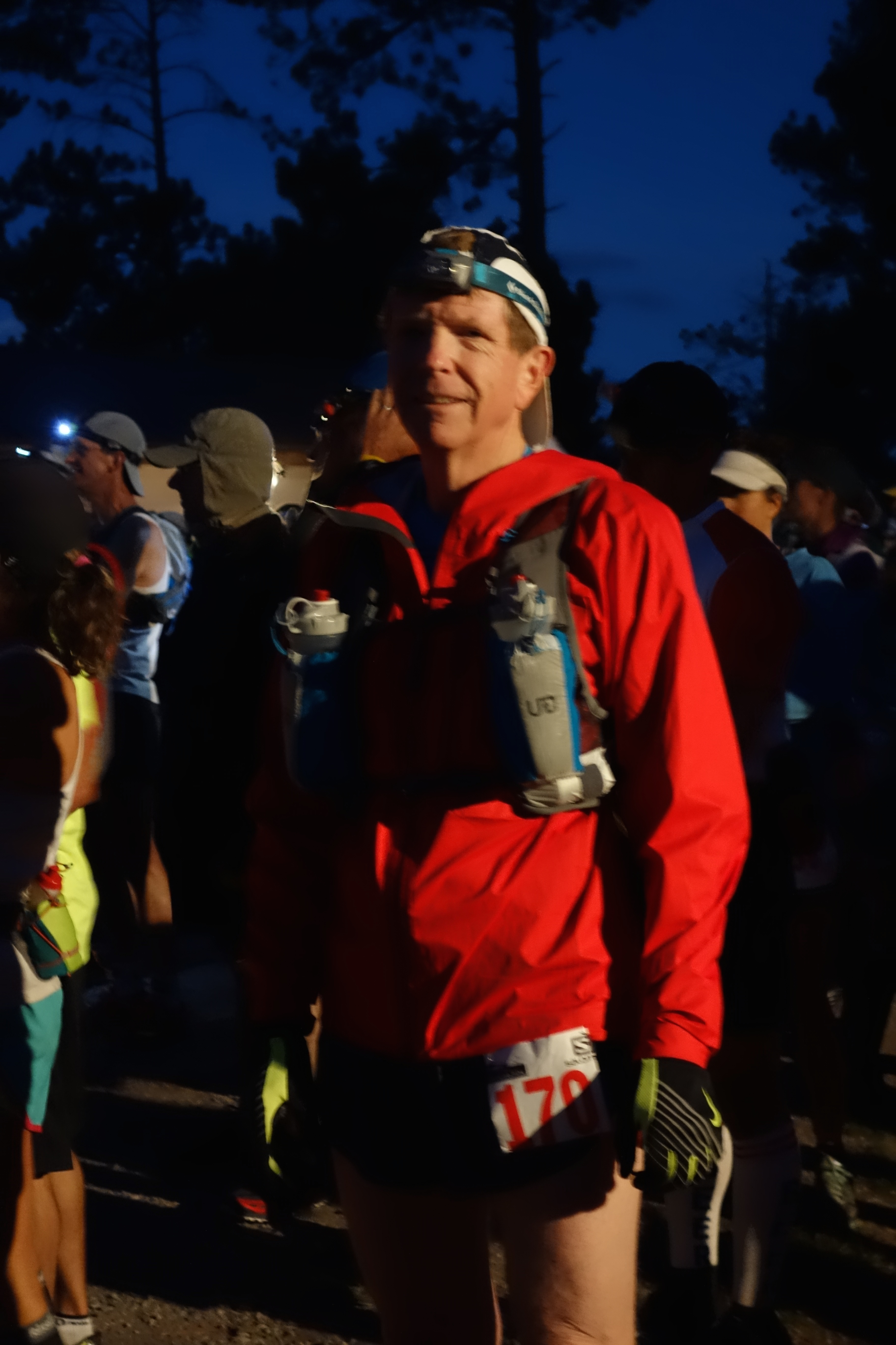
Dave Zerkle and I at 4:30 in the morning waiting for the 50 miler to start.

The 2016 JMTR 50 miler

Training for the JMTR 50 was an interesting endeavor this year.  Everyone in Los Alamos waited for a mega snow season promised by a massive El Nino year.  Indeed the El Nino as measured by sea surface temperatures along the equator in the Pacific was the largest in recorded history.

dn28595-1_800

Sea Surface temperature anomaly for the 1997 and 2015 El Nino cycles. 1997 was a devastating global event, and brought a tripling of normal moisture to the US southwest.

The climate system is quite complex so it is very difficult to “model” and predict the effects of a developing El Nino.  Thus, most climate scientists and certainly most amateur weather forecasters, assume that past systems will do a pretty good job of predicting consequences for the developing system.  Below are the sea surface temperature observations for 1997 and 2015 – and, indeed, they look remarkably similar.  How different could the weather be in winter/spring 1998 and 2016?

en_us2

en_us

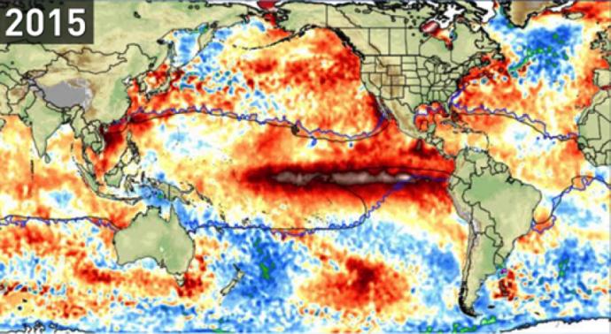
Comparisons of the sea surface temperature anomalies for December 1997 and 2015. The dark brown colors along the equator outline the “warm water pool” that drives the weather conditions that including much more precipitation in the southwest, and generally cooler temperatures.

Well, the answer is “pretty damn different”.  Northern New Mexico got a significant increase in moisture, but it was incredibly uneven in its distribution.  Los Alamos did not get any early snow fall; in fact it only had two large events.  These storms were large enough to produce an adequate ski season, but not like that seen in 1998. The spring was colder than usual, and many small storms dumping a few inches of snow all the way up to the week of the JMTR.  The net effect was that despite the modest snowfall, many of the high country trails in the Jemez were unavailable for running until late April.  This meant training was done closer to town and at elevations that rarely exceeded 8000 feet elevation.  Many miles were run, but the climbs were less excruciating, the air was thick (instead of what we suck down at 10,000′).  When I towed the line for the 2016 50 miler I was uncertain of my fitness – the training was just different.

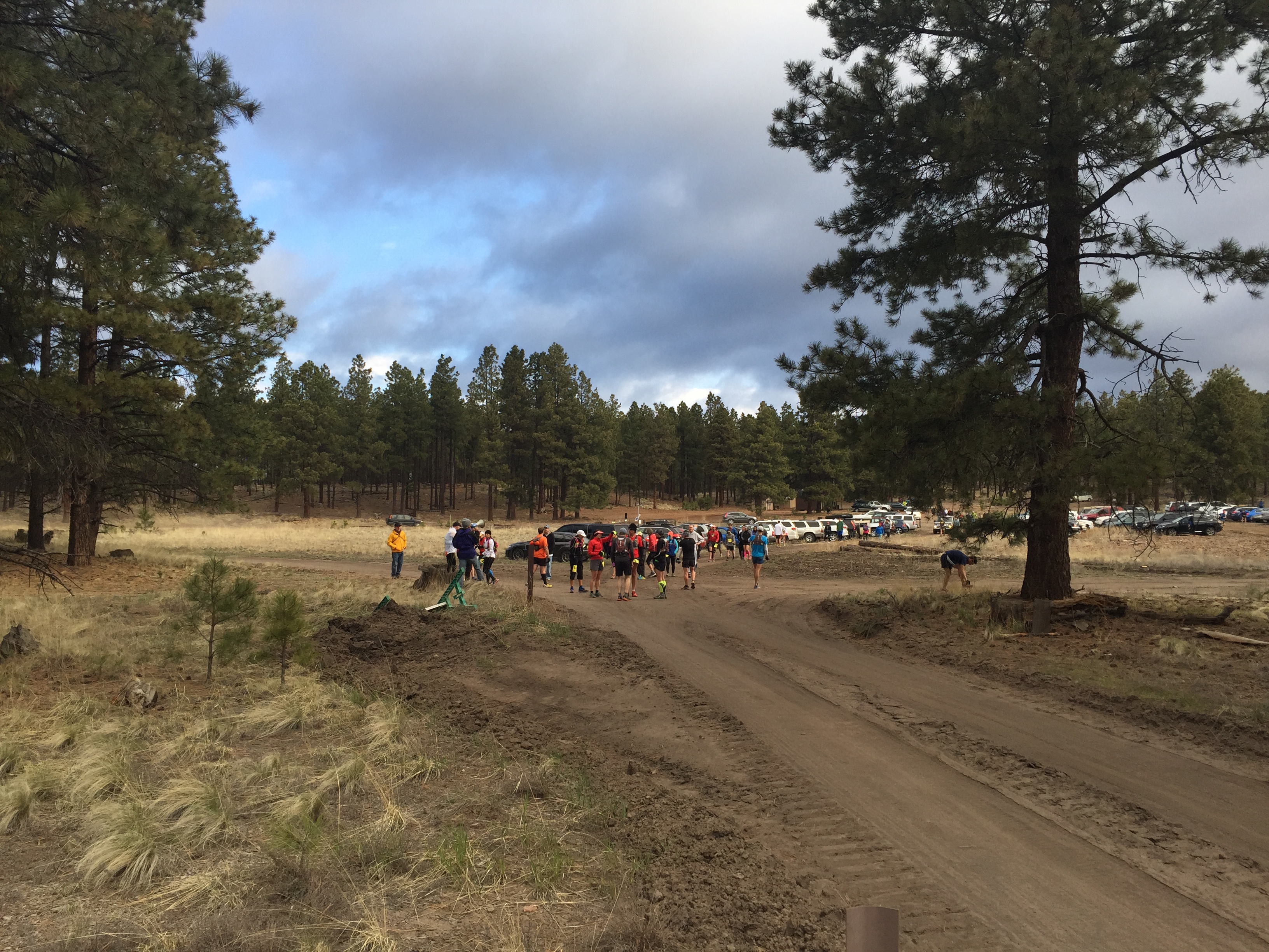
The JMTR starts at 5:00 am at the Posse Shack (some people get offended at the “Shack” label and prefer “Lodge”, but I grew up here in Los Alamos and we have called it the shack since the 1950s).  I am always impressed at the enthusiasm of the runners before a long day ahead.  However, I had some dread – it was 49 degrees at 5 am, which meant a warm day ahead.  I am not a warm weather runner by any stretch of imagination.  The start of the race is a dance of bouncing light beams from headlamps under a full moon sky.  The first couple of miles are along a rutted single track, and nice easy running.  My only thought was “not too fast, not too fast – it is a very long day”.  By mile three my headlamp is in my hand, but I note that the headband is soaked with sweat.  When we pull into Aid Station 1 we are 5 miles into the course — I can’t help but start the calculator in my brain and think I only have 90% to go!

figureforblog

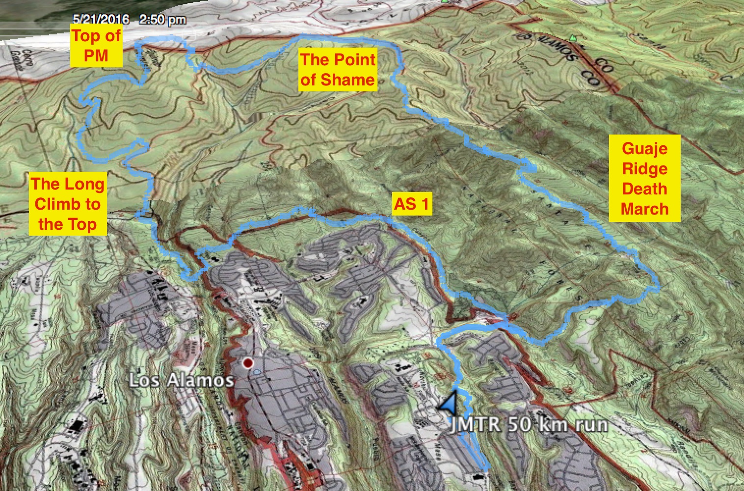
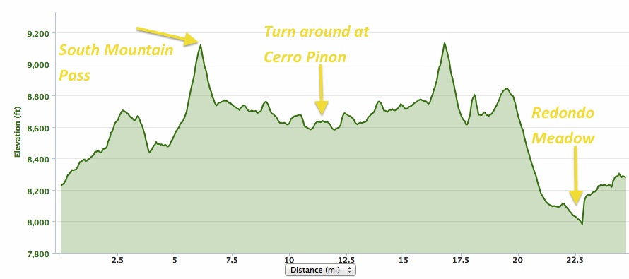
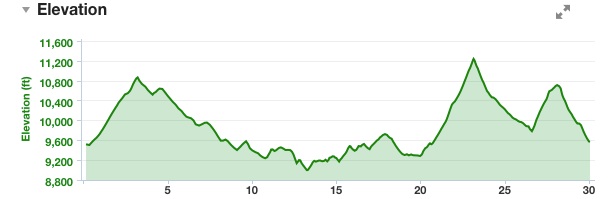
GPS track of my JMTR run. The blue line looks so trivial on a oblique view of a topographic map. However, the distance covered is 32.8 miles with 6,917 feet elevation gain.

In all honesty I knew something was not right by the time I left AS 1 – I was only 3 minutes slower than the plan, but I felt like I was wearing concrete galoshes.  My muscles did not hurt, but I was sweating way more than usual, and my face no doubt had the patina of lethargy. The real race starts at about mile 8.25 when the trail descends in Los Alamos Canyon and bottoms out at an elevation of 7,200 feet.  Over the next 8.5 miles the trail points upward to the top of Pajarito Mountain, and an elevation of 10,440 feet.  I pull out my trekking poles in Los Alamos Canyon and along steep segments I switch from a jog to a walk with an occasional power hike.

65868533-2Q6B0098

Before the long climb up UPCT. Jim Stein photograph.

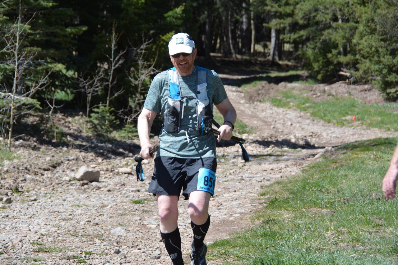
Aid Station 2 is at an elevation of 8,000 feet and at the 10 mile mark.  I am pretty tired here, but friends volunteer at this station, and that buoys the spirit (plus, thinking that 20 percent of the race is done!).  This is a fueling stop for me, and I grab 4 peanut and jelly squares and begin a walk up the trail.  I always make the same mistake: I grab PandB because it tastes good, but it sticks to the roof of my mouth, and makes it so I can’t breath.  After all these years you would think I would learn, but alas, this year is no different than all the previous races.  At this point my running partner surged on ahead to assure that he could make all the cut off times along the 50 mile course.

At mile 12.4 the climb up Upper Pajarito Canyon Trail (UPCT) starts.  Only 4.5 miles to the top, but the climb is 2100 feet.  The grade is relentless – runnable, but barely – and there are no sections of the trail built for resting.  Unfortunately for me on this day, nothing is runnable.  I am into power hiking at best, and it takes 1 1/2 hours to reach the summit.  I feel okay, but seem to be trapped in a gravitational well – everything is heavy and time is not particularly linear. I pause at the summit, and get out my iPhone to take a picture.  However, my hands are so swollen that my finger print will not activate the phone. I fold up my trekking poles and begin what should be a quick – at least 12 or 13 minutes/mile – run down to the Ski Hill Aid Station.

DSC_2499

Coming into AS 3, at Pajarito Ski Hill. I am right at the time I predicted for “TROUBLE”, about 45 minutes behind schedule.

The aid station is at mile 18.1.  By my schedule I should have arrived at 9:30, and I had noted that if I arrive at 10:15 am then I am in trouble.  I arrive at 10:17 – I am pretty despondent. I have run this segment of trail (or some approximation of it) at least 20 times in the last 3 years.  Only twice before have I been slower.  My wife is at the aid station, and this always lifts my spirits.  I down a tall glass of coca cola, feast on watermelon, eat a handful of potato chips for salt (plus I love potato chips…), and ponder the rest of the run.  My joints – in particular the one knee that has not replaced – ache, and my feet hurt.  I decide to walk and trot to the next aid station and make the decision on whether to switch to the 50 km race or continue along the 50 mile route.  There is a cutoff time of 12:30 pm at AS 4 for 50 milers; any runners arriving after this time MUST change to the 50 km course.  I arrive at the AS in plenty of time – about 11:10 am.  But this is much later than I imagined I would be here.  The die is cast, and I decide I will only run the 50 km course.  Better to finish a race than be stranded at a distant aid station.  I call this the point of shame, or more categorically, the metric/english units point of debacle.  50 km is no 50 miles.  Crash and burn in the Martian atmosphere.

There is a brief bright spot at the Pipeline Aid Station. They have ice!  It seems so hot now (the weather station back at the ski hill registered a temperature of 71 degrees), and the ice is a god send.  I fill my water bottle with ice (and in my mind I apologize to all the runners that will come after me because I am hogging this crystalline commodity!), and make the turn realizing I only have 12 miles to go.  12 miles is nothing – literally, a training run of 12 miles is what I do on a short day.  However, I am incredibly slow – mostly walking for a couple of miles until I reach an important junction on the course between pipeline road and Guaje Ridge trail (which is almost exactly 10 miles to the finish).  Just a week earlier I had been marking this section of the course with flagging, and thinking that I was going to romp down this trail at breakneck speed.  Nope.  The sun was blazing, and there were strong gust of wind that were so dry I was worried about becoming a mummified seismologist.

I ran the wonderful section of single track at about 15 minutes/mile.  Occasionally walking for motivation, but most running.  Only an ultra runner would understand the difficulty with running at this point in a race.  Standing or walking there is NO pain; however, try to run, and the body just does not respond.  It is curious, but it is a response to the trauma that the joints have experienced earlier in the day. After a slow 2 miles I pull into the Mitchell Trail Aid Station, and know I am only 8.1 miles from the end!  2 weekends ago I had run this last section in 1 hr and 36 minutes.  Well, that past run really meant nothing.  The lower Guaje Ridge trail is beautiful as far as single track is concerned – but is sort of sucks as far as being a scenic racetrack.

Cerro_Grande_May_12-19_2000_GAO_Fire_Progression

The 2000 Cerro Grande fire completely denuded Guaje Ridge. No trees were left alive, and most were burned to the ground. The lower Guaje Ridge is beginning to recover, but barely. It is a barren landscape.

The sun is blazing, and I am drinking quite a bit of water as I head out on the home stretch.  As often is the case in my ultras, I drink what I think is a lot of water to accommodate my ridiculous sweating.  However, I almost never have to urinate during the 8-10 hour run.  I have water sloshing in the belly, but it never makes it to the badder.  Today is no exception.  A crude calculation indicates I have consumed about 1.6 gallons of fluid up to this point, which must have come out my pores (one of the joys of being a scientist on an ultra is that you can use that long, lonely time on the trail to calculate things – lots of things.  This run I calculated the amount of fluid I consumed, the effects of Martian gravity on energy use during a run, the total amount of water I must have breathed in given a humidity of 10 percent, and of course, how I was going to survive the next four years no matter who was elected president).  Although I am running okay I am mostly irritated that this section of the course is no fun.  Mile after mile it is just exercise.  3 miles from the end I here a call of my name – it is my wife! She climbed up to the Mitchell Trail Aid Station, arrived 20 minutes behind me, and ran me down so she could pace me to the finish.  How amazing!  The last 3 miles are brutal, but as enjoyable as any I have run in the JMTR.  When we pull into the last Aid Station at 30.6 miles I see so many friends volunteering.  I feel like Norm walking into the bar on Cheers – everyone knows my name and are so kind and helpful. What a wonderful near-end to the race.

I still have 2 miles to the race end, and I decide just to walk.  It is way slower than I have ever done, but I climb up through the deep ruts carved in the Bandolier Tuff, and stumble back into the Posse Shack.  Slowest 50 km ever, but done nevertheless.

fourthtime

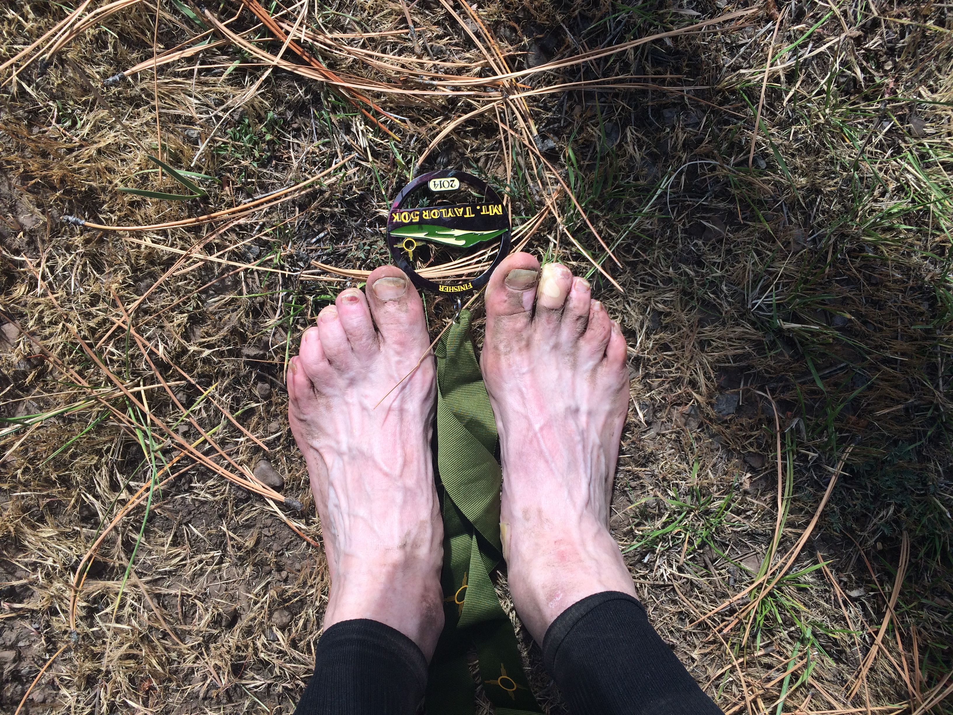
My fourth JMTR 50 km run was by far my hardest. But, the finisher pottery — front and center — was just as sweet as all the rest.

Mind over Matter (or Madder)

The JMTR has left me with worry and concern.  I have seen a significant decline in my long distance running in the last 18 months.  I have actually improved my short distance (10 km) speed, but anything over 3 hours seems to trigger a reaction in my body and performance wanes.  I remain a determined climber, but slopes that I use to bound up I now hike up.  In a few weeks I will turn 60 so there is a tendency to attribute this decline to growing older.  However, it is much more precipitous than any maturity curve would suggest.  I have struggled with no longer having a functioning thyroid, but again, this decline seems to outsize even that.  Overtraining, under training, joint pain, workplace stress – all things that could effect my athletic performance (I barely can type athletic performance in any sentence I write about myself).  I need to refocus, and consider all the possible factors, and enter the next phase of wandering in the wilderness.

Advertisement

Super Volcano in the Backyard: The Valles Caldera Marathon

Some things will never change. Some things will always be the same. Lean down your ear upon the earth and listen…..All things belonging to the earth will never change–the leaf, the blade, the flower, the wind that cries and sleeps and wakes again, the trees whose stiff arms clash and tremble in the dark, and the dust of lovers long since buried in the earth–all things proceeding from the earth to seasons, all things that lapse and change and come again upon the earth–these things will always be the same, for they come up from the earth that never changes, they go back into the earth that lasts forever. Only the earth endures, but it endures forever – Thomas Wolfe, in You Can’t Go Home Again (1940).

fromtheplane

Ariel view of the Valles Caldera and Jemez Mountains. This view is taken from a small plane at an elevation of 14,000′ looking south-southeast across the Valles Caldera. Photo by L. Crumple. (Click on pictures to get full sized view)

There are numerous influences in my childhood that propelled me to a career in the Earth sciences;  a father that loved to prospect and collect minerals, hundreds of family camping trips to the most interesting geologic province in the world (the Rocky Mountains!), and a progressive high school that offered a rich course in geology.  In hindsight, one of the most important influences was the fact that I grew up on the flank of a huge volcanic complex, the Jemez Mountain Volcanic Field.  The terrain of deep canyons, flat mesas, and a beautiful grass valley, the Valle Grande, surrounded by ponderosa pine covered peaks frame my childhood memories and help define home for me. The Jemez Mountains rise some 5000′ above the Rio Grande River and are remnants of a massive volcanic system that experienced two “super” eruptions about 1.4 million years ago.  The Jemez don’t really look like a volcano today if one’s idea of an active volcano is Mt. St. Helens or Kilauea – it is a large circular depression surrounded by the high peaks that once where the steep slopes of a series of craters that spewed forth hundreds of cubic km of hot ash. The figure at the top of this column is an aerial view of the Jemez, and the depression and surrounding peaks protect a series of valleys that once were filled with rain water after the great eruptions.  These valleys, or valles in spanish, are a unique feature of the Jemez. These mountains shaped me in many ways.  Out my back door was a riveting geologic panorama that provided an open invitation to explore nature.  Although most of the Valle Grande proper was off limits during my youth – it was a working cattle ranch that we just called “The Baca” in recognition that it was part of a old Land Grant called Baca Location Number 1 –  the surrounding mountains and forest lands were our play ground.

vallesgrande

View from within the Valle Grande to the west. The high peak is Redondo Peak, and the smaller rise on the righthand shoulder is Redondito Peak. The Valles Caldera marathon traverses around the base on Redondo on the edge of the Valles.

I learned about hiking, camping, wildlife, and calm call of nature.  I even learned some things about mineral collecting; in general, there is not much “mineral wise” in the Jemez, with the one exception. My first vehicle was a hand-me-down four wheel drive Toyota Land Cruiser.  Not many things worked on it (including the gas gauge which more than once left me stranded), but it did afforded me the freedom to explore the Jemez on my own.  My favorite trip was to the ghost town of Bland, a short-lived gold mining center located a few miles south of the Valles Caldera.  The mineral deposits were not formed by the volcanic processes that built the Jemez Mountains, but were from an earlier epoch of magmatic activity that injected quartz dikes into surrounding bedrock.  The Jemez volcanics covered these dikes, and later, through the randomness of erosion, were exposed in a narrow canyon (Bland Canyon).  In 1893 the first of a dozen claims was staked on these dikes for gold and silver.  A rush ensued, and soon a town was built and the population grew to more than a 1000 people.  The town was named Bland in honor of Richard Bland who had advocated for the governmental purchase of silver, and in turn, that bullion was minted into silver dollars.  The Bland act, and further requirements for the government to purchase silver (in particular, the Sherman Silver Purchase Act) were repealed in 1893 causing a collapse in silver prices — just as the mines in Bland were being discovered.

bland.1900

The boom town of Bland, circa 1900. Many of these same building were identifiable in the early 1970s when I searched for artifacts (with some success) and traces of gold or silver (without any success!). Unfortunately, all traces of Bland were destroyed in the 2011 Las Conchas fire – it is even impossible to find most of the old mine dumps.

I drove to the ghost town of Bland every chance I got in the early 1970s.  There was a “back way” in that required delicate 4WD navigation;  I was rewarded with a harrowing journey through the Jemez Mountains, and a chance to search through all the old building looking for artifacts and the mining dumps for some sign of gold or silver.  Mostly my searches were unsuccessful, but I had taste of the treasure hunter.

insulator

An insulator I collected near Bland in the early 1970s. The screw on glass has a patent date of 1893.

In the year 2000 the Federal Government purchased the “Baca” and it became the Valles Caldera Natural Preserve.  The charge of the Preserve was to remediate the effects of logging and cattle/sheep grazing, and eventually make the Valles Caldera a multi-use facility.  Although access is still carefully controlled to the Valles it has become the home to several special events.  In 2006 it became the site of a trail run – first a marathon, and later a half marathon and 10 km run were added.  The course has changed over the years, and a fire in late May of 2013 forced a change to a partial out-and-back route. The chance to run in a certified super volcano, only a few miles from my house is a huge draw – the Valles Grande Caldera Runs are a geologist’s dream.

IDL TIFF file

A recent NASA satellite image of the Valles and Jemez Mountains (click on the map to get a large, and clearer view). The circular depression of the caldera is obvious; left of the depression (east of the caldera) is Los Alamos. The brown-gray color is due to the denudation of the ponderosa pine and other vegetation after the 2000 Cerro Grande and 2011 Las Conches fires.

The volcano in my backyard

The Jemez Mountains and Valles Caldera are a spectacular sight from space. The satellite image above shows the circular depression that is about 13 miles across that formed after a series of very large eruptions of ash-flow tuffs emptied a large, shallow magma chamber.  Nearly 800 cubic km of ash were propelled from various volcanic vents, and the “hole” left by this erupting ash caused the volcanic edifice to collapsed back into itself producing a broad valley. Later, renewed magmatic activity pushed rhyolitic magmas up through the fractures formed during the collapse, producing a ring of domes breaking up the original valley into smaller, isolated valleys.  The largest of these magma extrusions, known as resurgent domes, is Redondo Peak, which has an elevation of 11,258′ and towers some 2500′ above the valley floor.  Redondo Peak is not a volcano – it was not “erupted” but extruded from the magma chamber beneath the Valles much like tooth paste would be extruded from a tube as it is slowly squeezed.

Vallea cauldera section 700

Geologic evolution of the Valles Caldera. The Valles volcanic center was active for 12 to 13 million years before a pair of major eruptions (1.5 and 1.2 million years before the present) caused the edifice of the volcanic system to collapse forming a large circular depression. Eventually this depression was dotted with a number of volcanic plugs or domes, forming the mottled landscape of Valles Caldera today (Image from the New Mexico Museum of Natural History).

The Valles Caldera remarkable symmetric, and incredibly well preserved — there were no major eruptions after the last collapse a million years ago to obscure the valley, resurgent domes and ring fractures that were formed during that collapse.  These qualities attracted geologists from around the world, and it has become the archetype volcanic caldera referenced in hundreds of studies and textbooks.  Although the Jemez Mountains were recognize being volcanic by the later part of the 19th century, it was not until the 1920s when C.S. Ross of the USGS visited, and later teamed with R.L. Smith in 1946 that the area was mapped in detail.  This mapping was done in part to understand the potential for supplying the new Los Alamos Scientific Laboratory with fresh water, and whether it was possible to bring a large natural gas line across the Valles to provide energy for my home town.  In 1970 Smith, Bailey and Ross published a beautiful geologic map of the Jemez Mountains and the Valles Caldera (figure below), and was the first map to grace the wall of my bedroom (I wish I could find that original wall hanging, but alas, it was packed away when I left for college and no doubt is today been composted and returned to the soil…).

jemez.htm_txt_smithmapjemez2

A section of the Smith, Bailey and Ross map (1970) showing the geology of the Valles Caldera. The yellow domes circling Redondo Peak (the brown color in the center of the figure) are the post collapse rhyolite resurgent domes.  The olive green color is the Bandelier Tuff – the base rock beneath Los Alamos.

The colors of the map hint at the extraordinary history of the Jemez Mountain Volcanic Field (JMVF).  The exact reason that the JMVF exists remains a bit of a mystery; it is located at the intersection of the western margin of the Rio Grande Rift and a trend of volcanic fields called the Jemez Lineament that has been postulated as a ancient “zone of weakness” that allows magma generated in the mantle to rise up into the crust.  I think that it is far more likely that the Jemez Lineament is the lucky connection of dots on a map, and that a more plausible explanation is that marks the boundary between a thick and stable crust (the Colorado Plateau) and thinner, more tectonically active crust.  Irregardless, it is clear that the opening of the Rio Grande rift caused volcanic activity to began about 13 million years ago in the vicinity of present day Los Alamos.  For about 10 million years the volcanism was dominated by basaltic lava flows.  Black Mesa, near Espanola, is one of the most famous landmarks representing this period of volcanism (Black Mesa is about 3.7 million years old).  About 3 million years ago eruption of more silica rich magmas commenced and the Jemez Mountain began to grow — there were probably 6 to 10 major volcanoes that tapped interconnected magma bodies.  These volcanoes conspired to create a major eruption about 1.5 million years ago that erupted what is known as the Otowi Member of the Bandelier Tuff.  Nearly 450 cubic kilometers of ash was erupted over a short period (probably a few years, but certainly less than a few decades).  This resulted in a collapse of the volcanic system, and the creation of the Valle Toledo Caldera.  This caldera is obscured by a similar sized eruption about 1.2 million years ago that ejected about 350 cubic kilometers of ash, the Tshirege Member of the Bandelier Tuff.  On the eastern margin of the Valle Toledo is the highest peak in the Jemez, Tschicoma Peak (elevation 11,561′), an remnant that survived both collapses.  The second eruption, and subsequent collapse created the now familiar Valles Caldera.

ashfall

Extent of ash fall from the second major Jemez Mountains Volcanic field eruption (1.2 million years ago). Ash has been identified in Kansas and Wyoming, and a large volume of the ash was transported down the Rio Grande (the blue streak in the map down the center of New Mexico).

The widely popular phrase “super volcano” has its roots in the 20th century, but mostly it is a phrase invented by the media around 2002 to dramatize the power of big volcanoes.  By 2003 the phrase appeared in more than 100 stories that covered everything from global warming and cooling to mass extinctions.  The USGS tied the phrase to the Volcano Explosivity Index (VEI), a measure of “explosiveness of eruptions”, and a VEI value of 8 became the definition of a super volcano, and implies a volume of material erupted that is at least 250 cubic km.  There have been 3 super volcanic eruptions in the US in the last 1.2 million years; the Jemez, Long Valley, California and Yellowstone in Montana/Wyoming.  All three of these eruptions resulted in the creation of a caldera.  Of course, our human centric view of geologic time — i.e, a million years is a long time — distorts the sense of “super” volcanic eruptions. Although Yellowstone was a large eruption, it was dwarfed by an eruption 28 million years ago that created the La Garita Caldera near Creede, Colorado.  Over the same time that it took the Jemez to erupt the Tshirege tuff, the La Garita erupted the Fish Canyon Tuff — all 5,000 cubic km of it (more than 15 times larger!).  Despite the size of La Garita,  Los Alamos is perched on the shoulder of a real super volcano.

VCC.copy

Comparisons of volumes of eruptions – Yellowstone and the Valles are “super volcanoes”, while more recent eruptions like Crater Lake and Krakatau have to settle for being “big” and Mt. St. Helens is just puny.

The relative tranquility of the Valles Caldera belies its violent history and magnificent history.  The most recent significant volcanic activity in the Jemez is the Banco Bonito rhyolite flow, which is located smack dab in the middle of the Jemez Caldera marathon.  The Banco Bonito is a very silica-rich rhyolite, and filled with large blocks of obsidian.  Although most everyone recognizes obsidian, and thinks arrowheads and black shiny pebbles, the geologist thinks about very rapid cooling of a volcanic rock.  Obsidian is silica glass – same material as a chunk of quartz, but it has no crystalline structure due to the rapid quenching of the hot lava. The Banco Bonito rhyolite was extruded (probably not erupted) 40,000 years ago.  Although the Jemez Mountain Volcanic Field will be active again in the future, it is mainly showing signs of exhaustion, and the likelihood of a future, large scale eruption is extremely small. Running through the Valles Caldera on a marathon is a unique experience.  Laid out along the course is every aspect of a few million years of violent tectonic history.  Ash fall, resurgent domes, ancient lake beds that filled with water in cooler and wetter times.

Vallesroute

A view from the southeast to the northwest across the Valle Grande, Redondo Peak, the the Colorado Plateau on the horizon. A little over 1/2 of the marathon course is an out-and-back from El Cajete to Cerro Pinon – right through the heart of the Valles Caldera. Also shown is the head of Bland Canyon, home of the ghost town. Picture from 2011 Nature article on Southwest drought.

The Valles Caldera Marathon

The Valles Caldera runs – there is a marathon, half marathon, and a 10 km – are not classic trail runs per se.  Most of the courses utilize dirt roads that once were used to move cattle or cut timber, and only some short segments are single track.  However, this does not diminish the spectacular setting of the race. It does mean that most people run the distances much faster than a typical trail run (I say “most” because single track versus tire rutted roads has nearly zero impact on my speed – sadly).  The races start at Banco Bonito Staging Area within Valles Caldera National Preserve.  The name “Banco Bonito” is applied to a modest plateau that is composed of the rhyolite-obsidian conglomerate that goes by the same name.  It is easy to find very attractive pieces of obsidian at the starting line — just look down.  There are more than 300 people signed up for the half marathon and 10k, but only about 45 of us toe the line for the full marathon at 7:30 in the morning.

start

Gathering of the runners for the start of the Valles Caldera marathon. Temperature at the start was 34 degrees, and throughout the day the weather alternated between sun, clouds and occasional grapple. Perfect.

The course for the marathon heads due east, climbing up the Banco Bonito lava flow along a logging road.  The lava flow is probably not obvious to most of the runners as it now is forested, and only along certain sections are there stratigraphic sections exposed.  But the topography of the lava flow is evident;  over the first three miles we climb about 450 feet (not much elevation gain, but enough to slow old runners down).  The pack of runners sorts out pretty rapidly, and good runners like Dave Coblentz disappear with a doppler shift over the horizon.  At the three mile mark the course comes to an aid station on the edge of a large bowl shaped depression — El Cajete.  This is a very significant geologic formation (but not such a significant aid station).  El Cajete is the crater that last had significant volcanic activity in the Valles Caldera.  It is responsible for the Banco Bonito lava flow 40,000 years ago, as well as a massive eruption of pumice sometime after the lava flow.  The pumice fell close to the El Cajete, and dammed the Jemez river creating a lake in the Valle Grande.

Cajete.elk

Aid station at mile 3 – looking out on El Cajete. If you click to enlarge the photo you can see a herd of elk scurrying across the crater on the right hand side — the crater is big, so the elk look small.

From El Cajete the course drops off the plateau and the run is downhill for 2 miles.  Fast and easy.  Unfortunately, the elevation lost is a penalty for the next part of the race.  At mile five there is a steep climb up a pass between Redondo Peak and another resurgent dome called South Mountain.  In a little bit more than a mile we climb 550 feet to the high point of the race, 9150′.  The top of the pass is a reward, but also a harbinger of things to come since we have to repeat this climb on the return from the Valle Grande.

profile

Course elevation profile. By my watch the course of 25.8 miles long.

From mile 6 to mile 12 the course is in the Valle Grande – well, strictly speaking, skirting around the edge of the Valle.  The grass “meadow” of the Valle Grande is due to the fact that it was a reoccurring lake bed in the last million years, and it is not particularly friendly nutrition wise to trees.  The last time the lake had a significant extent was after the El Cajete pumice eruption, and probably lasted for 4 to 7 thousand years (there have been smaller lakes during damp cool periods usually associated with glacial epochs).  The picture below is a view across the Valle towards Pajarito Mountain.  That summit, all 10,400 feet of it, is the high point of the Jemez Mountain Trail Runs — which will be run a month from now.

ValleGrande

A view across the Valle Grande to Pajarito Mountain. The weather alternated between sun and dark clouds through the entire run. The temperature was mostly in the high 40s, perfect for running a marathon.

Running through the Valle is always wonderful.  It is sensational scenery, and mostly flat topography.  At mile 9.4 I get passed by the leader of the pack returning towards the finish.  This means that the leader is about 4 miles ahead of me already.  Once the first runner passes by me it is a steady stream;  strangely, all the runners that are ahead of me look like they are strong and running very easily.  I, on the other hand, am beginning to lose focus and daydreaming of the geology.  Dave Coblentz passes me with a group of 5 or 6 runners at mile 9.7. The course “turns around” is at a point just beyond another resurgent dome — Cerro Pinon.  The milage here is just about 12 miles; there is a mental boost knowing that the “out and back” is done, but I also realize that there are 14 miles to go.  For the next 5 miles I pass by a few runners (a very few) that are slower than me, but mostly see no one.  I am alone – happy, but alone.  The climb back up the pass at South Mountain is brutal, but once that is done I am certain that I will finish the race largely unscathed.  The run down from South Mountain is fast, but as I expected, hard on my legs. The run between miles 18 and 22 is a descent of nearly 800 feet.  It should be fast, but my legs are tired.  There is a great aid station at mile 19, and I stop for way too long to eat oreo cookies.  The descent ends at a broad meadow called Redondo Meadow.  This meadow is an wildlife experiential station, and there are lots of people working in the area.  The course route is always confusing here because there is no real trail across the meadow, and there are meandering streams.  The course is marked, but that means you actually have to pay attention to the flagging (not my best skill – however, I have memorized the maps, so I don’t get detoured).  Once across the meadow the home stretch begins.  A steep climb up the Banco Bonito lava flow, and then a lonely run back to the finish.  I pass a couple of slowest runners of the 1/2 marathon, and try to encourage them (however, they are really tired).

finishline

Crossing the finish line – photo curtesy of Petra Pirc. I finish in a little over 5 1/2 hours. Long after the good runners, but happy for the experience.

I rambled into the finish line in a little over 5 1/2 hours.  It is a nice marathon – not exactly a trail run, but much harder than a street run.  The total elevation gain is about 3000 feet and the average elevation along the course is 8400′.  However, it is the geology that makes this run so great.  The Valles Caldera is truly a marvel….

Tsé Biiʼ Ndzisgaii: A trail run in the Valley of the Rocks with a nod to John Wayne

Monument Valley is the place where God put the West. John Wayne, American Actor, circa 1950.

the-mittens

Post card from the 1950s, part of a series celebrating the icons of the United States. This scene of the Mittens and Merrick Butte in Monument Valley defined the American West for a generation. The Monument Valley ultras follow a course around these iconic sandstone buttes. Click on photos for large versions.

The southern half of the Colorado Plateau stretches from Lake Meade in the west, to Cuba, New Mexico in the east, and is a stunning desert highland of pastel colored bluffs, and exotic wind sculpted rocks. The land is both beautiful and desolate; in more than 80,000 square miles there are only 250,000 inhabitants (more people live around Lake Meade and Flagstaff that the rest of the southern plateau combined), but there are 10 National Parks and 17 National Monuments, 10 Wilderness areas, along with another half dozen parks in the Navajo Nation.  It is also the land that American geologists wandered in the 1860-1880s and their observations shaped modern thoughts about geologic time and the extraordinary patient, but always persistent, force of erosion which eventually grinds even the highest mountains to dust. John Wesley Powell navigated the Colorado River through the Grand Canyon and Clarence Dutton mapped the geology with remarkable insight; these geologic giants were the vanguard of the American contribution of “the second age of discovery” that transformed the mystery of nature into a science.  I love visiting these desert lands; in a crowded and noisy world the Colorado Plateau imposes it’s will of solitude and reminds one of man’s temporary significance. Ulta Adventures runs a series of ultra runs across the southern Colorado Plateau that they call the Grand Circle.  Last year I ran the Ultra Adventures Bryce Canyon 50k – and it was a spectacular run!  The geology was great, the UA staff are wonderful, and course was challenging.  This year I decided I wanted to run the UA ultra in Monument Valley held in mid-March.  No other piece of real-estate has defined the American psyche of “the old west” than Monument Valley.  You would be hard pressed to find any baby boomer that would not immediately recognize the “Mittens” — sandstone bluffs in Monument Valley — as the movie backdrop to scores of films.

stagecouch2

Scene from the 1939 production of the film Stagecoach. John Wayne played the Ringo Kid – a criminal that makes good, vanquishes the real bad guys, and of course, gets the girl.

Monument Valley is a tract of canyon lands located about 100 km west of the Four Corners along the Utah-Arizona border. Within the valley there is a 140 square mile park – the Navajo Nation’s Monument Valley Park — that was “discovered” by film director John Ford in 1939 with the release of the classic western Stagecoach. Ford chose Monument Valley because, to his mind, the desolation and isolation of the bluffs and red sandstone captured the essence of the hardscrabble life of the wild west. Ford cast John Wayne as the Ringo Kid, a gunslinger. This roll is largely credited with making Wayne a film superstar – and forever he is pictured across from the Mittens.  There is a creation myth about how John Ford found Monument Valley — it starts with Harry Goulding, a sheep herder and owner of a trading post in Monument Valley packing up and heading to Hollywood with photographs of the scenery as an act of desperation during the crushing poverty of the great depression.  Goulding showed up at Ford’s offices and somehow, against all logic, convinced Ford that he should film his upcoming western in the corner of Arizona that was hundreds of miles from the nearest train station and only accessible by a dicey dirt road.  Ford eventually filmed parts of 6 of his most famous movies there;  other directors followed, and Monument Valley has appeared in more than 100 movies!

forrest-gump1-1200x1920_f_improf_446x253

Forrest Gump ends his epic run back and fore across the US at Monument Valley. This scene, as Forrest stops, and his followers are baffled, was shot on Hiway 163 looking south to the bluffs of Monument Valley.

It is only appropriate that the rich movie heritage of Monument Valley would collide with ultra runs. The 1994 movie Forrest Gump is the tale of a man’s life that serendipitously criss-crosses 40 years of tremulous American history. I saw the movie in Flagstaff, Arizona when my wife was working on the geodetics of volcanoes at the USGS field office – we loved the movie and it remains one our top ten favorites ever. In the movie, Forrest starts running on October 1, 1979 to ease the pain of rejection by his true love. He ends up running for 3 years, 2 months, 14 days and 16 hours, and covered 15,248 miles (crossing America at least 4 times) – no ultra runner has ever equaled the trail brazed by Forrest. Forrest ended his run at Monument Valley – he just stopped, and decided the run was over, and it was time to go home.

What a perfect setting for an ultra run; geology, history, and the termination point for the greatest ultra run ever.

racestart.ls

View from the start of the race — the day before. The west entrance to Monument Valley is guarded by three erosional remnants. From the left, West Mitten, East Mitten and Merrick Butte.

Running on Ancient Sand Dunes Monument Valley refers to a large swath of landscape along the Arizona-Utah border, but most people associate the name with a modest 3 by 5 mile drainage basin. This basin stretches from the world famous Mittens in the north to Wetherill and Hunts Mesas in the south. The name “Monument Valley” first showed up on maps in 1917.  Who exactly was responsible for that moniker is lost to history, but the name is appropriately descriptive; the view down the valley is filled with monoliths and buttes that are the erosional remnants of a thick layered cake of sedimentary rocks that were deposited by water and wind nearly 200 million years ago.  The Navajo name for the valley is Tse’Bii’Ndzisgaii, which translates approximately to Valley of the Rocks (at least my Navajo friend tells me this – others have slight variations).

monumentvalley1

Satellite image of Monument Valley. This is not a false color image – the land is reds and browns, colored by the strained sedimentary rocks that were deposited on an ancient continent during Permian times.

The Colorado Plateau is one of the most unique geologic provinces on the globe. A huge, broad plain or basin was formed at the margin of the primal landmass that today we call the North American Continent. This “basin” captured the cobbles and shards that resulted from the erosion of the ancient continent. Sometimes the basin was beneath a shallow sea filled with corral reefs and marine life. Other times it was at the edge of an uplifted and rejuvenated continent and was covered by a system of deltas cut by meandering rivers – not unlike the Mississippi delta today. Still other times it was a massive wasteland covered by sand dunes. Over a period of 500 million years this broad area we now call the Plateau accumulated a lithic layer cake; thousands of feet of alternating sandstones, limestones, shales and conglomerates. About 20 million years ago this layered rock cake was uplifted, and subjected to the same erosional forces – wind, water and ice – that had ground ancient mountain ranges to dust.

strat.ls

The stratigraphy of Monument Valley laid bare in Merrick Butte. The lower apron is the Organ Rock Shale, which gives the Valley the ubiquitous red dust. The steep cliffs are the sandstones from the DeChelly formation, and the butte is topped by the Shinarump conglomerate.

The slice of this great lithic cake that is exposed in Monument Valley dates from the Permian Age. The rocks exposed on the Valley floor are the oldest – and are known as the Organ Rock shale (about 280 million years old). This shale was deposited as muddy clays in deltas and swamps. Above the shale is the rock that builds the monuments, the DeChelly sandstone.  The DeChelly is an amazing rock – it is a nearly pure quartz grain sandstone, that is tough and strong, and can maintain vertical cliff faces hundreds of feet high.  The DeChelly was formed from wind blown sand dunes.  The modern day analogy for these type of sand dunes is the Namib Desert along the southwestern coast of Africa.  The desert that made the DeChelly sandstone was long lived — probably 25 million years of blowing dunes. Finally, that desert yielded to a more hospitable environment and rivers returned depositing sandstones and shales, which we call the Moenkopi formation.  About 230 million years ago the last of the rocks exposed at Monument Valley were deposited on top of the Moenkopi, the hard cobbles and boulders of the Shinarump conglomerate. The Shinarump is the “cap stone” on the mesa in Monument Valley, and reason that the softer rocks below have not completely eroded away.

makingbuttes

Carving Monument Valley. (from Abbot and Cook, 2007)

The landscape of Monument Valley today is only a shadow of what it most have been a few million years ago.  In a few more million years, there will be no sign of DeChelly sandstone, and all the steep cliffs will have been reduced to rubble.  The unique monuments are a result of the layered cake geology; the Shinarump conglomerate is a difficult rock to erode, and for millions of years protected the “softer” rocks below.  However, joints and zones of weakness in the Shinarump eventually yielded to the relentless rains, frost, wind and gravity, and began to erode forming small washes exposing the DeChelly sandstone below.  The DeChelly is relatively easily eroded, but forms steep cliff faces, making for spectacular canyons.  Eventually these canyons cut down to the soft Organ Rock shale which is rapidly washed away.  The canyons then begin to undercut the DeChelly, and the stout sandstone collapsed in rock falls and avalanches. What is left are isolated buttes, mesas, and rock towers. When you run through Monument Valley your view is one of the distant past.  The vertical cliffs demand your attention; they tell a story of time when huge sand dunes moved slowly across the edge of a continent.  There not many fossilized bones in the DeChelly, but there are numerous fossilized track ways of Permain Age creatures (both vertebrate and invertebrate).  The ultra runner today may find the course difficult, but the arthropod racers of 260 million years ago had it much worse.

startoftherace.ls

Sunrise over the Mittens, moments before the start of the race. The runners started the run with a traditional Navajo prayer, facing east to the rising sun and the start of a new day.

Race Day The Monument Valley Ultras — 100 miles, 50 miles and 55 km — all start near the Monument Valley visitor center that sits on the lip of a small cliff overlooking the iconic Mittens.  The runners gathered at 6:45 am for a traditional Navajo prayer welcoming the new day. The prayer, the approaching sun rise, a perfect temperature of 39 degrees, and the energy of the runners creates an emotional aura.  Two weeks before the race, Monument Valley received a record snow fall during a late season storm.  There was some question as to whether the race would follow the traditional course as flooding from the melting storm closed much of the Valley.  However, everything reopened days before the race;  the 55 km course followed a quick descent along a sweet single track that looped around the West Mitten before joining the main Monument Valley tour road.  For the first couple of miles I run a pace of about 9;45 minutes per mile – a little faster than I want given the long day ahead, but there never is any way to calm the emotion! One of the biggest surprises to to me in the first couple of miles is seeing the Mittens from all angles.  Although they look like large buttes, they are actually very thin monuments.  Viewed from the start of the race the West Mitten is a couple of hundred meters across, but  when I pass the western extreme I see that the West Mitten is only a few 10s of meters wide. Although the race started in the glow of pre-sunrise, soon the sun is lighting up the cliffs of DeChelly sandstone.  The reds and browns glow – the promise for a great run.

sunriseonmitchell.ls

The rising sun lights up Mitchell Mesa – the runners will have to climb that Mesa later in the day. Picture is from the main Monument Valley tour road, about 3.5 miles into the run.

There are a few tour vans on the Valley road, and tourists are busy taking pictures in the early morning light.  I roll into the main aid station, called Hogan, at 58 minutes.  The total distance covered is 5.75 miles, so I am feeling pretty good.  The 55 km course is shaped like a 4-leafed clover with the Hogan aid station at the center – I will pass through it four times today.  I am trying to run the course today with minimal aid station support – I only want to refill my water bottles, and I carry all the food I will need.  Turns out this is not a great idea – the food looks pretty good at Hogan!

thehub.ls

Running into the Hogan aid station — the hub of the 55 km course. I end up visiting this aid station four times during the run.

After a quick fill of my water bottles (and longing gazes at the food – I decide to stick to my plan, and eat a lemon wafer I am carrying), I start the second clover leaf, a relatively short 5 mile loop, almost all on a wonderful single track.  I roll back into the Hogan aid station at 2 hours (10.5 miles), and began a much longer loop towards Hunt’s Mesa.  The first couple of miles are along the Valley road, and pretty easy.  However, the course then begins to follow a very sandy trail/road route.  I had hoped that the recent snowfall would have made the sand semi-compact and easier to run.  Wrong.  The fine grained sand does not hold moisture, and it is a leg burner!  The course passes a series of slender monuments – the tallest of which is called the Totem.

totempole.ks

Standing in front of the Totem – a slender monument, about 14 miles into the run.

I ponder the fate of the Totem; it is an inverted pendulum, and will eventually fall.  It is clear that there has not been any significant earthquake activity for a couple of thousand years near Monument Valley, or the precarious nature of Totem would most certainly have caused it to tumbled.  I guess it will stand for a few thousand more years.  Assuming there are ultra runners in a few more millennia, they will not experience the Totem. Miles 14-18 are sandy.  The cliffs of the DeChelly sandstone are rounded by the abrasion from the winds.  Today is a rare and fortunate day – little wind.  The wind of Monument Valley picks up the fine gains of sand and silt that had eroded from the Permian sediments and slams them into the cliff faces.  This constant assault eventually carves the rocks into bridges and arches.

winderosion

Wind is a very powerful erosion agent, and its effects are well represented in Monument Valley along the race course. I first was introduced to modeling saltation (the lifting of particles by bouncing along a surface) 35 years ago in graduate school.

The route takes us to an amphitheater-arch call the “Big Hogan”.  It is a wonderful example of the power of saltation.  The wind has carved an amphitheater, and at the top has cut an arch – like the smoke hole in a hogan, hence the name.

arches.ls

Approaching the Big Hogan – an amphitheater that has a small arch in its ceiling. Sandy running, but the scenery is great!

The route eventually loops back to the Hogan aid station.  The mileage for the third visit is almost exactly 20 miles.  My time is 4 hrs and 6 minutes.  A little slower than I planned, but considering the sand and all the time I took out to take pictures, I am pretty much on schedule.  Once again, I look at the great selection of food laid out at the aid station and regret my stubborn dedication to minimal support.  Out of the Hogan aid station the last loop is an out and back to the top of Mitchell Mesa — before me is the most difficult climb in the run. The trail leads west along a road cut to support a uranium mine on the the top of Mitchell Mesa back in the 1960s.

mitchellmine.1

The location of Mitchell Mine, a uranium mine that operated between 1962 and 1965. The last push of the Monument Valley utra is a climb up to the top of Mitchell Mesa on the road built to service the mine.

During the uranium frenzy of the 1950s, amateur and professional prospectors fanned out across the Colorado Plateau in search of the metal that fueled the nuclear age.  There are numerous small uranium deposits located in old river channels within the Shinarump formation.  These old channels captured carbon debris – trees, branches, decomposing leaves, etc. – which in turn served to precipitate uranium out of circulating ground waters.  One of these ancient river channels cuts across Mitchell Mesa, and was mined briefly in the period 1962-1965.  The mine’s operation came to an abrupt end when the operator, Robert Shiver, accidentally backed the ore hauler he was driving over a cliff, and tumbled more than 450 feet into the valley.  The same cliff that took Shiver’s life is the one that we have to climb to get to the top of Mitchell Mesa!

Tyuyamunite

A sample of the uranium-vanadium mineral tyuyamunite from the Monument #2 mine – located across the valley from the Mitchell Mesa mine, and located in the same ancient river red. The tyuyamunite is replacing a log that had become stranded in the river channel.

The ore from the mine on Mitchell Mesa was primarily Tyuyamunite – a rare uranium-vanadium oxide (chemical formula: Ca(UO2)2V2O8·(5-8)H2O).  Like many uranium minerals it is colored canary yellow.  The picture above is a sample of Tyuyamunite that was found across the valley on Hunt’s Mesa.  I don’t see any sign of mineralization as I grind my way up the mesa…. The climb really begins at mile 23; there is a rocky and relentless pitch that ascends 1200 feet in only a mile.  I had visions that I would bound up the winding trail – wrong.  It takes me 30 minutes to get to the top, and my quads are burning.

mitchellmesaclimb.ls

Top of the climb up Mitchell Mesa, looking back at the narrow canyon that the trail runs up. You can see the faint track of the trail along the Organ Rock Shale in the center of the photo. It is hard to do the difficulty of the climb justice with a photo.

The run to the northern end of Mitchell Mesa is physically easy – but the views into the valley are breath taking, and I find myself drifting into tourist mode.  Mitchell Mesa and Merrick Butte are named after a pair of prospectors that were murdered in the Valley in December, 1879.  Charles Merrick had supposedly found three crude smelters built by Ute Indians to recover silver.  Merrick recruited Henry Mitchell to help him find the source of the silver; legend has it that they indeed did find a rich deposit, and the prospectors were heading home with ore samples when they met their untimely demise.  For years treasure hunters have searched for the lost Merrick-Mitchell mine, but it remains lost.

westmitten.mitchell.ls

West Mitten and Merrick Butte from the top of Mitchell Mesa. The views from the mesa are spectacular.

The run along the top of the mesa is only about a mile long, but it is difficult after the long climb.  There are patches of snow in the shade of trees, and I stop twice and fill my hat with a couple of handfuls of snow.  It is now about 64 degrees (at least according to my weather app), and I am really overheated.  The melting snow cools my hot head, and steels me for the last 9 miles of the run.

mitchellpoint.ls

The end of Mitchell Mesa and the turn around point, mile 25. The view looks down to the starting and ending point of the race – only about a mile away, and 1000 feet below. Unfortunately, I have to turn around, run a little under 9 more miles to get to the finish.

The turn around point is the end of the Mesa.  There is a hole punch that you apply to your bib, and turn around and retrace your steps back to the Hogan aid station.  The view from the turn-around point is down to the finish line — so close, yet so far.  I am pretty tired at this point, and my pace is slow.  I pass lots of runners still making their way to the turn-around point, and I realize that although I have been pretty much running alone for hours, there are people that are going to finish several hours after I do.  The descent off Mitchell Mesa is much more difficult than I expect – no springy legs hoping from rock to rock for me!  I get to the Hogan aid station for the final time about 7 hours and 14 minutes.  There is still a little less than four miles to go – argh. The last part of the run is completely along the Valley tour road.  Unlike earlier in the morning, the road is now heavy with traffic.  The speed limit is 15 miles per hour, and many of the cars and tour vans honor the limit, which minimizes the dust.  However, every fourth or fifth car comes zooming by, and stirs up a chocking cloud of red dust.  I really hate this part of the run, and curse at drivers that are obvious to the runner’s fate.  The last two miles of the run are a steep climb back up to the lip of the cliff where the race started at dawn.  I finish at 8 hours and 10 minutes by my watch – 40 minutes slower than I planned, but I am just happy to done!  My watch says 33.5 miles, so it is just short of 55 km. Within a few minutes of rest I begin to think about how great the run was, and even the dust of the tail end begins to seem not so bad.  A wonderful place to have a trail run.

forrestgump.ls

Homage to Gump: Standing near the point north of Monument Valley where Forrest Gump decided he had run enough.

My Forrest Gump Moment I discovered trail running late in life.  Not mountains, geology, the solitude of towering peaks and deep canyons – those have been with me since my earliest memories.  But trail running is a too recent passion, but has allowed me to experience calm even as my muscles ache and I experience true exhaustion.  I am not a competitive runner – oh sure, I wish I was fast, but my age and athletic ability preclude even the allusion of “competitive”. So, why run as hard as you can during an ultra run if you have no chance of being competitive?  Because it is a grand challenge – ultra train races are hard, and pushing your limits are rewarded with the knowledge that you accomplished something difficult.  That sounds a bit trite, but doing difficult things, accomplishing goals, are a reality check on realizing one’s potential.  Like most everyone, I have much grander goals in life than just running long distances on dusty trails;  I want to make a difference in the world, I want to discover, I want to make right.  Those goals are pretty hard to evaluate except post-mortem, and once I am dead I don’t much care.  But doing difficult things allows me to center; accomplishments are mileage posts along the way.

This past January I had my annual physical (I will soon be 59).  Once you pass the half century mark the ritual of the annual physical is aways approached with trepidation.  Most American medial studies define “old age” as an onset of a plethora of symptoms, usually beginning sometime between 60 and 70 years.  The most frightening of these symptoms is the decline of cognitive abilities – slowing down of the brain and gradual memory lose, for example.  Everyone is different, and the decline is certainly a broad spectrum, but just as erosion will eventually wear down Mt. Everest to a nub, brains do wear out.  So, at each annual check up I listen attentively to my doctor hoping to hear that I am amazingly young for “my age”.  My check up in January started more or less as always – I have great heart function, good cholesterol, I seem to have good hearing except when my wife asks me to do something, still have most of my hair, etc.  However, when the final part of my blood test was discussed my doctor said that my thyroid was pretty much kaput.  I was diagnosed with hypothyroidism – an under active thyroid – a little over a decade ago.  I have been taking levothroxin everyday for that decade.  This is a synthetic hormone replacement;  over the years my dose of levothroxin has been increased, so it was clear my thyroid was declining.  I did not receive the news of “kaput” well – I was assured that this is okay, but I needed increase my medication, and monitor it closely.  Hypothyroidism is not particularly rare – a few percent of Americans experience it, and both my parents had it.  But it does have consequences – the thyroid helps regulate many functions in the body (including hair loss, which I appear to be immune to), but to athletes it is the key to fatigue, and to recovery from endurance events.  In fact, there is a mini-scandal in world of endurance racers with the suggestion that some elite runners are using levothroxin to enhance performance.  That has never been my case! But now I began to question if I would be able to truly run, bike or swim anymore.  Was this the onset of old age for me?

The Monument Valley ultra was my first race since my new medicine regime. As I lined up on the start line I could not help but wonder if I could actually do the race.  However, I ran it just fine (well, my legs are not so sure it was just fine).  Unlike Forrest Gump, I am not ready to stop running.

goosenecks.ls

The Goose Necks – meanders on the San Juan River about 20 miles north of Monument Valley

Tsoodzil: An ultra run on turquoise mountain

How glorious a greeting the sun gives the mountains! John Muir, the great Scottish-American naturalist.

coverphoto

The Summit of Mt Taylor on race day. The view is to the east down the amphitheater.

80 miles west of Albuquerque a lone mountain peak rises above the horizon; it seems distant but significant, an alpine oasis in the high desert of the Colorado Plateau. The peak is Mt. Taylor, an extinct stratavolcano that towers some 5000 feet above the uranium mining boom town of Grants.  The high point of Mt. Taylor is 11,305′, located along the lip of an eroded caldera, and offers unobstructed views for at least 90 miles in all directions of the compass.  The mountain is one of four sacred peaks that surround the Dinetah, the traditional homeland of the Navajo.  The name Mt. Taylor was assigned in 1849 to honor President Zachary Taylor, but the Navajo call the mountain Tsoodzil, and more informally, the turquoise mountain – a name that it deserves as it appears to be a deep blue  gem on the horizon.

Mt Taylor is home to one of the three crown jewels of northern New Mexico trail running (the others being the Jemez Mountain Trail Runs and the La Luz Trail Run).  It is a relatively new event (the inaugural race was in 2012, although early versions of the run existed), but its fame, or at least admiration, has grown rapidly. The start and finish of the Mt Taylor 50k is a couple of miles west of the caldera rim and is at 9400′ elevation.  The course has some steep climbs (and equally steep descents) – about 7000′ elevation gain – much on single track, and through unspoiled mountain top wilderness.  I have wanted to do this race for some time, and signed up for the run within minutes of when the registration was opened in early February of 2014.  The run is limited to 175 people, and indeed, the roster fills early creating a waiting list.

Although I grew up about 100 miles north of Mt. Taylor, I had only visited the peak once; that was back in the summer of 1975 when I was an undergraduate student working summers at Los Alamos National Lab.  We installed a temporary seismic station near La Mosca lookout – which is on the course of the 50k! – to record seismic waveforms from a number of underground nuclear tests conducted in Nevada.  The nuclear weapons tests were part of Project Anvil, a series of 21 tests.  In 1974 the US and Soviet Union agreed to the terms of a bilateral treaty that would limit the size of nuclear weapons tests to 150 kt or less;  this treaty is known as the Threshold Test Ban Treaty (TTBT).  Although the terms of the TTBT were negotiated in 1974, both nations wanted to conduct a series of tests before it would come into force — this resulted in a period of frenzied activity for nuclear testing.  The treaty was submitted to the US Senate (but not acted on) in July 1976, and 150 kt became the punch line in numerous conflicts with the Soviets in the subsequent 15 years.  Little did I know at the time, but the concept of monitoring nuclear tests, and more importantly, determining the nuclear yield from geophysical data would dominate my career.  However, the installation of the seismic station on Mt. Taylor nearly 40 years ago was mostly a just a chance to visit at really interesting mountain top. I was far more familiar with the flanks of the Mt. Taylor were my father and I had collected numerous radioactive mineral species in the early 1970s. The Mt. Taylor 50k provided a long overdue opportunity to visit a wonderful New Mexico mountain.

bannerimage2

From the north looking to Mt. Taylor on the horizon above Mesa Chivato, and a volcanic plug called Cabezon in the right center (the picture is high resolution, so click on it).  The picture was taken while touring the geology of the Naciemento Uplift along the western margin of the Jemez Mountains.

Mt Taylor – A beautiful stratavolcano and tombstone

Mt. Taylor is a magnificent landmark – it really is an isolated volcanic peak on the edge of the Colorado Plateau, a huge region (more than 130,000 square miles) of relatively flat mesas and valleys with an average elevation of about 7000′.  The Plateau is a geologic mystery; it represents a region of relative geologic stability that has existed for  nearly a half a billion years.  All around the plateau there are geologic provinces that suffered tremendous episodes of geologic deformation – the Rocky Mountains, the Basin and Range in Arizona and Nevada, and the Rio Grande rift in New Mexico.  Why did the Colorado Plateau escape these tectonic spasms?

backgroundmap

Location map from Kelley 2014; The Mt. Taylor volcanic field is part of a series of volcanic provinces that ring the southern half of the Colorado Plateau. Mt. Taylor sits atop Mesa Chivato, which is a group of basaltic volcanic vents that were most active as Mt. Taylor became extinct.

Mt. Taylor seems unique, but is actually part of a much larger geologic phenomena – a ring of volcanoes that surrounds the southern boundary of the Colorado Plateau.  The most famous of these mountains in this “ring of fire” is the San Francisco Peaks north of Flagstaff. The Plateau is defined by a thick sequence of sedimentary rocks – some of these rocks were deposited in marine environments, others in wide river valley flood plains, and still others represent long periods of time when the surface was covered with wind blown dunes. Taken together, this block of real estate was near sea level for nearly an eighth of the entire age of the Earth. Around 25 million years ago the Plateau began to rise uniformly to its present elevation of 7000’ feet. The cause of this rise is a subject of much speculation and research, but most geoscientists accept that the uplift was due to a hot mantle. This idea holds the key to why the edge of the plateau has so much volcanism, similar to that that that produced Mt. Taylor. The juxtaposition of the thick, and obviously stable, lithosphere of the plateau and the much thinner lithosphere of the Basin and Range created what is know as Edge Driven Convection (EDC). This EDC brought hot mantle materials up toward the surface along the edges of the plateau and it melted rocks both in the upper mantle and lower crust which then erupted in a series of volcanoes.  The same reason Los Alamos has the marvelous Jemez Mountains is the reason Grants celebrates the glorious vista of Mt. Taylor.

crosssectionfromnorth

A notional cross-section through Mt. Taylor – the conical shape of the stratavolcano is a layered stack of andesites and ashes from eruptions. At some point Mt. Taylor probably reached 14 or 15,000 feet elevation; however, the volcano eventually blew its top and created the geomorphology that is seen today.

Mt Taylor first erupted about 3.5 million years ago, and was active for 2 million years.  The volcano had many eruptions that were mainly ash; these eruptions built an edifice that probably reached a maximum elevation of between 14 and 15,000 feet (which would have made the Mt. Taylor 50k much more difficult!).  Today there is a pronounced depression at the top — it is called the amphitheater — that is the eroded remains of a caldera.  The amphitheater is open towards the southeast and is drained by Water Canyon.  The shape of the amphitheater looks eerily like Mt. St. Helens 30 years after that volcano blew its top. As the volcanism of Mt. Taylor was winding down, a whole series of small vents developed to the northwest.  These vents extruded basalt rather than ash, and built a broad and flat table land known as Mesa Chivato.

mttaylor

Aerial view of Mt Taylor and Mesa Chivato. The high crest of Mt Taylor is visible in the new snowfall (the snow line is about 7000′ in this photo). The right of the crest is the amphitheater which drains to the southeast. The broad basaltic table land that is Mesa Chivato is to the upper right of Mt. Taylor (photo from Kirt Kempter) .

As spectacular as Mt. Taylor is, the rocks of the Colorado Plateau that sit beneath the volcano are more unique. There is a 2 km thick sequence of sedimentary rocks hidden below Mt. Taylor and Mesa Chivato, and these rocks contain one of the largest known reserves of uranium ore in the world. This uranium fueled the American nuclear power and nuclear weapons enterprises for half a century; it also brought tremendous devastation to the miners, in particular the Navajo miners, that extracted the ore from underground workings.

The long history of stability of the Colorado Plateau played an important role in making it a “trap” for uranium.  As great mountains of granite and ancient volcanoes rose and were eroded over the last half a billion years the rocks from these massifs were ground to cobbles and grains.  In turn, these grains slowly released their constitute minerals which reacted with the environment;  a tiny fraction of these minerals contained uranium, which was eventually mobilized by the ground waters and flowed through the rocks of the Plateau.  Occasionally these ground waters would encounter conditions that caused the uranium to precipitate out of solution and be deposited as new minerals.  When these conditions lasted millions of years the precipitates would become extensive enough to become uranium ore.  After WWII the US government started a prospecting frenzy for uranium, and the sediments of the Colorado Plateau became site of a new “gold rush”.

uraniummines

Location map for uranium mines that have produced ore to be milled. 98% of the ore came from mines in New Mexico, Arizona, Colorado and Utah – all on the Colorado Plateau.

Uranium was first discovered in New Mexico part of the Colorado Plateau in 1950.  A Navajo shepherd, Paddy Martinez, had heard about the uranium rush, and seen some yellow colored ore.  Martinez recalled seeing rocks with similar yellows stains at Haystack Butte, just west of Grants (strictly speaking, Martinez “rediscovered” the uranium deposits that others had noted in passing in the early 1920s), and started a mad era of exploration and mine development in the Grants Mineral Belt, which encircles Mt. Taylor. Legend has it that Martinez brought several pieces of yellow ore to stake his claim, and that the yellow ore was carnotite. I personally doubt this is true because carnotite is extremely rare in the grants Mineral Belt (I have never seen a single specimen). Nevertheless, the population of Grants went from a few thousand to 45,000 in a decade.  Two major mines were developed; Ambrosia Lake, north and west of Grants (you can see the mine workings as you drive up to the start of the Mt Taylor 50k), and the Jackpile Mine, a few miles east of Grants.  The Jackpile mine was remarkable; it was discovered in 1951, and between 1956 and 1960 it was the largest producer of uranium in the world – during the same time it produced more uranium than all other mines in the US combined!

jackpilemine

Jackpile uranium mine in full production in the 1970s.  Mt Taylor is visible on the horizon of the picture.

The ore of the Jackpile mine is dispersed uranium — mostly in the form of the minerals uraninite (UO2) and coffinite (U(SiO4)1-x(OH)4x) — in a sandstone that was created by a systems of braided streams that flowed from somewhere west and south of present day Grants in Jurassic time (145 to 200 million years before the present).  The host sandstone at the Jackpile defines a sausage shaped body that is about 50 km long and 25 km wide, and the average grade of ore is less than one percent.  However, it is clear that one of the factors that contributed to the deposition of uranium out of the ground waters was the presence of carbonaceous materials — dead plants.  Throughout the Jackpile sandstone there are large petrified logs – trees that must have been swept away in floods and then stranded as log jams – and these petrified logs are where uranium concentrations can rise to 20 percent or more.  In 1972 my father got a call to visit the Jackpile because they had discovered a cluster of logs that appeared to be completely replaced by uraninite.  I accompanied my father, and we collected about 20 pieces of petrified wood.  From our geiger counters it was clear that the material was radioactively “hot”, but the uniform dark color made identifying the minerals by sight impossible.  One of these logs became the source materials for my education in power diffraction. Back in Los Alamos we prepared about 15 different powder samples and my father performed the x-ray diffraction at work; he then brought home the films and it was my job to identify the diffraction peaks.  The material ended up being almost all coffinite.  I have long since gotten rid of all the material (safely and securely), but I learned how to identify minerals with x-rays on uranium grunge….sort of poetic justice I suppose.

u238chain

The decay chain of uranium 238 to radon and progeny. Although U238 is barely radioactive, its daughter radon 222 and subsequent decay to polonium 210 are cause of many miner’s lung cancer.

The Jackpile mine was an open pit mine, but many of the other mines had underground tunnels.  In general, the ventilation in these underground facilities was poor, and the presence of the uranium means that there was radon, which is a radioactive decay product. U238 is marginally radioactive (it has a half life roughly equal to the age of the Earth!), but when it does decay it will eventually produce radon gas as a daughter.  This gas is quite radioactive and decays by emitting an alpha particle.  The progeny of radon, in particular polonium, also emits an alpha particle.  Inhalation of radon allows the alpha particle emissions to interact with the very sensitive tissues of the lungs;  this irritation of the lung tissue dramatically increases the chances of developing lung cancer.  The cancer rates among Navajo uranium miners is extraordinary, and a very sad legacy of the mad rush to find the heavy metal.  A mineralogical sidebar to this tale is that in the year 1530, Paracelsus described a wasting disease that afflicted miners in Joachimsthal which he called male metallorum – we now know that is lung cancer from the exposure to radon.

The Navajo also associate Mt. Taylor with the home of the chief of the monsters – and by monsters, the Navajo means those things that get in the way of a successful like.  The monster the Navajo deal with now is leetso, the yellow dirt.  It is strange to write about running an ultra race and spend so many words on things nuclear.  But to me, there is always a celebration of the place of the race, and for Mt. Taylor there is a fabric that is very much woven by things nuclear;  a high peak overlooking a legacy, a cenotaph.

startofrace

Start of the race at 6:30 am. Cool and dark.

The race

I signed up for the Mt. Taylor 50k in February, and had every intention that it would be the my crowning achievement for ultra runs this year.  However, my approach to the race was quixotic at best.  I have run 4 ultras, many shorter trail run races, climbed Rainier, and done several cycling events this year, and by the end of September, my dedication to training for a long tail run had wained.  As September 27 approached I oscillated between unrealistic optimism and trepidation.  My base fitness was good – I run 30 to 35 miles per week and cycle 60 to 65.  However, I had not put in the long miles on individual runs that I needed for a tough ultra.  Further, much of the summer I had chosen to train for climbing Rainier (carrying a back pack, hiking 14ers in Colorado). In fact, I was still experiencing the effects of Rainier — I still had some blisters on my feet, and I had only partially recovered from an infection I got from stabbing myself in the leg with a crampon.  Finally, I had been called unexpectedly to DC the week before the 50k run for a very tough set of meetings and only flew back to Albuquerque late in the afternoon before the race.  But, then again, what could go wrong in 50 kilometers?

coloroffall

The race ascends the ridge below MLookout as the sun is rising. The color of fall is glorious. View to the west.

The race starts at 6:30 am – in the dark at Rock Tank Shelter.  The runners head due east and climb about 1500′ over 3.5 miles to the ridge just below the Mosca Lookout.  The goal is to reach the ridge as the sun rises above the horizon and welcomes Mt. Taylor to a new day.  I am quite certain that many of the runners made the ridge as the sun rose — I settled for a little more leisurely ascent, but nevertheless basked in glow of autumn colors and fantastic views.

thecourse

My gps track through the Mt. Taylor 50k.

The course for the Mt. Taylor race has three major climbs;  the Mosca Lookout ridge, the top of Mt. Taylor, and then a tough final climb up out of Water Canyon in the Amphitheater. After the first big climb the trail is descends down a forest road to about mile 10.5  This descent is fast and should be pretty easy.  Lots of people pass me running fast.  However, I realize that something is amiss on the descent.  My toes are really hurting because of the blisters, and the downhill pounding irritates the wounds.  I am a little unsure if my feet will betray me, or this will pass like the many aches and pains that appear during a 50k race.  Around the 11 mile mark the course turns on to the Continental Divide Trail (CDT).  This trail is soft single track, and rolling through conifer forest.  It is just a pleasure to be running along the trail and thinking about the fact that you could actually follow this trail from Canada to Mexico, some 3100 miles , and straddle the drainage divide between the Pacific and Atlantic.  No one is passing me on this section of the trail, but it hindsight that is because there is no one behind me.

The CTD loops around to return to the Rock Tank Shelter at about mile 16.  My feet are really bothering me as I approach the aid station, and I seriously consider dropping out here.  However, the race organizers have hung a banner that basically paraphrases the famous Lance Armstrong quote: “Pain is temporary. It may last a minute, or an hour, or a day, or a year, but eventually it will subside and something else will take its place. If I quit, however, it lasts forever.”  What, seriously?  Like the Sword of Damocles, the quote on quitting hangs over me.  I stumble into the aid station, get my drop bag, take off my shoes, change the bandages, and continue the journey.

thelongclimb

The long trail up to the summit of Mt. Taylor

The run between Rock Shelter and Gooseberry aid station is pretty flat and easy.  I am slow, but I am also determined to finish now.  Of course, I am beginning to fret about actually making the cut off times at the various aid stations!  The Gooseberry aid station is at about mile 20, and the many volunteers admonish the runners to be prepared for the long climb to the top of Mt. Taylor.  Indeed the climb is unrelenting for 2000 feet over the next 3.25 miles.  I did not find the climb to be physically punishing, but it was a mental challenge.  After about 2 miles the trail emerges from tree cover and you can see the top of the mountain;  but as one gazes towards the goal you can see switch backs and tiny dots representing runners ahead of you that appear to be barely moving.

profile

The elevation profile — three climbs, but the climb from Gooseberry aid station to the top of Mt. Taylor is epic.

I actually began to pass people on the ascent to Mt. Taylor.  Most of the runners (I use the words “runner” here out of respect.  None of us are running up this climb) look pretty bad to me.  Sweating, cursing, and asking the rhetorical question of “are we there yet?”.  I suppose I looked the same, but in my mind I had to look better than that.  The geology of the whole run is pretty uniform.  The rocks are andesite – gray and sharp.  However, on the ascent you begin to get views into the amphitheater, and magnitude of the stratavolcano comes into focus.  On the far horizons you can see the pastels of the rocks of the Colorado Plateau, and even some of the volcanic plugs dotting Mesa Chivato.

andesiteridge

Andesite ridge in the amphitheater — monument to eruptions past.

The last few switchbacks brings you to the summit ridge.  I can see the Jemez Mountains to the north and my home.  I can see the Ladron Mountains to the south (just north of Socorro), and I can image that this very vista has invoked the same sense of wonder I have right now for 5 thousand years.  Many others have come here before me, and I hope my son and grand children will follow.

Mt Taylor 50k - September 27, 2014

Finally at the top – it is cloudy, and threatening rain. However, it just brings relief from a warm September sun.

At the summit I am surprised to see my wife Michelle who has been waiting patiently for me for 90 minutes.  She has hiked up to take pictures, and seeing her provided a jolt of energy I needed to finish the race. The official photographer is also at the summit, and he deflates me as fast as seeing Michelle lifted me — he asks “is there anyone behind you?”.  I want to say, “oh yeah, there are lots of slower people than me, and I will not experience the pain of quitting!”.  But alas, I mumble that there are several people yet to come.  From the summit there is a tricky descent into the aid station at mile 24.  At this aid station the diabolical streak of the race organizers surfaces.  The course descends nearly 1000 feet into the amphitheater over 2 miles only to reverse course, and climb back up those same contours fighting gravity for 1 1/2 miles back to the same aid station.

done

Running downhill towards the finish line.  Almost done!

I comtemplate the sadistic streak in the race organizers, but any homicidal thoughts are quickly tempered by the truly outstanding volunteers that work on the course.  They are among the best I have ever seen, and their kind words of encouragement and concern for the runners is amazing.  There are now only a few miles remaining, mostly down hill, to the course finish.  My feet feel pretty much like hamburger, but the end is in sight.  I begin the descent – but wait, all those people I passed coming up the big hill start to pass me!  They all say “great job” – I can’t believe I am actually being passed by those folks that looked terrible below the Mt. Taylor summit.  They don’t look terrible now.  I amble into the finish line a little dejected, but happy that I committed to doing the entire course.  I feel I have some unfinished business, and will have to return next year to run the race the “right way”.

feet

It is a pleasure to remove my shoes – my feet are not a pretty sight, but the Mt. Taylor medal is terrific.

The great volunteers at the finish line have food, and make you feel like you must be in first place.  That notion is quickly dispelled when you notice that your drop bag is quite lonely on the trap where there were 175 drop bags a few hours ago.  However, I am informed I won a door prize, and it is a Patagonia jacket!  I have never won any prize for running before, and even if the trophy is purely based on serendipity, I feel like a winner!  It took me 8 hrs and 50 minutes, by far my worst ultra.  But I am quite glad I did it.  When I take off my shoes a survey the damage, I decide that I will not be running for a couple of weeks.  I have to get these toes back into functional form.  Within a couple of hours of the race conclusion all the pain has faded, and only the joy of the journey lingers.  I loved the Mt. Taylor 50k.