What exactly does “unhealthy air” mean? Running in Beijing

All you need in this life is ignorance and confidence, and then success is sure, Mark Twain, American philosopher.

beijingsmog

Beijing skyline, Thursday morning, St. Patrick’s Day, 2016. This picture was taken on the second ring of the Chinese Capital on the way to a meeting about 8:30 in the morning. The AQI (air quality index) is about 400, and the visibility is a few hundred yards at best….photo taken a few hours after a run in this air. Click on any figure to get a large image.

One of the joys in my life is to “experience” the places I visit with a run — usually hoping to sample the geology, although I am delighted to be able to sample the human culture with my slow sorties of 5 to 6 miles an hour. I don’t run much on city streets, but when I visit a new place I always plan a run to one of the iconic features of the city.  I visited Beijing for work in March, and despite admonishments about running in the Chinese capital, I planned for a 5+ mile run to and around Tiananmen Square.

160318-zuckerberg-runs-in-tiananmen-square-yh-0316p_c3fd2a02256d8ca13da3bd57493ed4f3.nbcnews-fp-1200-800

Mark Zuckerberg running in Tiananmen Square hours after me – if only I had known, I could have run with Facebook (banned in China, btw). Note the air quality. Also, note Zuckerberg’s feet – something is odd about how he floats across the paving stone.

Tiananmen Square is one of the largest city plazas in the world; the square covers more than 100 acres, and is surrounded by, or encloses, some of the most famous fixtures of Beijing. The square is framed by the Tiananmen Gate (roughly translates to “The Gate of Heavenly Peace”) in the north, The Great Hall of the People on the West, the Mao Zedong Memorial Hall on the south (inside this museum is the embalmed body of Mao resting in a clear coffin), and the National Museum of China on the east.  There is so much history within the Square especially with respect to the founding of the People’s Republic of China:  Mao gave a speech from Tiananmen Gate proclaiming the People’s Republic of China in 1949 (and, of course, the PRC  quashed uprising democratic uprising in the Square 50 years later), and in the center of the Square is Monument to the People’s Heroes, a tall tower honoring those that gave their lives to found the Republic.

Given my limited time for anything other than work on my trip to China, it was obvious that my run had to be to Tiananmen Square.  However, I also knew that I would have to run early in the morning – before the sun would rise – and thus, had to plan my trip with more care than usual.  I checked the US Embassy website that broadcasts information about air quality, and although the prediction for the day I could run was “not great”, it seemed that short trot would be tolerable…..

GeogMap

Topographic geography of China. Beijing is located in near the northern apex of the North China Basin. The Beijing metro area has seen explosive growth, far outstripping its infrastructure; in 1990 there were 10.8 million people, 13.6 million in 2000 and today there are 21.5 million people

Beijing, the Megacity of the First Quarter of the 21st Century

Beijing is a true megacity – it has a population about 21.5 million people and a huge transient workforce that might push the total populous to greater than 25 million on a given day.  Beijing does not have the largest population of a metro area in China; both Chongqing and Shanghai have larger metro-populations.  However, Beijing is the center of power in China, and it’s gravitational pull is great. In 1990 Beijing had less than 11 million people, and in the ensuing 25 years this population doubled.  I visited Beijing in 1990 as a member of a USGS delegation celebrating Sino-American cooperation in seismology.  At the time I was struck by the size of city, but also by the less-than first world nature of the infrastructure.  There were high rises, but Soviet style squat grey concrete architecture ruled the viewscape. Roads were choked bicycles – all riding in a style that seemed chaotic, but somehow worked.  Today there are brilliant high rise buildings with wonderful and unique architecture, and bikes are much rarer.  The streets – and there are many, many more multilane hiways – are filled with cars (Audi, BMW, Lexus, are common), all looking pretty new (I guess considering that the population is “new” to Beijing, the cars should be new also).  However, the new buildings and infrastructure of Beijing did not replace the old Beijing, it just built around it.  This is particularly true of the hutong, the traditional alley like streets that run every direction only a few yards from the multi-lane hiways.  To me, it is this contrast of dynastic China and superpower China that best captures Beijing.

hackers!

The electrical grid in a hutong near the JW Marriott Central Beijing. This single photograph explains the infrastructure of Beijing. Masses of wires, random coils, and even some dangling, unattached cable.

Beijing sits at the northern apex of a large triangular-shaped geomorphic feature called the Northern China Plain (NCP).  The NCP is really a large alluvial fan that was deposited as the Huang He River (sometimes called the “Yellow river”) meandered through history. The resulting plain is indeed “plain” – it is flat, all the geology is covered!  The soil is fertile, which means that agriculture was important, especially before the rise of the supercity.  When Mao established Beijing as the capital of the PRC, it had a population of about 2 million. It began to grow rapidly after that time, but projects to build infrastructure kept some sense of pace.  However, after 1990 and the growth rates of doubling in less that 25 years, the human push far outstripped the ability to accommodate a leisurely infrastructure construction rate.  Further, the dramatic growth in the Chinese GDP over the same time meant money – for cars.  Cars, plus the demand for energy, lead to one of most rapid increase in carbon based fuel use in a geographic area ever observed. Today, Beijing is a bustling center – and home to some of the worst air quality anywhere in the world.

Air Pollution – No really, I mean AIR POLLUTION

The most common way to measure air quality is with a composite index called the “Air Quality Index” or AQI.  There are slight variations from country to country, but the heart of all AQI measurements are the quantitative assessment of 5 or 6 pollutants averaged over a specific period of time (usually a day).  In China the AQI is based on SO2, NO2, CO2, O3, and suspended, or aerodynamic, particles of two sizes (diameters smaller than 10 microns, and smaller than 2.5 microns).  The AQI score is based on a formula that converts these pollutants to a number between 0 and 500 (the original intent was that the top of the scale could not be reached).  It is a very non-linear scale; air that has an AQI of 100 is not twice as bad as air with an AQI of 50.  In Beijing nearly the only pollutant that is important is the smallest scale suspended particles, known as PM2.5.  These are tiny particles are particularly harmful to humans because we have no filtration system to stop them from entering the deepest part of the lungs and there these particles can be absorbed into the blood stream.

indexwarning

AQI, or Air Quality Index, and the international standards for quality of air.

Excellent quality air has AQI scores of 0-50, and must have a suspended load of PM2.5 that is less than 12 micrograms per cubic meter (12 micrograms per 1000 liters of air).  This is pretty typical of the air in Los Alamos, my home.  There are many days with the measured average of PM2.5 is less an 3 micrograms per cubic meter. Unhealthy air registers an AQI of 151-200, which means that the PM2.5 load is less than 150 micrograms per cubic meter. The scale originally envisioned that an AQI of 500 was unattainable because it was so polluted — this would correspond to a PM2.5 of 500 micrograms/m**3.  However, in the last 2 years there have been observations in Beijing where in excess of 800 micrograms/m**3 were measured!

compositionofPM2.5

The composition of PM 2.5 in Beijing. The annual average “load” for the air in Beijing is about 120 micrograms of very fine material (PM 2.5, or suspended particles with diameters less that 2.5 micrometers). Then majority of the material is carbon and chemical byproducts of burning coal and gasoline.

The PM2.5 particles are very tiny — about 30 times smaller than the width of a human hair.  They are quite dangerous because humans evolved without a defense mechanism – ancient man was mostly worried about dust, with is a much larger particle.  The PM 2.5 are inhaled deeply into the respiratory tract, reaching the deepest recesses of the lungs. These particles  cause short-term health effects due to destruction of lung tissue, and can irritate the eyes, nose, and throat. There are many studies on how PM 2.5 decreases lung function, but few studies on the effects from short time exposure.  The dominate source of PM 2.5 particles is from automobile exhaust and other operations that involve the burning of fuels – in particular coal. In Beijing, automobiles plus coal power plants account for 75% of the PM2.5 particles.

When I was in Beijing in March (2016) there was a period where the AQI reached 460 – unbelievably bad air. The visibility was hundreds of feet, and eyes water freely — for everyone.

A Brief Run to Tiananmen Square

I planned to run to Tiananmen Square early in the morning on St. Patrick’s day.  The air was predicted to be bad, but I figured (see the Mark Twain quote at the top of this article) the run would be short.  If I had actually done the calculation on ingested PM 2.5 I would never have run – but ignorance is bless (and ill).

PM2.5

The AQI for a measuring station near Tiananmen Square. My run began on Thursday at about 5 am – which can be seen to have an AQI of  about 282. BAD air.

I had planned out a route to travel through the hutong to Tiananmen that would be about 2 miles.  I awake at 4 am (14 hours difference in time between Los Alamos and Beijing – jet lag is inappropriate to describe the effects of this time shift!).  I checked the temperature outside, and it was cool – seemed like great running weather.  I exited the hotel and immediately noticed that the air looked foggy, but it was dry as a bone.  I ran a slow place and took it the sites (although it was dark! no street lights).  In hindsight the route was not that well thought out – it was not like I could actually read the few street signs that were present.  It took me 2.4 miles before I even spied Tiananmen.

Struggle

Worker’s Statue, Tiananmen Square – in the early morning light and smog

When I arrived at the square I was coughing a bit, but I interpreted this as lingering colds from travel. The air was eery – a obscured skyline, and the feeling that it was closing in on me like a Stephen King novel.  I only took one picture (the image above), and that was of the Worker’s Statue.  The low level light and smog was certainly not ideal for iPhone pictures; I was also a bit nervous about being a “suspicious character”.

I took a more direct route back to the hotel.  I was struck by the wide hiways that had zero traffic on them at 5:30 in the morning knowing that in only 2 hours the traffic would be bumper to bumper.  I seems a staggered work day could solve at least some of the infrastructure issues. As I approached the hotel I was coughing frequently, and now it dawned on me that this really was a smog issue.  I checked the AQI for the area around Tiananmen Square, and found that the reading were now above 300 – which translates into a PM 2.5 load of about 250 micrograms/m**3.

runningair

The amount of air breathed per time for running: for then average 150 pound man, 60 liters are circulated in the lungs when running 5 miles/hr.

I pondered what the impact of breathing in these micro particles would really be – was it temporary, or more correctly, how temporary?  Deep in the lungs — in the alveoli, where the lungs perform the gas-exchange function — there are two distinct types of cells.  These cells are fragile, but also regenerate on a regular basis because of the fragility. Much work has been done on the rates of regeneration, mostly because of research on health benefits of cessation of smoking.  The rate of regeneration is on the order of weeks for localized areas, and the entire lung will be regenerated within the time frame of a year or two.  That was somewhat comforting, but I wanted to know exactly what damage I may have done with the run so I reasoned that it was based on the total PM 2.5 load I inhaled.  For an average male running 5 miles/hr about 60 liters of air is consumed per minute; my run as on the order of an hour, thus approximately 4000 liters of air was consumed.  I took the PM 2.5 load to be 250 micrograms per 1000 liters, and arrived at a total ingestion of 1000 micrograms of carbon crap.  Not pretty, but really quite modest in the scheme of things (if it was lead I would have been quite worried!) – I was confident that I would recover in hours, or days at worse.

dilbert

Dilbert cartoon — humm, this appeared in the Dilbert Calendar for this year on March 17th! Same day as I ran….coincidence?

My confidence was shaken a few hours later when I had a sever coughing fit and small amounts of blood were in my phlegm.  Realistically, small amounts of bloody phlegm is a benign sign of bronchitis, and testament to extreme irritation. However, I was both surprised and a bit shaken by the sight of blood! But it passed within a few hours, although the coughing fits persisted for several days.

I would not repeat this experiment of running in smog! But, as time has passed, it is just another interesting running experience – not unlike falling down a mountain during a trail run, or make poor decision to plow through black thorn on an overgrown trail.

frontrock

Granitic Gneiss in front of the new National Nuclear Security Center.

Not Much Geology

The lack of geology around Beijing is definitely a bummer — no rocks to tell the story of why Beijing is there, or what the area must have looked like in the distant past.  However, I was very pleasantly surprised to find some spectacular rocks on display at the State Nuclear Security Technical Center.  Feng shui is an important philosophical value of harmonizing man with the surrounding environment.  At the dedication of the new state center for nuclear security the Chinese had brought in several large rocks to achieve Feng shui; these rocks were trucked in from the most sacred mountain in all China.  Called the  Eastern Mountain, or Mt. Tai, which is located  about 150 km south of Beijing in Shandong province. Mt Tai is associated with the rising sun and thus, birth and renewal.  In the picture above I am standing in front of one of these rocks – to me it is a great example of granitic gneiss with bright streaks of biotite.  However, since the rock is also about renewal, I celebrate the recovery of my lungs!


Advertisement

The Serenity of Big Volcanoes: Recovery Running around Kilauea

The greater part of the vast floor of the desert under us was as black as ink, and apparently smooth and level; but over a mile square of it was ringed and streaked and striped with a thousand branching streams of liquid and gorgeously brilliant fire! It looked like a colossal railroad map of the State of Massachusetts done in chain lightning on a midnight sky. Imagine it – imagine a coal-black sky shivered into a tangled network of angry fire! Mark Twain, on his visit to Kilauea in June, 1866.

Halemaumau

Halemaumau – a crater within a crater. Halemaumau is a crater within the large summit crater of Kilauea, and has been active with lava lakes rising and falling in the last 2 years. This photo is from about a mile away and 1,500 feet above Halemaumau. The smoke is one of the main reasons the crater trail is closed. Click on any photo for full sized view.

Few things are more inspiring to a geoscientist, and disappointing to the average visitor, than the volcanoes of the Big Island of Hawaii.  In the last three quarters of a million years volcanic activity has built one of the largest mountains on Earth; in geologic terms this is almost a quantum time unit! Hawaii has 5 volcanic centers (and a sixth is waiting to emerge above sea level southeast of the island) which built a land mass with a surface area of over 4000 sq miles above sea level and has two summits topping 13,600 feet (Mauna Loa at 13,680′ and Mauna Kea at 13,800′ above sea level).  However, the average person that visits the Big Island is disappointed because these giants don’t have the crags and steep elevation gradients of stratvolcanoes like Mt. Rainier or Mt. St. Helens. True to their name, Hawaiian shield volcanoes the are shaped like the overturned shallow bowl shields of ancient Roman warriors.

firstsight

First glimpse of Hawaii on a flight from the mainland. On the left is the summit of Mauna Kea, and in the distance is Mauna Loa. The distance between the coastline in the picture and the summit of Mauna Kea is only 20 miles – making for spectacular prominence! But, alas, for most this view does not captivate.

These gentle giants are formed by thousands of eruptions that pour out basaltic lava that has the viscosity of hot syrup – and when it cools it leaves a simple layered stack of black rock.  Rarely are Hawaiian eruptions violent – no towering clouds of hot ash reaching 50,000′ above the surface of the Earth, or decapitating the tops of mountains like the 1980 eruption of Mt. St. Helens.  We like our geology violent…hence, the oft repeated comments at Volcanoes National Park, “is this all there is?  where is the lava?” When Mark Twain visited kilauea in 1866 he professed to being very disappointed.  He eventually warmed to the volcano, but was surprised at its “bland character”.

However, to the geoscientist, the enormity of Hawaii is spellbinding.  So much melted rock gives witness to the dynamics of a young and hot planet.  This is one of the wonders of the world that is so much bigger than mankind.  I have to frequently travel to Oahu for business, and I was able to stitch together a brief vacation on the Big Island which is coincident with the recovery period after running the Antelope Canyon Ultra.  There is no better way to experience geology than to run along the rocks;  recovery means sore legs (and in my case very tender feet), so the runs have to be short and slow (even slower than usual).  I planned a couple of short runs around Kilauea and long naps next to the wonderful beaches of the Kona Coast.  Running rejuvenated my body, but Kilauea soothed my soul.

Geologic map of the State of Hawai'i [Plate 8: Geologic map of the island of Hawai'i [scale 1:250,000]]

Geologic Map of the Big Island (scale 1:250,000).  The colors are largely related to age since all the rocks are pretty damn similar – basalt.  From the north (top of the map) the volcanoes are Kohala, Mauna Kea, Hualalai, Mauna Loa and Kilauea (all the red colored units).

Kilauea – Erupting since 1983!

The geology map of Hawaii resembles the tee-shirts seen at a Grateful Dead concert.  Colorful and vaguely psychedelic, the map is mostly stripes delineating lava flows.  The figure above shows the slow and steady march of the volcanoes to the south and east.  Kohala is now extinct, and Mauna Kea’s last eruption was more than 4500 years ago.  This volcanic trend, extending to all the Hawaiian Islands and the Emperor Seamount Chain located to the northwest, was one of the most mysterious geologic observations, and awaited the paradigm of plate tectonics for an explanation.  In 1963 J. Tuzo Wilson proposed that a “hot spot” caused all these volcanic islands – this hot spot was an upwelling of very hot mantle material  that melted through the cold oceanic plate (the Pacific Plate) as it moved to the northwest.  Imagine a blow torch beneath a piece of slowing moving tar paper.  The torch will melt the tar and leave a linear scar depicting the direction of motion of the tar paper.  Although Wilson’s hot spot model was a huge intellectual leap forward during the formative days of plate tectonics, it is now considered to be a gross simplification of a very complex process.  No matter, the theory does capture the fact that huge amounts of molten rock have reached the surface and built the Hawaiian Islands – and provides insight that Hawaii will continue to grow for millions of years into the future, with land masses emerging to the southeast of today’s Big Island (a far more benign process than what the Chinese are doing in the Spratly Islands….).

thelongclimb

The summit of Mauna Loa from the crater of Kilauea. The passing of the guard – Kilauea is now the most active volcano in the world, and sits some 9000 feet between the summit of Mauna Loa.

Kilauea is now the center of volcanic activity on Hawaii.  Eruptions might still occur on Mauna Loa (likely), Hualalai (plausible) and Mauna Kea (probably not), but Kilauea is spewing out basalt at prodigious rate, and in a few hundred thousand years will have a summit about 13,000 feet.  I first visited Kilauea in 1984 as a relatively new faculty member on a boondoggle (field trips are one of the main reasons scientists choose “geology” as a profession).  My visit corresponded with the one year anniversary of the an eruption on Kilauea – an eruption that has continued to today!

halemaumaufromdistance

Peering into Kilauea Crater from smoking cliffs. The view is disconcerting – below the grassy lip of the crater there is a 1500′ drop and then a nearly flat parking lot like layer of basalt. In the distance is a second crater, Halemaumau, which presently has a lave lake 300’below its crater lip.

On that first visit I got to hike through the Kilauea Crater, and right up to Halemuamau.  The 1983 eruption was producing lava several miles to the southeast of the crater, and there was little activity to indicate molten rock was ascending from some 60 km beneath the surface and collecting in shallower magma chambers.  Once the lava erupted it flows down the slopes of Kilauea into the sea. The focus of volcanic activity then was along what is called the southeastern rift zone; there were occasional fountains of lava out of a crater called Pu`u `Ō`ō, but it was not visible from the Kilauea Crater.

kilaueacaldera_geo

Eruptions near Kilauea crater. Although only a few of the eruptions of Kilauea surface in the crater, there are numerous flows that constantly remake the landscape. Recovery Trail Runs were in Kilauea Iki, a path along Chain of Craters Road, and Keanakakoi Crater.

I have visited Kilauea many times since 1984, mostly because my wife had a post doctoral stint (1992-1994) with the USGS and worked on the geodetics of Kilauea.  Although it is common to think of Kilauea as a shield volcano, therefore, like its older brothers Mauna Loa and Mauna Kea, it is in fact very different at this stage of its development.  The magma being erupted from Kilauea most closely resembles the magma erupted from Mauna Kea.  So despite appearances – and being located high on the flank of Mauna Loa – Kilauea is the southwestern extension of Mauna Kea.

riftzone.better

A tectonic map of Kilauea. There are three important features: the summit crater, the southwest rift and the east rift zone. As Kilauea builds on the slope of Mauna Loa the weight of eruptive lava flows “pull away” from the summit and slide towards the sea opening up the rift zones.

Every time Kilauea erupts and lava pours out, it travels down hill towards the Pacific ocean.  As the lava cools it places a load on the Mauna Loa slope; this load eventually is too much for the slope to support and a wedge is “torn” away.  This wedge is defined by the summit crater, southwest rift zone, and east rift zone.  This “tearing” is really the odd shaped pie piece sliding downhill.  The tearing opens up creates other pathways for the magma stored beneath Kilauea to erupt on to the surface.  Until Kilauea grows tall enough to minimize the elevation head of Mauna Loa the rift zones will continue to have eruptions.

lavaflowsinarow

Picture a lava flows exposed on the Chain of Craters Road. This is actually a tilted stack of basalt sheets. I took this picture on the Chain of Craters run.

This means that the volcano is not growing in a simple way – it builds, slips, and starts a new cycle of building that could be anywhere along the rift zones or the summit.  What is remarkable about the present eruption is that every part of the volcano has been active at one time or another; it started in east rift zone 10 miles from the summit and over a five year period 1 cubic mile of lava poured out.  In the 1990s the Pu`u `Ō`ō crater collapsed and numerous other new, smaller craters located northwest of Pu`u `Ō`ō opened up. Eventually, the volcanic center returned to Pu`u `Ō`ō, and by 2005 another couple of cubic miles of lava had flowed forth. In 2011 the volcanic activity shifted to the Kilauea Crater and southwestern rift zone, and on April 24, 2015, lava overflowed  Halema’uma’u crater within Kilauea.  It was this event that ultimately led to the closing of the trails and hiking near Kilauea.

volume

Volume of lava erupted from Kilauea in the last 200 years. The strong uptick in volcano growth on the right hand side of the chart is due to the present ongoing eruption.

It is difficult to fathom the rapid nature of the changes on Kilauea.  For a geoscientist it is like watching a movie at 100 times normal viewing speed.  The rocks may all look the same – black basalt – but face of the volcano is changing a rate that is similar to the changes in my own face (sags here and there, some age spots, and teeth falling out).  Running on rocks younger than me – way younger in some cases – is a unique experience!

runningonKilaueasIki

Running on the floor of Kilauea Iki. The basalt beneath my feet is from the 1959 eruption. Ever so slowly, trees are trying to reclaim the landscape.

Running on Rock Younger than Me

When I first envisioned this mini-vacation on the Big Island I thought I would try the ultimate volcano trail run — up to the summit of Mauna Loa from a trail head located near Kilauea.  The run starts at 6,000′ and over 19 miles climbs 7,500′ with traverses of rough lava flows interspersed with clumps of forest.  However, a 38 mile round trip — unsupported — was a total pipe dream.  Especially after running a 55 km ultra only days before arriving in Hawaii.  My next plan was to run through Kilauea Crater and recreate the hikes I experienced on my first visit. However, the plan was foiled when I found that the crater was off limits since the Halemaumau lava lake rose, and there was a significant increase in SO2 emissions (a very toxic gas!).  This meant that I was on to plan C, the best idea anyway.  I spent 2 days on 3 runs of modest distance (4-8 miles), and just enjoyed the rocks.

kileauaIka2

The trail across Kilauea Iki. The view is approximately 1 mile to the southern rim.  A pathway can be made out streaking across the center of the frame.

The first run was down and across a crater located just southeast of Kilauea Crater, Kilauea Iki (see the map above – it is the green colored crater).  The trail is well maintained but rocky and challenging for a run.  Over a mile the path way drops 600 feet from the trail head to the Iki floor.  The Iki floor is a smooth surface, occasionally interrupted by fissures and blowouts. The age of the floor is easy to calculate – it is the 1959 eruption!  The rock is 3 years younger than me.  The race across the crater floor is easy and relatively fast (although fast is a relative term). The run from south to north in the crater took about 14 minutes – but then there is a long climb back up towards the rim.  The climb up is through thick vegetation – Iki is located right between the wet and dry side of Hawaii, and mists are a constant running companion.  The total trip is 4.5 miles; but the rain and mist meant that we had the crater nearly to our selves!

treestump

One of the many bizarre basalt structures in the 1974 flow. The hole in the lower left of the figure is where the lava surrounded a tree – it eventually burned the tree away leaving a tunnel behind, and a lava clump to mark the former timber stand.

The next day I completed two other runs along the east rift zone (or more accurately, along the Chain of Craters Road).  The trails here wander from small crater to small crater.  Any crater older than about 30 years is being reclaimed by the vegetation.  The landscape is eery and strange.  Long sheets of basalt, but occasionally these sheets are covered with mounds – it sort of looks like volcanic acne.  These mounds are monuments to former stands of tall trees.  As the lava flowed downhill the trees impeded the progress, some lava chilled and became solid around the burning tree trucks.  These chilled regions built up mounds – and today the mounds have perfect holes throughout where tree trucks where eventually burned away.  The figure above is one of these basalt pimples, and you can see the round “tube” of a former trunk in the lower left of the photo.  The most impressive flow on the run was from an eruption in 1974 (the same year I graduated from high school).  The lava is remarkable smooth, and easy running.  However, once you step off the flow it is extremely difficult running.  The total distance covered was just under 8 miles.  The run ends near a truly spectacular view of the ocean across a series of high cliffs, known as Pali.

napaliII

Looking down towards the sea – 4 miles away, and a 2000′ drop. There are a series of steep cliffs, known as the Pali, that mark the breaking and sliding away of the stack of lava flows.

The Pali are fault scraps cutting across the lava flows – these scarps are the weak zones that fail once the load of basalt becomes too large.

faults

Fault map of the southeastern side of Hawaii. The faults represent breakaway regions sliding the load created by the basalt towards the deep ocean. Each of the faults has a significant scar – a large cliff known as “pali” in Hawaiian.

Running down the scarps is easy work except the views are run-stopping.  This trail run is all on the dry side of Hawaii, so no pesky trees to obscure the view.  I was a graduate student at Caltech when seismologist began to model the seismograms from exotic sources, and the 1975 Hawaii earthquake, with an epicenter within the Pali, proved to have a source mechanism that it is consistent with a large landslide.  The 1975 event is the largest Hawaiian earthquake (or, more precisely, landslide induced earthquake), and had a magnitude of 7.2 and caused a 12 m high local tsunami.

intoseaII

The edge of Hawaii – although the flows and pali continue far out to sea.  The total elevation of Mauna Loa, as measured from the sea floor, is about 56,000 ft.  Nearly twice the height of Everest, but no high camp or oxygen is required to summit.

At the ocean my runs end – sort of trivial in terms of distance, but perfect therapy for recovery from an ultra run.  Actually, the real recovery was to my soul.  Immersed in the geologic equivalent to a black hole, all the trials and tribulations of the last 2 months seem like back ground noise.  Relaxed.

sunset1

Sunset on the Kona Coast. Waves framing a sun disappearing behind Maui off in the distance.


Paradise Lost: Running on the edge of Lake Powell

Light. Space. Light and space without time, I think, for this is a country with only the slightest traces of human history. In the doctrine of the geologists with their scheme of ages, eons and epochs all is flux, as Heraclitus taught, but from the mortally human point of view the landscape of the Colorado is like a section of eternity—timeless, Edward Abbey, in Desert Solitaire (1968).

covershot

Horse Shoe Bend, on the Colorado River below Glen Canyon Dam. It is this narrow canyon that provided the geologic framework for a dam built in the early 1960s that flooded hundreds of canyons upstream. Click on any photo to get fill sized views.

On May 24, 1869, John Wesley Powell and 9 other men pushed four boats into the Green River and began one of the most challenging and legendary geologic adventures in history. Over the course of a little more than 3 months, Powell explored one of the last great unknowns – the course of the Colorado River and depths of the Grand Canyon.  The journey is mostly known for its harrowing traverse of the Grand Canyon, but along the way Powell’s expedition also found many amazing geologic features of the Colorado Plateau.  On August 3, 1869 Powell entered a series of meandering canyons in carved sandstone.  From his journal: “On the walls, and back many miles into the country, numbers of monument shaped buttes are observed. So we have a curious ensemble of wonderful features — carved walls, royal arches, glens, alcove gulches, mounds, and monuments. From which of these features shall we select a name? We decide to call it Glen Cañon. “

powell3

J.W. Powell’ carved his name Navajo Sandstone at Music Temple in Glen Canyon on the second expedition. Music Temple was (it is underwater now!) a large amphitheater or grotto in a side canyon that was said to echo musical notes with great fidelity.

Powell’s adventure captivated the nation, but from a scientific standpoint it was beset with difficulties – lost data, lost instruments, and deserting crew.  This motivated Powell to retrace the journey again in 1871, this time funded by a congressional appropriation, and he included a photographer. The photographs offer a glimpse into a magical landscape – one that man has dramatically altered, first with the Glen Canyon Dam, and now with a large power plant that dominates the skyline.

marblecanyon

Entering Marble Canyon (about 5 miles south of Glen Canyon), Powell expedition 1871. John K. Hillers photograph.

John Wesley Powell is a true hero to me.  I greatly admire the naturalists and geoscientists of the 19th century that traveled to the far corners of the world and invented a new science – geology.  Along the way these intellectual giants invented deep time, theories of the formation of the Earth and solar system, and applied mathematics, physics and chemistry to all the processes in nature; they brought rationale and order to what had previously been a mystical world. But J.W. Powell was far more than a wandering scientist – he was a leader among men, and overcame tremendous physical challenges to conquer extraordinary adventures. Powell was only 5′ 6″ tall, but projected authority and leadership.  He was born in 1834, and was exploring the Mississippi river valley by the age of 18. In 1861 he joined the Union forces and quickly became a captain; in the battle of Shiloh he was wounded in the right arm, and had to have it amputated below the elbow. However, even one armed, he continued to serve the Union. After the war he lectured on geology and mineralogy, and became the secretary of the Illinois Natural History Society. Shortly after that, the short, one-armed, middle aged man began to explore the American West.

John_Wesley_Powell_with_Native_American_at_Grand_Canyon_Arizona

John Wesley Powell on the shore of the Colorado River north of Glen Canyon in 1871. With Powell is Tau-Gu, a Paiute guide.

The Ultra Adventures team first introduced an “Antelope Canyon” race in 2014 on the shores of Lake Powell.  The UA team envisioned a race that captured the unique setting on the Glen Canyon – sweeping desert vistas, slick rock running along the edge of Glen Canyon below the dam (with 800 feet shear drops!), and running in slot canyons (twisting, narrow slices in the Navajo Sandstone created by flash floods). The first two years of the race the number of runners was quite modest – less than 120 in 2015.  I wanted to run the race as soon as I heard about it – and saw the jaw dropping photographs of the course.  The extra attraction was to be able to run where Powell had explored nearly 150 years ago.  Although I have extensively explored the Colorado Plateau, I had only spent fleeting moments around Lake Powell (the giant reservoir behind Glen Canyon dam…it is unlikely that Powell would have approved of the name).  I convinced a couple of others from my home town to join me for an early season ultra, and prepared to run along a intellectual precipice; the cliff between paradise and encroachment of man.

lakepowell3

Lake Powell is one of the largest man-made reservoirs in the world, and is capable of storing nearly 25 million acre feet of water. The “lake” is a long and twisting body that is the flooding of canyons that had been cut through the sediments of the Colorado Plateau by the Colorado and San Juan Rivers. GoogleEarth image viewing from the southeast (the town of Page, and site of the Antelope Ultras is on the far left hand side of the image).

Carving a Canyon

The Colorado River Basin stretches from the Wind River Mountains of western Wyoming to the Gulf of California, draining nearly a quarter of million square miles.  Snow that falls on the southern half of the Wind Rivers or the western part of Rocky Mountain National Park eventually collects into streams, and then rivers, ultimately merging into the mighty Colorado River. End-to-end, some water travels 1,400 miles only to be emptied into the sea some 75 miles south of Yuma, Arizona.

OLNotes6_Map_Powell1

The Colorado River Basin covers an area larger than France. It includes most of Arizona and Utah, and large sections of New Mexico, Colorado and Wyoming. The Colorado River Basin became part of the US after the war with Mexico in 1846, but remained “unexplored” until J.W. Powell floated from the Green River to the western end of the Grand Canyon in 1869. Although the Grand Canyon is rightfully the jewel of the Powell expedition, they also discovered and mapped many other spectacular canyons, including Glen Canyon.

The Colorado Basin is a geologic marvel.  Over millions of years rain and snow have fallen on the high peaks of the Rocky Mountains; this moisture from the atmosphere collects and is pulled by gravity down hill – from the high peaks at 14,000 feet elevation towards sea.  Along the way the water picks up particles and alters the minerals in the rocks that it passes by, slowly eroding that rock.  Ultimately that erosion carves canyons of extraordinary architecture. The time scales are geologic, and difficult for humans to fathom; however, gravity and water always win, and wear away the most resistant rock.

The story of how each of the canyons formed along the course of the Colorado River is complex – and in fact, each “canyon” is unique.  Glen Canyon is mostly carved in a red to white sandstone that is know as the Navajo Sandstone. The Navajo Sandstone is a remarkable geologic deposit – it is present over nearly 220,000 km2 of the Colorado Plateau today (a larger area than numerous Eastern US states!), and is the petrified remains of a vast ocean sand that once was on the edge of a super continent, Pangea, during the Jurassic Age. 190 million years ago this ocean of sand probably covered an area three times as large as the present day deposits; larger than even today’s Rub’ al Khali, the Arabian Peninsula’s vast Empty Quarter.

crossbedding1

An outcrop of the Navajo Sandstone near Horse Shoe Bend. The unique layering structure – like a stack of cards that have different angles – is fossilized crossbedding from Jurassic aged sand dunes.

The vast sand dunes moved by blowing sand from one side of the dune to the other – always with the prevailing direction of the wind. This results in a tilted layer cake structure within the dune.

Formation_of_cross-stratification

A graphic depicting the formation of cross bedding – where the “fluid flow” is wind carrying or pushing sand grains. Figure from Wikipedia.

The Jurassic aged dunes became “fossils” for a couple of reasons: first, the great sand ocean was within a basin which slowly subsided.  The sand blew in, and was slowly buried.  Secondly, the buried dunes were exposed to ground water that interacted with the sand grains – in the case of the Navajo dunes these grains were pure quartz – and started slowly chemically altering the grains into a hard, concrete like material.  Finally, and perhaps most remarkably, these frozen dunes were left undeformed for tens of millions of years, providing the vast expanse that we see today for the Navajo Sandstone.

The slow erosion of the Navajo into the present geography of Glen Canyon took at least 20 million years.  Along the way, other events occurred – like flash floods.  These flash floods pick up the quartz sand that had already been eroded and swept those hard quartz grains across the soft rock surface scouring out impossibly narrow slot canyons.

Lowerantelope

The narrows of Lower Antelope Canyon – a slot canyon formed by flash floods. Picture taken the day before the race.

The fate of Glen Canyon was sealed in a deal struck only 25 miles from my Los Alamos, New Mexico home.  In 1922 representatives from the western states that bordered the Colorado Drainage Basin met and divided up the water flowing down the Colorado River at Bishop’s Lodge located near Santa Fe.  The states were thirsty  for water to spur development and the northern states (Utah, Colorado and Wyoming, along with some interest from New Mexico) wanted their “rights” in law before Californians drank up all the flow downstream.  The Colorado River Compact was signed, and the Basin was divided into two sections – a northern and a southern.  The dividing line was Lee’s Ferry, at the very end of Glen Canyon.  The die was cast – the northern states would argue for a dam near or in Glen Canyon to hold “their water”.

lee'sferry

Lee’s Ferry, located at the terminus of Glen Canyon (photo taken the day before the race). This is the dividing line between the upper and lower Colorado River Basin.

The story of how the dam was built is worthy of volumes – and certainly beyond anything I would write for a trail running blog.  Despite a heated debate, congress appropriated money for the Dam in 1956, and the lake began to fill in 1963.  What was delicately carved canyons became the playground of boaters, and the water was used to spur population expansion in Arizona.  It is likely that the dam will eventually go away – maybe in a millennium or two, but short in geologic time – but for now, the canyons are a place of human engineering.

start&finish

The start and finish of the Antelope Canyon ultra, separated by 9 hours. I ran much of the course with Dave Zerkle and Dave Dogruel. Carolyn Zerkle photo.

The Antelope Canyon Ultra

The 2016 version of the Antelope Canyon Ultra was actually 3 races; a 50 miler, a 55 km, and a half marathon.  Despite the name, only the 50 miler traverses Antelope Canyon, which is the most famous of the Colorado Plateau slot canyons.  Every year thousands of tourists visit Antelope Canyon and take stunning photographs of shafts of light dancing on carved red sandstone. However, despite the mis-epithet, the 55 km was every bit as spectacular as the 50 miler, and the run included a much less well known, but equally stunning slot canyon, called Waterholes Canyon.  So, really, when we lined up to run the ultra we were running the “Waterholes Canyon Ultra”! The biggest surprise to me when I arrived in Page, Arizona the day before the start was that the race had grown in size exponentially.  Between the three distances, there were more than 700 runners! Page is a small town, and February is not boating season, but it was still amazing how runners were apparent everywhere – from Subway to Safeway, people wearing Garmin watches was the norm.

The start of the race was somewhat surreal – out in the desert there were two huge and dusty “parking lots” filled with runner’s automobiles. The starting area was congested with colorful technical running clothes, more than a few plaid shirts and lots of trucker hats.  However, once the start occurred — with a casual countdown from 4 somewhere around 7 am — the carnival atmosphere subsided. The first two miles were a harbinger to come; the course was along a trail that was sand, and not sand like on a beach, but red, microscopic grained quartz sand.  Within the first two miles we were able to maintain a nice pace, but it was obvious muscles were being used to propel us that were seldom used in trail running in Los Alamos.  There was no real way to find hard packed regions, both because so many runners were ahead of us, but because the nature of the sand. Plodding forward was the mantra of the day.  We made good time to “Horse Shoe Bend Aid Station” (should have been named Band-Aid Station) about 5 miles from the start.  We arrived in 55 minutes, and in the back of my mind I was thinking “My training paid off! I must of gotten in shape!”.  Alas, when we arrived at this same aid station 12.5 miles later (at mile 17.5, or a little over the halfway point), I was thinking “I probably should improve my swimming”.

HorseShoeBendrun

About mile 5.5 we arrive at Glen Canyon and shear cliffs above the clear-green Colorado River below. The sun is up, but not high enough to capture the magnificence of Horse Shoe Bend. This is why trail running is so fun – great views, and you just stop and take pictures.

From the aid station to the overlook of the Colorado River is only a half of a mile.  It was spectacular to be running on the edge of the canyon, and I thought about what J.W. Powell must have imagined as he rowed on the river and looked up at the cliffs where we were now running. After leaving Horse Shoe bend the course is out of the cursed sand, and on slick rock – bare Navajo Sandstone – for about 5 miles.  The running is technical, and there are many hops and climbs up carved rock ravines.  The slick rock was most welcomed after the sand, although it can not be considered “a fast track” – at least for us.  The views down the canyon are marvelous, and at about mile 10.5 we come to the overview of the inflow from Waterholes Canyon – simply stunning.

slickrock

Dave Zerkle and Dave Doggrel running on the slick rock near the edge of Glen Canyon. Every step is different than the last.

The course follows the Waterholes canyon drainage to about mile 12.7 where there is a well stocked aid station.  This marks the beginning of the absolute best part of the course – a running experience that can best be described as ecstasy.  After fueling, runners carefully descend about 150 feet down into the bottom of Waterholes.

waterholecanyon

Waterholes Canyon – near the Aid Station at mile 13. The canyon is alternatively narrow (so narrow that you have to turn sideways occasionally) to somewhat broader.

waterholes2

The light dances off the carved faces of Waterholes – it is a sublime experience to run in nature’s artwork.

The run through Waterholes is about 1.6 miles – it is not fast, but it is beautiful.  Along the way there are steep passages that require ladders.  These ladder climbs cause bottlenecks, and it is actually more difficult to climb the metal rungs than I thought it would be. Just before I exited the canyon I was passed by the first 50 miler – he had an hour head start on us (the 50 milers started at 6 am) but he had run 16 miles further than I had. Humbling!

The climb out of the canyon is up a steep sandy hill, which marks the worst part of the course! From here there is 8 miles of running on sand.  Sometimes 3 inches deep, sometimes only an inch, but sand nevertheless.  The sand slows you down, and even more insidious, it fills your shoes.  The first 3 miles of the great sand slog is along a dirt road that was built to service the great power lines coming out of Glen Canyon Dam.  The road is straight, but the sand is soft. Upon arrival at the Horse Shoe Aid station for the second time, we have reached the half way point of the journey.  I have to sit down and pour sand out of my shoes – and even before I can put my shoes back on the fabric of my Hokas sheds more sand into the shoe.  It takes three dumps after shaking before I put the shoes back on – but the real impact of the sand is the rub it has induced on my toes and heels.

halfway

Zerkle and I coming into the aid station at the halfway point. The sand at our feet is everywhere – and the sun is bright, and no shade of any kind will come our way for the next 17 miles.

After the aid station I have to stop twice more and empty my shoes; I put band-Aids on the blisters that are forming, and tape on my toes.  However, by mile 20 it is clear that my feet are going to be torn up by race’s end.  We are much slower in our pace now, and dealing with the sand becomes a ritual. Finally, at mile 21.5 we climb up a steep trail to the butte that is home to Page, Arizona.  At mile 22 we reach an aid station and empty the sand one last time, and prepare to run the last section of the course, which is a sweet single track trail that is called “Page Rim Trail”.  It is absolutely perfect for speedy running!

mile27

View from the Page Rim trail at mile 27. The water is a branch of Lake Powell, and to the right of the water is Antelope Island, created by the flooding of Glen Canyon. The vistas are sweeping – but also apparent from the picture is that there is no relief from a bright sun!

I run the first mile of the Rim trail pretty fast, but my feet are killing me.  I start to try and adjust my stride to take pressure off where I think my toes are blistering.  This really slows me down, and ultimately led to the onset of cramping in my legs.  At about mile 27.5 I begin to cramp in both legs, and then, suddenly my right leg twists up in the mother of all cramps and I fall down!  I am a bit concerned that I will be paralyzed with pretzel leg, but eventually get the leg to upwind.  I decide to walk for a while….and in fact every time I start to run, I start to cramp.  Disaster – I end up walking the last 5 miles of the ultra.

crossingfinishingline2

Finish line – about 8:55 for the entire run. Given the long walk at the end, I am happy to have survived. Dave Dogruel photograph.

It is disappointing to be so slow, but the course is simply stunning.I expected the Antelope Canyon Ultra to be both interesting and challenging…it was both.  I was unprepared for the sand, and I was amazed at those runners that seemed to think the sand was fairly pedestrian.  My friends and I thought otherwise.  But, despite the sand, probably the biggest challenge was staying hydrated.  By my estimation I drank nearly 2 gallons of fluid from just before the race start to the end; yet I never eliminated any of that fluid during the run.  I sweated – well, I suppose that is an understatement.  All that water went somewhere.  I wonder if Powell sweated to exhaustion during his expeditions?  It is not in his journals, but he was a polite and reserved man.

salt&swag

My salty hat after I arrived home – there were some free standing salt crystals, which in retrospect, is kind of cool. The finishers award is also shown.

Paradise Lost

The vast region of bluffs and canyons around Page is beautiful today – but it looks nothing like it did when Powell first floated by in 1869.  The building of Glen Canyon Dam – which was authorized by congress only a few weeks before I was born in 1956 – changed both the landscape, but also the national psyche about conservation.  Edward Abby wrote about the enormity of Glen Canyon and how it appeared that no human had even touched the great work of art geology had wrought.  By 1963 that had changed – the lake began to fill, erasing the canyons, and bringing tourism, boaters and power plants to the barren red rocks.  It erupted a sense within the country that perhaps manifest destiny, as defined by huge engineering projects, was not the only or best use of our land.  It is too late to debate the past – it is done.  Boaters are happy (Lake Powell boasts the largest house boat in North America….can that be bad?), but I personally mourn the loss of something monumental.

navajogenerating

Navajo Generating Station, just east of the Antelope Canyon Ultra course. This is a 2250 megawatt coal-fired power plant and the third largest source of CO2 emissions in the US.

I fully realize that nature will win in the end – no dam will survive geology epochs, the coal will run out, and plants will be shut down and removed – but even the most isolated vista now feels polluted with humanity (including me).  It is a paradise lost – but it is also a huge classroom about the Anthropocene, the age of Man.  Running in the slot canyons reminds me of the enormity of geology, but the aluminum ladders that I climb over the steep sections reminds me we always tame nature.

wallaceslotcanyon

Entering Waterholes Canyon – this is a mystical land. Photo by Dave Dogruel, and to me, this is what trail running is all about.

Sacred Land: A Run Through Canyon De Chelly

Be still and the earth will speak to you – Navajo Proverb

panoramacover2

Spider (home of Spider Grandmother) Rock, Canyon De Chelly, Arizona. Spider Rock rises some 750 feet above the Valley floor, and is the sacred home of one of the most important deities in the Navajo culture, Tse-che-nako. The image is looking east, and shows the separation of Canyon De Chelly and Monument Canyon. The canyons drain the highlands of the Chuska Mountains on the distant horizon. Click on any figure/photograph to get a large version.

Landscapes can be spiritual.  The soaring expanse of a mountain peak can inspire; the ever shifting sands of a field of dunes makes human time seen inconsequential.  Then there are some landscapes that are interwoven with humanity. Canyon De Chelly is just such a place.  A narrow, twisting, dendritic chasm carved in the red sandstones of Permian Age located in the center of the Navajo Nation, Canyon De Chelly has been the home to humans for at least 2500 years.  A fortuitous accident of a quarter of billion years of geology, the narrow and steep canyons provide shelter and act as a cistern for precious rain and snow that falls on distant mountains.  It is impossible to peer into Canyon De Chelly and not feel the 400 generations of souls that have lived here – there are ruins and evidence of occupation in every nook and cranny; yet, the evidence of humanity blends with the landscape in a most harmonious way. It is impossible to separate rock and man; the landscape is alive.

cdchelly_l7_2000256_lrg

Landsat 7 false-color image of Canyon De Chelly (acquired in on September 12, 2000). There are two main branches in the canyon complex draining the highlands of the Defiance Uplift. The northern branch is Canyon del Muerto, and the southern drainage is Canyon de Chelly (which further branches to the south in Monument Canyon). The image color scheme is tuned to highlight vegetation – the bright green in the valley floors reflects the healthy vegetation from the perennial streams. These canyons are an oasis in a harsh environment, and have been the home of humans for nearly 2500 years.

I last visited Canyon De Chelly about 20 years ago when I led a field trip of about 40 underclassmen from the University of Arizona to the northern part of the state.  The students were enrolled in a class called “Geologic Disasters and Society”, and we visited faults, volcanoes, meteorite impacts, and sites of possible environmental collapse.  Canyon De Chelly was the focus of the last of these “disasters”.  The Canyon had a thriving – and populous – culture between 900 AD and the 13th century, and then there appeared to be a massive migration away from the Canyon, and other population centers like Mesa Verde and Chaco Canyon to places like southern Arizona.  Twenty years ago the popular archeologic theory was that a prolonged drought stressed the urban-like centers, forcing the population to seek more productive lands.  Indeed, tree ring and pollen studies indicate that the 13th century was a time of drought – however, today most archeologists think that drought was no worse than several decades in the 10th century, and by 1350 the drought was replaced by a wet period, but the population did not return.  The abandonment of these population centers was probably far more complex than a simple drought – and most likely had to do with social unrest and changing religions values. The Canyon later became one of the centers of the Navajo people, and they have now have lived there for hundreds of years.

aviewupdechelly

A view down Canyon De Chelly looking towards the west. The Canyon floor is verdant with cottonwoods and peach trees.

Navajo runner Shaun Martin conceived of ultra run in the spiritual lands of Canyon De Chelly in 2012.  It is a place that is sacred, and the idea of a “race” is a poor fit.  However, Martin preaches “This race is about running in the Navajo tradition, running as a prayer.”  The inaugural ultra took place in 2013, and in 2014 I learned of the run and was extremely excited about the chance to participate.  Alas, a pressing work assignment kept me from joining the 150 runners that got to view the towering cliffs and braided stream of the Canyon the way Navajos runners have done for hundreds of years.  I was determined to make the run in 2015, and when fall came I was happy to travel back to the heart of the Colorado Plateau!

AdamsWhiteHouse

White House Pueblo, photo by Ansel Adams, 1942. The National Park Service commissioned Adams to create a photo mural for the Department of the Interior Building in DC in 1941, and he visited Canyon De Chelly twice to take pictures. The White House is named for the white streaks on the cliffs above the structure, and is one of the most iconic Anasazi ruins in the west.

Canyon De Chelly – A Slice Through the Permian

The Colorado Plateau is remarkable place; there are thousands of feet of sedimentary rock that record nearly 500 million years of the Earth’s history stacked up like a layered cake. This layered cake was deposited along the margin of the proto-North American continent and today covers about 150,000 square miles; sometimes the area of the Plateau was below sea level, sometimes it was a continental swap like the bayou of Louisiana, and sometimes is was a dry desert covered with sand dunes.  Over this incredibly long time the North American continental mass suffered plate collisions, massive volcanic eruptions and huge episodes of crustal stretching and extension.  Yet, the layered cake of the Plateau escaped the massive disruption that one sees in the Basin and Range of Nevada and western Arizona, or the Rocky Mountains of Colorado and New Mexico.  Large scale geology maps — like those that cover the entire USA — tend to indicate that the Plateau is extremely simple.  But one must look for more subtle features to realize that the Plateau has plenty of geologic character.

geologymap

A structural map of the Colorado Plateau. Although the layered cake dominates the description of the geology, there are a series of basins and uplifts that reflect gentle folds and bends of the rocks due to episodes continental scale compressions and expansions.

There is a gentle warp that trends along a line from Black Mesa in Arizona to the San Juan Basin in New Mexico. You can imagine this “warp” as the response of firm cake that is squeezed on its sides; to accommodate the squeeze, the layered cake folds up.  Ridges rise – known as anticlines – and basins fall – known as synclines.  The cross-section (large very large vertical exaggeration) below shows an slice through Canyon De Chelly.  To the east of the town of Chinle is a broad uplift known as the Defiance Uplift; the Chuska Mountains sits atop of an anticline.

largecrossection

Simplified cross section through Black Mesa, Chinle, the Chuska Mountains, and ending near Durango, Colorado. The vertical scale is very exaggerated compared to the horizontal scale.

The Defiance Uplift is the most signifiant factor in the creation of Canyon De Chelly. The highlands were slowly eroded; rain and snow that fell on the Chuska Mountains flowed in streams and rivers eroding the sediments and carving washes and canyons.

drainagemap

Google Earth image centered on Canyon De Chelly and Canyon Del Muerto draining the highlands of the Chuska Mountains along the right hand side of the figure. On the left hand side is Black Mesa. The canyons are cut into the De Chelly sandstone that dips to the west and descends beneath Black Mesa.

The topography of the canyons — narrow, steep walled chasms — is controlled by the nature of the sedimentary rock that has been eroded.  Canyon De Chelly and Canyon Del Muerto are carved in the DeChelly sandstone, a nearly pure quartz grained rock, that is tough and strong, and can maintain vertical cliff faces hundreds of feet high.  The DeChelly was formed from wind blown sand dunes.  The modern day analogy for these type of sand dunes is the Namib Desert along the southwestern coast of Africa.  The desert that made the DeChelly sandstone occupied a coastal plain some 250 million years ago and was long lived — probably 25 million years of blowing dunes. Finally, that desert yielded to a more hospitable environment and rivers returned depositing sandstones and shales on top of the dunes, which we call the Moenkopi formation.  About 230 million years ago the last of the rocks from this period of time were deposited on top of the Moenkopi, the hard cobbles and boulders of the Shinarump conglomerate. The Shinarump is the “cap stone” above the DeChelly sandstone, and protected it from the forces of erosion for 150 million years.

DSC00657

Unconformity between the DeChelly sandstone (pink rocks) and the hard cap of the Shinarump conglomerate (light colored rock).  Photograph taken on the north rim of Canyon Del Muerto.

The Defiance uplift bent the DeChelly sandstone and the Shinarump into a broad arch.  Eventually a weakness in the Shinarump allowed the forces of erosion to attack the sandstone, and began carving the canyons.  The canyons are odd – they have no real walls at the western terminus (at Chinle) or the eastern headwaters in the Chuska.  The height of the walls reaches 1500 feet – at the mid-point of the headwaters and terminus.

These deeply incised canyons provided a perfect refuge for humans – the steep walls are a formidable natural defense, and the drainage captures all the waters that fall on the Chuska as snow and rain, providing a perfect – if bizarre – agriculture environment.

mummyhouse

Mummy House, built 1000 years ago in a convex depression above the floor of Canyon Del Muerto. Photograph taken the day after the Canyon De Chelly ultra.

There is archeological evidence that humans first visited, and occasionally lived in Canyon De Chelly (and Canyon Del Muerto) a few millennia BC.  However, the first year-round inhabitants began to build pit houses along the valley floors about 300 BC.  The so called Basketmakers flourished for nearly a thousand years, but gradually disappeared and were replaced by the Pueblo culture, which constructed the large stone structures in the walls – they also built Chaco Canyon  and Mesa Verde. Most of the Pueblo culture building took place between 1000 and 1280 AD.  White House, Mummy Cave, Antelope House, and dozens of other communities supported a population of more than a thousand.

difficultruins

Pueblo culture ruins occupy scores of sites – from a few scattered towers, like in this photograph from Canyon De Chelly, to larger villages like White House.

The Pueblo culture abruptly abandoned Canyon De Chelly at the end of the 13th century.  The exodus was swift and complete – and there is no consensus explanation for sudden migration.  The Hopi, and later the Navajo, began to use the Canyon, and by 1700 AD it was at the center of the Navajo culture.

1s00295v

Spider  Rock, Canyon De Chelly. This stereo pair was taken by T.H. O’Sullivan during the Wheeler expedition on 1873. The photo calls the sandstone tower “Explorer’s Column”, but it has long been considered the home of Spider Woman (Na’ashjéii Asdzáá) benefactor of humans.

The first European-American visit to the Canyon De Chelly region occurred during a punitive Spanish expedition in 1805. Lt. Antonio Narbona, the future governor of Mexico’s northern outpost — New Mexico — entered the canyon looking to confront what he characterized as Navajo aggression.  Over a two day period Narbona’s troops slaughtered more than hundred Navajo women and children.  The main battles occurred in the area of Massacre Cave in Canyon Del Muerto (Canyon of the Dead).  Unfortunately, the unique character of the canyons that had protected the inhabitants for 2000 years served to trap the women and children.  The first detailed description of the Canyon preserved in modern literature came in 1849, when Colonel John M. Washington’s explored the first few miles of the Canyon – following the route of the ultra run!  In 1873 one of the great geologic surveys – the Wheeler Expedition – visited Canyon De Chelly. This expedition had one of the earliest, and foremost, photographers, Timothy H. O’Sullivan, who took some amazing photographs (the Spider Rock stereo pair shown above) that introduced the spectacular character – both geology and human – to the broader American community.

The canyon has been visited by thousands of luminaries since O’Sullivan took his photos, and the universal emotion is that this place is sacred land.  The geology has made life possible here – but the inhabitants lived in the geology not simply exploiting it.  It is difficult to capture in a few words that spirit of the Canyon.  It has to be experienced.

someLArunners

A group of Los Alamos runners a few minutes before the start of the Canyon De Chelly ultra.

The Run

Most of the ultra races I enter are mountain runs with lots of climbing (which is usually done with power walking, or, not-so-power walking).  The Canyon De Chelly ultra is different – it is lots of running with a single very steep hill.  I was marginally prepared in terms of training; I like to climb hills so I tend to make that my training instead of long miles at pace.  On the other hand, this run is well know for its miles through soft sand on the valley floor, which is not exactly “running at pace” either.  No matter, early on the morning of Oct 10 I gathered with about 160 other adventures to see Canyon De Chelly the way it was meant to be seen – not from the rim peering down hundreds, or even thousands, of feet at a distance valley floor.

blessing the rising sun

Blessing of the rising sun. Facing east, the dawn to celebrated, and the runners go forth to experience the Earth.

At 6 am the runners assemble at the western end of Canyon De Chelly.  Actually, the end of the Canyon is a more appropriate moniker.  The steep walls of the De Chelly sandstone have plunged beneath the erosional cover of Chinle Wash, so the assembly area is a broad and sandy plain.  The sky is magical – there is a crescent moon, and four planets make a solar arc across the dark sky.  Mercury is just below the moon, and higher in the sky are the bright lights of Jupiter, Mars and Venus.  When the glow of the impending sunrise begins, the runners gather for a morning prayer around a camp fire.  With an opening in the circle of runners to the east, the Navajo prayer and blessing reminds all that running here is special — it is a privilege.

sandinthemorning

Running in the sand at the start of the race (and at the end!). The sand is soft, and even after a couple of miles the runner’s calves feel the effort.

Sometime after 7 the run starts in the cool glow of the rising sun.  The course follows Canyon De Chelly wash, which is a river of soft sand.  Most of the first 2.5 to 3  miles are about finding a pathway that is at least a little packed so that each stride is not an energy sucking sink into several inches of sand.  My pace is about 11:30 minutes per mile, and I know it is a long day.  Runners are soon spread out and form a long line of colorful shirts and running packs. The walls of the canyon slowly rise above the wash, and after a couple of miles there are shear cliffs a couple of hundred feet high framing the valley.  I struggle to find a good running line, and inside my head I hear my wife telling me “run the tangent”, meaning find the shortest distance for the twisting course.  Unfortunately, the tangent has nothing to do with the pathway of most packed sand!

firstruin

First Ruin, about 3.5 miles into the run. Bright run highlights why the Anasazi built on the northside of the canyon — the early morning sun warmed their homes even as the most of the Canyon remained in darkness.

After a couple of miles there are some tracks along the edge of the canyon that are not sand, but hard packed clay and the running becomes easier.  The first significant pueblo ruin appears about 3.5 miles into the run;  appropriately named “First Ruin”, the sun shining brightly on stone houses built 1000 years ago in a crease in the De Chelly sandstone.  It is pretty easy to keep a pace of 10:20-10:40 per mile from First Ruin to the first aid station at White House Ruin.

whitehouse

White House Ruin. Photograph taken the day before the race from the overlook on the south rim. The Ruin has both a series building in the cave and a pueblo below. The first aid station, 6 miles into the race is just to the right of this photograph.

The temperature at the start of the run was in the mid-40s.  That is perfect for running an ultra!  However, it is clear by 9 am that the day will bring much warmer temperatures.  The course winds back and forth across the valley which expands and contracts to distances of a few hundred yards wide to more than a quarter of a mile.  There are grooves of cottonwood and fruit trees that provide shade, as well as the towering walls of the south rim of the canyon. I maintain a good pace  to aid station 2, located about 11 miles into the run.  One of the joys to running this type of race is that the ebb and flow of pace brings you into and out of contact with other runners and you get to meet people from all over the country.  I spend a couple miles chatting with the only female sergeant in Alaskan law enforcement; another mile or two with a fellow from Salt Lake City that is running his first ultra in memory of his recently departed father.

coursemap

My GPS track for the run. The course starts and ends in the west — the left hand side of the map. The narrow canyons play havoc with the gps sync of my watch, and although the time of the run is accurate, I note that occasionally my watch thinks I am running at 8:30 or 16:30 per mile, when in fact I am just about 11 minutes per mile out to sharp bend to the south on the right hand side of the map. This where Bat Canyon begins.

I had a plan for the run – I always have a plan, but rarely execute it.  However, today, I am almost exactly on task, and at 3 hours I have run 15.9 miles.  The very first runners to pass me going back towards the start/finish are a pair of Navajo young men striding like they are floating.  They pass after I have only run 14.5 miles, but given the length of the course they are beyond 20 miles!  The course for the first 15 miles has been almost flat – an artifact of canyon floor.  The walls of the canyon now are over a thousand feet above me, and when I arrive at Spider Rock I know that I have to climb that 1000 feet.

elevationprofile2

Elevation profile of the Canyon De Chelly ultra. The section from 16.25 to 17.4 is a very steep scramble up Bat Canyon. The top of Bat Canyon is the turn-around point, and tired legs need to “scramble” down before making the way back to the finish.

From Spider Rock the course turns south and heads up Bat Canyon.  The first mile or so is a modest ascent, but mentally the pressure builds as I peer up the canyon and can see the rim far above me. Soon the trail becomes a very narrow single track with large boulders of red sandstone.  I suppose athletes could run up this, but I am reduced to walking and using my hands to scramble. In some ways it is a relief not to be running – different muscles are used for scrambling! It is a hard ascent, but I arrive at the turn around at about 3hr 40 minutes (only a little slower than I thought I would).  A good part about the scramble is that I get to look at the rocks up close, and I find large blocks of Shinarump Conglomerate, the capping rock that long protected the De Chelly sandstone from erosion.

conglomerateboulder

The Shinarump Conglomerate – ancient stream channels that brought cobbles of granite and quartz pebbles from a highlands located somewhere to the northwest. The conglomerate cemented to a very hard layer of rock that resisted erosion.

Although I have stuck to my running plan I know that the second half of the race is really what all ultras are about – tired legs, all the sins of improper hydration and fueling surface, and the mental fatigue of running for 7 or 8 hours.  I drink an ice cold coke at the Bat Canyon aid station, and begin the descent.  It is far worse that the ascent!  It is impossible to get any rhythm and the narrow track means that passing by all the runners still climbing up is like driving in stop and go traffic.

topofbatcanyon

A view back down Bat Canyon towards Canyon De Chelly. The run down this steep trail is far harder for me than the scramble up.

After losing about 250 feet of elevation as I run back down Bat Canyon, I try to hop out of the narrow single track to let a faster group of runners pass by.  Unfortunately, I stumble backwards and bend my bad (well, my knee that has all its original parts) knee backwards.  It hurts, but seems like I can “tough it out”, and hopefully it will feel well with a mile or two.  However, the knee swells, and it is quite stiff.  I decide to walk for a while, and enjoy the company of a Los Alamos colleague for 2 miles.

spiderrockbat

The “back side” of Spider Rock as viewed from the end of Bat Canyon. It is only 14.5 miles back to the finish from here – but the sky is blue, and the temperature is pushing 80 degrees.

Even with the slow pace – about 17 minutes a mile – almost no runners catch us or pass.  The slow pace allows time to enjoy the unique scenery, but I realize that I should do something to control the swelling.  I pull out my ibuprofen, take a couple, and within minutes the swelling seems better, and even more importantly, I feel like I can run at a modest pace.  I am quite relieved that I know I will make to the finish line even if my time is slower than I like.  In fact, I begin to catch a few other runners, and actually feel pretty good when I arrive at the last aid station.  The table is stacked with slices of locally grown melons – they taste of the nectar of the gods!

After the final aid station there is only 6 miles to run, but much of that is through the dreaded soft sand.  Further, the sun is overhead, and the temperature is in the 80s.  I pass about half a dozen runners, and they look totally spent.  Not much I can do for them except offer encouragement – and tell them the distance remaining based on my GPS app.  The last 3 miles three strangers come together – myself, a young and recent mother from Salt Lake City, and a grandmother (only a few years younger than I) from North Carolina.  Good conversation and mutual support makes the 40 minutes or so of sand file by, and I finally cross the finish line in about 8 hrs 15 minutes.  Tired, but elated.

award

The unique reward for completing the Canyon De Chelly ultra is a hand made turquoise necklace.

The finish line area is filled with runners celebrating a spiritual journey through a special land.  Traditional Navajo foods and more smiles than I can imagine.  I am sore and tired, and stiffen up within a hour of completing the run. But after a night of fitful sleep — trying not to let my legs cramp or my knee to swell — I arise at 5 am and head out to the north rim of the Canyon and watch the sun rise over the Defiance Plateau.  The view is wonderful, and one that I have shared with so many that passed before me in this beautiful place.

DSC00641

Sunrise over the Defiance Plateau, the day after the race.

Hot Spots and Glaciers: Running from the North American Plate to the Eurasian Plate

Beneath all the wealth of detail in a geological map lies an elegant, orderly simplicity — J. Tuzo WilsonScottish Canadian geophysicist that laid much of the framework for modern Plate Tectonics.

newcover

Sunrise in the Hengladir Valley, near Hengill Volcano, Iceland. Running with Michelle and looking at a boiling hot spring. Elísabet Margeirsdóttir photograph. Click on any figure to make it full sized.

4.5 billion years is a long time — even for a geoscientist.  The age of the Earth is known with remarkable precision (the error in age is less that +/- 1 percent), thanks to radiometric dating of Earth and Moon igneous rocks and meteorites from other parts of the solar system.  The Earth has been an evolving planet for about one third of the existence of the universe; despite this “old age”, the planet is a dynamic and HOT planet.  The heat flow from the Earth’s interior is a little less than 50 terawatts, which drives the constant reshaping of the surface — raising mountains, erupting volcanoes and causing earthquakes.  The source of this geothermal energy is fairly well understood, and is due to the decay of radioactive elements and primordial heat (the heat left over from the original formation of the planet).  However, how the heat is transferred from the Earth’s interior to the surface is less well understood.  The details of the heat transfer matters — it is the driver of plate tectonics.

In the early part of the 19th Century Charles Lyell, a great British geologist, proposed that the Earth had to be at least 300 million years old based on the slow rates of geologic processes.  This ancient age for the planet not only infuriated the religious order of the day, but it annoyed the growing global physics community because it was based on speculation and logic arguments instead of models and calculations.  Lord Kelvin expressed this contempt simply: “When you measure what you are speaking about and express it in numbers, you know something about it, but when you cannot express it in numbers your knowledge about is of a meagre and unsatisfactory kind.”  Kelvin went on to calculate the age of the Earth assuming cooling through conduction, and arrived at an age of between 20 and 90 million years.  I used to assign this problem as homework in my course on mathematical methods in geophysics.  The calculation is straightforward and stunningly incorrect.  Kelvin’s calculation had almost nothing to do with the Earth’s heat flow – it had the wrong heat transport model by ignoring convention and did not account for continuing heat production through radioactive decay.  In 1919 Arthur Holmes — another great British geologist — suggested that the high temperatures in the Earth’s interior meant that rocks could “flow” in convection, and mass movement was the primary mechanism for moving heat from the deep interior to the surface.

Arthur-Holmes-convection-02

Arthur Holmes used his idea of convection in the mantle of the Earth to propose a mechanism to drive plate tectonics in 1928. It took another 30 years before the Earth science community began to understand it as the unifying theory in geology.

It took another 30 years before a later generation of geophysicists took Holmes ideas and connected them with observations of ocean bathymetry, volcanic chemistry, and the geography of earthquakes to understand Plate Tectonics.  However, there were some still some very odd observations that defied explanation with the plate tectonics paradigm.  One of these was the idea of “hot spots” – large volcanic complexes that seemed to be located totally independent of plate tectonics.  J. Tuzo Wilson — a Canadian geophysicist — showed that Hawaii was a long chain of volcanic islands that could be explained as a “hot spot” that melted the overlying plate as it passed by on its path determined by the driving forces of plate tectonics.  The nature of these hot spots was a subject to great debate (during my graduate school career it was the regular topic of daily coffee discussions), with most scientists believing that they were thin columns of hot mantle that came from depths near the Earth’s core.  Today, the concept of “thin” plumes is largely rejected in favor of broad convection plumes.

There is one place on Earth where a hot spot and a mid-ocean ridge coexist – Iceland.  This is a truly strange and marvelous place.  The hotspot has created an island about 1/3 the size of New Mexico; the center of the island is constantly being pulled apart as the mid-Atlantic ridge grows and the North America plate moves away from Eurasia at a rate of about 2 cm per year.

geologicmap.iceland

Geologic Map of Iceland. The “pink” zones show the recent volcanic activity that includes both the spreading center that travels across iceland through the Reykjavik Peninsula in the southeast to Husavik in the north as well as the center of the hotspot.

I have always wanted to visit Iceland and see with my own eyes the most impressive expression of the Earth’s heat engine.  The physical location of Iceland — centered about 66 degrees north latitude — adds an extra wrinkle to the heat.  The climate demands snow and ice…the geology demands volcanoes and lava flows.  Finally the opportunity arrived to visit Iceland arose, and I planned to run from North America to Eurasia, and from glaciers to geysers.

adventuremap

Map of southwest Iceland, and the locations of our various runs, treks and geology visits.

Running in the Rift

I planned a late September trip to Iceland, and arranged to see the geology the only way it is meant to be seen — underfoot.  I had the fantasy of the ultimate trail run; running from one major tectonic plate to another.  The mid-Atlantic ridge comes ashore in Iceland along the Reykjavik Peninsula (see the geologic map above), and the splits the island from north-to-south. The plate boundary is not a single, simple fault.  It is more diffuse;  however, geodetic measures clearly delineate that it is possible to run from North America to Eurasia with a  good geology map.

About 25 miles east of Reykjavik sits Hengill Volcano.  Modest by volcanic measures, Hengill is a row of craters aligned along a NNE trend, and has erupted material that now covers about 100 km2.  The last eruption was about 2000 year before the present, but today is a major source of geothermal electrical production. The climb up the volcano offers wonderful views even though its maximum elevation is only 2200 ft.

We (my wife and I) planned a run from the west side of Hengill, up towards the summit craters, and then down Reykjadalur Valley, which is also known as the Smokey Valley due to its large number of fumaroles.  We used a running tour guide from Arctic Running (Elísabet Margeirsdóttir) to lead us over the 10.5 miles of very varied terrain.

michelleandterryuphill1

Running on the flank of Hengill Volcano.  This rocky hills are called “borgs”.

After a brief climb up the flank of Hengill, the run is across a moonscape of cinders and volcanic bombs and cobbles.  The run is challenging because of the surprises in footing, but is mostly slow paced because there is so much to see.  After about 6 miles the trail crosses a pass that allows a view 40 km to the north.

passtoThingvellir2

Smackdab in the middle of the Mid-Atlantic Rift – North America to the left of the photo, Eurasia to the right. In the distance is the large lake Þingvallavatn, which is in the rift valley (usually marked on maps for the culture center Thingvellir).

In the distance is Þingvallavatn, the largest lake in Iceland.  This lake is located within the rift valley separating the plates.  On another day we visited the lake and the numerous basalt flows and dozens of grabens.

Thingvellir

Þingvallavatn and the rift valley. There are numerous fissures in the basalt that are expressions of dozens of pull-apart grabbens. These grabens are an markers of the plate boundaries. However, despite the advertisements that you can “stand on both plates”, the boundary is more diffuse – probably 2-5 miles across. The view is to the southeast, and on the horizon is Volcano Hengill, source of the previous pictures.

Þingvallavatn is partially within Þingvallir National Park, which is quite popular with the tourists.  The original Icelandic Parliament was established here in 930 (about 60 years after Norsemen arrived on the Island), and remained here until the beginning of the 19th Century.  Despite the crowds, a short hike will allow one to explore the geology in relative solitude.

riverdowntherift

Another graben at Þingvallavatn. The sides of the grabben form the channel for a river.

The trail run turns to the south from the pass on the flanks of Hengill and enters Reykjadalur.  Every hillside is alive with fumaroles – the mountains are literally smoking. At about mile 8 the warm waters of the all the springs drain into a modest river which runs along a short plain.  The river here is famous for bathing, and indeed we stopped and soaked a bit before running on to the end of the trail.  The water in the various natural pools is about 100 degrees – a warm bath.

terryrunning5

Running down hard scoria into Reykjadalur – The Smokey Valley.

The final part of the run has a challenge that is unlike any I have faced.  There are two spots that have warning signs advising hikers not to breath in the milky clouds coming from some of the springs.  The warning talks of health hazards – and it clearly related to the release of H2S.

terryrunning6

A special hazard of running the lower Smokey Valley – clouds of steam that are rich is H2S. Signs warn to hold your breath….really.

At the first of the these warning I attempted to hold my breath, but clearly I was not running fast enough, and had to take a deep gulp of air right in the middle of the cloud.  The rotten egg smell is enough to cause one to knell over, but the total exposure is pretty limited.

craterwithwater

Kerið crater — just beyond the completion of the Smokey Valley trail run. A 3000 year old scoria crater filled with water.

A short distance beyond the end of the trail run is a series of “cinder cones” that have erupted in the last few hundred years.  The best preserved of these is Kerið crater, which is filled with a deep blue lake.  The contrast in colors – the red of the scoria and the blue of the lake make for a striking geologic panorama.

startuptoThorsmork

Glacier on mountains mean flowing water everywhere. Starting up the the washout plains to Thorsmork, and one of the scenic waterfalls.

Trekking Across a Volcanic Complex

A short jog across the plate boundaries serves only as a reminder that the geology of Iceland is immense!  The Hengill area is dominated by the dynamics of the spreading center.  Further to the east are a series of very large volcanic complexes – not really volcanoes, but a series of vents and craters that have a strong fingerprint of the deeper mantle chemistry indicative of the Iceland hotspot.

firsttripupvalley.Vatnafjoll

Glacial outwash on the road to Thorsmörk. On the horizon is another volcano, Tindfjallajokull.

Only a few 10s of miles east of Hengill sits the most famous Iceland volcano, Hekla. Hekla is a stratavolcano that is about 4900 ft in elevation, and has had 20 significant eruptions since the first occupation of Iceland.  There are numerous deposits in Ireland and Scotland of tephra from Hekla eruptions.  A large eruption conjured a vision of hell, and a monk wrote: “The renowned fiery cauldron of Sicily which men call Hell’s chimney … that cauldron is affirmed to be like a small furnace compared to this enormous inferno”.  Hekla is one of only two Icelandic words that made it into common English language.  “Heck” is a shortened version of Hekla, and “what the heck” literally means “what the hell”.

800px-Hekla_(A._Ortelius)_Detail_from_map_of_Iceland_1585

Abraham Ortelius’ 1585 map of Iceland showing Hekla in eruption. The text translates as “The Hekla, perpetually condemned to storms and snow, vomits stones under terrible noise”.

A few miles southeast of Helka is one of the treasures of Iceland, Thorsmörk (Thor’s Valley).  This valley is bounded by glaciers to the north and south (Tindfjallajokull and Eyjafjallajökull respectively), and blocked by a third major glacier, Myrdalsjokull in the east.  I planned to hike between the Eyjafjallajökull and Myrdalsjokull glaciers (adding the word glacier is redundant since jokull means glacier, but Icelandic words are very difficult!) through a pass known as Fimmvörðuháls.  The second part of my jog across Iceland was trek on the edges of the hotspot.

roadtotrek

The beginning of the trek – Thorsmörk, looking up at the glaciers of Myrdalsjokull and across the wide plain of a flood basin and the river Krossa.  The Myrdalsjokull glacier sits atop the Katla volcanic complex – one of the largest in Iceland.

We hired a ride to the Thorsmörk, and hoped for about 35 km of walking. Along the way we visited one of the small valley glaciers that connects to Eyjafjallajökull, Gigjokull. Eyjafjalla erupted in 2010, and caused significant ice melting that caused Gigjokull to surge, and released a great outwash of debris destroying the jökulurð (terminal moraine).

EFLA

Gigjokull glacier;  The toe is about 50 m across.

A few miles beyond Gigjokull we begin our trek climbing along the flanks of Eyjafjalla.  The soft volcanic tephras and modestly welded tuffs are deeply eroded by the constant rainfall.  The trek is up and down, intermixed with stunning views.

trekingonMyrdalsjokull

On the trail, looking up at Myrdalsjokull. The elevation on the trail is 1600 feet, and glacier line is 2200 feet. Scenic hike, but the volcanic terrain has been eroded with endless canyons, so lots of climbing and descending.

The last climb of the day is up a hill called Rettarfell.  Coming down the trail there is a view across the Krossa river.  The fall colors are tremendous – delicate red flows intermixed with yellow grasses offset the harsh black and gray volcanic rumble. In the picture below the end of journey is in sight – a hut across the river in the center of the photograph.

topviewtohut

Descending off the flank of Eyjafjalla into the hut for the evening. Fall colors are spectacular.

The first day has been perfect weather wise, and the trekking was quite enjoyable. However, the weather forecast for the next day is ominous.

descending.the.trailfromRettarfell

Descending into the valley for the end of day one.

One of the most challenging aspects of the trek is actually crossing the Krossa. The river is braided with many strands, and the main sections have channels flowing several feet deep.  In the hut there is a “book of shame” that documents all the jeeps that attempted to cross the river only to become mired, and then flooded.  Various hiking clubs in Iceland have built portable bridges that can be wheeled from one location to another as the river changes its course.  From high up on the ridges at Rettarfell I can see the bridges, but they look like they are just stuck out randomly on the flood plain – we joke that Iceland, like American, has its bridges to no where.  Fortunately, the bridges are in the right spot and traveling across to the hut for the evening is uneventful.

Trekcabin

Early in the morning of day 2 in Thorsmörk – a short night because we waited for a meager northern lights.

The hut is comfortable – and a light sleeping bag on a foam mattress is more like probation than a life sentence in prison.  Although the clouds began to come in around 10 pm, we held out hope that the total darkness of the remote area would reward us with a glimpse of the northern lights.  Indeed, as predicted by the Iceland Aurora Watch, the lights appeared at 10:30.  However, they were quite weak and fleeting.  The was a chance that they would reappear at midnight, but all we got for that wait was sleep deprivation.  On the other hand, the night sky was filled with stars I seldom get to see, and the Milky Way splashed across the horizon like a haphazard paint stroke.

morninglite

First morning’s light. Clouds moving in, but barely indicated the steady rain to follow.

The plan for the second day was a 22 km trek with a descent along the Skógá River, ending with a spectacular water fall, Skógafoss (foss means “falls” in Icelandic, so Skogafoss waterfall is also a wonderful redundancy!).  However, by 10 am the rain was falling in buckets, and the wind had gusts in which it was impossible to remain upright. We shortened the hike – but covered distances along the trail on both sides of the pass.  By 2pm it was clear that this trek would mostly be noted for the fact that we did not drown.

lastwaterfall3

Skógafoss falls, along the Skógá River, draining both Eyjafjallajökull and Myrdalsjokull.  The drop across the basalt cliff is about 60 m, and produces a persistent mist.  This mist is famous for strong rainbows…however, there are no rainbows in the driving rain.

The end of the trek comes with the realization that Michelle’s rain gear is no longer certified…everything leaked.

michelle

End of the trek – and the 20 year old quality raincoat that can now be best used as a sponge.

After the trek we made a short trip to Reynisfjara, which is famous for its black sand beaches.  The beaches are indeed beautiful, but it is interesting that if you say “black sand beach” to an Icelander they will reply – all our beaches are black sand, and there are too many miles to count.

blacksands

Black sand beaches of Reynisfjara. The “sand” is actually pebbles of basalt.

blacksand

A close up of the “black sand”. The image is about 2 feet across. I tried running on the beach, and it was quite difficult!

The purpose of the trek was to visit the glaciers and volcanics of the hotspot.  Although the scenery was amazing, it was difficult to see uniqueness in the volcanics; it is clear that the stratavolcanoes are broad and much larger than the modest structures along the extension of the Reykjavik Ridge.  However, the changes in rock type is subtle – at least to the eye.

Dotting the i – Visiting Geysir and Langjokull

No visit to the volcanoes of southwest Iceland would be complete without a journey to Geysir and then on to the second largest Icelandic glacier, Langjökull (strictly speaking, Langjökull is an “icecap” – meaning it flows in all directions from its summit). This particular journey is not amenable to running (or trekking), so we hired a driver.

geysirthefirst

The pool of hot water over The Great Geysir in the Haukadalur Valley. The valley sits in a structural embayment within a rhyolite dome, and the meteoric waters that fall on the dome descend through cracks and are heated by a shallow magma body. The Great Geysir no longer erupts, but that probably is a temporary condition.

The Haukadalur Valley is about 50 km northeast of Þingvallavatn.  There are a half dozen large, boiling hot springs in an area roughly the size of two football fields. Presently there is only one of these that erupts with regularity – Strokkur – which has a periodicity of about 8 minutes.  The Great Geysir was the first boiling fountain described in literature, and was adopted into the English language as “geyser”. In the past the Great Geysir had eruptions that reached 170 m in height.  The plumbing of the system of hot springs appears to be highly influenced/connected to the occurrence of earthquakes in the area.  Moderate sized quakes appear to turn on and off the eruptive cycles of the various springs.

hotwatervents

Crystal clear water in a boiling hot spring. Looking down this conduit one can see approximately 2 m (or so the sign says). Although the water is crystal clear, every few minutes a cluster of bubbles ascend releasing pungent H2S gas.

Haukadalur Valley suffers from inevitable comparisons with Yellowstone and Old Faithful.  The modest sized region is thick with tourists – but most of these are loaded and unloaded in large buses that follow a loop called the “Golden Circle”.  We did not spend much time at Geysir, but it was on the way to Langjökull so the stop is worthwhile.  The massive glacier Langjökull is visible from Haukadalur, and frames a horizon as an imposing block of snow and ice.

Langjokullglacier

Langjökull – a massive ice cap glacier. The glacier has a volume of ice that is approximately 200 km3. Late in the season – like the 3rd week in Sept — the lower reaches of the glacier is covered with black mounds that resemble giant ant mounds.

Langjökull covers a highlands that is actually two active volcanic systems.  The glacier is about 50 km long in the north-south direction and 20 km wide (east-west); at its  thickest the ice is 580 m.  The large size of the glacier makes it easily seen from space (see the location map at the top of the blog section on the Hengill run).  Unfortunately, the glacier is in rapid retreat.  Using 1990 as a baseline, Langjökull has lost 15% of its ariel extent, and models project it will disappear by the middle of next century.

glacierriver2

A large moulin – vertical hole or shaft in the glacier that serves as a plumbing system within the ice mass. Our line of snow mobiles are in the upper left for scale.

We toured the glacier via snowmobile.  As advertised, driving the snowmobiles was no more difficult than driving a bicycle.  I ride my bike a lot, so my thought was “this will be really easy”.  Well, Michelle and I sharing a snowmobile means that we had to coordinate our leans with every sharp turn.  Our coordination was not world class.  However, the tour allowed us to see the scale of the glacier, and certainly observe the obvious signs of ice retreat.

splashofcolor

A spot of color in the volcanic highlands. The fall season gives texture to the otherwise monotonous gray of volcanic rubble.

The journey to, and away from Langjökull is a winding dirt road through barren volcanic badlands.  However, late in the fall the sparse vegetation is alive with bright color.  There is something majestic about survival of these plants even in the most hostile environments.

gullfoss

The most famous water fall in Iceland – Gullfoss.

The drive back to Reykjavik follows the Hvítá river for a short distance.  Along this route the river tumbles over a 3 step staircase creating a beautiful waterfall.  Gullfoss, like Geysir, is on the tour bus route for the Golden Circle so the area is always crowed with camera clickers (okay, I was also a camera clicker).

Hotspots require more time

The geology of Iceland is wonderful – and although the southwestern portion of the island is relatively compact, it is clear that a series of runs and treks hardly do justice to the remarkable tectonic processes that are going on here.  The evidence of volcanism is everywhere, but strangely mysterious in that it is also hidden.  The forces of water, ice and erosion are also everywhere.  Nothing about the landscape of the island seems permanent; wait a hundred years, and eruptions and floods will change the view shed.  It is clear that a real visit to Iceland requires far more than a few days…but it is a great place to run!

atthefirstfalls

Urridafoss falls – the largest VOLUME waterfall in Iceland, and totally off the beaten track.  Waterfalls here a ubiquitous, and perhaps a bigger signature of the geology than even the volcanoes.

The World’s Greatest Mineral Rush: Uranium Minerals of the Colorado Plateau

My experiments proved that the radiation of uranium compounds … is an atomic property of the element of uranium. Its intensity is proportional to the quantity of uranium contained in the compound, and depends neither on conditions of chemical combination, nor on external circumstances, such as light or temperature — Marie Skłodowska Curie, Polish/French scientist who won 2 Nobel Prizes;  her doctorate thesis was the first to show that radiation came from an atom, not from environmental conditions.

When rock blooms yellow and Geiger counters rattle - uranium! From a National Geographic Society publication, 1953

When rock blooms yellow and Geiger counters rattle – uranium! From a National Geographic Society publication, 1953. Click on any figure for a larger version.

The theme of the 2015 Denver Gem and Mineral show is “Minerals of the American Southwest”. The theme evokes images of colorful copper minerals from Arizona, gold and silver from Colorado, red beryl and champagne topaz from Utah, and perfect fluorites from Bingham, New Mexico. The four states have a rich mining heritage with boom towns, barons, and villains. The influence of the American Southwest on the modern mineral collecting hobby is also outsized – from personalities of famous collectors and mineral dealers to mega mineral shows, perhaps no geographic region is more influential. The southwest was also the site of the greatest mineral rush in history, but is largely unremembered – the great uranium rush of the 1950s.

My father and I visited many of the uranium mines – mostly the abandoned ones in Utah – in the early 1970s, and I collected a boat load of  “yellow smears”.  I learned how to read the x-ray diffraction films from studying samples I prepared for identification.  I was cautioned to store these treasures in the barn rather than my bedroom because of issues with radon or radioactive decay.  I never really built a systematic collection, and my specimens were eventually disposed of for environmental reasons, but I was fascinated by the story of the uranium minerals.  In 1974, I read Edward Abbey’s book Desert Solitaireand was deeply affectedly by his descriptions of the joy of  isolation and the beauty of the canyon country and mountains around Moab. I also saw in this book the tremendous loss that we experience when we destroy wilderness.  I was asked to talk at the 2015 Denver show on minerals of the southwest, and it was assumed I would wax on and on about the silver minerals…but I decided to revisit uranium!

carnotite.utah

Small crystal clusters of carnotite, largest cluster is 0.7 mm across. San Juan Co., Utah

The launch of the Manhattan Project in 1939 suddenly made uranium a valuable commodity, but established mines were few globally; in the US only a few mines in western Colorado were producing any uranium (mainly as a byproduct of vanadium mining). Leslie Grooves, director of the Manhattan Project secretly purchased the entire stockpile of  Vanadium Corporation of America, which was stored at Uravan, Colorado – but that was only 800 tons of ore. Once the war was over the US had less than 100 pounds of enriched uranium (U235), and development of domestic uranium mining became a government priority. The newly minted Atomic Energy Commission announced remarkable incentives for new uranium discoveries: a price of $3.50 per pound of uranium oxide, and a $10,000 bonus paid on the delivery of 20 tones of ore that assayed 20 percent uranium oxide. By the early 1950s there were more prospectors looking for uranium on the Colorado Plateau than ever mined gold in the history of California – in fact, there were 30 uranium “rushers” for every 1 ’49 rusher to the Sierra Nevada.

xlg_uranium_rush_0

Hundred’s of articles appeared in the early 1950s publicized the “rush” for uranium. Many of these articles were funded by the AEC and suppliers of geiger counters.

The AEC incentives worked — by the mid-1950s there were about 800 major uranium ore producers on the Colorado Plateau, and ore production was doubling every 18 months.  The rush made more millionaires than the great Colorado silver rushes of the 1870s or the Arizona copper rushes of the 1880s.  Moab, Utah was dubbed the “Uranium capital of the World”, and had 20 millionaires for every 250 citizens.  The AEC cancelled the bonus for uranium production in the early 1970s, and eventually the mining industry declined to a subsistence level.  However, the rush to the Colorado Plateau had a huge impact – from 1949 to 1971 the mines produced about 400 million tons of ore that yielded 200,000 tons metric tons of uranium metal.

Coincident with the great uranium rush, mineral hobbyist clubs and minerals shows exploded – the American Federation of Mineralogical Societies (AFMS) was founded in 1947.  Although it is a stretch to directly connect the great uranium rush with the rise of mineral collecting as a hobby, it is obvious that the heavy promotion of uranium prospecting peaked the interest of many Americans, and rock hounding entered a golden age.  Many collectors purchased or collected uranium minerals from the Plateau, and these prizes sat in places of honor in the collector’s cabinets.  However, as the hazards of uranium mining became understood in the 1970s, collectors began to dispose many of their specimens.  Today, it is almost impossible to find a fine Colorado Plateau uranium mineral specimen – and the heritage of an amazing American event has faded from the public memory.

uraniummines

Map showing the location of uranium mines in the US. The data is from a EPA data base, and does not show the size of the mine. However, the density of the mines is a good indication of the richness of the deposits.

A Brief History of the Colorado Plateau Uranium

The history of uranium on the Colorado Plateau begins a half century before the Great Rush when prospectors were looking for the more valuable commodities of radium and vanadium.   Settlers in the Paradox Basin in southwest Colorado knew of a yellow, powdery material found in sandstones before 1880; it is likely that Ute and Navajo Indians collected this same material as a pigment for hundreds of years. By the late 1890s various prospectors had collected a few hundred pounds of the material, but did not know what it was, nor could they find a market. In 1881 Tom Talbert discovered the same yellow material in Montrose County, and eventually this material found its way to Gordon Kimball in Ouray. Kimball sent samples to Frenchman Charles Poulot (residing in Denver) in 1898, who determined it contained both uranium and vanadium. Poulot gave the material to M. M. C. Friedel and E. Cumenge (of Cumengite fame) who determined an approximate formula: K2(UO2)2(VO4)2·1-3H2O  Also in the samples were significant amounts of radium – which is a decay product of U238.  This coincided with Curie’s discovery of the element radium, and she began to purchase carnotite from Colorado for research.  Radium became the vanguard material for worldwide research on radioactivity, and a number of mines were staked along the Colorado Plateau.

coradium_1

Colorado radium played a very significant roll in the lab of Madame Curie, and was essential to define the unit of radioactivity, the Curie.

Aside from staking claims, nothing of substance happened in carnotite mining until 1910 when a new medical market for radium developed — it appeared to have a dramatic effect on certain cancerous tumors — and southwestern Colorado became a major supplier.  However, the outbreak of WWI completely quashed the demand. As the demand for radium dried up, the demand for vanadium increased rapidly. It was discovered early in the 20th century that adding a small amount of vanadium increased the strength of steel. In 1905 Henry Ford was introduced to a vanadium rich steel, and was so impressed with its characteristics, he used it in the chassis of his Model-T.  By the end of WWI the carnotite mining shifted from the focus on recovering radium to vanadium, and by 1922 radium recovery ceased all together.  Although the demand for vanadium was cyclic, by about 1935 it had become an important enough metal that Vanadium Corporation of America purchased most of the former carnotite mines, and founded the town of Uravan (contraction of uranium and vanadium).

carnotite.early

Location of the carnotite deposits mined for radium and then vanadium before WWII. From Chenoweth, 1981.

After 1936 there was a steady increase in prospecting and development of properties along the Utah-Colorado border targeted the Morrison Formation (Jurassic age), in particular, a fluvial sandstone/mudstone unit called the Salt Wash Member.  With the outbreak of WWII steel became essential; vanadium was declared a strategic metal, and more than 600,000 tons of vanadium ore with a 2% grade was produced.

uravan1935

Mine and mills at Uravan, ca 1935

The modern era of uranium exploration and mining on the Colorado Plateau began when the Atomic Energy Commission was established by the Atomic Energy Act of 1946.  All  functions of the Manhattan Project, including the acquisition of uranium, were transferred to the ACE at mid-night, December 31, 1946. The AEC set up a procurement shop in Grand Junction, Colorado and begin devising schemes for securing uranium. At the time there were only 15 mines operating on the Colorado Plateau, and uranium was still considered a lesser product than vanadium. The AEC was the only buyer of uranium, and thus, set a price they thought would incentivize production; it soon became apparent that the AEC also had to be involved in the milling of ore, and provided bonuses for uranium oxide concentrations. The very first procurement contract was signed with Vanadium Corporation of American on May 28, 1947. The AEC demanded a rapid expansion of exploration and mining efforts, and provided assistance by undertaking geologic surveys and providing free assay services.

Between 1948 and 1956 the AEC and the USGS tasked several hundred geologists to scourer the Colorado Plateau and make their maps and drilling core results freely available to prospectors. The AEC also built more than a thousand miles of roads across the plateau to promote access to the most remote regions. Prospectors and weekend treasure hunters flocked to Utah and Colorado, and later to New Mexico and Arizona.  Some of these prospectors struck it rich, and lived life higher than the biggest copper or silver baron of the 19th century.  One of these “lucky” prospectors was Charlie Steen.

For two years Steen roamed the area around Moab, Utah and “barely” subsisted with his family in a trailer and tar paper shack. Using his experience in the oil industry, he was certain the uranium would collect in anticlines – sort of like an oil trap – and he drilled haphazardly. On July 6, 1952, Steen drilled into an incredibly rich deposit of “pitchblende” (uraninite) at 200 feet depth, and over the next year developed the Mi Vida mine. The fact that the ore was uraninite – not carnotite-  in a rock type previously not shown to carry uranium, and at a depth that similarly unexpected, caught the government geologists by surprise. Steen became a multi-millionaire, and his find electrified the country – and greatly accelerated the rush to the plateau!

charlie-mark-dog

Charlie Steen underground with his son at the Mi Vida Mine, ca 1955

Geologists began to understand the nature of the Colorado Plateau uranium deposits in the late 1950s. Garrels and Larsen (1959) published USGS professional paer 320, Geochemistry and Mineralogy of the Colorado Plateau Uranium Ores, and it became clear that hydrology was the most important factor in localizing the uranium in vast  columns of sedimentary rock.

bigdeposits

Uranium deposits on the Colorado Plateau in 1959 with a size of more than 1000 tons.

Uranium is found in more than a dozen sedimentary strata on the plateau but the Morrison formation of late Jurassic age and Chinle of Triassic age account for 95% of the produced uranium. The Morrison was formed from the erosional sediments derived from a highlands called the Elko that existed along what today is the Utah-Nevada border. These sediments were deposited in floodplains, river channels and swamps, not unlike the Mississippi delta today. The Chinle is dominated by eolian (wind-driven dunes) deposits with smaller river channels cut during intervals of more precipitation. The uranium appears to have mobilized by ground water; dissolving and moving sparsely concentrated uranium and precipitating and concentrating that uranium when structural or chemical boundaries are encountered. The deposition of the uranium occurred millions of years after the deposit of the sedimentary rocks — perhaps 100 million years later.  The deposition is most signifiant where the sediments contained trapped organic materials – logs in river channels or organic ooze in swamps. In fact, there are many examples of petrified logs that have been completely replaced by uraninite or coffinite.

The real key to the Colorado Plateau deposits is the long term stability of the sediment column.  This stability has allowed dilute solutions to build these diffuse deposits.  This is not the best environment to grow beautiful crystals, but small variations in chemistry has allowed for a wide range of uranium minerals.  Through 2010 the Colorado Plateau has produced more than 600,000 tons of uranium oxide – and today contains 15% of the worldwide uranium reserve.

uraniummetal

High purity uranium “biscuit”. Uranium metal is not known in nature.

Colorado Plateau Uranium Minerals

The mineralogy of uranium is a fascinating and complex topic – the nearly ubiquitous presence off U in the environment, its large atomic radius, strong affinity for oxygen (lithophile), and high solubility in certain valence states leads to large number of secondary uranium minerals. The lithophile nature of U also means that 4.5 billion years of Earth evolution has concentrated the element in the crust; the statistic abundance of U in the crust is 2.7 ppm, as compared to 0.075 pm for silver and .004 ppm for gold. In other words, there are 675 atoms of uranium for every atom of gold in crustal rocks!

Figure1_OriginEarth

Relative abundance of elements from cosmology, normalized to the abundance of Si. Note that uranium, as expected with its large Z, is much rarer than lighter elements. It is a few orders of magnitude less common than gold. However, uranium is strongly lithophilic, and has been concentrated in the Earth’s crust to the point that it is more common on the surface than either gold or silver.

The fact that uranium has been so strongly enriched in the crust is also one of the reasons it is so ubiquitous – traces can be found in every rock type, soils and water. Uranium is a “5f electron” element, which controls much of the way it behaves in the environment. 5f refers to the electron configuration, or the distribution of electrons about the atom; uranium is an electron donor and has four different valence states depending on environmental conditions. Two of these states, U4+ and U6+, are stable in geologic environments. In igneous environments the +4 valence state prevails, and uranium is one of the last elements to form minerals in a magmatic or hydrothermal fluid. By far, the most common mineral to form in igneous environments is uraninite (UO2).  However, once that uraninite is exposed to a humid and oxidizing environment the surface of the uraninite undergoes oxidation and the U4+ → U6+; the higher valence state is incompatible with the uraninite structure, and the uraninite decomposes, releasing the U6+, which rapidly binds with two oxygen atoms to form the uranyl ion [UO2]2+

The uranyl ion has a linear structure, with very strong bonding between the uranium and oxygen, and it is highly soluble in ground water.  This high solubility leads to extraordinary mobility of uranium, and a key contributor to Colorado Plateau deposits.  The uranium mined today in Grants or Paradox Basin did not originate anywhere near those locations; it likely was deposited in minor uraninite deposits during the billions of years of mountain building in what has become the North American Plate.  Decomposed, oxidize, and transported through great distances, the uranium was concentrated when subtle encounters with ground water chemistry changes.

changingvalence

Paragenetic sequence of uranium minerals — from primary uraninite with a +4 valence to hundreds of uranium minerals with a +6 valence (from Plasil, 2014).

The mineralogy of U6+ is very diverse because of the uranyl ion; it has a linear, dumbbell shaped structure that cannot be easily substituted by other high valence cations. The uranyl ion will most commonly attach to tetrahedral anion groups; SO4, PO4, AsO4, SiO4. Any charge balance is then accommodated by other cations. The figure above is a generalization of the paragenes of uranium minerals; at the top is the primary oxides and moving down the chart shows the minerals that form as uranyl migrates away from the primary source. Typically uranyl carbonates form first, and vanadates – like carnotite – form far from the original source and after many generations of mineral growth and decomposition.

There are about 160 different uranium minerals known, and 61 have been reported as coming from the Colorado Plateau, and 12 have the Plateau as their type locality (there are dozen uranium minerals yet to be characterized for the Plateau deposits).  The names are mostly unfamiliar to collectors – things like Becquerelite Ca(UO2)6O4(OH)6 · 8H2O,  Schrockingerite, NaCa3(UO2)(CO3)3(SO4)F · 10H2O and Rabbittite, Ca3Mg3(UO2)2(CO3)6(OH)4 · 18H2O.  They have colors that span the rainbow, although bright yellows and deep greens are favored.  Those minerals that contain the uranyl ion all fluoresce (although U4+ minerals do not), and differences in hydration – and loss of water with alteration – changes the fluorescence. Unfortunately, the sedimentary deposits of the Plateau do not lend themselves to environments in which large, distinct crystals grow.  Below is a gallery of some of the more important uranium speciemens:

Carnotite K2(UO2)2(VO4)2 · 3H2O

Carnotite.HappyJack(BYU)

Carnotite, Happy Jack MIne, Utah. BYU collection.

carnotite.monumentvalley.arizona

Carnotite crystals, to 2 mm. Monument Valley, Arizona. Stephan Wolfsried photograph and specimen.

Coffinite U(SiO4)1-x(OH)4

coffinite.1

Coffinite, Mount Taylor deposit, Ambrosia Lake area, Grants District, McKinley Co., New Mexico. Field of view is 3cm.

Uraninite UO2

uraninite.bigindiandistrict.sanjuanco.utah

Uraninite, Big Indian District, San Juan Co., Utah.

Tyuyamunite Ca(UO2)2(VO4)2 · 5-8H2O

Tyuyamunite.paradoxvalley

Tyuyamunite, Paradox Valley, Montrose Co., Colorado. Dave Bunk collection, Jesse La Plante photograph.

Zippeite K3(UO2)4(SO4)2O3(OH) · 3H2O

zippeite.biggypsumvalley

Zippeite, Big Gypsum Valley, San Miguel Co., Colorado. Dave Bunk collection, Jesse La Plante photograph.

Unknown Uranium Carbonate

amazing

Slick Rock, San Miguel Co., Colorado. Dave Bunk collection, Jesse La Plante photograph.

The uranium minerals were intimately associated with vanadium minerals – often these carried some amount of the uranyl complex.  The Colorado Plateau vanadium minerals are as unique as their uranium counterparts, and often even more colorful and unusual.  A few are featured below:

Schrockingerite NaCa3(UO2)(CO3)3(SO4)F · 10H2O

schrockingerite.monogrammesa

Schrockingerite, Monogram Mesa, Montrose Co., Colorado. Dave Bunk collection, Jesse La Plante photograph.

Metamunirite NaVO3

metamunirite.burromine.slickrock.sanmiguel

Metamunirite, Burro Mine, Slick Rock, San Miguel Co., Colorado. Dave Bunk collection, Jesse La Plante photograph.

Metahewettite CaV6O16 · 3H2O

metahewetite.hummermine.uravan

Metahewettite, Hummer Mine, Uravan, Montrose Co., Colorado. Dave Bunk collection, Jesse La Plante photograph.

Pascoite Ca3(V10O28) · 17H2O

pascoite.biggypsumvalley.sanmiguelco

Pascoite, Big Gypsum Valley, San Miguel Co., Colorado. Dave Bunk collection, Jesse La Plante photograph.

Metarossite Ca(V2O6) · 2H2O

metarossite.arrowheadclaim.sanmiguelco

Metarossite, Arrowhead Claim, San Miguel Co., Colorado. Dave Bunk collection, Jesse La Plante photograph.

Hewettite CaV6O16 · 9H2O

hewettite.hummermine.uravan

Hewettite, Hummer Mine, Uravan, Montrose Co., Colorado. Dave Bunk collection, Jesse La Plate photograph.

Paradise Lost

The Great Uranium rush was over by the early 1960s.  Many lone prospectors roamed some of the most desolate and beautiful country in the world in search of radioactive treasure.  Uranium mining in the 1960s was controlled by large corporations, and huge open pit mines like Jackpile east of Grants, New Mexico supplied tons of uranium.  By 1971 the government had more uranium than it could possibly use, and cancelled the incentives.  By 1980 the world market drove the prices for the silver-colored metal to prices that shut down even the largest producers.  Today the prices occasionally spike, leading to much discussion about reviving mining on the Colorado Plateau.  However, the heavy environmental toll has a very dark legacy.  It is unlikely that there will ever be another uranium mine in the Triassic and Jurassic sandstones that make the plateau look like the landscape of Mars.

Running the Heart of the Caldera; It’s about joy not genetics

I am glad I will not be young in a future without wilderness — Aldo Leopold, scientist and author, New Mexico Forester, and architect of the modern Environmental Ethics movement.

RunningPeaks

A romp through the San Juans – three 14ers and a collapsed caldera. The run started at the Silver Creek Trailhead, up to Redcloud, over to Sunshine, back to the Trailhead and then looped around Handies Peak. A figure-8 course of high altitude bless. click on pictures to make them large format

“Why do you like to run?” – a question I often get asked. I usually make up some answer to steer the conversation back away from emotional strands to more comfortable analytic themes. In fact, I don’t like to just “run” – I am not really very good at it (if being good is measured by being speedy), and although I run most every day, my joy is found ON the run, especially along rough and rocky wilderness trails where the enormity of nature overwhelms prosaic modern life. The irresistible forces of geology, the incredible delicate touch of nature that can make even the smallest flower bloom with perfectly symmetry, winds that carry no smells made by man – these are the things that unleash astounding joy. At the end of the day I like having accomplished something difficult in a run, but that is more about being a driven personality; it is the joy of nature that makes running so essential to me.

Most any trail can unleash nature, but there are some very special places for me that are beyond the pale.  The San Juan Mountains are my personal enchanting wilderness; not only are the mountains and geology stunning, but rich history of minerals and rugged miners are backdrops to a place that I have visited for more than a half century.  The wilderness here is stark – miles and miles of exposed ridges and peaks far above timberline.  But surprisingly, there is evidence everywhere that prospectors touched and turned over rocks in the most inhospitable places; nature is supreme, but the San Juans have been a siren for hundreds of years for people like me.

Covershot

Top of Handies Peak (9/6/15) looking north after a brief storm. The San Juan Mountains have miles and miles of rugged peaks above tree line. Near Lake City, the Red Cloud Wilderness Study Area is nearly 40,000 acres with 34 peaks above 13,000 ft.

Despite my motivation of joy of running in nature and an espoused aversion to “racing”, I do seek out and enjoy organize ultra trail runs.  I choose interesting places – mostly based on geology or history – and toe the line on a half dozen 50+ km races per year. I try to run fast, but in reality, I am a jogging geoscientist.  I am happy with that, but hate failure nevertheless.  Earlier this year I stumbled and fell during a glorious race in the San Juan Mountains known as the San Juan Solstice 50 miler (SJS50).  I have unfinished business with this race, and have focused training around next year’s event.  Of course, this means “training” by returning and running often in the San Juan Mountains.

HC2

Summiting Red Cloud, day II of the Heart of the Caldera. This picture is about 35 minutes after first sunrise, and about 13,500′ in elevation. Fantastic terrane!

The Runs:  Familiar mountains, but a long journey

I decided to set up a trail run(s) within the Lake City Caldera and enjoy the high San Juans before winter once again shroud the peaks in impassable snow.  Labor Day weekend traditionally marks the change in session in the San Juans – although it is quite common to have great weather into mid-October, it is also not usual to get freakish September snows, making running above 13,000 feet a Darwin-Award type event.

Day I of the Heart of the Caldera was a modest 16 miler in the northeast part of the Lake City Caldera.  The route was inspired by the San Juan Solstice 50 M; the path follows Alpine Gulch (a major north-south drainage into Henson Creek) to a pass between Red Mountain and a peak known as 13,881 (many unnamed peaks are only denoted by their elevations).  From the pass, which has an elevation of approximately 11,770 ft, the route climbs and then follows a ridge line to 13,811.  It is a scrabble of about 700 feet to the smooth summit of 13,881 – it is also incredibly peaceful and isolate.  No trail, no people!  From the summit of 13,881 the route is a backtrack with a side scrabble up another prominent peak, Grassy Mountain (elevation 12,821 ft).

The weather forecast for September 5, called for significant rainfall starting at about 11 am.  There had been plenty of rain the previous couple of days in the area, and when I started the run at 6:30 am it only took 1 mile or so before I was soaked to the bone from the dew provided by the heavy growth of the underbrush.  Compared to the SJS50 in late June, the Alpine Gulch Trail was barely passable (or even visible!) due to the summer growth.  The stream was running with less volume than in June, but the 7 crossing required during the climb still meant wadding in ankle deep water.  About 2 miles up Alpine Gulch the drainage splits into an East and West Fork; the East Fork leads to the pass and peaks beyond.  Somewhere around 10,000 ft elevation, there is no sign of the trail, but a runner knows that you must keep heading upward.  There are a number of mines (mostly small spoil mounds) along the valley that I did not notice during the SJS50.  The stream meanders through the spoils, and obviously collects discharge from the old underground workings.  The water is crystal clear, but the channel has a thick orange mud coating.

waterEF

East Fork of Alpine Gulch. The water is clear, but there is a mud that probably represents iron minerals that flow out of the old underground workings of mines in the area.

Above 11,000 feet elevation it is possible to rediscover the trail, and running is easier (actually that is a mis-statement, running is never easy above 11,000 ft).  Clouds begin to roll in, and I fear that storm is due any moment (my fear is for lightning, not rain – I can get no wetter…).  A mist descends, and lowers the visibility, but no heavy showers or hail. I pass the saddle, which serves as the first aid station in the SJS50 at 1 hr and 40 minutes (4.8 miles).  I had hoped for views, but all horizons look gray and wet.

RedMtn

A view of Red Mountain, home of some of the richest mines near Lake City. The view is from the ridge line on 13,881 looking due north. The iron stains are eponymous hero – signaling that hydrothermal solutions surged through the collapsed Lake City Caldera 5-8 million years ago.

The mists – or clouds – temporarily rose about 13,000 ft as I climbed up the ridge to peak 13,881.  Still no great views, but I could at least gaze upon Red Mountain to the north (and know that Lake City was only a couple of thousand feet below).  The picture above is taken about 5.5 miles into the run, and sense of isolation settles on me with great comfort.  The clouds soon dropped to surround me with a thick gray curtain.  It remained with me even as I summited 13,881 – I think the visibility was less than 20 yards.  I quickly retraced the path way back, and headed for Grassy Mountain (or where I thought the peak was!).  This is beautiful running county – all above timberline, and alpine grasses.

Grassymtn

A few hundred ft below the summit of Grassy Mountain. The clouds shrouded the peak, giving the sense that perhaps this was Mt. Doom in Mordor.

I climbed up Grassy Mountain – sort of strange name for a peak in the San Juans.  On the flanks are alpine grasses, but in the clouds I only see crags.  When I reached the summit I was surprised to find a peak register.  I opened the log, and saw only 4 people had signed the register in the last 3 years.  I guess Grassy Mountain is not on the beaten path.  I was now at mile 9.2, and decided to eat some food before running back down the Gulch.  I was rewarded with a temporary rise of the cloud, and captured a panorama of 13,811 and the ridge line defining its northern shoulder.

13,881.ridge

Panorama from the crest of Grassy Mountain towards peak 13881 (on the left hand side of the photo). The distance from Grassy to 13,881 is about 1.3 miles as the crow flies.

The descent back to the Alpine Gulch Trailhead was uneventful;  for day one the mileage was just over 16 miles, and the elevation gain was 4,200 ft.  I finished in 5hrs and 50 minutes, assuring that I could brag about a trail run with an average pace of under 3 miles and hour…but that would seem fast compared to day II of the Heart of the Caldera!

The second day I had advertised through the Mountain Trail Series, an excellent resource for trail runners in Northern New Mexico.  I had proposed a run to the top of 3 14ers in the western edge of Lake city Caldera: Red Cloud (14,041 ft), Sunshine (14,006 ft) and Handies (14,058 ft).  The trails connecting these peaks are straight forward, and is quite “runnable” although there is major elevation gain along the 24 mile route.  Labor Day weekend is a great time for a trail run – but that also means there are LOTS of trail runs, and the interest in what I call the “Figure 8 of fun” was mostly cheer leading.  We started and finished the run at Silver Creek Trailhead, which is located in the center of the “figure 8”.  Silver Creek TH is at an elevation of 10,400′;  we started the run at 5:45 am on September 6, and quickly run (an exaggeration…) up the first couple of miles of Silver Creek in the dark.  The temperature at the start was 34 degrees, which is pretty nice when it is dry and there is no wind.  We pass about 10 groups of hikers that had an even earlier start on the day than we did.  Silver Creek gets its name from the stain it leaves on the rock – not from any great silver deposits in the surrounding peaks.  There are some molybdenum deposits in the valley, and these deposits carry some easily dissolved aluminum which precipitates out on the stream boulders giving them the look of the moon when it is full.

sunrise.redcloud

1000 ft below the summit of Red Cloud. The sun has risen in the east (the left hand side of the photograph), and there is a fresh dusting of snow barely visible on the summit. This photo reminded me very much of my last visit to Red Cloud with my good friend Dave Bunk, who made his first 14er summit. He was carrying an old school backpack, and plowed up the steep trail with grit and determination!

There is nothing difficult about the trail to Red Cloud, but the last mile is quite steep, and our pace slows to 40 minutes per mile.  The previous days clouds had dusted the top of Red Cloud with snow, and the trail rocks was coated with ice.  Hoka running shoes and ice are a comical mix, but with care and luck, we arrived at the summit in 1 hr 50 minutes (the distance is 4.5 miles).

RedCloud.summit

Dave Dogruel at the summit of Red Cloud at about 7:30 am. View is to the north.

It is only 1.5 miles running along a ridge to the south to reach Sunshine Peak. However, the icy conditions meant it was a bit of slog.  Sunshine peak is the lowest of Colorado’s 14ers, and the prominence along the ridge line is only 450 feet. However, this in no way diminishes Sunshine, and in fact, is one my very favorite peaks.  Once a runner arrives at Sunshine the views in all directions are stunning; but most hikers and runners just stop at the summit – a little further journey, perhaps 30 yards, leads to a most amazing view.  Sunshine towers above the Valley of the Lake Fork of the Gunnison River.  There is a nearly vertical drop of 4500 feet!

townofsehrman

View from the summit of Sunshine into the Valley of the Lake Fork of the Gunnison. The path of green in the left-center of the photo is the former sight of the mining town of Sherman – only 1.1 miles away as the crow flies, but 4500′ lower in elevation!

The view down to Lake Fork of the Gunnison River spies a flats at the intersection of two drainages.  It is green from vegetation, but even from this elevation, it looks like a great place for flash floods.  Never to be deterred by geologic disasters, miners built on that exact spot when a rich silver deposit was discovered in 1876.

Blackwonder

The Black Wonder Mine and Mill, from a stock certificate issued in the late 1890s. The mine was high up on the ridge, and ore was transported down via a tram to the mill built on the river.

There is not much to be seen at Sherman today, but I did spend time in my youth picking over the dumps of the Black Wonder.  I don’t have anything to show for it today, but the view from Sunshine floods my mind with happy memories.

townofsherman.new

Photograph of the Black Wonder Mill, and the general store next door in the late 19th century. It was totally destroyed in a flood shortly after this photo. Today this is the site of an aid station in the Hardrock 100.

The total distance from the TH to Sunshine is 6 miles, and we made the summit in just under 3 hours.  The views in all directions are wonderful, but we see lots of clouds building, and know that time is short to assure a safe Handies summit.

day1today2.x

A view from Sunshine to the northeast. The highest ridge-peak in the center of the photograph is peak 13,881. The right of 13,881 is a lower peak in the very center of the photograph, which is Grassy Mountain. Day I of the Heart of the Caldera meets Day II.

The sun has melted the ice on the rocks, and the descent back to the trailhead is pretty fast.  We retrace our steeps are reclimb Red Cloud.  One of my favorite views is to the west, and looking across the southern fork of Silver Creek.  Some hikers choose to bush whack down the steep talus, but it is strongly discouraged – both for safety reasons, and also the erosion that it promotes.  The picture below shows the steep walls of the valley and the long stringers of rockslides.

rockslides

Looking across the South fork of Silver Creek.

We arrive back at Silver Creek TH in 5 hours, and have the lunch of trail running champions – cold pizza and cheetos.  12 miles into the run, and about 12 to go. Right across from the Silver Creek Trail is the Grizzy Basin Trail, heading west-southwest up Handies.  This 4 mile trail is on the Hardrock 100 course, and is a relentless climb that averages 18% grade.  Not really runnable by the likes of me – I am in total awe of my friends like Dave Coblentz and Blake Wood that run this in the Hardrock year after year.

Grizzly.to.Handies

Mile 2 on the Grizzly Gulch trail looking up towards the summit of Handies. The trail follows the ridge on the right shoulder of the peak.

The climb up Grizzly brings our first taste of real weather.  We have hail and wind, intermixed with sunshine.  The trail is nearly empty of hikers – most day hikers chose the much shorter route from west side of Handies (which will be our descent route).  We arrive at the summit and the wind is spectacular.  Handies is a broad summit, and there is little cover from the wind.  The summit is 16.5 miles into the run, and we arrive at 7 hrs elapse.

summitinghandies

Summiting Handies – the last push before getting to the broad top.

I have been to the top of Handies many times, but never I have been there with not another hiker/runner in sight.  All around is wilderness, and although I can see the road to Cinnamon Pass far below I feel far removed from “civilization”.  Many people see marvelous vistas from Handies, but when you ask about the rocks, they shrug and mention that they are all gray and not descript.  That is not what I see – I see exploding volcanoes, the mid-Tertiary ignimbrite flare-up that shaped Colorado and New Mexico, and collapsed calderas that would someday host some of the richest mines in America.

HandiesPeak

Geology of the area around Handies Peak. Most people see gray nondescript rock, but I see the colors of dozens of volcanic eruptions and the erosion of those rocks.

I don’t see grays – I see colors of the different flows and episodes, like a geologic map.  the picture above is the geologic map of the area around Handies, and the colors represent rocks that came from different volcanoes.  A collage of violence.

back.to.sunshine

View back down Grizzly Gulch towards Sunshine – which is behind the vail of moisture falling in the distance. As a crow flies the distance is about 3 miles, but much longer when you run!

The descent down Handies is one of the best runs known to trail lovers – about 3 miles of pretty smooth trail, only a few rock glaciers crossing, and a drop of 2500 feet.  We run those three miles in about 50 minutes, and fell great coming into the upper TH in American Basin.

americanbasin

View from Handies into American Basin. In the center of the photo is Sloan Lake, a cirque basin.

We arrive at the TH in a little less than 8 hrs total elapse time.  However, all the fun is now gone.  We have 4 miles of running along Hinsdale County road 30 to get back to the Silver Creek TH.  It should be fast because in that distance it there is an elevation drop of more than a thousand feet.  We spend about 30 minutes talking to various people in American Basin – a surprising number saw us on Red Cloud and after their climb had driven over to American Basin.  I was shocked that they recognized us, but most said it was easy to remember the crazy guys running at 14,000 ft.  One person said that they remembered my shoes (Hokas) and wondered if I had a foot problem…

roadbacktoTH

Hinsdale Co. RD 30 back to the Silver Creek TH. 4 miles of hard packed rumble….

We left the American Basin TH having run 19.5 miles in 8 hrs and 30 minutes – about 30 minutes slower than I expected.  We still had 4 miles to go, and realistically, it should have taken us an hour.  However, all the chatting – and even more likely the running 16 miles the day before – meant that I was not really able to convince my body to get going.  It took an hour and 20 minutes to get to the finish line.

The Heart of the Caldera runs were a great adventure.  The solitude of the first day was perfectly blended with the challenge and struggle of the climbs of three 14ers on the second.  The total distance covered was just under 40 miles, and the elevation gain was about 12,500 feet.  But, the benefit of breaking the ultra into two days meant that I got to eat at Bruno’s in Lake City between runs!  Bruno’s is a fantastic restaurant run by Frederika & Chef Bruno with some of the best food I have ever eaten.  We always go to Bruno’s and it is so unexpected in a remote corner of the San Juans like Lake City, that it brings joy to my heart.  The downside of multi-day events – several days of 4 am starts!

readytoroll

4 am starts are the norm. Not sure if this is evolution or illness.

Running Fast?

The Redcloud-Sunshine-Handies loop is a challenging run – a geologist’s dream to be sure, but still, it is a true physical test. I have many friends from Los Alamos that have done this loop and I am always amazed how fast they can cover this geologic gauntlet.  I can’t help but wonder why are my friends and colleagues so much faster?  Do I have a poor training regiment?  Am I even less coordinated than I appear in everyday conversation?  Or, am I genetically predisposed for last place in a trail run?  Mostly on a lark I decided to have a genetic analysis based on a blood sample for “athletic genes” a few years ago.

Beginning in the 1960s a group of physicians began to look at genes as indicators of human performance – either in the classroom or on the athletic pitch.  There have been huge data bases complied that provide a statistical framework to investigate the “nature vs nurture” arguments of why some excel in particular fields.  Athletics is one of the richest data basis; there are about 20,000 human genes, and through statistical analysis there are approximately 100 that seem to be related to athletic performance.  I say “seems” because although we can understand the rudimentary functions of genes the complex interplay between all the genes is not even poorly understood.  However, in the last 4 Olympic Games, every single male medalist in distance running races shared some specific alleles!  An allele is a variant form of a gene – inherited – and there can be specific variations that are quite rare.

I had analysis done on 30  genes;  I had some strange vision that a secret would be unlocked by having this analysis.  However, I was mostly unsurprised.  I found a genetic makeup that statistically suggests I have a higher BMI and less VO2 max than endurance athletes (I am slightly stocky, and not quite as good a delivering oxygen to my blood as I would hope), Further, I have a “more efficient deposition of fat leading to higher BMI when consuming a high fat diet”, meaning my love for cheese should be reflected in my choice of swim ware.  But I also found a statistical cadre with powerful muscles, and a quick recovery time.  All my indicators of endurance fell in the vast middle of expected performance – I guess pretty much what I show in every race.

What the genetic markers don’t measure is will power.  Nor do they measure joy.  The lesson learned from this academic excursion – which I am prone to do – is that the mind is the organ that matters.  It is complex; but it is our mind that lets us truly experience joy and happiness.  For me, trail running unleashes something in my soul (mind), that makes life an adventure.

San Juan Solstice 50M; A most beautiful run cut way too short

“Joy to you, we’ve won”, the final words uttered by Philippides upon running from Marathon to Athens to announce the victory over the Persians, circa 490 BC.  Philippides was a professional day-long runner delivering urgent messages.  He is an inspiration for ultra runners — he ran first to Sparta to plea for help (240 km over two days), and then ran the 40 km from Marathon to Athens before expiring.

14000feetandlookingsw

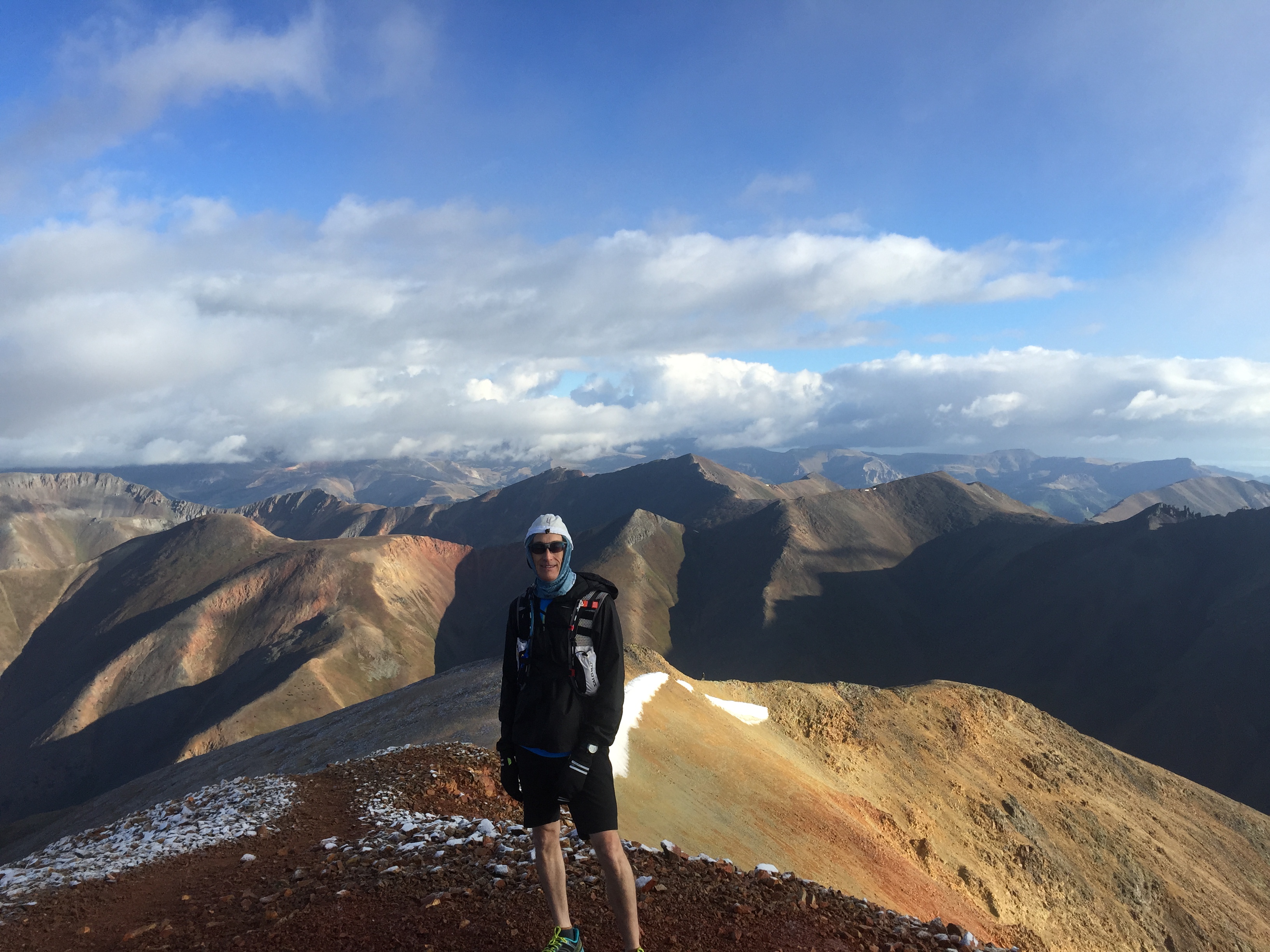
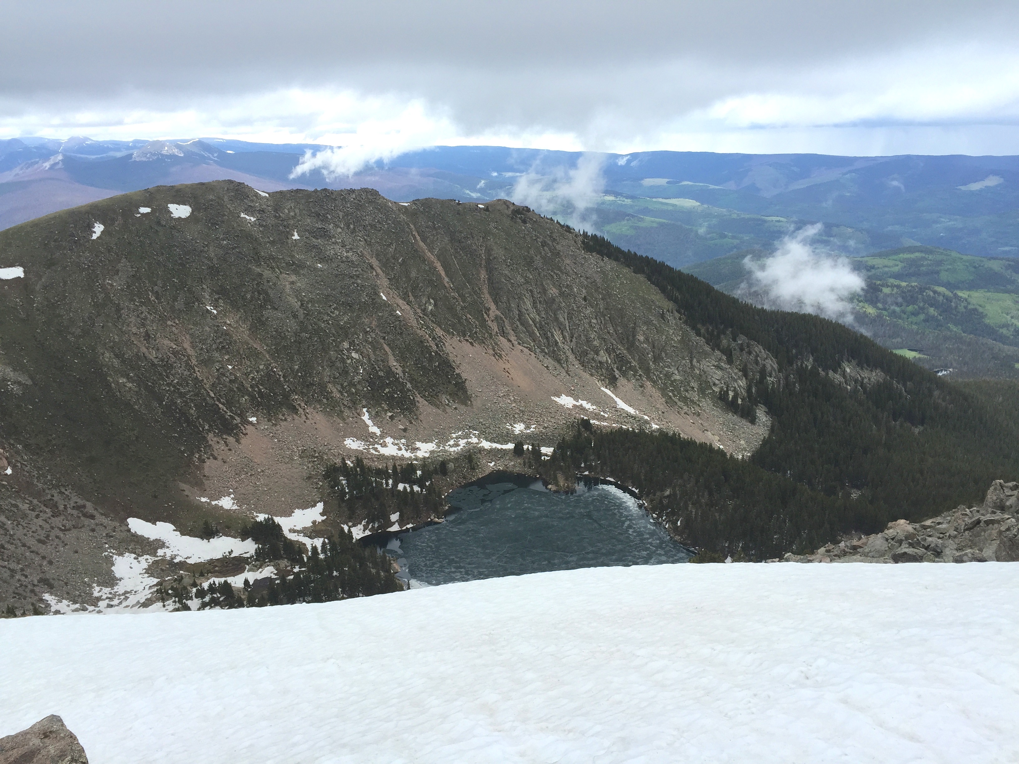
Top of Handies Peak, San Juan Mountains, early June, 2009. The view is to the southeast, and you can see above timberline for 35 miles.

Calderas, collapse, karats, and cannibals, oh my!  The tiny town of Lake City in southwestern Colorado is the home to a magnificent mountain ultra, the San Juan Solstice 50 miler (SJS50).  Lake City is the epicenter of unbelievably beautiful high mountains, amazing geology, mineral and mining history, and only a few miles from the most infamous episode of cannibalism in the old wild west.  In my opinion the San Juan Mountains are the most beautiful in the world, and the mining history has drawn me to the range for 50 years; the opportunity to run a long race through the mountains I have known was something incredibly special that I just had to do (even if I was only marginally qualified for the extreme course!).

michelleonhandies

Michelle Hall, my wife, on her first 14er Handies Peak. Over her shoulder Uncompahgre and Wetterhorn (more 14ers) are visible. Handies is a couple of miles southwest of the SJS50 course.

I first visited the San Juans with my father on a mineral collecting expedition in the early 1960s.  Although I have no real memory of that adventure, I know that it was the first of more than 50 trips we would take before I left home for college.  I visited every mining camp, large and small, across the San Juans looking for mineral treasure.  I found silver, gold, rhodochrosite, great quartz crystals, galena, hubnerite, and artifacts galore. But mostly, I found a place that inspired and thrilled me, and connected with my soul.  The San Juans are no longer a “hidden gem”; they are visited by more than 150,000 people every year.  Telluride has become a major ski resort and playground of the rich.  There are dozens of companies that provide jeep tours to some of the most remote and rugged corners of the range, and sometimes in the summer there are more than 500 ATVs ferrying people to vistas they could barely imagine before they got to the San Juans.  However, despite its growing popularity, the San Juans are still a wilderness, and there are ample opportunities for solitude and reflection — along with climbing, camping, running, and yes, even mineral collecting.

lookingforsilver

Collecting minerals. My grandson’s first mineral collecting trip was to TomBoy located in the San Juans above Telluride. He was 2 and half years old, and found lots of rocks…and a taste of the world’s most beautiful mountain range.

The San Juans are where I took my then-to-become wife on our first “very serious” date.  Once she camped above timberline, and pounded on rocks looking for silver, and had to purify water before breakfast, we knew that we were right for each other.  She saw Cement Creek, Cinnamon and Stoney Pass and the ghost town of Animas Forks before she met my parents.  Years later we returned for a celebration of an anniversary and she climbed her first 14er, Handies Peak.  Later my son would also climb his first 14er there, and it transformed him into a “mountain man”.

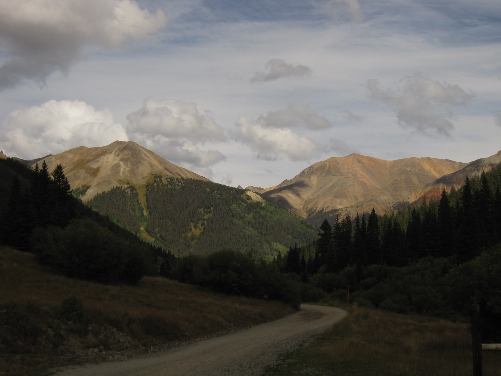
Lake City is on the north-central flank of the San Juans, and is less well known than the “big three” mining towns that brought much fame to the area:  Silverton, Ouray, and Telluride.  However, Lake City is just as historic, and is only a few miles – as the crow flies – from 5 peaks that top 14,000 feet. The San Juan Solstice 50 started as the Lake City 50 miler back in 1995.  The terrain is spectacular, but also poses challenges for snow pack and summer lightning storms – much of the course is above timberline. In the early part of last decade the race assumed its modern name, and the goal of running close to the solstice became a mantra.  The SJS50 is extremely popular, and requires runners to qualify and signup for a lottery for the 250 available spots.  The lottery and wait list adds drama to the hopeful runners, but the real challenge is waiting to see if the snow pack cooperates with the third week in June.  In 2015 it was touch and go – an amazing wet late spring kept the high country under a thick white blanket.  Snows finally began to melt in mid-June – and boy did they melt, sending roaring runoff down the drainages.  This set the stage for a true adventure – a 50 mile run with more than 12,800 feet elevation gain and loss, a low point of about 8,700 ft elevation, and an average elevation of approximately 11,000 ft, snow fields, and 9 stream crossing with churning melt waters.  What could possibly go wrong?

Well, it turns out lots can go wrong – flat tires on 4WD roads, warning for missing 25 mile/hour speed limits, and most unfortunately, a bad trip on a downhill run that ends a race early.  However,  the SJS50 is now a life challenge for me.

fromUlay

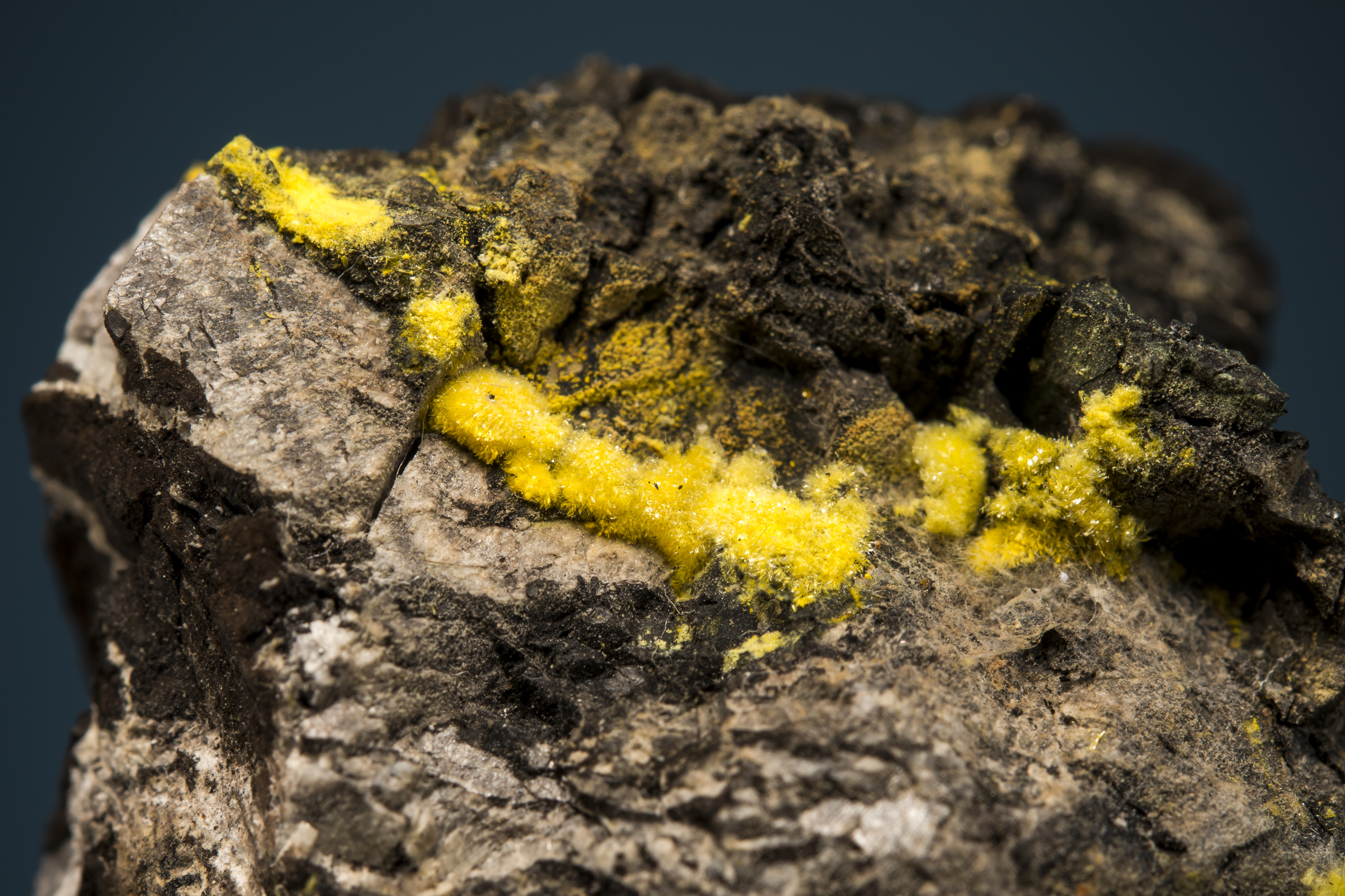
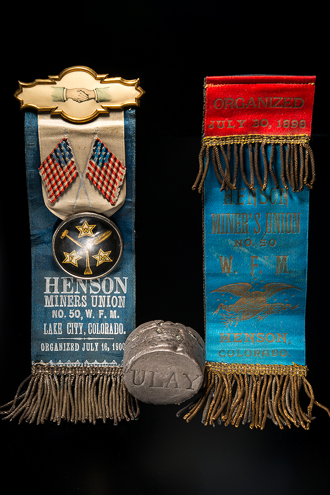
Artifacts from the Ute and Ulay mines, located just beyond Alpine Gulch. In the early part of the 20th Century there was a major struggle between newly formed unions and mine management that played out across the mining camps of the Southwest. Pictured are two union ribbons and a ceremonial “sliver slug” stamped “Ulay” (the slug is about 2 inches across). These artifacts are from the collection of a close friend, Dave Bunk. The history of the Lake City is really about the miners and mines – and what is left today are these wonderful artifacts. Jesse LaPlante photograph.

There’s gold in them thar hills (with a shout out to Mark Twain)

I have written several articles on the San Juans – some for technical journals, and some for more popular literature.  Recently, Gloria Staebler and Lithographie published a monogramThe San Juan Triangle of Colorado; Mountains of Minerals that captures the spirit of the geology and the wonderful minerals.  From my writing in the monogram I attempt to tell the tale of the 8th wonder of the world.

san-juan-triangle-co_2

Lithographie monographie on the San Juans (http://www.lithographie.org/bookshop/the_san_juan_triangle.htm)

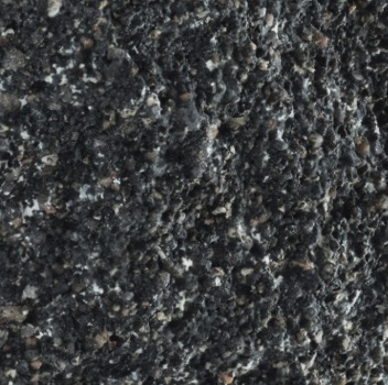
The San Juan Mountains are a spectacular range of towering and rugged peaks that cover an area larger than the entire state of Vermont –  25,000 sq km of alpine bliss in southwestern Colorado. The range stretches from Creede in the northeast to Durango in the southwest; the San Juans are home to 14 peaks over 14,000 feet in elevation and  hundreds of peaks that top 12,000 feet.  The topography is extraordinarily steep, and much of the range is above timberline.  The imposing landscape was shaped by some of the most violent volcanic eruptions known in geologic history.  Between 35 and 26 million years ago huge volcanic centers rose and collapsed and erupted 10s of thousands of cubic km of rhyolitic and andesitic tuffs.  The scared landscape that remained was full of factures and faults that would later localize the magmatic fluids that deposited the ore bodies of some of Colorado’s richest mining districts:  Creede, Summitville, Silverton, Ouray, Telluride, Rico, and of course, Lake City.

allthecalderas

The volcanic centers of the San Juans. The western-most center is a series of calderas that formed over a 5 million year period nearly 28 million years ago. The initials “LC” denotes the Lake City Caldera, home of the SJS50.

The extraordinary episode of volcanism that created the San Juan Mountains began at the end of the Eocene (a geologic epoch 56-34 million years ago).  More than 30 centers of volcanism formed through out southern Colorado and northern New Mexico in what is known as the Mid-Tertiary Ignimbrite Flare-Up.  These volcanoes probably looked like stratavolcanos that form above subduction zones (eg, Mount Rainier and Mount Fuji) but they produced far more voluminous eruptions.  Initially, the eruptions produced andesites and explosive ash falls, but starting about 30 million years ago huge sheets of pyroclastic flows were erupted.  The pyroclastic flows are welded tuffs known as ignimbrites. These flows are unparalleled in size; within the San Juans there are at least 22 flows that are larger than 100 cubic kilometers.  The only way to explain these flows is to assume nearly continuous eruptions for dozens of years.  The eruptive centers ultimately collapse forming large calderas. The largest eruption known in the geologic record occurred in the San Juan Mountains at the La Garita Caldera north of Creede (denoted as LG in the figure above).   La Garita produced the Fish Canyon eruption 28 million years ago; the Fish Canyon Tuff was voluminous – more than 5000 cubic kilometers!  The Fish Canyon tuff could fill Lake Michigan!  Equally remarkable, after La Garita erupted the Fish Canyon tuff, the volcanic system continued to be active for 1.5 million years producing at least 7 other major eruptions.

The reason for the Mid-Tertiary Ignimbrite Flare-Up is a subject of geologic debate, but most geologists believe that the volcanism is related to the tectonics along the west coast of North America.  The Laramide Orogeny, which resulted in the uplift of much of the Rocky Mountains along an arc from Canada to New Mexico, is thought to be related to the subduction of the Farallon oceanic plate beneath North America.  The Farallon plate was quite young geologically, and thus buoyant.  This likely resulted in a shallow angle of subduction, which caused an uplift of the entire western US.  About 35 million years ago the last bit of the Farallon plate was subducted resulting in a major re-ordering of plate tectonics on the western edge of the North America.  Without subduction, the Farallon plate began to simply sink through the mantle in a process that is known as “slab roll-back”. This allowed very hot mantle to melt large regions of the lower most crust, and created the magma sources for the ignimbrites.  The eruptions of ignimbrites lead to the collapse of the huge calderas throughout the San Juans and developed a structural fabric that would localize much younger volcanic activity, which would give rise to rich mineral districts.

LakeCityCaldera

The Lake City Caldera (from Bove et al., 2001). The high peaks between Henson Creek, which passes through Lake City, and the Lake Fork of the Gunnison River are all volcanic centers that erupted about 22.5 million years before the present.  Collapse of the volcanic center produced an elliptical depression – about 1/2 the diameter of the Valles Grande Caldera near Los Alamos.

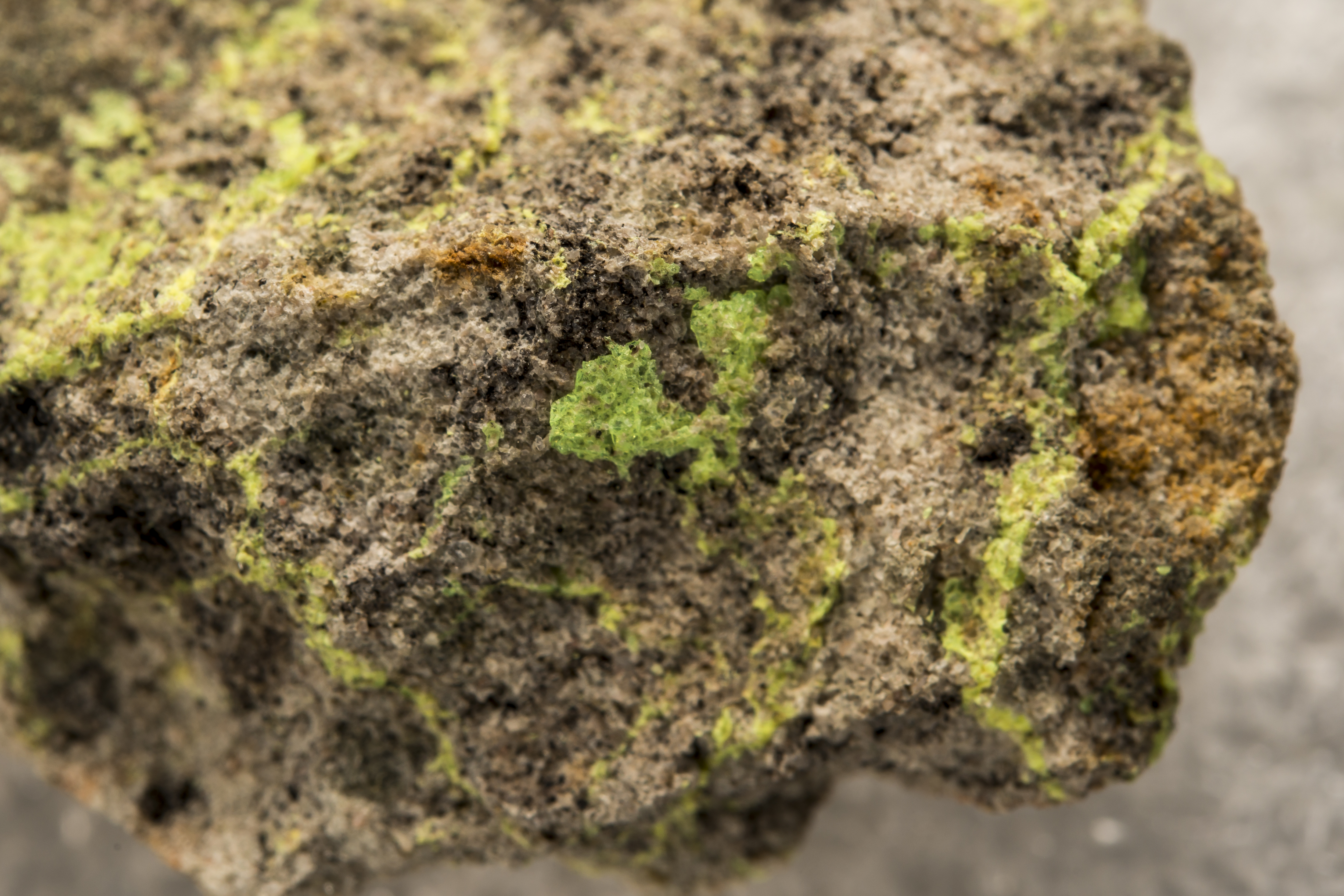
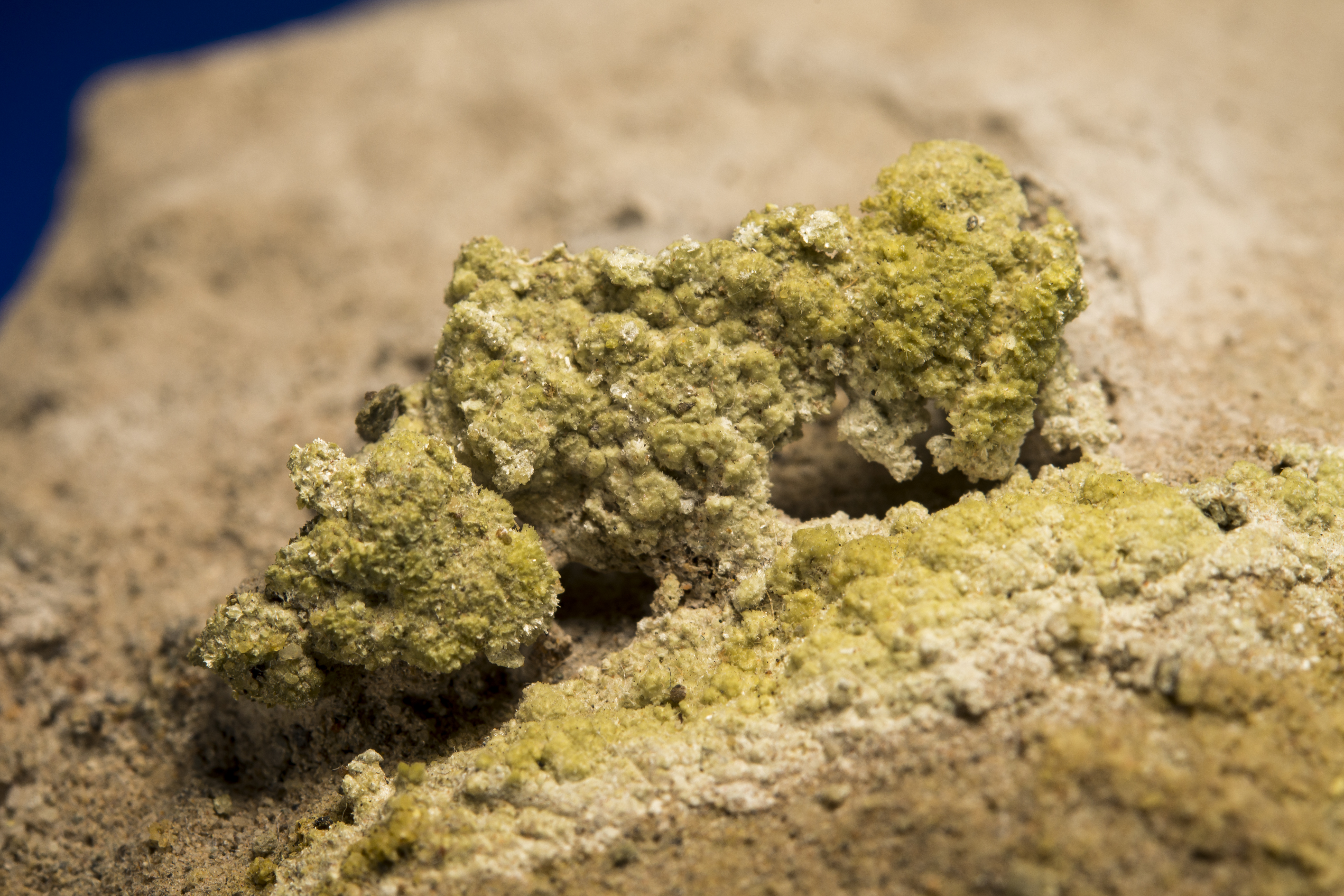
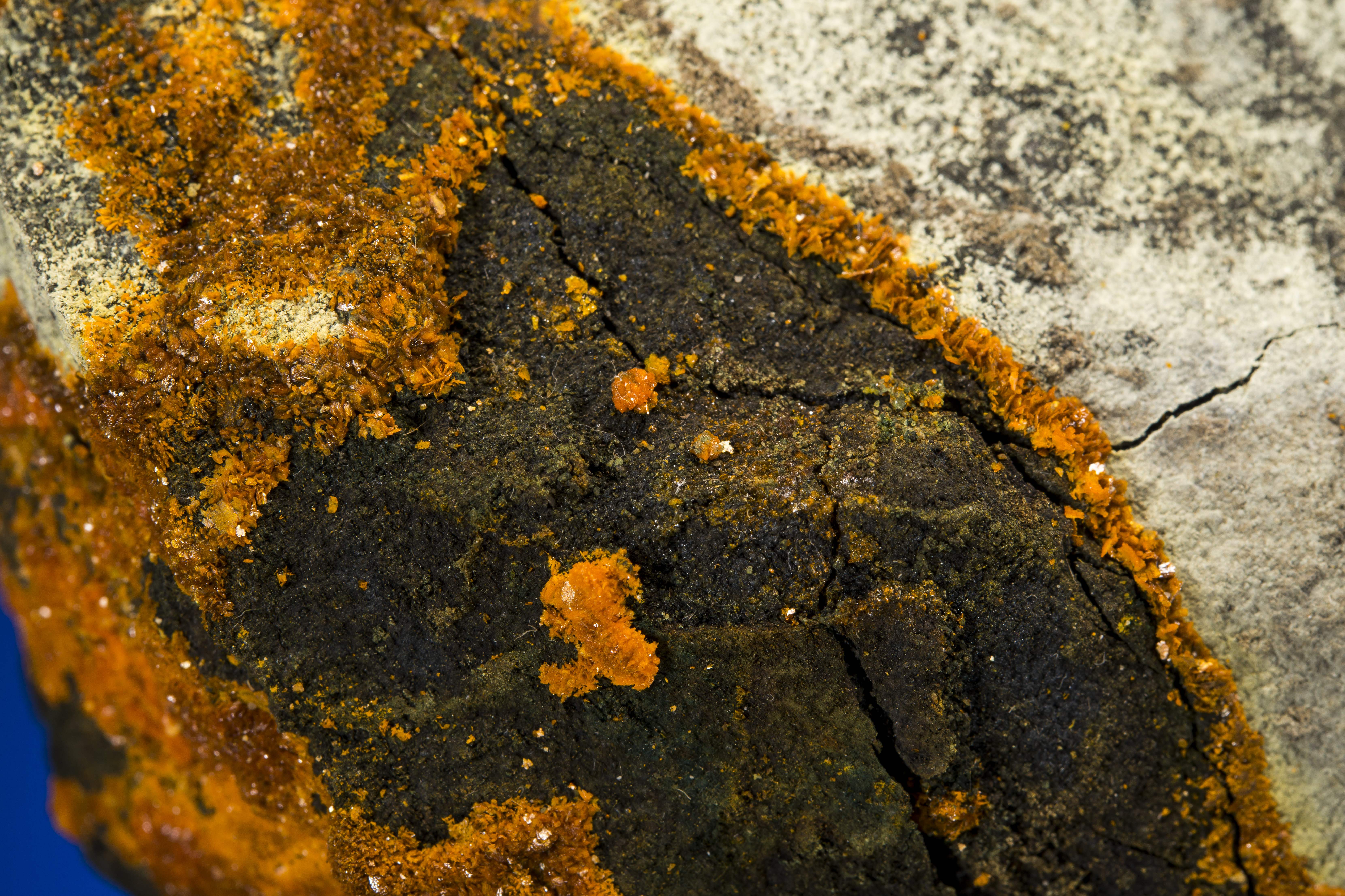
In the area defined by the San Juan Triangle (Telluride-Ouray-Silverton, and over to Lake City) there are four collapsed calderas; the Uncompahgre, San Juan, Silverton, and Lake City.  The first three were formed during a time period of 29 to 27 million years ago.  The Lake City caldera was the last to form, at the end of the ignimbrite flare up, 22.5 million years ago.  The geologic record within the San Juan Triangle is complex and difficult to interpret due to the superposition of the calderas and their structural manifestations. The Uncompahgre and San Juan calderas are the oldest; they were active at the same time, and collapsed simultaneously with the eruption of a very large ignimbrite sheet.   The ring faults associated with the Uncompahgre and San Juan calderas form an oblong structure that is about 45 km by 15 km, trending southwest-northeast. The formation of the Lake City Caldera was the last gasp of the Mid-Tertiary Ignimbrite flare up.  The rich ore deposits in the San Juan Triangle were emplaced 5 to 15 m.y. after the calderas formed. This mineralization is classified as epithermal and is associated with minor episodes of magmatic activity.   The base metal deposits contain mainly galena, sphalerite, and chalcopyrite while the precious metal deposits are mainly native gold.  Silver occurs in a suite of exotic minerals that includes tetrahedrite/tennantite, proustite, and pyrargyrite.  Gangue minerals include quartz (most common), calcite, pyrite, pyroxmangite, rhodochrosite, fluorite, and barite.

CapitolCityminerals

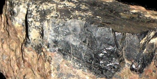
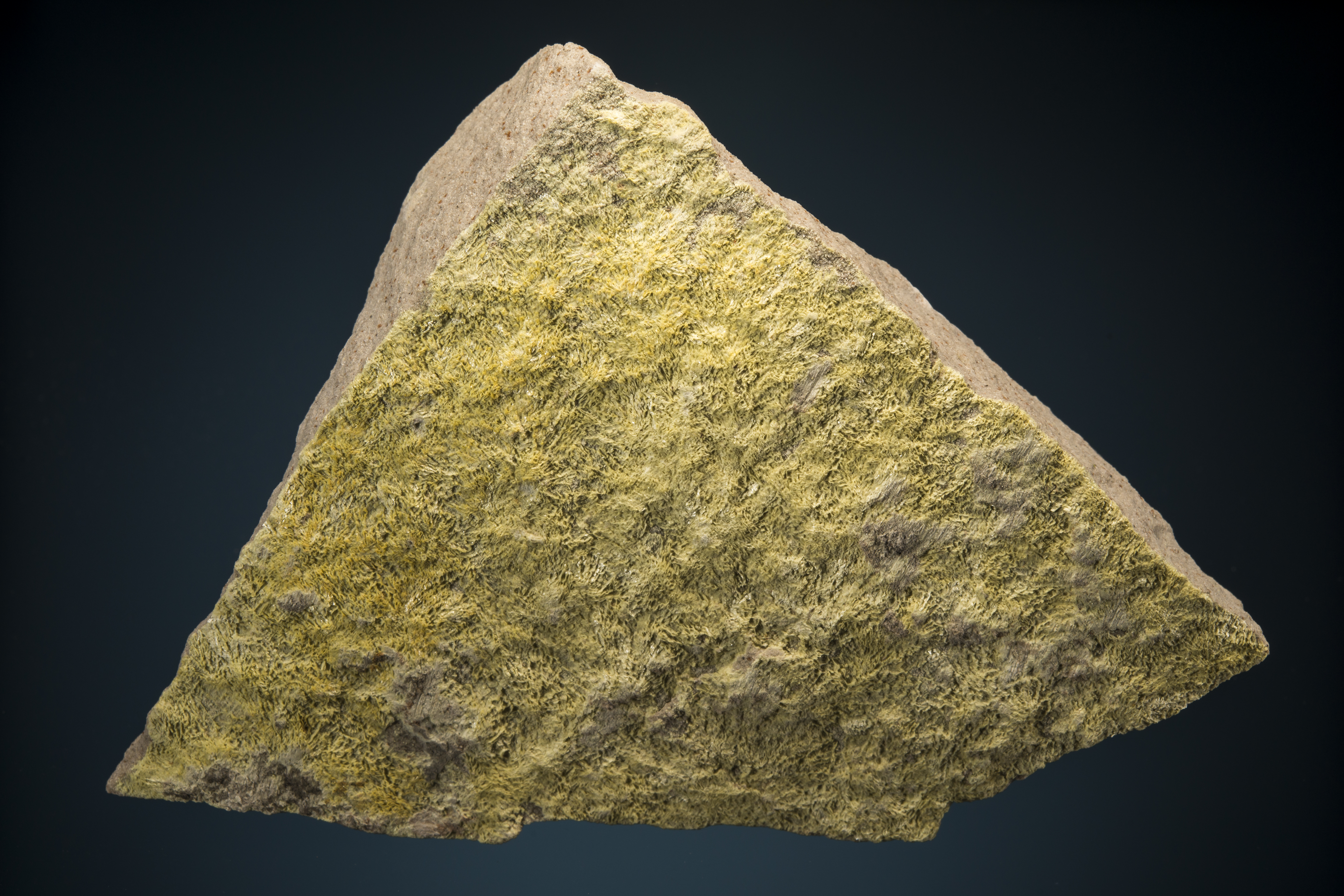
Minerals from “Mr. Mesler’s Mine”, which was located in Capitol City, and short distance beyond Alpine Gulch on Henson Creek (about 9 miles from Lake City). From Dave Bunk’s collection (Jesse LaPlante photograph).

There were hints of the great mineral wealth of the San Juans in the earliest expeditions exploring the western US.  In 1848, John Fremont led a privately funded expedition into Colorado to scout a route for an intra-continental rail route along the 38th Parallel. The expedition was a disaster due to an exceptionally cold winter, but an unnamed member of Freemont’s party discovered gold nuggets and flakes near present day Lake City. The exact location of the discovery is not known, but it was probably the Lake Fork of the Gunnison River, and may well have been related to the future Golden Fleece mine, which would become Lake City’s most famous mine 30 years later.  This is the first documented discovery of gold in the state of Colorado, although it was largely ignored.

In 1859 gold was discovered along the Front Range, west of present day Denver. This coincided with the decline of gold mining along the Sierra Nevada of California and created a rush of prospectors to Colorado. This became known as the Pike’s Peak Gold Rush, although the gold discoveries had nothing to do with the famous 14er. The huge influx of prospectors far outstripped the easily won gold in the Denver area, and prospectors fanned out to other parts of the Rockies. In the late summer of 1860 Charles Baker led a party of gold seekers to the San Juans. Baker entered the San Juans along the Lake Fork of the Gunnison River – he walked along part of the course of the SJS50! His party eventually passed over Cinnamon Pass, and discovered gold along the Animas River near Silverton.  There was no putting the genie back in the bottle – mining became the heart beat of the San Juans for a century.  The early years were extremely difficult;  the San Juans were actually part of land the US government had agreed was owned by the Ute Indians, the area was so remote that it was nearly impossible to supply and provision, and the mining season was short and harsh due to the alpine environment.  In 1873 the Brunot Agreement opened the land to mining (the Utes in return received $25,000 annually in royalty, and the right to hunt), and  soon toll roads and narrow gage trains began to “civilize” the area.

1911mapofGF

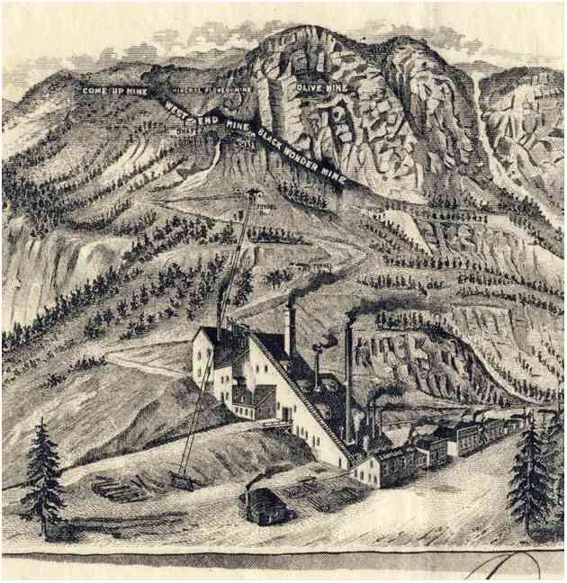
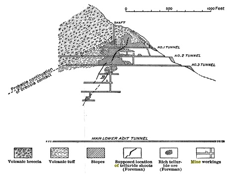
Early cross-section of the Golden Fleece Mine.The upper reaches of the mine assayed at 125 oz of gold and 1250 oz of silver per ton.

The first major mineral discovery near Lake City occurred on August 27, 1871 Henry Henson discovered a rich silver deposit – to be called the Ute-Ulay – along a stream about 3.5 miles from the present location of Lake City. Later this stream would be named Henson Creek (the SJS50 follows Henson Creek for the first 2.5 miles of the course). Once the Brunot Agreement was signed, Henson returned and developed the Ute-Ulay mine, which was a major silver and lead producer (but few mineral specimens exist today – a pity).  This development attracted entrepreneurs of every type; one of these was Enos Hotchkiss who came to build a toll road but instead discovered gold above Lake San Cristobal, a couple of mines south of Lake City.  Hotchkiss did not find much gold at first – in fact his claim was largely based on the obvious color of the rock – anyone with a sprinkling of geologic knowledge just has to gaze up Red Mountain and see the beautiful color of an oxidized cap, and know that there is gold in them thar hills. However, the claim was enough to commit to prospecting, and Lake City was founded on this promise. Eventually the Hotchkiss claim was renamed the Golden Fleece Mine, and became one of Colorado’s most famous.  The early years of the Golden Fleece relied on telluride ores, and there are reports of individual mining carts assaying 50,000 dollars of bullion.  I have been underground at various adits associated with the Golden Fleece looking for rumored veins of hessite, one of my favorite minerals. Alas, like most old San Juan mines, the conditions are deplorable, and one is actually just lucky to get out alive.

goldenfleecestock

Stock certificate from the Golden Fleece mining and milling company dated 1896. Although the Golden Fleece produced silver, and thus was impacted by the 1893 silver crash, the steady production of gold helped the property make it through the “silver crisis”. Dave Bunk collection.

The news of the Golden Fleece started a “Lake City” rush. By 1880 there were dozens of mines in Carson (along the SJS50 course), Argentum and Capitol City.  The population of Lake City swelled to 2500, and the boom times were full steam.  However, silver soon ran into the buzz saw of politics.  The rich deposits of the San Juans began to push the price for silver bullion down, and western mining barons demanded action.  In 1890 Congress passed the Sherman Silver Purchase Act, which required the US government to purchase $4.5 million dollars worth of silver every month.  This proved to be as unpopular among the Republicans of the day as the Affordable Health Care act today, and was repelled in 1893 – and the price of silver plummeted.  In a few week period the price dropped from $1.50 per oz to 63 cents.  At the time, Colorado produced about 2/3 of all the silver in the country; within 2 years more than 1/2 the silver mines in Colorado – including those near Lake City – were shuttered.  Although the mining industry would eventually recover, the heyday had passed.  Today there is some mining in the Lake City area – for example the Golden Wonder Mine located at the head of Deadman’s Gulch – but mostly there is history of an incredible tough breed of pioneer that has long passed.

rhodochrosite.bunk

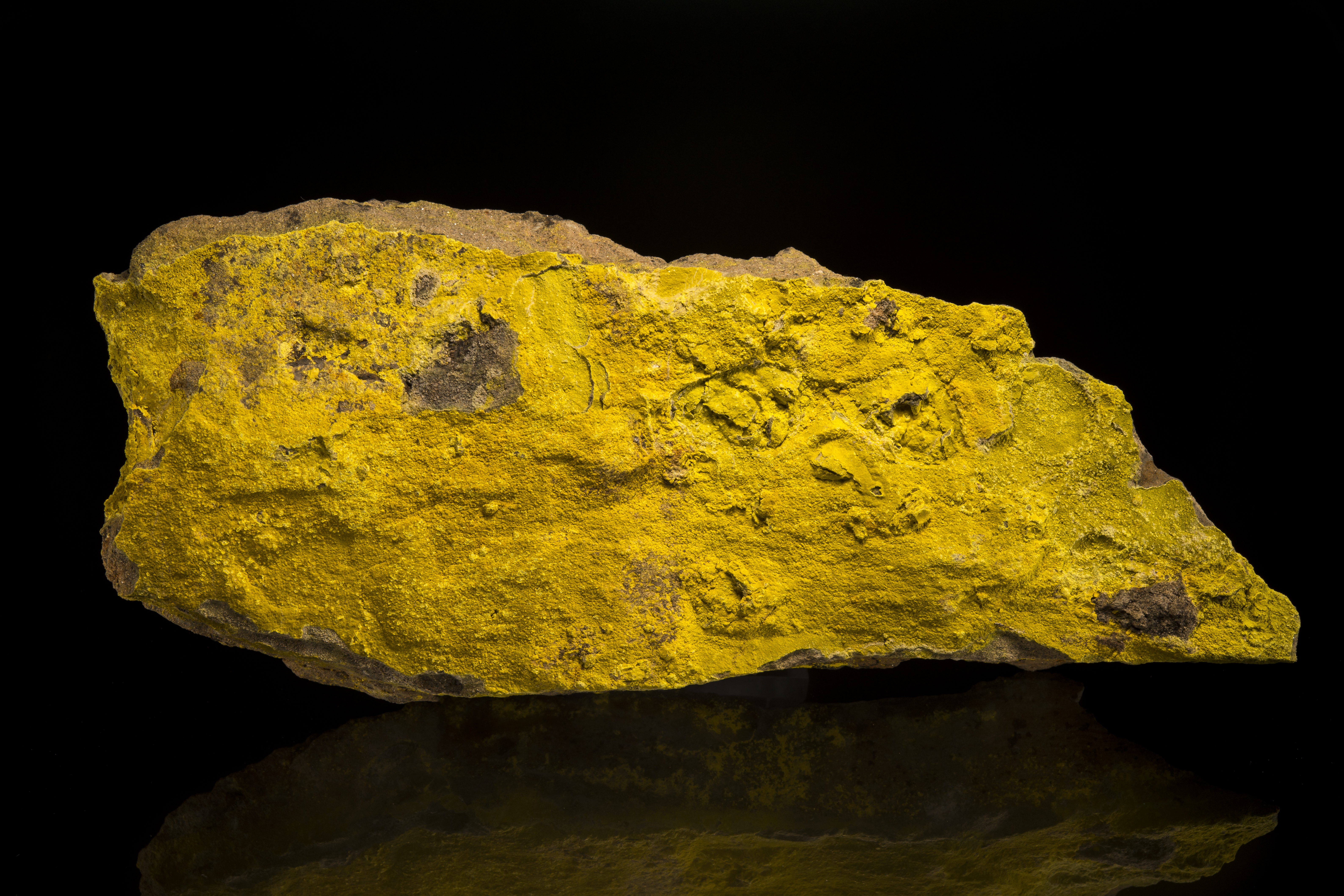
Rhodochrosite, Champion Mine, Dave Bunk collection.  The Champion Mine is located near Cinnamon Pass – the road over Cinnamon Pass was built by Enos Hotchkiss. Jesse LaPlante photograph.

In 1911 Irving et. al published Geology and Ore Deposits near Lake City, Colorado.  In the text is a haunting statement: “Secondary enrichment…led to the formation of the rich bonanzas of ruby silver found here and throughout …”  Oh, to find a pyrargyrite or proustite from Lake City! I have not in 50 years, so I suppose I am happy to run the San Juan Solstice instead.

googleLC

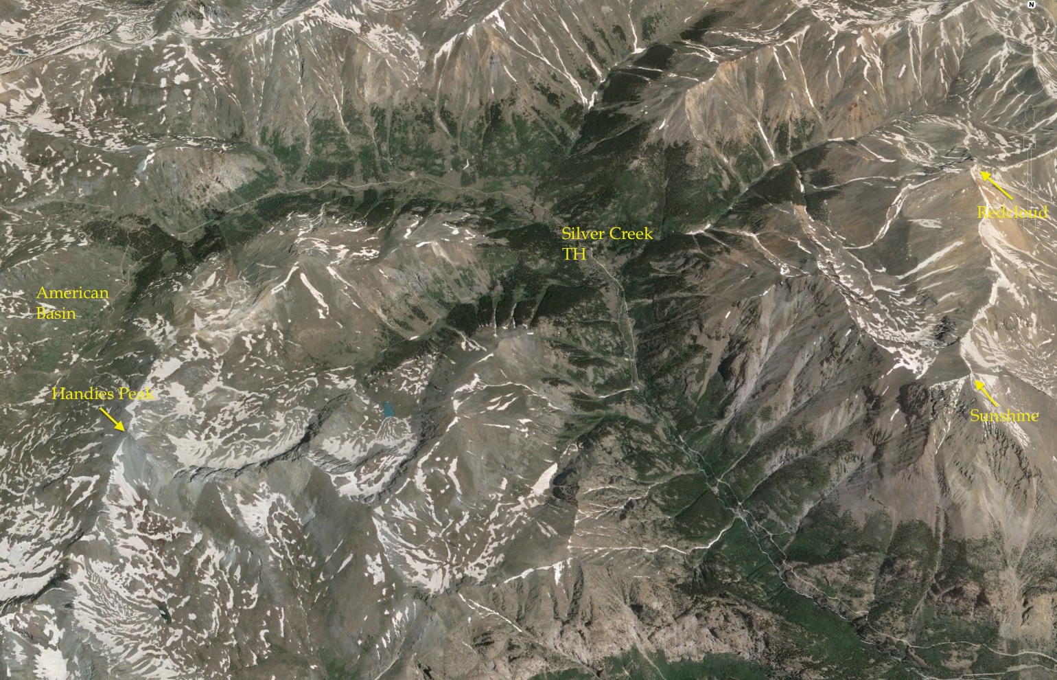
Google Earth Image of various points along the SJS50. The course starts in Lake City and head west on Henson Creek, then south up, way up, Alpine Gulch. The course turns towards Redcloud Peak, a 14er, but before arriving there descends into the Lake Fork valley. After crossing the valley the course climbs steeply up to the continental divide, and has 15 miles above timberline.

50 Miles, a clock ticking, and then a trip

Lake City is a small town, and every resident seems to be involved in the race.  The Lake City of my youth was a decaying frontier mining town; like nearly all Colorado mountain mining communities it has been gentrified and is now a destination for outdoor enthusiasts of all sorts. Gentrification came decades later than to Aspen or Telluride, so it is still has the rustic flavor of the early part of the 20th Century.  But make no mistake, expensive vacation homes and a very fine French Chef are now part of the Lake City landscape.  The SJS50 checkin is most of the day before the race – lots of hard core trail runners from all around are wandering the small town park that serves as the start and finish to the race.  It does not take insightful self awareness to immediately recognize that I am not really “like” most of the runners.  However, that is not why I run, and I am truly excited to be in the San Juans.

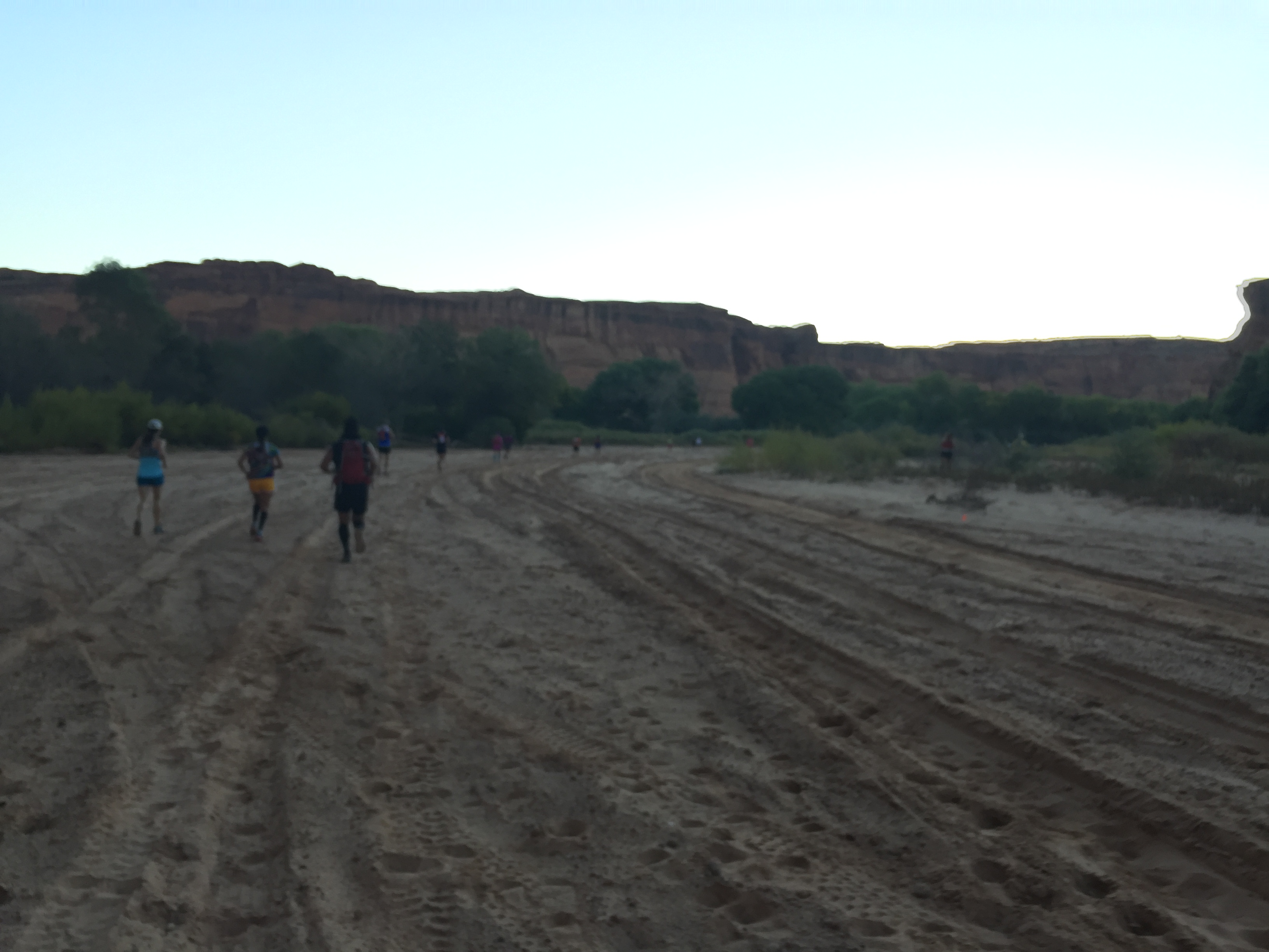
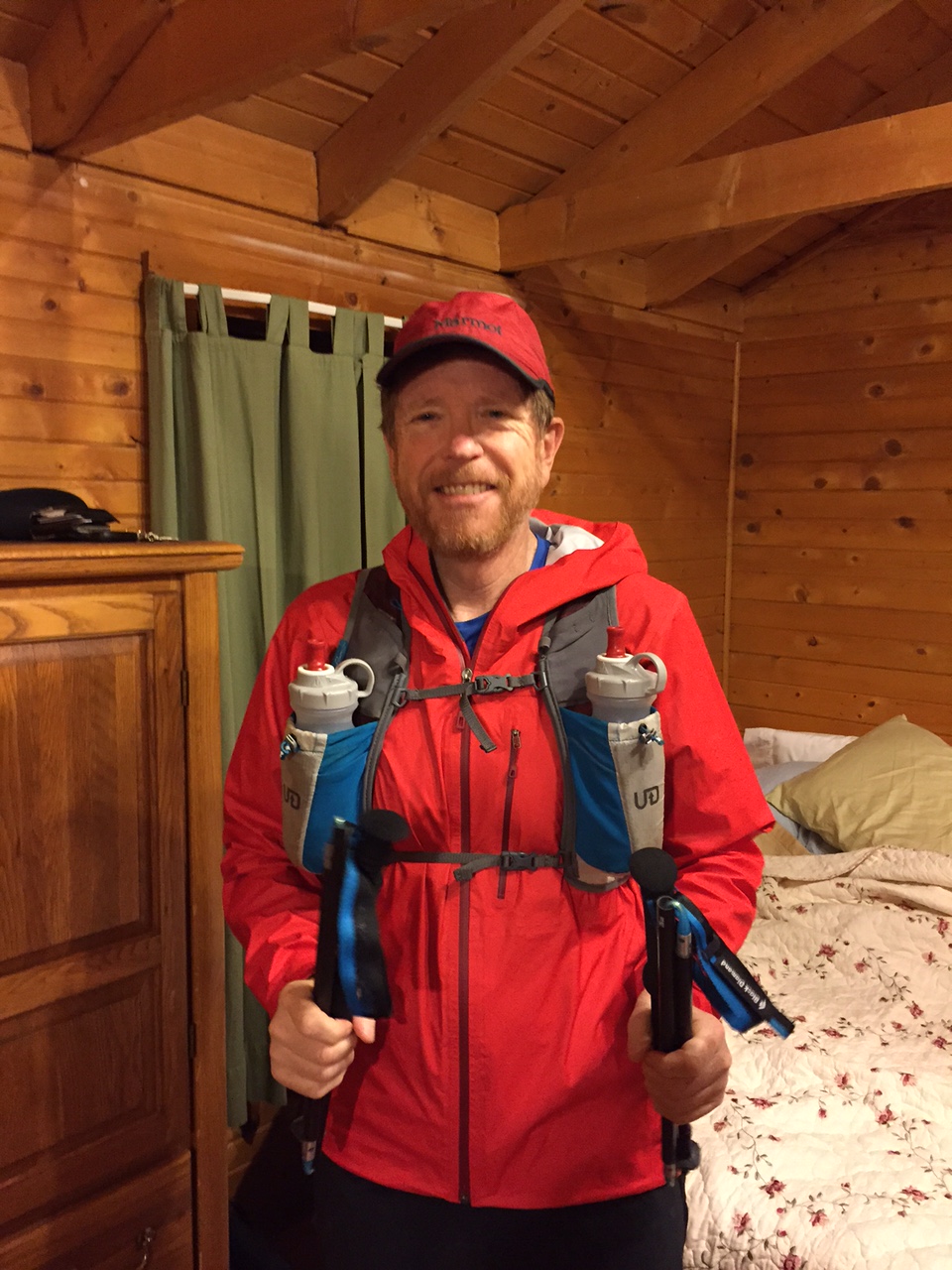
The final checkin for race begins at 4 am on Saturday, June 27.  I put my drop bags into the piles for a couple of the aid stations, and begin to get nervous.  Visiting various parts of the course the day before I know that it will be wet and muddy, so I have a couple of extra pairs of shoes, lots of socks, and of course, my special energy supplies tucked into my drop bags that proudly displace my name and bib number.  In ultras your bib number is aways assigned alphabetically, so my bag is pretty easy to find (although not as easy to find as my friend Dave Zerkle from Los Alamos….).  At 4:55 a soft bull horn announces that the race will start in 5 minutes.  I hustle into position, but it seems strange to me that runners are still milling around the park or standing in line at the port-a-potties.  Suddenly I hear, with no warning, a growled “GO”, and people are off running.  There are also runners running from the port-a-potties.  I realize that 13 or 14 hours running will not rely on a punctual start.

startinginthedark

The glint of reflective tape and headlamps at 5 am start of the San Juan Solstice. A bit of a chaotic beginning, but a perfect morning.

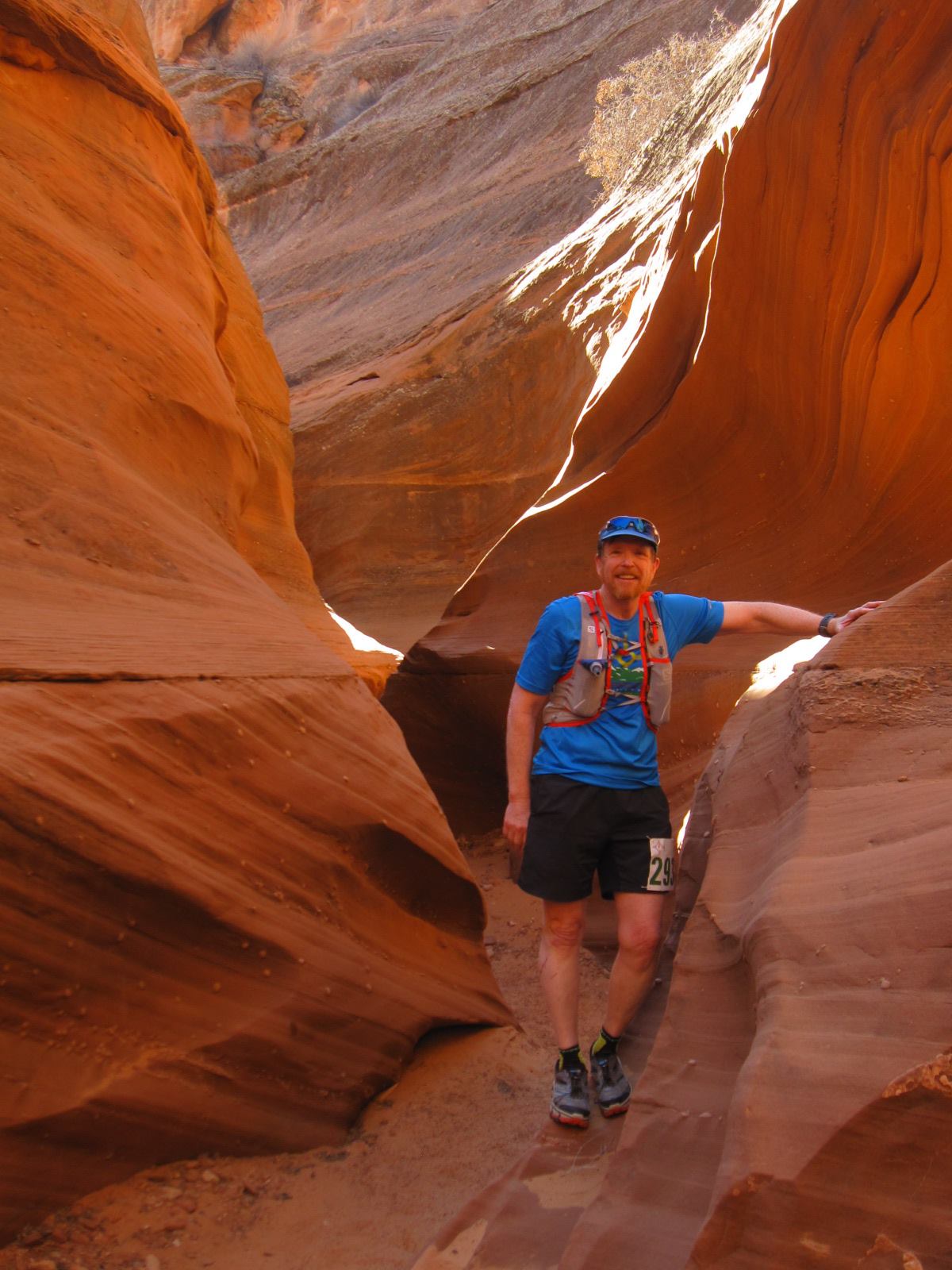
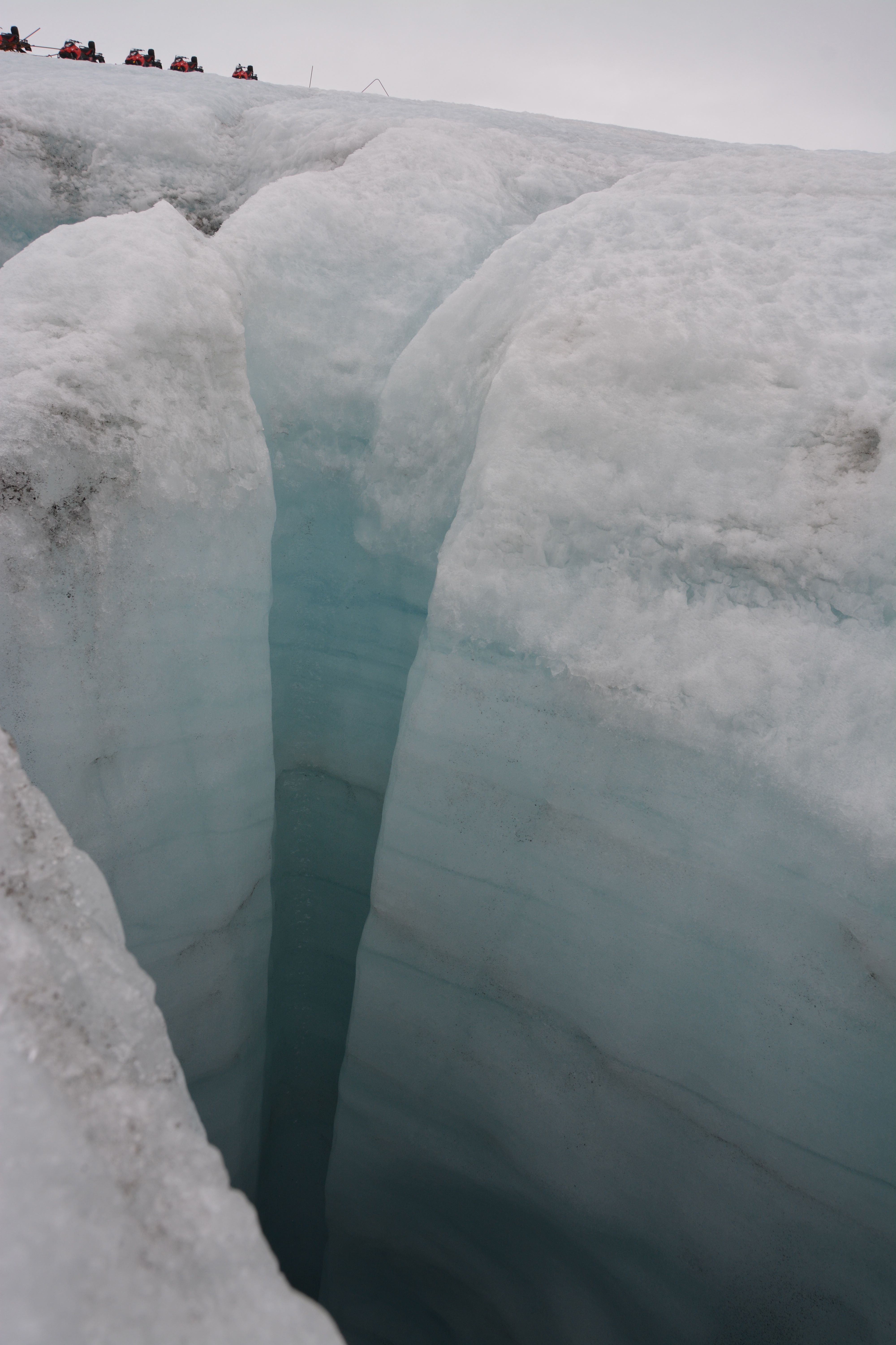
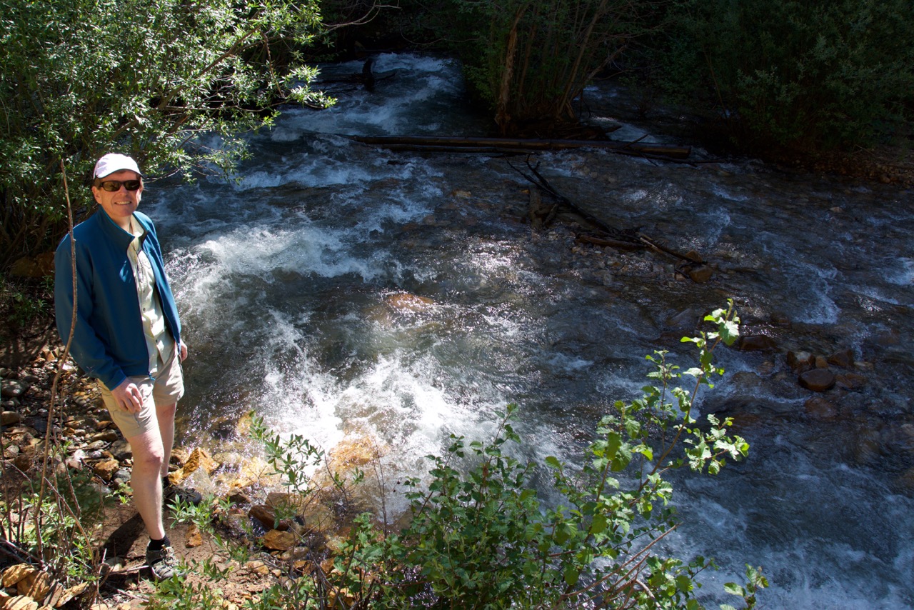
The first 2.6 miles of the race are up a gravel road along Henson Creek.  There is not much chit-chat, and the sounds I hear are the crunch of 500 feet on the road gravel and mixed with the turbulent roar of Henson Creek bringing snow melt down from the high country.  Dave Zerkle and I settle into a very agreeable pace of a little better than 11 minutes per mile (the specter of 50 miles looms large).  When we arrive at Alpine Gulch we start the real race.  Although we have climbed 500 feet thus far, in the next 6.5 miles we have nearly 4000 feet elevation gain.  The sun is still an hour from lighting the narrow canyon, but there is enough glow to switch off the headlamps.  The creek in Alpine Gulch is churning, but the water is much lower than just a week before. At mile 3.75 we come to the first of 7 (or 8, 9, or 10, but who is counting) crossings of the creek.  The crossing has a rope for assistance, and a number of volunteers to offer advice.  The runners stack up waiting for their chance to jump into the frigid waters…the first step is a doozy, although the water is only a bit above my knees.  Cold, but I am surprised how good it feels!

river.crossing

The first river crossing along Alpine Gulch. This photo was taken the day before the race, scouting the various segments. The picture does not give a great sense of the water depth, but it is about 2.5 feet here. At some of the higher crossing the water is definitely crotch level.

The course criss crosses the gulch many times, and at each water entry there are volunteers and a rope.  Some crossing are more challenging than others, but every time the runners emerge with soaked shoes, socks and compression sleeves.  I really enjoy the crossings, except they continually bunch the runners.  Dave Zerkle and I are trying to maintain a 20 minutes per mile or better (the average grade on most of the climb is 17%).  For the most part, the running dynamics are such that we can pass the slower runners, and get passed by the occasional faster runner (probably the people that were in the port-a-pottie when the race started).  However, around mile 6 I become quite impatient with the “group-pace” and ask to semi-sprint past a dozen runners.  It is hard work, but rewarded with open trail. A downside is that I lost Zerkle.  The first aid station is located at a small saddle at mile 7.6.  The cutoff time for this station is 7:45 am – in other words, 2hr45min from the start.  Sounds easy, but the climb is tough.  I planned on arriving at 7 am, and I am 6 minutes early.  I feel fantastic, and have visions of a sub-13 hr race.

redmountain

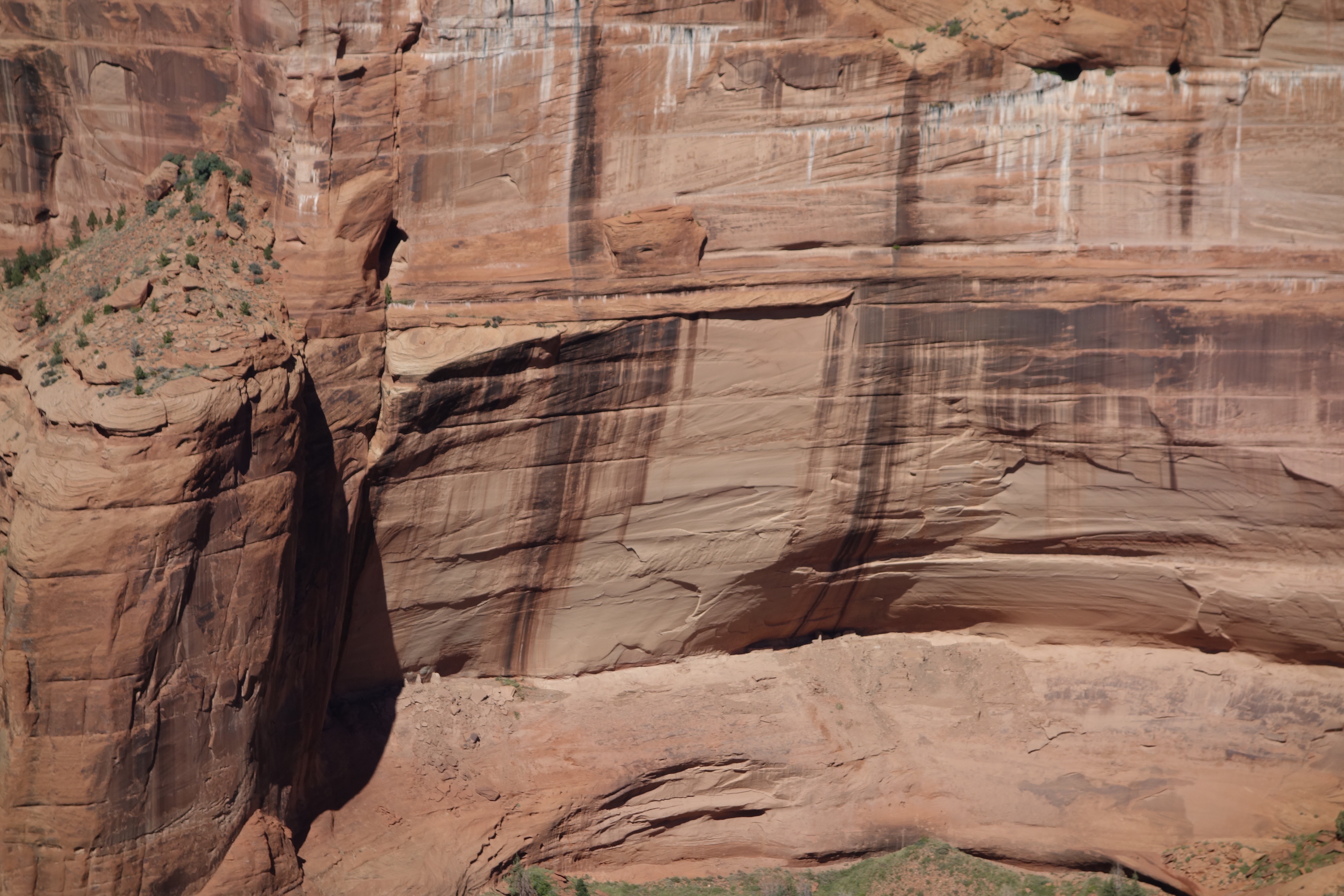
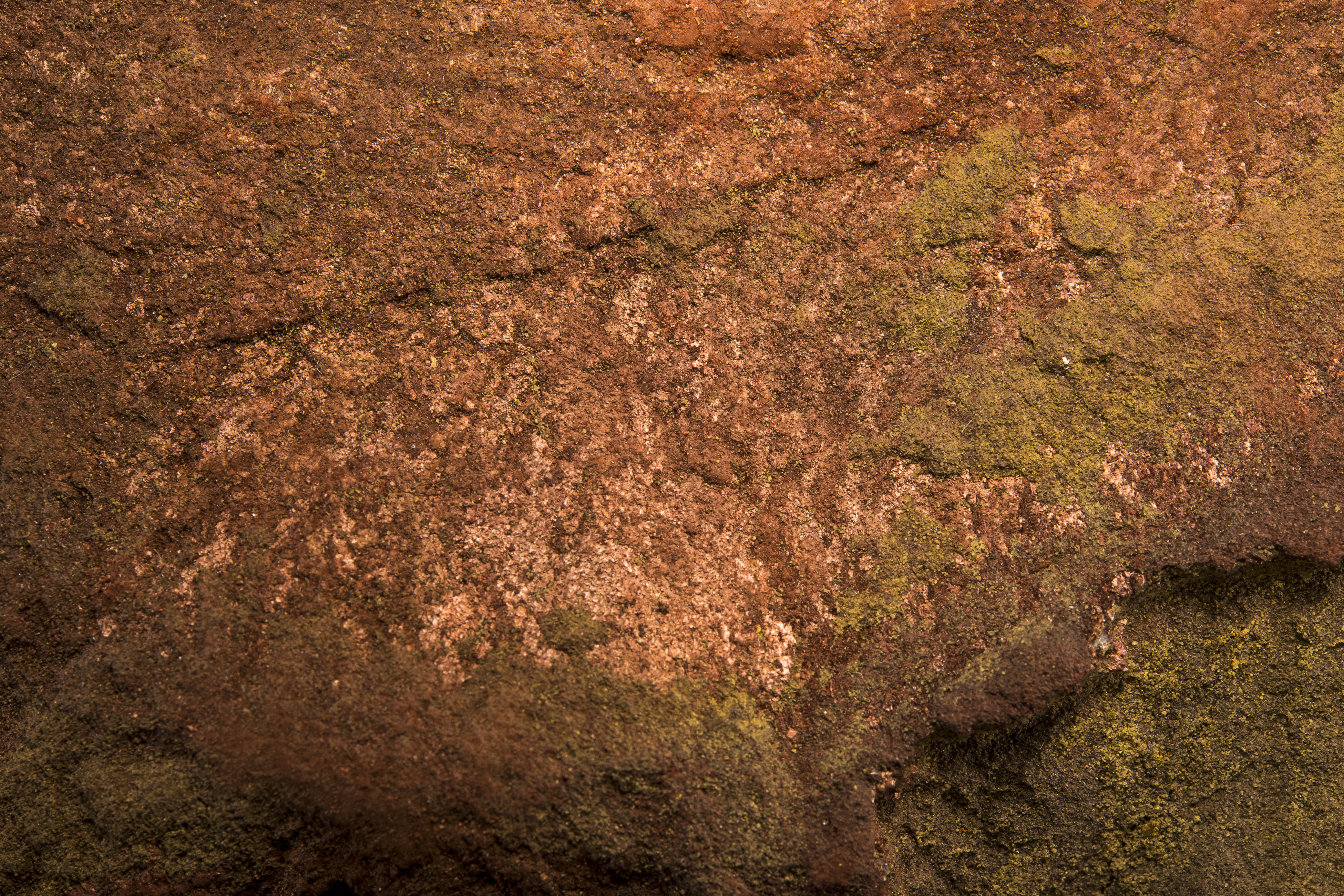
View of the south side of Red Mountain from Aid Station #1. The red color that is usually so distinctive is muted in the early morning sun. However, on the ascent up the gulch there are many old mines and the cabins of prospectors past.

Although the aid station is at a saddle, the climbing continues.  I am still moving well, not really tired, and hypnotized by the scenery.  I feel like I am home.  Shortly before summitting at the high point of the first part of the course I catch up to another runner from Los Alamos, Sarah Thien.  She has been battling an injury, and is not her usual rapid self.  We do get to chat a bit, and both marvel that the mountains surrounding us.

terryontop

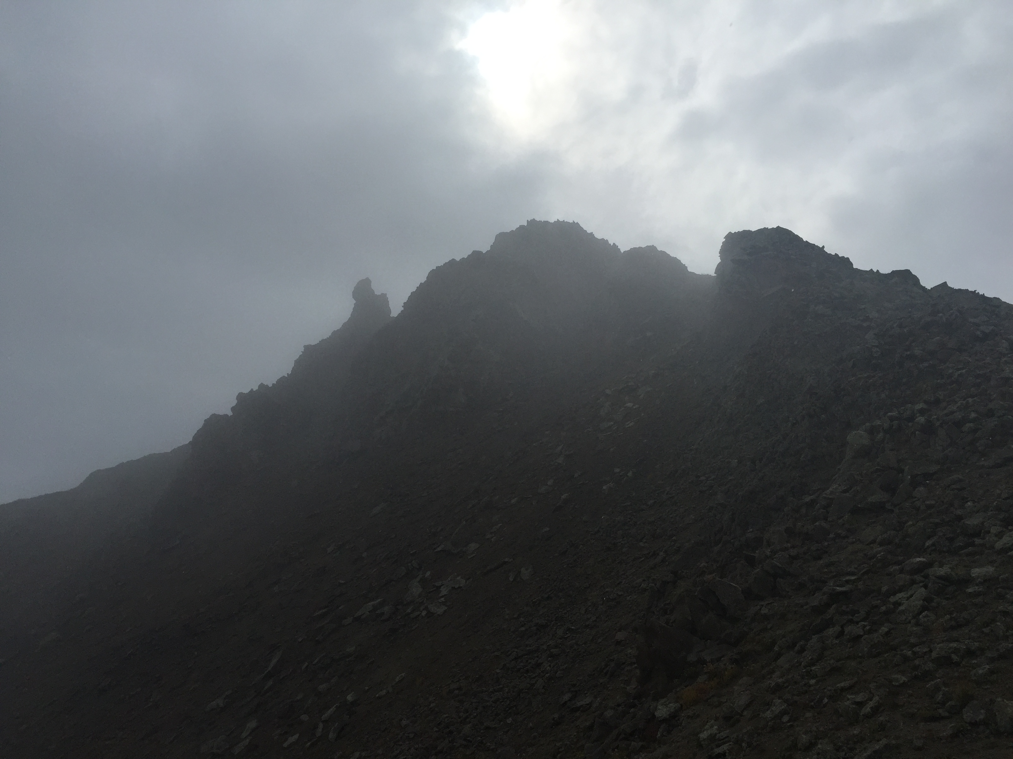
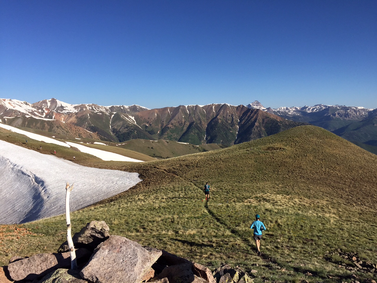
The first climb is nearly over – a pass on the shoulder of an unnamed 13,600 foot peak visible over my left shoulder. The day is spectacular! In the distance I can see Handies and Sunshine Peaks.

Once on the divide I know that the course is going to descend nearly 3500 feet in the next six miles.  All those hard earned feet and inches of elevation gained are soon to be lost, and gravity wins again.  I always have a difficult time shifting gears from climbing to running downhill.  I suppose it is the stiffness of age, but my hips always have to be convinced that it is okay to have strides longer than 10 inches.  After a mile or so I am beginning to hit a stride of 11:30 minutes per mile;  I had hope for 10 minutes per mile, but I am ahead of schedule never the less!

sarah.top

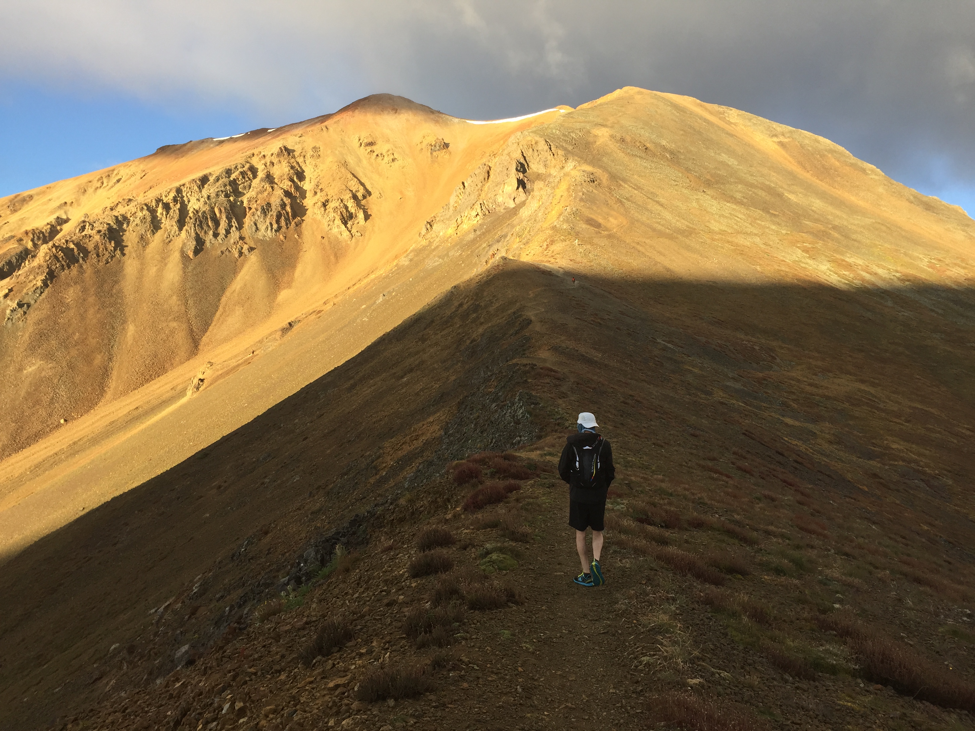
Sarah Thien running across the divide. The view is towards the west, and the high peaks of Uncompahgre and Wetterhorn can be seen in the distance.

There are a number of snow crossing, but the elite runners have post holed a pathway.  The snow is soft and wet — and slippery – but mostly enjoyable.  At mile 10.5 the snow is behind me, and the steep descent begins.  I am excited and begin to try and sprint.  Disaster strikes at mile 11 – I trip.  I am on a steep trail section and tumble head-long downhill. I land hard on my artificial knee and my right forearm.  The trail is rutted, and I am facedown, feet above my head, unable to get up.  I realize this is bad, but I hope that it is a typical trail run trip where the blood is always worse than the damage.  My dignity is challenged as I try and right myself – a woman runs past as I am still down and asks “did you fall?”  Oh, if only I could have actually answered that question with a response it deserved!

I get up, and start downhill knowing that the Williams Aid Station is only 4.5 miles ahead.  I can’t really run, but I am moving.  Lots of runners now pass me, reminding me that hubris is a nasty sin. I am worried about my knee – being an artificial joint I imagine some horrific breakage.  Hardly likely, but a concern nevertheless. My right foot (below my artificial knee) is totally numb.  Every step feels like I am swinging a club attached to my knee.  Before the fall I was on pace to arrive at the Williams Aid Station at 9:05 am.  Instead I arrive at 9:32.  I check in, and then very reluctantly, drop the race.

cuts

After clean up – once the blood and grim is removed, it does not look so bad. Well, at least the knee. Unfortunately, the day is done.

The medical staff help clean up the wounds, and I get bandaged up.  My wife is at the aid station, and provides the sad sag-wagon ride back to Lake City.  After only finishing 16 miles I am quite depressed.  I look up on the ride in and see two parts of the course I very much looked forward to: Slumgullion and Vickers.

slumgullion

Michelle standing at the Slumgullion pass point of interest. Over her head is the scarp of the repeated Earthflows.

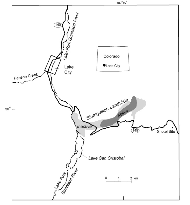
The Slumgullion Earthflow is one of the most interesting and odd geologic features on the entire run. In the 1870s this strange tongue of yellow chalky debris was identified as a landslide off Mesa Seco (the map below shows the geography of the slide).  It was later recognized that the Slumgullion was not “a landslide” but a series of large scale debris flows that have been active for hundreds of years.  About 1200 years ago the competent rocks on the top of Mesa Seco began to slide down towards the river valley because the underlying rocks, which are heavily altered ignimbrites from the Lake City Caldera complex, were exposed and rapidly eroded.  The first flow damned the river and formed a prototype Lake San Cristobal.  Eventually the river cut through this old debris flow and drained the lake, only to see two other episodes of mass wasting, one 700 years ago, and most recently, 300 years ago (and this flow is still active). The distance from the head of the flow – the scarp on the cliffs of Mesa Seco – to the toe is about 7 km, and 170 million cubic meters of material are contained within the scarp.

fig1

The Slumgullon – a large landslide due to the collapse of steep cliffs of decomposing volcanic tuff.

There is a section of the slide that remains active.  At one time it was a standard geology student training exercise to measure downward movement with seasonal surveys.  Today the movement is measured with SAR (synthetic aperture radar).  The image below is from a pair of NASA overflights, and is colored to show the motion over a one week period in 2011.  The red/purple colors show the most rapid motion, about 4 inches per week.

675939main_Slumgullion-UAVSAR

SAR image of the Slumgullion Earthflow. The slide is outlined in red, and the colors are constructed from the fringes of the differences between two radar images. The slide a few hundred meters above the SJS50 crossing is slowly moving downhill.

Although the Slumgullion slide is strange, it pales in weirdness to the last section of the course – the climb up Mesa Seco.  The SJS50 course is very close to the Alferd (sometimes written Alfred) Packer cannibalism site – in fact we are probably running on the very ground that Packer’s victims camped on at back in 1874. Packer – with no real experience, but a gift for tall tales – guided 5 men to the area in February (the middle of winter!) to look for gold.  It seems they were prospecting very close to the future Golden Wonder Mine (it is in Deadman Gulch, named for the Packer victims), but they became snow bound and quickly ran out of supplies.  There are many versions of what happened next, but it is clear that Alferd killed and ate his companions to survive.  For this reason I believe that the final aid station, named “Vicker’s” for the nearby ranch should actually be called Packer, and there should be bacon there…. I ponder what it must have been like to be in the San Juans 140 years ago.  I often think I was born 100 years too late, and could have been a naturalist.  Then I recall the amusing tale of the Hinsdale County Judge that presided over the trial of Packer and sentenced him to be hanged (the sentence was eventually overturned because Alferd ate his victims while Colorado was still a territory, and cannibalism was not a crime in the territory….really!); was reputed to have said: “Stand up yah voracious man-eatin’ sonofabitch…. When yah came to Hinsdale County, there was siven dimmycrats. But you, yah et five of ’em, goddam yah….Packer, you Republican cannibal, I would sintince ya ta hell but the statutes forbid it.”  Ah politics, they have not changed in 140 years.

After I get cleaned up and rebandaged, I go to the finish line and wait for all my friends to finish.  As the first runners come in I am struck how most look very different than runners after a 50K race.  Here they are far more tired, looking thankful for the finish instead of happy.  Nearly every runner I know tells a tale of how difficult the conditions were this year and how hard, very hard, the run was.  I think of Philippides who’s legend inspires ultra runners — giving it all, raising their arms in victory as they cross the finish line, and crumpling to the ground in exhaustion.  I suspect even Philippides would find the SJS50 challenging.

theend

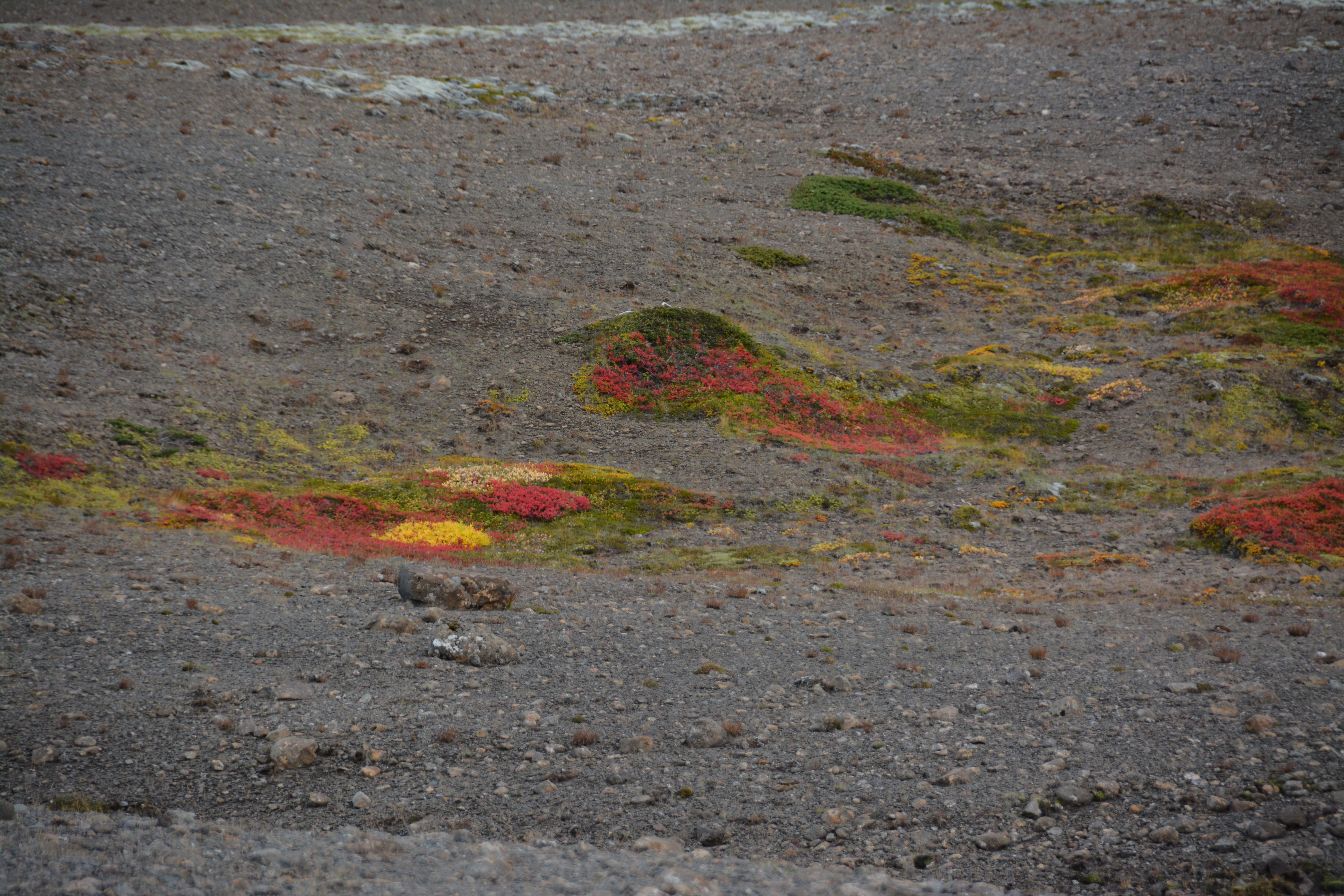
A butterfly at Alpine Gulch. Simple beauty everywhere.

My morning after the race I have come to grips with my race-interupted.  I have decided that this is something I can not leave undone. I will return in 2016 – in fact, it will be the focus of all my training for the next year.  I also wonder how I can make the San Juans my home.

The Riff of the Rio Grande Rift: Running in the Pecos Wilderness and up Santa Fe Baldy

Both the man of science and the man of action live always at the edge of mystery, surrounded by it – J. Robert Oppenheimer, who was appointed the Director of Los Alamos Laboratory in November 1942.

stormoverSangre.post

View of a late spring storm over the Sangre de Cristo mountains viewed from Los Alamos (photo by Jim Stein, Los Alamos photographer extraordinaire, May 26, 2015). The peak in the center-left is Santa Fe Baldy (elevation 12,632 feet).

The town of Los Alamos sits high above the Rio Grande River on the Pajarito Plateau.  The location of the town will always be associated with the Jemez Mountains and the spectacular Valles Caldera; however, the view from the town is always to the east, across the Rio Grande Rift, and towards the Sangre de Cristo Mountains.  The Sangre are the southern most range of mountains that are part of the Rockies, and the view from Los Alamos is dominated by a series of rugged high peaks – Truchas, Jicarita, Sante Fe Baldy Peaks all top 12,500′ – these rocky spires guard the Pecos Wilderness, one of the Jewels of unspoiled New Mexico.

The creation myth of the Los Alamos often casts J. Robert Oppenheimer as selecting the isolated and rugged Pajarito Plateau for the project Y laboratory because of a connection with the Los Alamos Ranch School, a boy’s college prep school. However, that is incorrect – indeed, Oppenheimer recommended and lobbied for a laboratory in New Mexico because of his affection for the area.  But that attachment was with the area that would become the Pecos Wilderness Area.  In 1922 Oppenheimer and his brother Frank visited the Pecos Valley and loved it – so much so, that the brothers first rented, and eventually bought, a ranch along the Pecos River which they named “Perro Caliente” (the legend is that when Oppenheimer found the land for sale he shouted “hot dog”, and the name seemed logical for the new ranch).  When General Groves and Oppenheimer visited New Mexico to locate project Y the preferred site was near Jemez Springs.  However, Oppenheimer convinced Groves that the high cliffs would make the scientists claustrophobic, and thus, unproductive.  The next site visited was the Los Alamos Ranch School, and Oppenheimer beamed with joy at the view towards the Sangre de Cristo mountains, and exclaimed that the scientists would be inspired by the vast vista.  Of course, to the is day, the scientists — at least this one — remain inspired by the magnificent mountains.

attheranch

J. Robert Oppenheimer and E.O. Lawrence at the Oppenheimer Ranch along the Pecos River in the Sangre de Cristo Mountains. Oppenheimer often rode a horse from his ranch up to Lake Katherine just below Santa Fe Baldy.

The high mountain peaks of the Sangre are accessible by a number of trails that are only 35 miles from Los Alamos.  These trails allow great entry into the high country for trail running (and hiking!); several of the trailheads are located at the Santa Fe Ski Basin, and are gateways to runs of 20, 30, and even 50+ miles at elevations that never drop below 10,000′. This is a perfect training ground for the ultras like the San Juan Solstice 50 Miler (June 27, only 2 weeks away) — so off went about 10 runners from Los Alamos and Santa Fe on June 13 to get some quality high altitude climbing and descending, and tasting the ever changing alpine weather.

Zerkle.done

Dave Zerkle, at the Sante Fe Ski Basin after a wet run up Santa Fe Baldy.

The geologic story of Santa Fe Baldy

New Mexico is an arid state. In fact, it has the lowest water-to-land ratio of any of the 50 states in the US, and more than three quarters of the few lakes that exist are actually man made reservoirs. Despite this lack of water, or perhaps because it is so scarce, the human history of the state is dominated by a narrow ribbon of water that bisects New Mexico, the Rio Grande River.  The Rio Grande is long, but not wide, and only in New Mexico would the name “Grande” be applied to this river.  The stream gauge at Otowi Bridge — on the hiway route from Los Alamos to the Sangre de Cristo Mountains – read 2500 cubic ft per second the morning of June 13, 2015 (the Mississippi River flow was 220 times larger at St Louis this morning).  However, this modest flow supports the state, and 75 percent of the state’s population lives within 50 miles of the Rio Grande.

The Rio Grande River is also a remarkable geologic marker. The headwaters are in the San Juan Mountains of Colorado, and entire course of the river through New Mexico follows a topographic depression that traces the Rio Grande Rift (RGR).  The RGR is relatively uncommon geologic phenomena, a continental rift (there are only three others in world), and it represents a stable continental plate slowly being torn apart; or more correctly, stretched apart.  The RGR stated about 25-30 million year before the present, and represents the end stages of extensive crustal extension throughout the southwest. The crust between the California-Nevada border and the Tucson, Arizona extended by as much as 50% during this time. The RGR is presently opening at less than 2 mm per year, but integrated over millions of years this has created a “hole” where the crust has been stretched apart. This hole is instantiated by a series of basins that have been filled with the sediments transported down the Rio Grande River.

Basins

The trace of the Rio Grande Rift is marked by a deep graben, which is mostly filled with sediments that have washed down the Rio Grande River over the last 25 million years. Los Alamos sits on the western margin of the Rift, and the Sangre de Cristo Mountains are along the eastern margin. Between Los Alamos and Sante Fe Baldy is the Espanola Basin.

The figure above shows the largest of these basins, including the location of the Espanola Basin which sits between Los Alamos and Santa Fe, and is more than 10,000 ft deep and filled with ancient river sediments.  The flanks of rifts are almost always elevated relative to pre-opening of the rift.  This may seem counter intuitive given that the opening of the rift creates a “hole”.  However, the opening of the rift is usually associated with ascending hot mantle material, which “lifts” the region overall.

riftdynamics

Conceptional cartoon for continental rift dynamics. Ascending hot mantle materials raise the elevation, and as the crust is extended a rift valley forms. The flanks of the rift are often uplifted high mountains with steep faces sloping into the rift valley.

This is the case for the entire eastern flank of the Rio Grande Rift in northern New Mexico.  The present topography of the Sangre de Cristo Mountains owes its existence to the opening of the RGR.  The Sangres are an ancient mountain range and certainly were part of a proto-Rocky Mountains.  However, studies of erosional surfaces indicate that 35 million years ago the prominence of the Sangres was only a thousand feet.  Opening of the rift allowed the rocks of the range to rise to their present elevation and develop and prominence of over 7,500′.

pecosmapRobertsonMoench1979

Geologic map of the Pecos Wilderness Area. The western margin is a block of plutonic granitic rocks that have been uplifted during the opening of the Rio Grande Rift. This block contains all the high peaks of the Sangre de Cristo range (from Robertson and Moench, 1979).

The core of the Sangre de Christo Mountains in the Pecos Wilderness area are Precambrian plutonic granites (and granitic gneiss).  In the figure shown above, the large elongate block on the western side of the map shows the extent of this plutonic rocks which are approximately 1.6 billion years old.  They are fragments of the original North American crust that were probably formed 5 to 10 km beneath the surface of the Earth.

The topography from the Jemez Mountains to the Sangre de Cristo Range are due to the dynamics of the Rio Grande Rift.  In fact, the entire landscape of the New Mexico has been influenced and shaped by the RGR.  As a geologic architect, the rift is Frank Lloyd Wright.

lookinguptobaldy

Looking up at Santa Fe Baldy from the Winsor Trail just beyond the Rio Nambe crossing. 2000 feet to climb in about 2.5 miles. Steep and sweet.

Sky running in the Sangre 

The Mountain Trail Series group (meaning Dave Coblentz from Los Alamos) organized a trail run for the high country of Pecos Wilderness.  The run (route shown below) climbed several of the peaks, and included some cross-country (no trails).  Several of the less ambitious (I am actually always ambitious, but my athletic ambitions do not match my actual skill) chose to run a section of the course.  The IDEA was to run up Santa Fe Baldy and then loop back over Lake Peak.

Coblentz.map

Map of the “course” for Beyond Baldy, a Mountain Trail Series Event. A group of us chose a slightly less ambitious versions that topped Santa Fe Baldy and Lake Peak without venturing cross country to Redondo Peak.

The forecast called for rain, but gave a glimmer of hope that the precipitation would hold off until noon.  However, at the start of the run at 7 am it was clear that a storm was brewing.  The Winsor Trailhead has an elevation of about 10,200′, and that is the low point of the run. The trail starts with a steep, switchback climb – about 500 feet in the first half mile – and by the top of first segment the fast runners have baked me off the end of the group.  This is good because it gives me time to look at the rocks and not feel pressure.  The trail is soft and not particularly rocky, but there are ample outcrops to see large blocks of granitic gneiss/schist glistening in the morning light.  The schist is rich in mica – and it is a marvel to imagine that this delicate mineral could last for over a billion years!

Once the trail enters the Pecos Wilderness boundary it is fairly flat for about 4 miles.  Easy running, along with a couple nice stream crossings.  When you arrive at the Winsor-Nambe trail fork the serious business of climbing begins.  However, today is a training run, so the pace is steady and easy. About 1/2 hour from the summit of Baldy we can see the fast runners along the ridge nearly to the top.

terryontop

Standing on the summit of Santa Fe Baldy. Behind me is the silhouette of Truchas Peak and ridge, about 30 miles north. There is no sunshine this June morning.

The views from the summit of Santa Fe Baldy are usually breathtaking.  However, today, hanging clouds at the front edge of a storm surround the ridges and obscures any distant vistas.  There is a fine view down to Katherine Lake, which still has some ice!  Lake Katherine is within a cirque on the northeast side of Baldy.  This cirque was formed by alpine glaciers that were extensive about 11,000 years ago.  Based on the number and character of the cirques on Baldy and Lake Peak the annual average temperature of the region must have been about 10 degrees F less than today. Katherine Lake is the largest alpine lake in the New Mexico (although small), and has an unbelievable connection to J. Robert Oppenheimer – he named it.  The lake is on maps that were produced before 1930 with no name, but in 1933 a map was produced that included the name “Katherine Lake”, and a reference to Oppenheimer as the namer.  It turns out that on J. Robert’s first visits to Pecos he became infatuated with a young woman of an old New Mexico family, Katherine Chaves.  His affections were apparently unreturned (it would appear that Oppenheimer was a nerd as far as the opposite sex was concerned, and he may have never even approach Chaves), but on his many trips riding horses in the Pecos came to love the small lake beneath Baldy, and wistfully named it Katherine Lake.

lookingatkatherine

a view from Santa Fe Baldy down to Katherine Lake. There was still a thin covering of ice on most of the lake, extremely unusual for June!

After a short break at the summit it was clear that it would soon start storming, and we began the descent down Baldy back towards Lake Peak.

zerkle

Dave Zerkle on the flank of Santa Fe Baldy. Over his right shoulder is Lake Peak and the cirque that contains Nambe Lake.

Soon there was grapple falling – then hail – then rain – then hard hail.  All those things are just an enjoyable part of trail running.  However, they were accompanied by thunder and lightning, and it was prudent to get off the exposed ridge lines as fast as possible. At this point I am reminded that being an old, slow runner has advantages – feet close together makes for less potential drop during a close-by lightning strike!

lightning

Most lightning fatalities are NOT from direct strikes. Rather, they are from close by strikes and the fact that humans make a grounding loop. Strangely, if your feet are together the potential drop from one foot to the other is much lower than if you have a wide stance….So, run with a shuffle.

The down pour dictated a change of plans, and we had to delay the run up to Lake Peak for another day.  Nevertheless, the run up Baldy is a great adventure!

moonrise

Moonrise over Santa Fe Baldy seen from Los Alamos. Another outstanding photo from Jim Stein. Full moon, mid-April, 2015.

The 10th Anniversary of the Jemez Mountain Trail Run: Surviving or thriving during a mountain ultra run

One thorn of experience is worth a whole wilderness of warning, James Russell Lowell, 19th Century American Poet

LosAlamos.morning

Sunrise in Los Alamos, New Mexico a few weeks before the running of the Jemez Mountain Trail Runs.

The May 23rd running of the Jemez Mountain Trail Runs marks the 10th anniversary of a wonderful group of trail runs hosted by the High Altitude Athletics Club and staffed by a most enthusiastic group of volunteers. 50 miles, 50 km, and a very “heavy” ½ marathon bring 600 runners to be challenged by steep climbs and descents traveling along the volcanic ruins of a magnificent caldera complex around Los Alamos, New Mexico. In the decade since the event was conceived as a modest local ultra event, much has changed in the world of long distance trail running; but the original goal of the JMTR – celebrating the joy of running in the mountains, is very much in evidence in Los Alamos in late May 2015.

Los Alamos has always been a unique community.  It is best known as the home of Los Alamos National Laboratory (and indeed the community would not exist without the Lab), and has a high concentration of world class scientists and engineers;  however, there are other national laboratories spread across the country, and it fair to say that in many ways the residents of Los Alamos are rather different. I grew up in Los Alamos, went away to be an academic for two decades, and had the privilege to return 13 years ago and work at the Lab.  There is a character to the town and it’s residents — lab employees or not — that embraces the rural mountain lifestyle.  People here love the outdoors and in general, they are likely to run, bike, hike, camp, hunt, swim, ski – most anything that celebrates nature.  The Jemez Mountain Trail Run is a good example of this romance.  The German website Deutsche Ultramarathon Verengung (DUV) tracks statistics for ultra trail runs, and although there is no doubt that some races are missed, it is a good measure of worldwide ultra (50 km races and beyond) participation.  In 2014, 34,954 Americans (unique names) ran in ultras.  There are 200 million adults in the US (between ages of 18 and 65);  assuming all adults could run an ultra, only .0175 percent of this population choses to do so.  The adult population of Los Alamos is approximately 12,000, which would imply that if the town was “like” the rest of the US, then about 2 of the residents would run an ultra.  In fact, in 2014, 49 Los Alamos residents ran at least one ultra — DUV and Ultrasign report that Los Alamos residents ran no less than 71 ultras, including 5 or 6 runners that entered and finished 100 mile races.  Applying bulk statistics is always fraught with danger, but it is clear that there is much Jemez love for being on the trail for long periods of time!

may21_27

Aaron Goldman, the force behind the original Jemez Mountain Trail Run in 2006. Photo from Sue Norwood, at the pre-race dinner in 2009.  Goldman passed away a short time before the 2010 JMTR.

In 2006 Aaron Goldman, a Los Alamos ultrarunner (and extraordinary humanitarian) called a friend Kristen Kern (coincidentally, the race director of the Valles Caldera Runs) and broached the idea of running a trail-based ultra.  There had always been a strong running community in the town, but access policies to land and roads adjacent to the 40 square miles of Los Alamos National Laboratory changed dramatically after 9/11.  This eventually spelled the end of long road races, and Goldman wanted to revive the racing scene on the spectacular trails in the adjacent Santa Fe National Forest.  Aaron and Kris thought about a 50 miler, a marathon and a long-distance relay race.  The marathon eventually morphed into a 50 km ultra, and the relay was dropped for logistic reasons (relay runners would actually have to travel further to their hand-off stations than they would actually run).  Goldman expected about 20 or 30 runners total – when he had an interview with the local newspaper to drum up support he stated “any weekend jogger can run our 50 mile course”.  The original race was successful beyond all hopes – about 100 runners started, although only 50 finished (apparently the non-finishers had not been jogging on weekends enough).  The next year there were two hundred runners, and the JMTR became a fixture.

Thecourse

The JMTR 50k course (made in 2014, so there are minor variations in 2015). The course starts and ends at the Posse Shack, on North Mesa in Los Alamos. The low point is at mile 9 at the bottom of Los Alamos Canyon, and the high point is at mile 17 on the top of Pajarito Mountain. Click on figure to make full size.

The course for the various races has changed a number of times over the decade.  The 2011 Las Conchas fire devastated much of the high country in the eastern reaches of the Jemez Mountains, and later trail improvements by the Forest Service made for an improved pathway, but the theme has always been “a couple of long steep climbs, and spending time above 10,000 elevation”.  The run(s) are wonderful because of the courses, but the most amazing feature of the JMTR are the volunteers.  A core group of more than a dozen work year long on the event, but as the the third saturday in May approaches dozens more join in;  seems there are at least a hundred enthusiastic volunteers on race day manning the aid stations, coordinating the tracking of the runners and providing first aid, staging the best ultra party at the end, and making sure that JMTR is an ultra to remember. I am both both happy running, and proud of my community as I prepare to slog the 33 miles from the Pajarito Plateau to Pajarito Mountain, and race down Guaje Ridge.

Surviving the JMTR

I have run the JMTR 50 km several times, and I run the trails that comprise the course pretty much every week. I would not rank the course as overly difficult, although it is challenging. However, most of the people that come to run the JMTR are from outside New Mexico (Texas and Colorado are state most commonly represented), and many are from home bases that are at a much lower elevation. In addition, informal surveys of the runners indicate that 15 to 25 percent identify the JMTR as their first trail ultra. In fact, this year my wife (who is an outstanding marathoner) and two colleagues from the Washington DC area ran the JMTR as their first trail ultra.  Elites and runners that routinely race in the Rockies don’t need any advice on the JMTR.  However, there are some simple things to be aware of if you are coming from lower elevation, or are a novice distance trail runner.  The single biggest issue is attitude – the race starts at an elevation of 7280′ and has a short dip down to 7190′ in Los Alamos Canyon, and tops out at 10,440′ on Pajarito Mountain.  The average elevation during the 50k is about 9100 feet (the average is determined by time spent running the different sections of the courses – the steep, high elevation climbs take a couple of hours for most runners).

altitude550

Altitude zones, and the reduction of atmospheric pressure (and available oxygen) as a function of elevation.

The largest environmental factor limiting human performance is access to oxygen. Over the range of athletic performance (from sea level to the top of Mt. Everest) the percentage of the atmosphere that is oxygen is constant (about 20% of atmosphere is O2); however, the amount of the atmosphere decreases rapidly with elevation.  At sea level the pressure of the atmosphere by definition is 1 atm.  Climb to 8000 feet and the atmospheric pressure decreases to about 3/4 of that at sea level, and thus the available O2 decreases the same amount.  The effects of decreasing O2 pressures have been studied extensively – especially after the 1968 Mexico City Olympics. Although many world records were established in events like the high jump, NO records were recorded in “endurance” events at Mexico City.  Coincidentally, the elevation of Mexico City is nearly identical to the starting line of the JMTR.  The figure below shows a generalization of performance based on the duration of a particular event.  For all runners of the JMTR the expectation is that oxygen debt will translate to a race time that is somewhere between 15 and 25 percent slower than if the JMTR was run in Orlando, Florida.  That is a huge difference, and there is no way to “change” that value.  Arrival a day or two in Los Alamos before the JTMR will allow acclimatization so some high altitude effects (like dehydration), but it has nearly zero effect on athletic performance.  It typically takes 6 weeks to adjust endurance performance, and even then the high altitude performance will be significantly reduced from expected sea level performance.  I routinely visit Washington DC at least twice an month, and I have a standard running workout that allows me to compare this elevation effect.  I run a flat 6 miles with intervals; in Los Alamos my overall pace is about 10:20/mile, and in DC it is 9:00/mile.  No fooling mother nature!  This does not really make the JMTR “harder” than sea level ultras, just slower.  Expect slow, and accept the joy of running high.

performance

Generalized athletic performance as a function of elevation (from xxxx, 1998). Click on figure to see a larger version. Very short duration races – like the 100 m dash – benefit from the lower air pressures by reducing drag. However, long duration events – like an ultra run – see performance degradation due to lack of oxygen.

There are other effects of elevation in addition to lower oxygen pressures.  The lower atmospheric pressures mean lower water content also — relative humidity is not a great comparison between sea level and Los Alamos because it takes much less water content to saturate the high altitude atmosphere.  25% relative humidity in Los Alamos translates to the water content of a relative humidity of about 15% at sea level.  In addition, the higher elevation means lower temperatures, which additionally reduces the ability of the atmosphere to “hold” water.  It is a certainty that when you run the JMTR every expelled breath will contain much more water than the return inhaled breath.  The dry air has the advantage that sweat evaporates quickly, and it is easier to stay cool.  However, this also leads to dehydration – drink much more that you are use to!

Another effect of altitude is the intensity of UV radiation, the cause of sunburn.  The strength of UV radiation is directly proportional to the amount of atmosphere the photons pass through (UV is mostly absorbed by ozone).   The UV index is a standardized scale that relates UV intensity to “time to sunburn” for an fair-skinned person (the scale was invented in Canada, where fair skin = alabaster).  On a clear, sunny day the UV index at sea level might be a value of 8 — at 9000 feet a similar sunny day would have a UV value of 12.  The value of 12 translates to expected sunburn within 10 minutes for unprotected and exposed skin.  Sun screen is a must for the JMTR!

costofhill

The energy cost of climbing a hill — both running and walking.

The final challenge of the JMTR is the steep climbs – and to some extent, the fast descents.  The figure above shows the energy cost for climbing a hill (the y axis is Joules per kg-minute, and x axis is the gradient, as measured in feet climbed divided by horizontal feet traveled).  The graph shows two sets of curves – one for walking (Cw) and one for running (Cr).  The biomechanics of running and walking are different, and the energy cost of running is higher – it takes twice as many calories to run a minute as it does to walk a minute.  A gradient of 20 percent (~climbing 1000 feet in a mile) takes twice as much energy as compared to running a flat course.  Between mile 13 and 17 on the JMTR the gradient is approximately 10 percent, and the energy penalty is 50%!  This will tire even seasoned runners.  Although relative penalty for walking is about the same (50%), the energy used while walking is much lower, and therefore, walking some or most of this this long ascent of Pajarito Mountain will significantly increase your energy reserve for running the last section of the JMTR.  By the way, there is a slight energy penalty associated with running downhill also due to the pounding motion on the legs.  However, this is small – the body is most efficient running down a 10% grade.

summitpajarito

I have much experience in walking the race course to the top of Pajarito Mountain – over a dozen races along this course has taught me that power walking a few miles improves my overall race time significantly. Picture from the 2014 Pajarito Trail Fest on a beautiful fall day.

All the best advice for running any ultra can only go so far.  On race day many factors – health, sleep, injuries, etc. will actually determine the outcome.  I was reminded of this lesson this year – flu like symptoms and dehydration forced me to drop the JMTR at the 18.2 mile point.  It was my first DNF in an ultra, but it was clear that my body was not in tune with my hopes!  All ultras are a struggle, and runners go through physical and mental cycles of feeling well.  Sometimes the troughs are deeper than the crests.

Trying to run the 2015 JMTR

The starting and ending point for the JMTR is a historical log-cabin known as the “Posse Shack”.  The Los Alamos Sheriff’s Posse – a group of equestrian enthusiasts for the most part – built the shack as a meeting place and social center in 1958.  The Posse Shack is located on North Mesa (although many locals call it “Horse Mesa” because of the stables), one of a dozen mesas that make up the Pajarito Plateau.  The mesa is an erosional remanent and is composed of Bandelier Tuff – volcanic ash that was erupted in two mega eruptions about 1.4 million years before the present from volcanic vents that were above the Valles Caldera.  The tuff was laid down as a hot ash cloud, and “welded” by internal heat.  Despite the moniker of welded tuff, the rock is quite soft, and easily eroded.  The course takes off due east and then drops into Bayo Canyon, and runners, hikers and horse riders of the past have carved a narrow track in the tuff.

EarlyPosse

The Posse Shack, shortly after it open 57 years ago. The modest building still serves as a gathering point for events in Los Alamos.

It has been an unusual spring in Los Alamos, and for five weeks in a row before race there has been snow and rain on the town.  This moisture is most welcome even if it generated endless discussion about the consequences for the JMTR.  Last year (2014) a noon time snow squall ended up chasing a hundred runners off the course.  However, this year the weather is perfect at race time – the temperature was 47 degrees, and there was almost no chance of rain.  I awoke at 4:00 am, but had a heart rate of 41 beats per minute.  I would love to claim that this was due to extraordinary conditioning, but alas, this low heart rate means that the lack of a thyroid is “acting up”. I fixed the heart rate by downing several cups of strong coffee – got it up to 50 by race time, but knew running 50 k was going to be difficult.  2015 has been a tough year physically for me, and the latest challenge started as a toothache about 4 weeks before the JMTR.  10 days before the race it degenerated into a full blown abscess, and I awoke to a swollen face that caused one of my eyes to be shut.  The swelling was remedied by a regiment of penicillin, and after a week (3 days before the race) my face was normal, and the tooth(s) although dead did not bother me.  However, the penicillin also killed all the useful bacteria in my digestive track.  I knew that there was a chance of dehydration during the run because of digestive issues (that is a “delicate” euphemism), but prepared for the long run.

startline

Starting line at 5:50 am, May 23, 2015. Note that the white chalk line is more like a gathering point than anything else.

The start of the 50 k is always strange.  The race director and staff are mellow, and the  “ready, set, go” is decidedly informal. However, once the start is announced the runners sprint away. Sprint!  There is 33+ miles to cover and thousands of feet to climb, but the emotion of the start catches up even the most jaded runner.  I always resist the urge to sprint – for about 10 seconds, and then I am stampeding with everyone else. As the course dips down into Bayo Canyon I always feel like a lemming that follows the pack to certain doom.

lemmings-at-the-cliff.2

The start of the 50 km race is always crazy. It very much reminds me of lemmings running as fast as they can off a cliff – no return!

The first five miles of the run is deceptively easy, and although the there is some steady climbing it is pretty easy to roll into the first aid station in under an hour.  Of course, the fastest runners have past the aid station in 45 minutes or less, so the field of runners is spread out. I arrive at the aid station at 55 minutes, but I am not feeling great.  Fortunately, for the next 10 miles or so I have great company and discuss everything from basketball to lab politics.  Mile 9 really defines the beginning of the JMTR – that is the low point elevation wise in Los Alamos Canyon.  Over the next 9 miles the climb is steady and unrelenting.  Conversation makes the miles seem pretty easy, and we arrive at Aid Station 2 (10.2 miles) about 2hrs and 15 minutes from the start.  That time is 10 minutes slower than I have ever covered on this course, but does not seem alarming yet.

Right before the aid station there is a very tough climb – short, but steep.  It is associated with the scarp of the Pajarito Fault.  The fault is related to the Rio Grande Rift and has been active (at least in a geologic sense) for at least 5 my.  The offset of the Bandelier Tuff approaching the aid station is 100m. This short climb sends alarm bells off in my head about my state of health.

dacite.geology

Once Aid Station 2 is passed, the trail is out of the Bandelier Tuff, and the rocks become much harder and angular.  For the next 8 miles the geology is dominated by grey dacite – there are little white flecks of plagioclase, and sometimes you can find tiny biotite crystals. Today the rocks just seemed grey. The dacite was not formed by a massive eruption, but by a series of lava flows and injections of dikes.  The map above shows the Pajarito Mountain Dacite, and the surprising location of a 3 million year old vent that extruded the dacite.  Yes, Pajarito Mountain is an ancient volcanic vent, and that vent is located just east of high point of the JMTR.

Although I am feeling punkish, we are making pretty good time on the trail.  By mile 14 we still only 10 minutes off my typical pace.  However, I have to get off the trail fast here – I urge my companions on, and by the time I am able to resume the run I am far behind.  Unfortunately, no amount of water drinking can cure the stomach maladies that now have me in their firm grip.  By the time I top out near Pajarito Mountain, I have no real control over my body.  I usually love the run from the mountain top down to the ski lodge – a drop of 1200 feet in 1.3 miles – today I am limited to a slow trot.  I make it to the ski lodge in 5 hours, but I make the very painful decision that I have to drop, and declare a “Did Not Finish”.

Only 18 miles covered on the 10th Anniversary JMTR.  Bummer.  However, the incredible volunteers at the ski lodge aid station have me pseudo hydrated soon after I drop, and arrange a ride for me back to the Posse Shack.

The JMTR was a great event despite my pitiful journey.  I was most fortunate to have a couple of guests in my home that traveled from Washington DC to race in the JMTR.  BethAnn Telford is an amazing and inspriational woman – she was diagnosed with brain cancer in the Winter of 2005 and has dedicated her life to raising awareness of the illness and constantly inspiring others that suffer from this killer.  BethAnn is an amazing runner and came out to experience the JMTR as training for a Rim-2-Rim run this October to highlight HOPE that no disease should stop the joy of life.  With BethAnn was a young woman, Sarah Domnarski, that is a running partner.  My wife ran with BethAnn and Sarah for their first ultra, and they were far more successful than I.

IMG_0368

The HOPE team at standing in front of the JMTR quilt honoring ten years of running in Los Alamos Mountains. From left, Michelle Hall, Sarah Domnarski, and BethAnn Telford.