Climbing the Grand Staircase: An ultra trail run in the footsteps of Clarence Dutton

May your trails be crooked, winding, lonesome, dangerous, leading to the most amazing view.  Edward Abbey, in the Preface for Desert Solitaire

hoodoos1

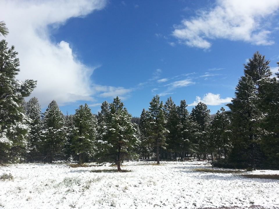
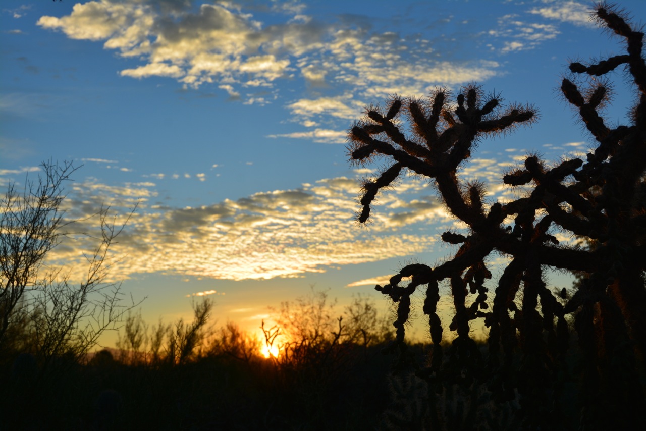
Hoodoos of Bryce Canyon, just a few miles east of the trail route for the Bryce 100. The hoodoos are erosional columns in the Claron Formation, a 30-60 million year old lake limestone.

Los Alamos, New Mexico – my hometown – sits on the eastern edge of the Colorado Plateau, an expanse of high desert and pastel hued rocks that covers more than 125,000 sq miles.  The plateau is a geologic marvel; the entire geologic history of the Western United States is laid bare from the bottom of the Grand Canyon where 2 billion year old Vishnu Schist is exposed to the Pink Cliffs of Bryce Canyon in Utah which are 35 million year old sediments that were deposited in a great inland lake. The nearly 2 billion years of history is stacked like a layered cake gently tilted on its side, barely disturbed by faults and folds and other signs of geologic trauma.  There is a huge gap in time – more than a billion years – between the Vishnu Schist and Tapeats Sandstone overlying it, which represents a long epoch in which the region must have stood far above sea level.  Located above the 540 million year old Tapeats Sandstone there are younger rocks, which geologists can use as  a yardstick of ocean invasion and retreat.  Thousands of feet of sedimentary rock record the slow grinding of the ancient continents into gravel and dust.  Nowhere else on Earth is the last half of a billion years of history so beautifully preserved.  The western United States has suffered continental collisions, incredible crustal stretching, massive volcanic eruptions, and yet the Colorado Plateau escaped any significant deformation.  The layered cake geology of the Colorado Plateau is clear road map to our geologic past!

I was looking for a 50 km trail run in southern Utah when I found the Bryce 100 (which has 3 different distances to run, including 50 km) – and it looked like a wonderful tour through a high part of the Colorado Plateau.  I signed up with enthusiasm, and then realized that it was in the middle of June.  I looked at the historical meteorological data at a weather station in Bryce Canyon and realized it likely to be as warm as 85 degrees on the day of the trail run.  Trail runs in the heat are very much like the old saw of the frog in a pot that is brought to a slow boil (lethal, but one in which the frog is a willing participant).  However, the idea of running in the footsteps of John Wesley Powell and Clarence Dutton, giants in American Geology, was enough to blind me to the dangers of hyperthermia and hypohydration.

finalwave

Paria Canyon is just south of Hiway 89 traveling between Page, Arizona and Kanab, Utah. Around Paria Canyon are a number of incised channels cut through the red colored Navajo Sandstone. This sandstone was deposited on land – and the fabric in the rock was formed as crossbedding is wind blown dunes. This particular wash is one of the most famous “picture” sites that no one knows how to get to on the Colorado Plateau. The erosion across the fabric gives the appearance of waves, and this is called “The Wave”. I visited this wonderful place on my journey to the start line of the Bryce 100.

For me, a trail run is more about adventure than about being in a “race”.  Seeing new places from a vantage point I have not had before, challenges, and thinking about nature are the joy of the trail.  Although I live on the edge of the Colorado Plateau, I have spent far less time in the high desert than in the rougher mountains of Colorado and New Mexico. But I have an affinity for the Colorado Plateau also – the modern portrait of the geology of North America was laid out here by Powell and Dutton, who were inspired by the carved rock towers of Monument Valley and the vastness of the Grand Canyon.  The Bryce 100 was a trail run and a field trip!

Geologic Giants

The 19th Century was the most remarkable period of scientific discovery in history. In fact, the “profession” of science and the term scientist was first coined in 1833. This was a time of intellectual enlightenment, and the concept that laws governed every aspect of nature and life changed  human thought. Gauss, Laplace, Legrande, and Fourier invented modern mathematics; Dmitri Mendeleev invented the periodic table of elements; Lord Kelvin (Scotsman William Thomson) invented the temperature scale and formulated the second law of thermodynamics; Charles Lyell published Principles of Geology in 1830 and established the concept of uniformitarianism; Charles Darwin published The Origin of Species and established the theory of evolution.

Clarence Dutton

Clarence Dutton – geophysical poet, and namer of of the attractions and vistas in the Grand Canyon

Against the heady backdrop of new theories for life and forces governing nature, the empty “space” beyond the 100th meridian drew the interest of the nation.  As the civil war ended, there was pressure to civilize and cultivate the west, but little was actually known about the region.  The U.S. government decided to fund four major mapping expeditions to western half of the country — these were lead by Clarence King, George Montague Wheeler, Ferdinand Hayden, and John Wesley Powell. All these men left their signature on geology, but it was Powell that was truly a visionary.  Powell lead the first successful traverse down the length of the Colorado River through the Grand Canyon in 1869, and his follow-on visits to the region lead to the first modern understanding of great arid regions of the southwest.  Powell eventually convinced a  colleague to map the Colorado Plateau in detail – that colleague was Clarence Dutton.  Dutton’s accomplishments are extraordinary, but his prodigious legacy is often overlooked.

Image

Cover page of Dutton’s classic work on the geology of the “missing” portion of the geologic map of the USA

Clarence Dutton is a hero of mine. He had remarkable insight into “how the Earth works”, and published works on geology, volcanology, and the geology of earthquakes. In 1889 he coined the phrase “isostasy” and proposed why mountains are high and valleys have low elevation. Along with this keen scientific insight came the soul of a poet. Dutton’s words paint vivid images, and he is compared to John Muir in capturing the heartbeat of a landscape. Dutton wrote the classic paper in 1880, and it remains a masterpiece.

grandstaircase

The Grand Staircase – climbing out of the Grand Canyon. The 500 million years of geologic history in the rocks preserves the entire evolutionary record of life on Earth. Figure from the Utah Geologic Survey (click on figure to enlarge).

When Dutton was doing the fieldwork for the Geology of the High Plateaus of Utah, he noted that the layered cake geology of the region created a series of steep cliffs and flat terraces that looked like a “great stairway” climbing north from the Grand Canyon. This description eventually morphed into the “Grand Staircase”, the name the region is known as now. The geologic cross section above shows the series of cliffs – there are 6 prominent cliffs as you travel the 150 miles north from the bottom of the Grand Canyon. The final stair is the Pink Cliffs which is topped by the Paunsaugunt Plateau. The Bryce 100 is run on and around the Paunsaugunt Plateau – and the top of Dutton’s Grand Staircase!

Image

A small section fromDutton’s map “Geological map of the district of the high plateaus of Utah” centered on the area of the Bryce 100.

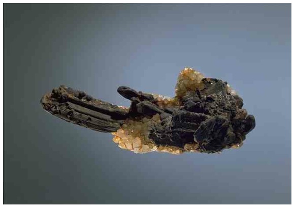
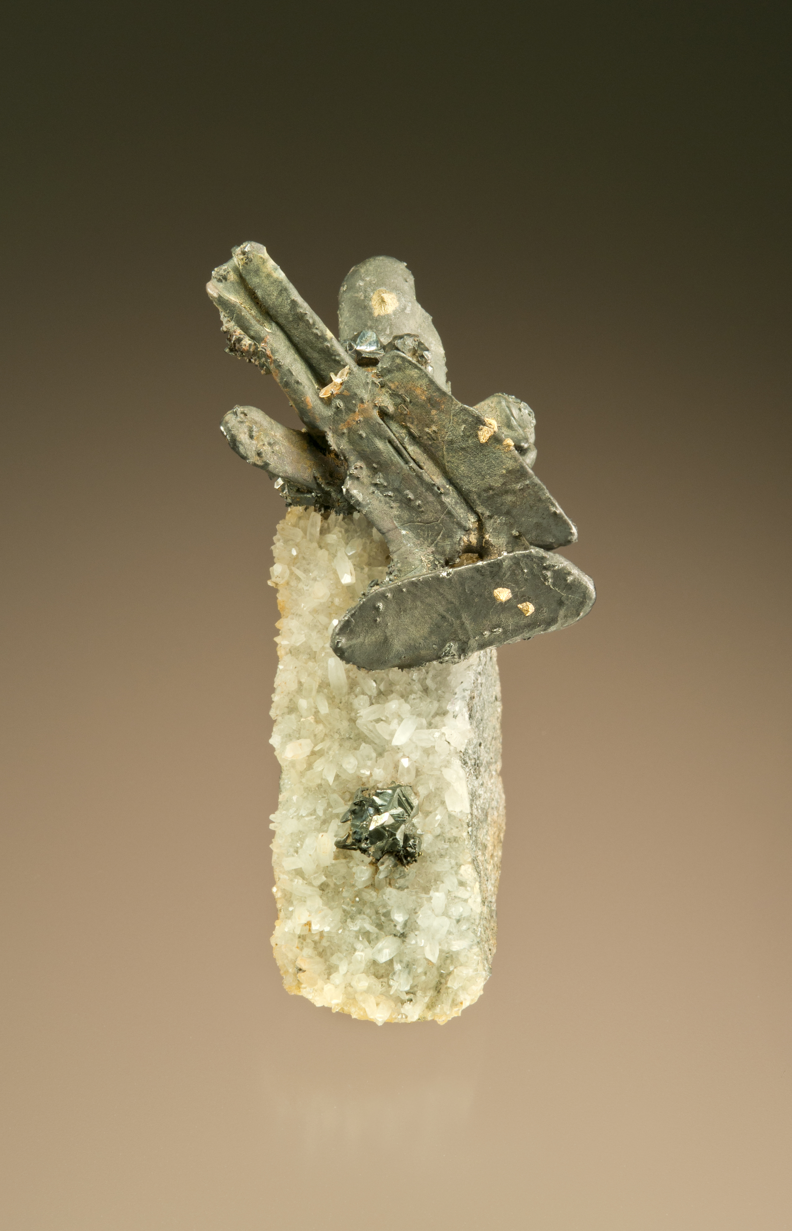
In Dutton’s 1880 work he published wonderful color maps to illustrate the geology.  The map above is a section from Dutton that is centered on Paunsaugunt Plateau and the trail for the Bryce 100.  The course travels along the western edge of the plateau, then climbs up and over the plateau to finally descends to the finish along the drainage of the East Fork Sevier River. The yellow color on the map represents the Claron Formation, which geologically is a series of lake and river deposits – sands, gravels, and cobbles along with a few limestones. The lake environment was rich in iron, and the pink color of many of the rocks is due to iron oxide staining. The rocks of the Claron are easily eroded, and the climate of the high plateau means that frost wedging plays a roll in breaking apart the strata. It is this frost wedging that produces the famous hoodoos (or rock towers) that populate the Bryce region.

Dutton wrote of the very region that the trail run traverses – the course is truly in the foot steps of a geologic giant.  One last comment on Dutton (and another reason he is one of my heroes). He was an early hire into the brand new US Geologic Survey in 1875. After his outstanding work on the Colorado Plateau he worked on earthquakes and volcanoes and was promoted to the chief of the volocanology unit at the USGS.  He eventually became disillusioned with the growing agency and wrote: “Our Survey is now at its zenith & I prophesy its decline. The ‘organization’ is rapidly ‘ per fecting’, i.e., more clerks, more rules, more red tape, less freedom of movement, less discretion on the part of the geologists & less outturn of scientific product. This is inevitable. It is the law of nature & can no more be stopped than the growth & decadence of the human body.” Not only do I get to share the Pink Cliffs with Dutton, but also his views on the crush of bureaucracy.

moonsetting

The full moon setting over the start of the race. The course heads for the moon, and then wanders around the Paunsaugunt Plateau

The Race

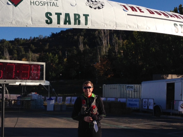
The Bryce 100 — which is actually a 100 and 50 miler along with a 50k — is staged out of Bryce Canyon City. “City” is a misnomer – the town sites at the edge of the national park entrance, and is a collection of hotels and various adventure companies.  I chose to stay at the main hotel, Ruby’s Inn, a sprawling complex of buildings typical of concessionaire hotels in western US parks.  My room is in a remote building, and everyone in the building seems to be here for the race.  As I make my way to my room I pass countless rooms with their doors open – and there are stacks of water bottles, jugs of protein powder, and all sorts of stuff that ultra runners accumulate.  There is a major benefit to having a hotel dedicated to the runners; lights are out at 9:30 pm, and there is nary a sound until 4:30 in the morning!

stuff

The secret to the ultra – stuff. My stuff includes Tailwind formula for my water bottles, stinger gels, Kind candy bars, lots of sun screen, and gloves for the first couple of miles

The runners are bused to the start of the race, about 7 miles from the hotel.  The starting temperature is a brisk 39 degrees, but perfect conditions for running. There are about 135 runners in the 50 km race, mostly 20s and 30s somethings, and most are in running groups.  I am the only person from New Mexico, but as with most trail runs, everyone is very friendly and chatty.  I find 3 different geologists running the race!  Clearly, the attraction to interesting geology is a big deal for this race.  The course takes off to the west and climbs from 7600 feet elevation to about 8300 feet elevation over the first 6 miles.  The first six miles is a roller coaster – run up 50-200 feet and then descend the same distance as the course crosses dozens of small drainages.

BryceCanyonRun

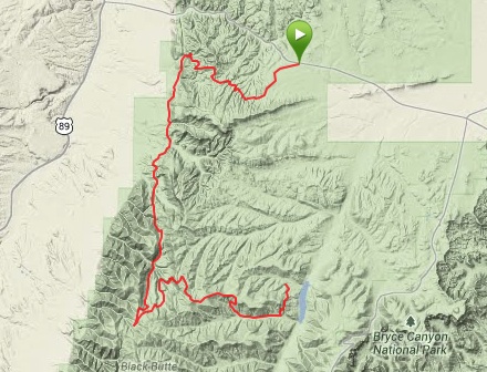
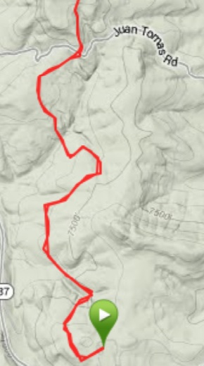
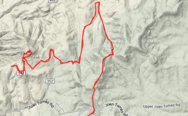
The Bryce Canyon Route for the 50 km — actually 32.6 km, and 5400 feet elevation gain. The course travels to west side of P Plateau, and climbs up and over into a drainage

The first two miles are on a forest service road – not too interesting for running.  However, after two miles the course follows a wonderful single track.  The track is very smooth, a consequence of the erosion of the base rock – the Claron Formation.  The Claron is about 200 m thick on the Paunsaugunt Plateau, and is composed of soft, red colored siltstones and white colored limestones that are rich in sands. These sedimentary rocks were deposited in an ancient lake that was formed due to the rise of the Rocky Mountains some 70 million years before the present. The rise resulted in a basin to the west of Rockies, and Lake Claron filled this basin – at is maximum size it was similar in area to Lake Michigan. The rocks are rich in iron and manganese oxides, which give the distinctive color. Around 30 million years before the present the Colorado Plateau began a period of uplift, and Claron Lake disappeared, and the former lake bottom rocks became exposed and formed the Pink Cliffs.

runninghoodoos

Running among the HooDoos in the Claron Formation

Between miles 6 and 7 the trail wanders among some wonderful hoodoos.  In fact, the rocks are so interesting I am having trouble not stopping a shaping photos every couple of hundred yards!  The hoodoos form because the Clarion is relatively soft, but has thin strata that are more resistant to erosion.  Frost wedging plays a fairly unique roll in the hoodoo formation – cracks are filled with moisture, and when it freezes it parts the harder, more resistant limestones leaving small “caps” that eventually sit atop columns and chimneys.

na_hoodooformation

Graphical explanation for the formation of Hoodoos along the Pink Cliffs. The rocks of the Claron Formation are quite soft and easily eroded – but what is unique here is the roll of frost wedging breaking apart the rock. The frequent freezing in the region causes soil moisture to freeze and expand which “pries” apart blocks of rock. Repeating this process isolates pillars, or the Hoodoos (Figure from National Park Travel)

The first 10 miles are pretty fast.  I roll into the first aid station at exactly 2 hours (the station is 10.4 miles from the start).  I feel fantastic, although it is getting warm – at least to me.  It is 8 miles to the next aid station, and I have a plan to be there a little before the 4 hour mark.  All my life I have loved maps.  I am an expert at reading maps – but I fail miserably on this next section of the course.  I used the course map posted on the website for the race, which shows the elevation at a very corse scale.  I estimated that there would be modest climbing and descending over the 8 miles, but in fact this section of the trail is quite difficult.  There is much more climbing and very slippery descending than I expect.  The first thing I did when I got back to the hotel room was to download the USGS quadrangle for the region – WHAT!  At the higher resolution it is obvious that this section is tough.  I am embarrassed that I let scale screw me…

After the second aid station the climbing really begins.  It is a lot more walking than running for me.  I actually pass lots of people on the ascent of the Paunsaugunt Plateau.  But the course becomes truly diabolical at mile 23.  The elevation has dropped to 7700 feet, and over the next 2 miles the dusty and sandy trail climbs 1400 feet.  Although most of the course up to this point has had liberal tree cover, the Pink Cliffs show no mercy or vegetation. I swear it is 100 degrees, but alas, when I check the weather record at the Bryce Canyon airport station, I find it was actually 65 degrees.

onthewayhome

Looking north on the long climb up the Paunsaugunt Plateau. The Pink Cliffs are beautiful, and steep.

The views are breath taking, but I am toast at the final aid station, mile 25.  I refill both my water bottles with Gator aid, but it is a bit too late.  The trail after the aid station joins a hard packed BLM road.  It is not particularly pleasant running, but the home stretch is afoot.  The first couple of miles of the road actually continue the climb, and finally at mile 26.5 top out at 9200 feet elevation (by my watch).  Then it is downhill!  However, I just kind of amble down the road, and all those folks that passed going up the hill scream past me.  I got road rash from several that passed me at a high rate of speed!  I do meet several interesting people on the descent, and have conversations;  I meet a young man from Monument Valley that has never run further than 13.1 miles before today.  He is celebrating 6 months of sobriety, and was recently baptized – a joy to talk to.  I meet a couple of people from Phoenix that have only been trail running for the last year.  They are very fast until mile 29, and then absolutely die.  The final part of the course is another uphill for a mile, and it is really tough.

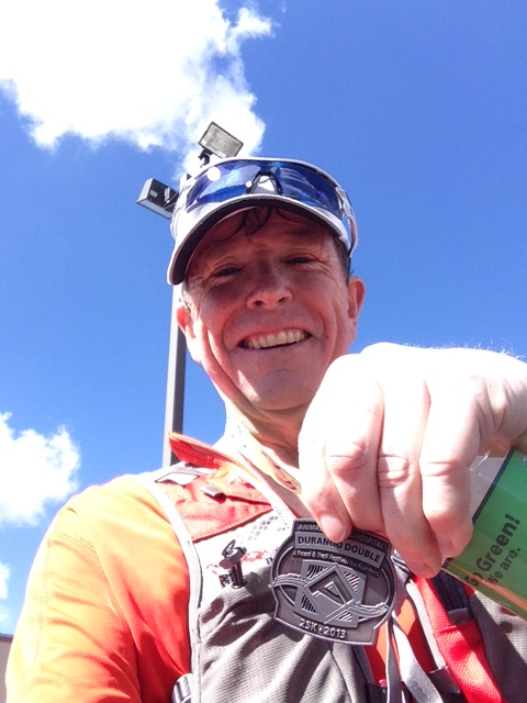
It took me just under 8 and a half hours to finish the 32.6 miles (I love that trail runs are ALWAYS longer than the standard amount).  Waiting for the bus back the Bryce Canyon City I talk to the other runners – as always, at the end, everyone is happy.  The relief of finishing, and the any pain fades pretty fast.  My joy was getting to wander through some unique and interesting geology.  I think I will do this again.

towerbridge

Tower Bridge, Bryce Canyon.

The Jemez Mountain Trail Run 2014: Dragon Weather

Blow, winds, and crack your cheeks. Rage, blow, You cataracts and hurricanoes, spout Till you have drenched our steeples, downed the cocks. William Shakespeare

Image

Near the pipeline aid station on the JMTR after the storm on May 24. Photo is from Ed Santiago who posted this on the JMTR Facebook page.

The 2014 edition of the Jemez Mountain Trail Run occurred on May 24 when the average high temperature in Los Alamos is 70 degrees and the low is 45 degrees. It rarely rains this late in May, and the expected weather for this date is “perfect”. The JMTR is a tough race in the most perfect conditions – lots of elevation gain, and the race organizers always want the runners to get their monies worth so they have “long” courses; the 50k this year was just a tiny bit less than 33 miles instead of 31.07 miles. However, a strong weather system driven by a deep southern excursion of the jet stream drove a series of rain/snow storms across Northern New Mexico on Friday and Saturday (May 23 and 24), causing “imperfect” weather for the JMTR.

Image

Jet Stream Dip, and the weather conditions for the southwest — perfect storm!

The first wave of the storm swept through Los Alamos Thursday night and continued into Friday afternoon and evening.  It dropped a about 2/3 of an inch of rain — much to the delight of the town residents that cringe at the thought of a hot, dry summer and the possibility of wildfires.  Early in the morning of race day the weather looked exceptional – mostly sunny, cool, and the rain had removed the choking dust from the trail!  There was a chance for rain in the afternoon, but that held the promise for a “cooling sprinkle” for the later stages of the 50 km and 50 mile rambles.

Image

A few minutes before the start of the 50 km race at 6 am. It was cool at the Posse Shack, but the promise was for a great day! Colleagues Dave Zerkle and Eric Martens.

The 50 km race

The JMTR in 2013 was hot — the temperatures in town got to a bit above 80 degrees by 2 pm, and the humidity was less than 10 percent.  Those are tough race conditions, and I lost 7 pound during the race (which is inexcusable!) due to dehydration.  So, needless to say, I was excited about the possibility of a super race with the cool temperatures this year.  I had not trained as much as I would have liked due to extensive travel for work, but I felt good.  The course for the 50 km was different this year.  The Pajarito Canyon trail was a casualty of the 2000 Cerro Grande Fire that roared across the east Jemez and Los Alamos in 2000. The fire ended up burning 48,000 acres (and 400 homes in Los Alamos), and changed the landscape of the Jemez.  Late in the fall of the 2013 the Pajarito Trail was rebuilt and provided a new pathway to climb Pajarito Mountain without trudging directly up the ski hill.

Image

Route of the 2014 JMTR 50 km (from my Garmin, 32.97 miles, 6812 feet elevation gain). In the lower left hand side of the map is the new trail segment ascending the headwaters of Pajarito Canyon.

The race started uneventful, but delightful.  The race heads east out North Mesa before dipping in Bayo Canyon.  Typically this trail is thick with dust, but the previous days’ rains had congealed the dust into a runner’s carpet.  No clouds of dirt in the air, the first 10 miles were a runners dream.

Image

Mile 2 – wow this is fun!

Beyond the mile 10 mark and the second aid station is the climb up Pajarito Mountain.  This is 3000 feet of climbing over 7 miles.  The new segment up Pajarito Canyon is beautiful, and easier than the ski hill….but it is very long.  I chatted with many people on this section of the course, and they were wondering if the steady climb would ever end.  Once you top out at Pajarito Mountain (10,440 feet) there is a 1000 foot descent over one mile to the Pajarito Ski Hill complex and the third aid station.  I am also amazed with how slow the descent is for me – after the long climb my legs are not designed to run downhill.  I arrive about 11 am, and the sun is shining – and I feel great!

Image

Coming into the ski hill aid station. At 11 am it is a perfect day! 18.6 miles done, and mostly downhill to the end.

However, there are dark skies to west, and it is clear that some sort of storm is brewing.  The skies are far more ominous than I would have expected from the weather forecast.  I don’t really have any concerns for me finishing, but I fear for the 50 milers that will likely be caught in storm on their second ascent of Pajarito Mountain.  It looks like thunderstorms to me — and no one wants to be above tree line with lightning.  About 100 people die annually from lightning strikes (although most are golfers not runners…), and isolated high elevation ridges are much more likely to attract lightning than forested valleys.  I did not really imagine that it could snow, but in hindsight the conditions were perfect for that.  As I headed out towards aid station 4 at pipeline road the wind began to really pick up, and it was clear that some rain was on the way.

Image

The actual weather conditions for a station near my house in Los Alamos. You can see that the temperature began to plummet after noon, and the wind began to pick up. The top red line is the temperature, and it dropped from 62 degrees to 46 degrees over 3 hours. The yellow bars in the second panel show the wind speed, and the bottom panel is precipitation (aqua) and precipitation rate.

The temperature on Pajarito mountain is usually about 10 degrees cooler than in Los Alamos, due to the difference in elevation.  With a storm that has strong winds the temperature differential came be as high as 25 degrees.  As I pulled out of aid station 4 there was some rain in the air – not much, but enough to know that the storm was serious.  More importantly, the wind began to gust strongly.  At the Los Alamos weather station there were gusts that topped out just about 30 miles per hour.  It was much cooler descending the mountain down Guaje Ridge, although I attributed much of that to not working as hard as I was when I was climbing Pajarito Mountain. When you arrive at aid station 5 you are only 7 miles from the finish line.  The aid station is at an elevation of 8800 feet, and that 7 miles means a drop of 1600 feet – a runner’s delight.  However, it began to rain much harder on the descent, and I noticed that the front of my legs were bright red.  There were not many people on the trail that I could see, although I was passed by a couple runners doing the 50 miler – and they were moving!  The three people I did catch all were suffering from the weather.  I stopped and talked to one fellow that was beginning to shiver.  I was worried that he might not make it, but finally after a slow trot together I decided that he could probably get to the 6th aid station unassisted.

Around mile 30 (not yet quite at the last aid station – station 6, where they always have pie!) I was having a little trouble running, or more correctly, stumbling.  I attributed this to fatigue, but in hindsight it was the onset of mild hypothermia.  My hands were cold, but there was only a couple of miles to go.  The excitement (or, more accurately, the relief) of finishing carried me on.  Climbing up out of Bayo Canyon back to the finish line I was soaked to the core and cold – and I noticed that all the volunteers at the finish were bundled up in nice warm rain jackets.  I stumbled across the finish line, and thought I felt fine.

Image

The finish line. Cold, but I thought I was doing great!

Once inside the Posse Shack I changed out of my wet shirt into a dry shirt and coat that my wife had brought me.  I felt good, although I began to shiver.  Within 10 minutes I was shivering uncontrollably, and had some trouble controlling my hands.  At that point I realized that I had moderate hypothermia.  Hypothermia occurs when the core body temperature drops below 98.6 degrees and normal bodily functions are interrupted.  Mild hypothermia is basically shivering and what is called vasoconstriction – when blood flow is interrupted, so your finger tips turn blue and your exposed legs turn red. This interruption of blood flow causes a loss of muscle coordination, and slurred words and stumbling may happen. Recovery from mild hypothermia is not too difficult, as long as you are not exposed to the elements. Several warm cups of hot chocolate and a blanket from the EMT got me back into sorts. It seems strange that hypothermia is such a danger for runners – we are working hard, so we are producing heat.  However, it is the loss of that heat with wet conditions that lowers the CORE temperature and leads to the danger.

All in all, I enjoyed the JMTR 2014 — but I was lucky.  Many of my colleagues got stuck on the mountain as the rain began to change to snow, and the temperatures dropped to freezing.  The race director eventually stopped the race, and pulled runners off the mountain.  It had to be done.  It is a mystery of nature that weather is highly changeable, and that humans can only operate efficiently within a narrow range of conditions.  Trail running is more than distance – it is a battle with nature, the mountain, and the weather.

Conventional Wisdom and Scientific Fact: The dilemma for a trail runner

It will be convenient to have a name for the ideas which are esteemed at any time for their acceptability, and it should be a term that emphasizes this predictability. I shall refer to these ideas henceforth as the conventional wisdom. John Kenneth Galbraith, Economist, 1958.

Image

Stephen Lee ( Dark Glass Photography) photograph of a late April 2014 snow dusting of Pajarito Mountain. The 2014 Jemez Trail Run 50 km and 50 mile runs will climb Pajarito Mountain and top out at its 10,440 foot elevation. The Jemez Trail Run is one of the reasons I “got into” trail running.

Conventional wisdom is an ancient high idol – it has been used to guide and misguide people from the beginning of time.  Conventional wisdom is sometimes right, sometimes wrong, but nevertheless shapes core values and beliefs. The power of conventional wisdom is that it sounds right and thus quashes skepticism – even among scientists.  It is surprising how often conventional wisdom turns out to be wrong, or at least miss-applied.  In my case, conventional wisdom gospel collided with a passion to run on mountain trails.

Nowhere is conventional wisdom more often evoked than with all things to do with health.  This is mostly because the human system is so complex that there is a natural desire to deconstruct it into smaller, simpler, components. Often the conventional wisdom is based on some scientific evidence; however, medicine has a long history of poorly understood experiments.  Dr. John Ioannidis, one of the world’s leading medical statisticians states that up to 90% of medical studies that are published in leading research journals are flawed – mostly because variables are not controlled or hypothesis tested were biased to desired outcome. In other words, a prescription based on a “medial study” was actually likely to be wrong……  Although this is harsh, it is not really a criticism of your local physician who is only repeating the oft-cited medical journal results.  It is stunning how often medical journals publish papers which have totally opposite conclusions.  My personal favorite are studies on whether coffee is good or bad for you – a simple google scholar search yields results for hundreds of studies – and the score?  Coffee might be good or might be bad for you.  It is good for me, I can assure you..

Image

Coffee is a wonder drug as far as I can tell. It certainly has made my life better…..Graphic from the Wall Street Journal

I had my left hip replaced in 1998 at the tender age of 42.  It was a life-changing event for me.  It relieved me of great pain, but it also came with the stern instruction that I could not participate in any high impact sports again.  In 2009 I had my right knee replaced.  Again, the pain it relieved was a godsend, but I was told that my “bionic” state was subject to wear, and it was only a matter of time before I would have to have the metal joints redone.  The only way to delay the return to the surgeon’s table was to minimize impact – no running, jumping, skiing, parachuting, etc.  I totally bought into this physician direction – it certainly made sense!

However, life was not that simple for me.  I could ride a bike and I could swim; but that is not what I wanted in my life.  I loved being in the mountains, on a trail, climbing a peak.  I discovered trail running, and found a special joy.  I started slowly (well, I am still a very slow runner, and will always be), but besides the spiritual peace I found with trail running I began to feel physically better than I had in decades.  Back pain disappeared, my non-replaced knee stopped aching, and I felt like a “million bucks”. At some level this made no sense, but I began to wonder if the knee replacement and the fitness from running had corrected a long present biomechanical problem.  Trail running in New Mexico is far different than road running — the trails are rough so there is no rhythmic pounding.  There is lots of “stepping” in climbs and descents.  I was pressed by many who care about me to stop the nonsense of trail running or risk the wrath of prosthesis fatigue.  I decided to really investigate the facts behind the prohibition of running with artificial joints, and was extremely surprised to find that conventional wisdom was based on flimsy evidence.

Image

Running in the Jemez Mountains after an early fall snow. The peace and joy of nature is an immeasurable factor in quality of life.

The Path to Replacement

I have always enjoyed sports – almost every sport I tried.  I am not athletic, but I am dedicated.  I enjoyed running, cycling, football, etc., but after high school my passion was basketball.  I am short and slow, but if you play enough you will have seen everything and experience is a nice equalizer.  For 25 years I played basketball at least 4 times a week – and played hard.  Conventional wisdom says that if you play basketball regularly then you will be injured regularly….a stray elbow, a turned ankle, a jammed finger.  I believe that in this case conventional wisdom is a universal truth. Along the way I had several knee surgeries to remove torn cartilage, and my knees began to really get sore.  But not sore enough that I wanted to give up playing.  In 1989 I was given a prescription for indometacin (a non-steroid anti-inflammatory), and the daily doses meant that I could run up and down the court.  In 1996 I began to get numbness in my left foot, and finally went into a doctor to find out what was wrong.  After a number of diagnoses, mostly wrong, my hip was x-rayed.  In the words of radiographer “I had the hip of an 80 year old arthritic man – heavily scored and damaged”.  Only way to stop the pain was to get a total hip replacement.  My response was emotional, but the real issue for me was “why?”.  The answer always came back the same – sports damaged your joint.  I accepted this conventional wisdom, but today I believe it is far more complicated that just “sports”.

Image

My hip xray 11 years after replacement. The two common modes of failure are wear of the ball joint, and separation of the stem from the femur. Neither mode is present in the slightest after a decade.

Recovery from hip surgery was not actually that difficult.  I was riding a bike within 10 days, and I could not believe how much better I felt.  Mostly, I remember that I could finally sleep through the night!  My knees still hurt and I was limited in my hiking.  I never played basketball again (but had to avoid going any where near the Bear Down Gymnasium at the University of Arizona for fear that I would be sucked into a pick up game).  Over the next ten years my knees slowly got worse.  My kneecaps seemed to grow (they are/were huge), and finally in 2009 I followed the advice and had my worst knee (the right side) replaced.  Getting a knee replaced is much, much more difficult than a hip.  It took a long time to recover and be pain free.  Along the way, both my parents died, Los Alamos was evacuated due to the largest wild fire in New Mexico history, and my job seemed to consume me.  I gained weight, and physically began to feel old.  I decided to start climbing the hills around Los Alamos – slowly at first, but pretty soon I was trotting.  I lost the weight, but much more surprising, I the aches and pains I attributed to age began to ease.  By the winter of 2012 I was feeling physically strong, and able to do 20 to 25 mile trail runs with no ill effects except exhaustion.

Image

Xray of my right knee shortly after surgery. The “picket fence” on the right side of the image are the staples to close the incision. The replacement includes implants both on the femur and the tibia bones. The knee cap is also reshaped and spurs and growths were removed.

Biomechanics and Stress Loads on Hips and Knees

Artificial hips and knees are relatively common place in the United States; earlier this year the total number of prosthetics was estimated to top 7 million with a ratio of 2 knee replacements for every hip (in fairness, most of the knee replacements are “partials” vs total). The owners of these replacements are skewed towards those over age 60, although the demographics is shifting to younger ages rapidly.  It is very difficult to get good statistics on the failure rates of the prosthetics; there are different kinds, and all have peculiarities.  On average, about 2 percent of artificial hips fail or need to be replaced after 5 years, and about 6 percent after 15 years (so more failures early).  For knees, the 15-year failure rate is slightly lower, about 5%.  The statistics for these failures are robust.  However, there is a paucity of large scale, longitudinal studies examining the cause of failure.  Most reports are largely anecdotal, and the overwhelming correlation is with obesity and inactivity, which would seem to be counter to conventional wisdom.

There are two oft-cited studies that made an attempt to examine prosthetic failure to physical activity.  The first  is a 2010 study presented at the American Academy of Orthopaedic Surgeons that looked at knees.  The sample size was small – 218 patients – but it found that those that ran after surgery were 20 percent  less likely to have mechanical failure. The second study was done at the  Sainte-Marguerite Hospital in Marseille, France and had a similarly small sample size: 210 patients, with 70 “active” in high impact sports and 140 that were not and focused on hip replacements.  The metric was “survivability” of the hips 15 years after replacement.  80% of the active sports participants had high performing hips, while 94% of the low activity participants had high performing hips.  This would suggest that high impact sports had a negative impact on the prosthetic – the opposite of the 2010 study.  So, who is right?  Is there a difference between hips and knees?  Is there a difference between French and Americans?  I have read both studies, and a number of analysis of these studies, and am struck by the very poor quality in control of the complex variables.  Different types of artificial hips (metal-on-metal, coated metal, etc) were mixed, there was no quantification of level of activity other than self reporting, and there was no details of the type of failures.  At best, it would seem to indicate that there is NO EVIDENCE that running is worse than walking for the survivability of hips and knees!

Image

The simple gaits of running vs walking. When running force or stress increases and decreases throughout the gait and involves a transfer from the foot/ankle to the knee to the hip.

If the studies are ambiguous about whether running causes prosthetics to fail, where does the conventional wisdom come from?  The best explanation is in biomechanics – the human engineering of running.  The gold standard for biomechanics is a 1997 review paper by Tom Novacheck, The biomechanics of running (a pdf can be found here: http://www.elitetrack.com/article_files/biomechanicsofrunning.pdf). Stress is generated and transferred to the body in several ways. With the first strike (FS in the figure above) the full weight of the body comes into contact with the ground – impact stress – and is transferred up through the ankle to the knee and into the hip. The running gait then pushes the body off the ground (Toe Off, of TO in the figure), which generates a similar set of stresses.  The stresses on the joints are a combination of the weight of the runner and the contraction of the muscles.

typicalforce

Force on impact during a running gait. There are two keys: body weight and length of time in contact with the ground.

Experimental studies have quantified the forces on a runner as the foot strikes and then leaves the ground – the figure above is a classic “average runner”.  The first little peak is due to the shock of striking the ground and then some of shock is absorbed in the padding of the running shoe.  The y axis is the nominal force which is scaled to the body weight;  it pays to be a light weight when running!

There has been much work done to see how this force load is accommodated within the body, and the classic “average human” works the hip, knee and ankle — and does this differently for walking, running and sprinting.  This figure is shown below.  The difference between walking and running is dominated by the engagement of the knee – in the graphic the overall stress is indicated by the size of the pie chart. In simple terms, more stress when running, and that stress is really experienced in the knees.

The partition of energy (stress x time) between leg joints for walking, running and sprinting.

The partition of energy (stress x time) between leg joints for walking, running and sprinting.

It is this figure more than anything else that drives the conventional wisdom that running wears out prosthetics.  Running generates more stress than walking, and this leads to the conclusion that higher stress results in more wear. But why?  That is not true in bone – in fact, for bones increased stress promotes growth and stronger joints.  Although metal, ceramics and plastic can’t “grow”, aren’t they engineered to withstand the modest stresses of a 155 pound man running at the leisurely pace of 6 miles an hour?

The question of running and artificial joint wear is murky, and there is no strong evidence that modest running leads to more wear.  I am confident that my trail running is not accelerating my demise.  On the other hand, I am equally confident that eventually my knee and hip will eventually deteriorate – maybe when I am 65, maybe when I am 70, but it will happen.  However, the quality of life trumps the possibility of extending the prosthetics a few years.  I feel I can answer the question I get all the time — aren’t you concerned that you are ruining your artificial joints by running on the trail?  The answer is “not really”.  I believe that my original joint arthritis was not caused by “sports” but by a biomechanical misalignment within my body.  Surgery corrected that (probably unintentionally) — it is a gift.  I celebrate that gift every trail run.  The surgeries did effect me in other ways – cut nerves, changed muscles, and made me weaker.  I will never be a fast runner, but that is just fine.  Conventional wisdom says a “happy man is a healthy man”.

Mark Twain was one of the most keen observers of the human condition.  He said: “When even the brightest mind in our world has been trained up from childhood in a superstition of any kind, it will never be possible for that mind, in its maturity, to examine sincerely, dispassionately, and conscientiously any evidence or any circumstance which shall seem to cast a doubt upon the validity of that superstition. I doubt if I could do it myself.”

Running along the beach – A 300 million year old beach: the Cedro Peak 45 km trail run

Geology is the study of pressure and time. That’s all it takes really, pressure, and time. Comments by Red in The Shawshank Redemption (1994).

Image

A Google Earth view looking north along the crest of the Manzano and Sandia Mountains, just to the east of Albuquerque, New Mexico. The Sandia and Manzano mountains are a 75 km long north-south, and are the uplifted shoulder of the Rio Grande Rift. The Sandia and Manzano mountains are separated by the Tijeras Canyon which provides the passage for interstate 25. The Cedro Ultra is a race along the flank of the Manzanos and climbs to the top of a limestone hill, Cedro Peak.

One of the most iconic landscapes for New Mexico is the Sandia and Manzano Mountains towering to the east of the Rio Grande Valley in Albuquerque, our state’s largest city.  The elevation of the Rio Grande in Albuquerque is a little more than 4900 feet, and the high point of the Sandias is 10,678 feet.  This elevation prominence is expressed in dramatic fashion due to the steep westward facing scarp of the Sandia-Manzano mountains – which is actually the bounding fault that uplifted the mountains beginning some 10 million years ago.  The view looking from the city to the moutains in the east is one that looks like a layered cake.  The core of the range is Precambrian granite that is 1.5 billion years old, overlain by a light colored, flat lying limestones that are 300 million years old.

sandiamountains

The Sandia Mountains as dusk – the pale red color of the 1.5 billion year old granite is source of the mountains namesake, the spanish word for watermelon. The top hundred meters is the light colored, 300 million year old limestone. The gap in ages between the rocks, 1.2 billion years, is called the Great Unconformity

The backside of the Sandia-Manzano mountains have a relatively gently dipping topography with rolling hills.  When I was planning my training for the 2014 Jemez Trail Run I wanted a long “tune up race”, and the Cedro Peak 45 km run looked like a perfect opportunity.  Cedro Peak is just south of Tijeras Canyon, a narrow valley that separates the Sandia and Manzano mountains.  I did not know much about the Cedro Peak run except that it was in a place I liked, and reports are that it was “faster” than the Jemez Trail Runs.  I have long ago given up on the idea that I would ever be a fast trail runner.  I simply don’t have the athletic ability to run miles and miles of sub 9-minute miles on rocky and uneven trails, and age is beginning to really fossilize my body.  However, I really love being out on trails, and find great happiness climbing and descending hills and smelling the desert foliage.  The last time I had been to area around Cedro Peak was as an undergraduate student in the mid-1970s on a Historical Geology field trip.  We collected trilobites within a mile or two of the race course – in fact I suspected that I would be tripping over ancient marine life in the 45 km of running!

Image

The geography of what will become North America 300 million years ago. There is a large continental mass to the east of the ancient New Mexico, and a shallow sea along with a few islands covered New Mexico. The Sandia and Manzano mountains were part of this shallow sea, and this Pennsylvanian Ocean (Pennsylvanian refers to a geologic era) was teaming with primitive life.

The Geology of Cedro Peak

Perhaps because I run with my head down and move pretty slowly, I am always dissecting the geology of a trail run.  The Cedro Peak ultra is no different;  most of the rocks that are along the 45 km of trail are ancient limestones and tell the story of a shallow, warm sea that existed for a 100 million years surrounding a system of equatorial islands.  The figure above provides a guess at what the region that will becomes the western US looked like about 300 million years ago during the geologic epoch known as the Carboniferous  (360 to 300 mya).  On a little finer resolution, rocks that pave the Cedro run are from what geologist call the Pennsylvanian period.

In the figure you can see the light outlines of the New Mexico – very near Albuquerque was the western shore of a large island.  This island had been above sea level for more than 1.2 billion years, slowly eroding away.  Also on the map is a projection of the equator during this time, and Albuquerque was the equivalent to the modern day Galapagos Islands – spot on the 0o latitude.  Life, both plant and animal, was very different 300 million years ago.  Amphibians were the main land creatures, and they did not venture far from the ocean.

The ocean surrounding the island was not unlike the Florida Keys today. The waters were rich with life that utilized photosynthesis for growth, which, in turn, took carbon  out of the atmosphere and produced carbonate (CO3) for their skeletons and shells.  When these organisms died their remains accumulated in giant graveyards and slowly compressed and made limestone.  To paraphrase from the The Shawshank Redemption, time and pressure turned the graveyard into a distinctive rock that will last more than a quarter of a billion years.  The  limestones in the Manzano mountains are known by several names, but the most generic and common is the “Madera Limestone”.  Most of the rock beneath the racers feet in the Cedro Peak ultra is Madera limestone, and if one looks closely at any cobble it can be seen that it is filled with fossils, the skeletal remains of creatures that lived 300 million years ago.

blogbrac

Brachiopod from the Madera Limestone (collected in the Jemez Mountains, late 1960s). This is the hard shell on the “head” of a marine worm.

I collected many fossils from the Madera Limestone – although not the Sandia-Manzano Mountains, but instead a small outcrop in San Diego Canyon, north of Jemez Springs in the Jemez mountains.  The fossils in the Jemez are identical to those in the Manzanos with one notable exception – trilobites.  There are more than 90 taxa of fossils in the Madera;  most of these are brachiopods and gastropods.  The picture above is a Jemez brachiopod I collected in the late 1960s.  It looks like a modern mollusk, but it is not!  There are actually brachiopods alive today (very rare), and they are  marine worms.  In the Pennsylvanian times brachiopods dominated the shallow marine environment.

The first person to systematically collect and describe the fossils from the Madera Limestone was Jules Marcou, an extraordinary French geologist and paleotologist.  In 1853 Marcou published a map, Geological Map of the United States, and the British Provinces of North America, followed up by a book entitled Geology of North America.  These works were panned by the giants in American Geology at the time – including Dana, the father of American mineralogy, but Marcou did get much of the relative dating of geologic beds correct, including the Madera Limestone.

trilobites

Trilobites from Cedro Canyon, not far from the path of the Cedro Peak Ultra. Trilobites walked on the ocean bottom and swam short distances; they regularly molted their hard shells, which accounts for the clusters of fossils within small areas.

I first visited the region around Cedro Peak as an undergraduate student in the mid-1970s on a historical geology field trip. The reason for the trip was to visit Madera Limestone, and we ventured up Cedro Canyon, located just south and west of the peak. About 2 miles from the peak is one of the most famous New Mexico fossil localities – the Cedro Canyon Trilobite beds.  Trilobites are one of the most successful life forms ever, and even though they became extinct before the first dinosaur walked the Earth they had flourished for 270 million years!  Many evolutionary biologists consider them the foundation of all complex land based life forms today.  Trilobites are the earliest arthropods, and are a hard shelled creature with many body segments and a large number of jointed legs – they sort of look like a cross between cockroaches and centipedes.  Trilobites are relatively uncommon Pennsylvanian rocks, but this single locality in Cedro Canyon has produced hundreds of fossils.  The picture above is a well-fossilized group in the University of New Mexico collection. I was thinking of visited the locality after the race on April 12, but I was toast after the run – and I used the excuse that since my visit 38 years ago many fossil collectors have picked through the outcrop, and  I would have came up empty handed!

startline

Standing at the start line about 23 minutes before 7 am, April 12. The weather is near perfect, and the race was afoot!

The Run

One of the joys of running an ultra trail run is that each is different, the runners and race volunteers are mellow, and there is always something funky.  The Cedro Ultra is put on by the Albuquerque Road Runners, and has two options – a 45 km out-and-back, and a 45 miler.  It is a relatively small (or more correctly, intimate) race, with about 80 people in the 45 km, and 60 in the longer course.  Packet pickup is at an older hotel in Albuquerque near the intersection of I-25 and I-40 (which is known as the “Big-I”).  I arrived on Friday about 5 pm to pick up my packet, and was a little surprised (and probably a little intimidated) to find the parking lot filled with motorcycles and black leather.  The hotel was also hosting a get together for a veterans biker group.  At the entrance to the hotel lobby is a large stone tablet inscribed with the Ten Commandments — as I said, all trail runs have their version of funk.

prerace

Entrance to Hotel Elegante MCM — Lots of motorcycles and the Ten Commandments!

Check-in was uneventful – everyone is helpful, and the runners checking in are, as always, filled with optimism about the next day’s run.  I inquired if there was a special category for runner with at least two prosthetics, and as usual, my question was met with blank stares.  It is obvious that I will never actually place in a race based on age group, so I am looking for a way to win some hardware based on my artificial joints.  Alas, I am not going be in the running for any recognition at the Cedro Peak ultra.

The 45 km race is slated to start at the Oak Flat campground south of Tijeras at 7am.  It is about a 25 minute drive from downtown Albuquerque to the campground, so we (my wife drove me down) arrived about 6:30.  The weather is perfect – temperature was 46 degrees, there was light cloud cover, and a gentle breeze.  The starting line is situated at about 7700 feet elevation, and in a nice groove of Ponderosa Pines and Gamble’s Oaks.  Ponderosa Pine have a range of about 7000 to 8500 feet elevation in New Mexico, and the starting point reminds me much of my home in Los Alamos. The volunteers for the race are friendly and helpful, and I know a few of the runners gathering for the race.  The start at 7 o’clock is low key, and about 80 runners quickly funnel onto a nice single track trail.

firsthalf

GPS track from my garmin for the first (and last) 5 miles of the Cedro Peak course. The trail descends some 350 over the first 1.5 miles making for a fast start. The first aid station is at the intersection for Juan Tomas road.

Although this may have been a tropical beach 300 million years ago, today it resembles nothing “oceanic”.  The course follows a soft trail for about 2 miles with minimal rocks, and drops in elevation about 350 feet. This makes for a very fast start, and spreads out the pack.  I am able to easily keep my pace at 11 mins/mile for the first 4.5 miles, and am feeling great.  The drop in elevation takes us out of the Ponderosa into Pinyon-Juniper forest.  Pinyon-Juniper is the defining forest cover for the high New Mexico desert (elevations of 6000-7500 feet).  The problem with Pinyon-Juniper forest is that Juniper trees are prolific pollinators, and April is within the period of spewing out a strong allergen.  I am not alone among the runners with a dripping nose by the first aid station located about 4.5 miles from the start.  Junipers are a variety of cedar, and it is this tree name that gives Cedro Peak its name (cedro is spanish for cedar).

seondhalf

The second part of the out-and-back course, from the first aid station, summiting Cedro Peak, and going to a turn around to the west. The course follows a high ridge line before diving down into a canyon.

Beyond the first aid station the course follows a ridge line that ascends to 7800 feet elevation, the high point along the course.  The trail now has much more exposed geology – i.e., rocks and cobbles.  It is all gray limestone, which erodes as sharp and angular fragments that are unforgiving to ankles.  The entire region, from start to finish is criss crossed with many trails.  Fortunately, the race crew has done an outstanding job of flagging the course (and I am quite thankful that in places they over flagged because when I was coming back I was tired and alone, and easily confused at every intersection!). At mile 6 the trail drops off the ridge line for a rapid descent into a canyon.  I am not very good at steep descents, and fear for a bad stumble.  However, my phobia is not shared by many of the younger races who just fly past me hopping from rock to rock.  After the 1.75 mile descent, the course is rolling until aid station 2, located at the base of  Cedro Peak.  I am more or less running with a group of about 10 people into the aid station.  I pass most of the people on the uphill sections, and get passed on the downhill or flats.  The second aid station is located about 11.9 miles from the start, and just as I am coming into the aid station I get passed by the first runners on their way back to the start line (that means they are at mile 16 when I am at mile 12).  I have to admit that the fast runners look much fresher and better than I do even though I am way behind them.

elevation

Elevation Profile along the Cedro Peak Ultra. The course is an out and back, so the climbing is “symmetric”. The killer climb starts after 20 miles – between mile 21 and 21.7 you climb about 600 feet, so the grade is above 15%

At the Cedro Peak aid station I am feeling pretty strong, and fuel up on some of the best home made chocolate chip cookies that I have ever eaten.  The course elevation profile (from my garmin) is shown in the figure above.  The profile is symmetric reflecting the out-and-back course.  The sharp climb from miles 12 to 13 is ascent of Cedro Peak.  This is walking territory for me — not too difficult, but no sense in running up this hill.  The top of the hill is covered with telecommunication equipment, and too my surprise, it is yellow with spring flower blooms.

floweratcedro

Cedro Peak is a prominent point in the area, and is used for communications towers. The top was covered with spring flowers – a splash of yellow in the other wise drab Pinon-Juniper forest.

The climb up Cedro peak brings a relief from the monotony of gray limestone cobbles and blocks.  The top of the peak has an exposure of the Burson formation, which marks the retreat of the ocean from the surrounding island, and the limestone is replaced by rocks deposited on land.   The rocks becomes interbedded black shales and some red sandstones that are detrital (erosional) fragments cemented by authigenic quartz.  The sandstones are a beautiful pink-bed, and sparkle in the mid-morning sun.  The sandstones and shales are a signature of alternating swamps and dry alluvial dunes during a period of time lasting a few million years. Once at the top of Cedro Peak it is a quick descent to a service road and a plod of about a mile to the course turn-around.  I am still pretty much with the same 10 people, although I am definitely beginning to tire.  I reach the turn around (14 miles) at just under 3 hrs, right on the pace I had wanted.

The turn around is mentally challenging — it is nice to be heading towards the finish line, but I can remember the big climbs to come.  First, up Cedro Peak (another walk), down to the aid station (all the chocolate chip cookies are gone!  how can that be?), and then only 12 miles to go.  My group is beginning to stretch, and I am definitely taking up the rear.  The rolling hills are just drudgery but not too difficult.  Then, mile 21 – the “hill”.  I can see three runners in front of me on the start of the steep ascent, but within 5 minutes I see no one!  This is a steep section, and using my garmin I calculate that there are sections of the grade that are approaching 20 percent, and the entire mile (mile 21 to mile 22) averages just under 15%).  I feel okay, but I am going so slow.  It takes me 24 minutes to climb the mile up the hill!  By now I am totally alone, and I am wondering if I made a wrong turn (of course not, the race organizers have done a great job marking the course).

At the top of the ridge I try to speed up, but there seems to be a disconnect between my brain and my legs.  I feel okay, and I am not breathing hard; however, my legs are ignoring the command to start a more rapid turn over.  I begin to wonder if my artificial hip and knee have some kind of computer chip that has been hacked by Russia cyber criminals with a denial of service attack.  This thought is delusional of course, because my hip was replaced when Yeltsin was president, and surely the Russians did not have that capability then….. I simply can’t run any faster than about 16 mins/mile.  However, the slow pace has a benefit — I begin to see and identify fossils in the limestone rocks.  I see lots of crinoids, a couple of brachiopods, and lots of unknown shell fragments.  I don’t stop to pick them up because I fear that I will never be able to start running again, but I plan a future trip here with my grandkids to collect fossils.

At the last aid station I drink a half dozen cups of coke, and eat some potato chips.  There are 12 people manning the aid station, and I am the only runner there.  I think they are waiting for me to move on so they can go home.  The last 4.5 miles is painfully slow but the climb up 350 feet really is not difficult. I am alone until the last 500 yards when I am caught by another runner, but is polite enough not to race past me at the finish line.

finishline

The finish line – back at Oak Flat, some 7 hours later, and running is sloooow motion.

I finish in over 7 hours, meaning it took me more than 4 hours to run the return 14 miles.  I am quite disappointed with my time, but on the other hand I enjoyed the course.  I can’t really say why I transformed into a slug, but hopefully this will help prepare me for the Jemez Trail Run in a month.  There is a wonderful band playing at the finish line, and the hosts have a nice grill.  I can’t eat for at least an hour after running, so the food is not for me — but that is a mute point any way as the reward for an ultra run is going to Maria’s in Santa Fe and feasting on carne adovada.

The Cedro Peak ultra is a nice, well run race. As the Shawshank Redemption quote says — all it takes is pressure and time.  A New Mexico treasure less well known.

A rolling stone does gather moss; return of a silver specimen and the meaning of collecting

Truth is the property of no individual but is the treasure of all men.  Ralph Waldo Emerson

Image

A label from the collection of Archduke Stephan, dating in the mid 1800s

I often get asked why I collect minerals, and in general I ignore the inquiry because the answer is a thesis not a sentence.  Recently I had returned to me several silver specimens from my collection that “disappeared” for 2 years.  The conditions of the “disappearance” is a tale of poor decisions (mine), disorganization (a middle man) and opportunistic dishonesty (a mineral dealer of questionable ethics).  However, fate and friends dealt a favorable hand and the specimens were returned (although one was damaged), and my joy in return of the prodigal stones gave me a chance to explain my rationale for collecting.

Image

Frieberg silver wire, 6 cm high.  I acquired this specimen in 2010, and it was first cataloged in a collection in 1832.

The centerpiece of the missing specimens was a silver wire from the great German locality of Freiberg.  The specimen is a little over 6 cm high and has a patina of age giving it a glow of significance.  The specimen was first documented to be in a collection in 1832, and it passed through at least 9 different owners before it came to me.  The specimen has beauty to me, but more importantly, it is an artifact of history and humanity. This particular specimen has aesthetics, and its form is an interesting mineralogical tale. In addition it is from a mining locality that has a rich history, and once the silver wire was mined, it was a prized natural history specimen that was passed along to collectors that had the same passion as I.

Collectors:  Evolution or Illness

There are dedicated collectors in every society, and these collectors are not defined by economic or social class.  There is a large body of literature on the psychology of collecting (most of which I find pompous and over reaching!), and there are two basic schools of thought.  The first is the Freudian view that says collectors are afflicted with a compulsive disorder; collecting is emotional and a desire to control or connect.  The second view is the collecting is an evolutionary trait associated with amassing treasure as a survival instinct.  Neither of these synopses really describes the passion that most serious mineral collectors I knew feel.

The vast majority of mineral collectors I associate with feel joy in finding a natural object that has beauty and form.  There are mineral collectors that pursue specimens as investment or status.  However, they are usually of the “moneyed class”, and they represent something different that most of the collectors I know, although the first prominent mineral collectors were indeed from the rich and powerful.  Mineral collecting began in the 18th century by aristocrats – they assembled cabinets of rocks and minerals, and these cabinets were badges of social class.  Perhaps the most famous of these early aristocratic collectors was Archduke Stephan Franz Victor von Habsburg-Lothringen. Born into the Hapsburg Royal Court, Stephan was well educated, and destined to a life not sullied by common labors.  He built a mineral collection and cabinet that eventually contained more than 20,000 specimens.  The top figure in this posting is one of Stephan’s labels – there are many mineral collectors that value a Stephan label almost as much as a mineral.  The stephanite specimen below is also from Freiberg, and was once in the Archduke’s collection.  Stephanite is named for Stephan.

Image

Frieberg stephanite, 7 cm high, acquired in 2008.  This is an extraordinary stephanite crystal group, and has spent part of its “life” in two museums and three private collections before coming to my collection.

Collecting Silver

I first started collecting minerals at age 4 or 5, fostered by the passion of my father who loved collecting minerals in the field.  At least a couple of times a month we would journey to mines or mineral localities in New Mexico, Colorado or Arizona.  I can’t really say why my father was such a dedicated field collector – he was a chemist by profession, but the science of minerals did not seem to be what was important to him.  He was raised in the home of his grandfather who was a prospector in Arizona, and this man seemed certain that the next great lode was hidden in the deserts and rugged mountains of Arizona just waiting to be discovered.  This lust of treasure hunting more describes my father’s passion – he was not really looking for the mother lode, but he loved finding a great specimen in the ground.  Once we got the rocks home he was far less interested in them – the pursuit was his passion.  He built an extraordinary library for topographical mineralogy – boxes and filing cabinets filled with Xeroxed reports and papers from obscure journals.  He assembled this material to map out where to go and collect next.

My brothers and sisters often accompanied my father on our journeys through the southwest.  However, none of them became mineral collectors, nor even really dabbled in collecting.  Clearly, mineral collecting is not a simple matter of nurture.  My first mineral collections were mostly driven by form – I loved euhedral crystals with sharp faces.  By age 10 I had a catalog for my collection that numbered in the several hundred; within a few years after that I was actively trading many of my specimens with a dealer in Albuquerque in an attempt to acquire “better” material.  In high school I had my first serious cull of my collection after which I would only collect sulfide ore minerals.  I had a very fine collection of galena, pyrite, chalcopyrite and a few chalcocites!

 Image

Freiberg acanthite, 5.5 cm high.  This specimen was acquired in 2002, and has been pictured in numerous publications

I continued to refine my collecting until the early 1980s when I decided to only collected silver minerals.  Although I am interested in nearly all minerals, my focus is quite narrow.  There about 4600 different mineral species known, and approximately 160 of them have silver as an essential element; of these, only about 15 are “common” or available as crystals that are easily seen with the naked eye.  Silver has been reported from more than 20,000 localities world wide – approximately 100 different localities have produced quantities of very well crystallized specimens of the common silver species.  In my collection today I have samples of 109 of the different silver species, and I have every important locality represented.

Freiberg

The wire silver from Freiberg is a quintessential specimen from my collection.  The Erzgebirge are a modest mountain range that runs along the boundary between southeastern Germany and the northern part of the Czech Republic) for about 100 km.  The English translation of Erzgebirge is “Ore Mountains”, and these rolling hills are the birth place of modern mining, metallurgy and mineralogy. The German side of the Erzgebirge is known as the Saxony side, while the Czech side is referred to as Bohemia. The Bohemia mines of fame include Kutna Hora and Jachymos/St. Joachimsthal, while the Saxon mining areas of note are Schneeberg and Schlema, Annaberg, Marienberg, Johanngeorgenstadt, and the most famous of all, Freiberg.

The story of the Erzgebirge silver is voluminous topic; a simple summary of Freiberg serves to at least stake the claim of the Ore Mountains as being the most important silver mining camps in history.  Silver was first discovered in Freiberg in 1163 – the area is located about 30 km west-southwest of Desden.  The town was officially founded in 1186, and over 800 years of mining produced about 8 kilotonnes of silver.  The two most famous Freiberg mines are the Himmelfahrt and Himmelsfurst – these were large mines with multiple shafts.  The enduring influence of Frieberg came with the founding of the Bergakademie Frieberg, or Frieberg Mining Academy, by Prince Franz Xaver in 1765. The mining academy in Freiberg can now lay claim to the oldest School of Mines, and can lay claim to educating some of the most famous mining engineers and mineralogist in the world.  A.G. Werner, a mining geologist on the faculty first proposed a chemical classification of minerals in 1774 – he invented the modern scheme for describing minerals. The Frieberg Academy had a profound effect on mineralogy also be preserving specimens that came from the mines and build a remarkable mineral collection.

 Image

Freiberg silver, 7 cm high, acquired in 2001.  This is a classic example of wire silver that must have grown from the decomposition of acanthite.  The wires have been exposed by removing the encasing calcite.

I had the chance to visit the Freiberg Academy in the summer of 1991.  The Berlin wall had just fallen, and East and West Germany had reunified.  It was clear as I drove from Frankfurt to Dresden that there really were two Germanys.  The infrastructure in the east was third world, and as I drove through Dresden there still were Soviet tanks deployed.  However, when I got to Freiberg, the Academy staff were incredibly warm and helpful.  What I saw in the collections was amazing, and made my connection to my Freiberg silver minerals much richer.

ImageImage

Freiberg Pyrargyrite, field of view is 1.7 cm.  This specimen was acquired in 1984, a came through a dealer that had traded it out of the American Museum of Natural History in New York.  The AMNH is one of the great mineral museums in the world, and received the collections from the Columbia School of Mines in the early part of the 20th Century.

Silver has an affinity for anions of sulfur, selenium and tellurium, all of which have similar ionic radii.  These minerals are known as the silver sulfides (in the nomenclature of Dana, these include the tellurides and selenides), of which the acanthite group is the most common.  The acanthite group includes the simplest sulfides (the most common of these are acanthite, argentite, aguilarite, naumannite, hessite, petzite, empressite, jalpaite, stromeyerite and eucairite).  This group of minerals displays the characteristic of temperature-dependent dimorphism.  At high temperatures these minerals are usually cubic or hexagonal, whereas at lower temperatures the minerals display an orthorhombic or monoclinic crystal structure.  The transition temperature is usually between 130 and 180o C.  Acanthite and argentite are the most common dimorphic pair.  Acanthtite is the form that is stable at room temperature, so even when a specimen appears to have cubic crystals, it is a monoclinic microstructure frozen in the cubic frame.  The same thing that makes the silver-sulfur bond temperature dependent also makes acanthite sensitive to decomposition when temperature and pressure change – silver is released from the sulfur bond and grows wires out of the acanthite.  Silver wires are extremely common, and it is clear that they are all formed by the decomposition of a silver sulfide (most likely acanthite).  This was first observed and understood at Freiberg.

Image

An early explanation for the growth of silver wires by the decomposition of acanthite

The rest of the story of the mineral mystery

I have wanted to write a book on the silver minerals for a long time.  Gloria Staebler has provided me the encouragement to pursue this book which will be years in the making.  Along the way I decided to illustrate certain aspects of the mineralogy with pictures of many of my specimens.  Photographing minerals specimens is not easy under the best of circumstances, and silver minerals are extremely difficult.  Their dark color, intergrown crystals, and occasional high luster means that most attempts to capture their beauty with a camera result in images that closely resemble black ink blots.  With this in mind, I sent a subcollection of the specimens to be photographed by one of the best mineral artists in the world.  However, sending multiple specimens to be photographed far from my immediate control was a poor decision.  It took several attempts to get the images right;  over time one small box of the specimens are returned to the wrong owner.  Although I did not get back my specimens there was no documentation that I did not get back these back – in fact, many people assumed I simply had misplaced them.  I knew that was not the case, but I was frustrated in locating the silvers.

Image

Advertisement in the Mineralogical Record that featured my Freiberg silver. Read the ad – this is what is wrong with mineral collecting today.

In late February of this year I received the March-April issue of Mineralogical Record.  As usual, I first read the most interesting article to me, and then thumbed through the rest of the volume looking at advertisements from various mineral dealers.  As I turned the pages I was stunned – there was a picture of my Freiberg silver in the ad of dealer for sale.  I was outraged!  Indeed my specimens had been returned to the wrong owner, but that dealer chose to assume that mistake was fortuitous!  Found wealth!  The repatriation was emotional and messy, but I am reminded again that honesty is a rarer commodity than it should be.  The fortuitous dealer claims that he did nothing wrong at all – in fact, he simply just thought the minerals were his, and he had forgotten how he got them.

This story is not done, but in most ways the universe is again right.  However, the story of a mineral lost is also a tale about collectors and the mineral hobby.  When I first started in the hobby more than 50 years ago it was different.  There were far more scholars than today. My sense is that this is not because there is less interest in mineralogy, but because the opportunities to build a meaningful collection are greatly diminished.  Prices have escalated – this is always true in collectables – but in a very dramatic way collecting is out of reach for the person of average means.  I have benefited occasionally from this “art pricing model”; specimens I bought for hundreds of dollars I have traded or sold for 100 times purchase value.  New collectors do not have the “hundreds of dollars” specimens available to trade or sell to better create a collection, and thus, they tend to drift away.  The case of the dealer wanting to sell my “fortuitously” purloined silvers is symptomatic of the commercial side of the collecting equation.  Not something to be happy about, nor do I see an enlightening horizon.

Stories in Stone: Mineral Collecting and the Tucson Gem and Mineral Show

A rock or stone is not a subject that, of itself, may interest a philosopher to study; but, when he comes to see the necessity of those hard bodies, in the constitution of this earth, or for the permanency of the land on which we dwell, and when he finds that there are means wisely provided for the renovation of this necessary decaying part, as well as that of every other, he then, with pleasure, contemplates this manifestation of design, and thus connects the mineral system of this earth with that by which the heavenly bodies are made to move perpetually in their orbits. James Hutton, the Father of Geology, 1795

fullmooncatalina

Moon Rise over the Catalina Mountains — Start of the Tucson Show, 2014 (photo, Michelle Hall)

One of my very first memories — vivid in my mind but probably a mixture of early experiences – is collecting topaz crystals with my father in west-central Utah.  Today, I know we were at Topaz Mountain, but my childhood memory is an image of a sandy wash on a cold winter day.  I was probably 4 years old given that my father was on temporary duty away from Los Alamos and working at the Dugway Proving Grounds.  My father had made a couple of screens, and we were shoveling the sands of the wash on to the screens and sorting through the leavings for nearly colorless topaz crystals.  We found then by the bucket load, and I remember holding in my hand dozens of crystals that sparkled brightly in the sunlight.  I don’t really remember what I was thinking when I held those crystals, but I have been collecting minerals ever since that trip.  In the 54 years or so since that memory I have searched through a thousand mines in the western US for minerals, built a dozen collections, made large rock gardens, sold thousands of minerals to buy a few hundred, and visited every mineral museum I could find in the world.  I discovered mineral shows in the 1960s, and in 1973 my father and I went to our first Tucson Gem and Mineral Show.  It was an amazing experience for me – we first went to the Desert Inn, and I could not believe the array of minerals for sale on the top of beds in a hotel!  However, it was the main show that hooked me forever.  On the show floor were special exhibit cases, and one of the very first we visited was Harvard case, which contained what I think, is the world’s most famous mineral:  a 5-inch tall “ram’s horn” of gold from Colorado.  I was spell bound!  And right next to the gold was cerussite from New Mexico that was so much better than anything I had ever seen from my home state that I was in disbelief.  I have not missed a Tucson show since that time!

The experience of that first Tucson Show had a profound effect on me, and it is fair to say it shaped my life.  I went to New Mexico Tech for my undergraduate degrees, and many weekends were spent collecting minerals from all over New Mexico – these were the seed corn to my personal collection.  Every February I would load up my pickup with the spoils of my efforts and head for Tucson. I would sell everything (for a lot less than I hoped) to a couple of dealers in motel rooms, and then use the money to buy 5 to 10 minerals for my collection.  Nothing was easy, but 1970s were a far different time, and there were many mineral dealers interested in good, colorful low-end specimens in bulk.  I still have 3 specimens that I purchased in those heady days.  When I graduated from Caltech in 1983 with a degree in seismology I had 4 different job offers, but there was only one that I wanted – a professorship at the University of Arizona.  I am a bit embarrassed to say that I based my career choice not on scholarly reputation, but rather on the opportunity to live at the center of the mineral collecting universe!

silverfirst

Catalogue number 1 in my present collection – a wire of silver from Kongsberg purchased at the Tucson show in 1978

The 2014 Show

 2014 is the 60th Anniversary of the Tucson Gem and Mineral Show.  Every year they have a theme, and this year in honor of the 60years of bringing thousands of collectors from around the world to southern Arizona, the theme is “Diamonds, Gold and Silver”.   The theme serves as a focus for special exhibits on the show floor, and I committed to put in several cases of my minerals and help organize a community display (in general, I do not like to display my collection – in fact, I don’t particularly like to show my minerals even in my own home).

Since the mid-1980s I have exclusively collected silver and silver minerals.  Although I enjoy mineralogy and mining in general, silver is my passion.  Else where I have written about silver: “For many collectors, the word conjures up images of baroque ropes of white, lustrous metal from Kongsberg or beautiful herringbone plates from Batopilas.  For other collectors, the vermillion red of a Chanarcillo proustite is  the most alluring color of all specimens.  Silver and silver-bearing minerals are part of the nobility of the mineral kingdom; no other group of minerals has more associated mining lore or history.  Silver financed empires and great wars. Silver is said to have magical purifying properties, and alchemists promised secret processes to turn lead into silver (both of these myths are partially true!).  To the mineral collector, silver minerals hold a particular fascination.  Superb specimens are known from hundreds of localities worldwide, and unlike gold, silver is quite a reactive element, forming more 160 different silver-bearing elements”.

I brought minerals for two cases:  one focused on native silver and acanthit group minerals (acanthite has the formula of Ag2S, and the acanthite group minerals include some substitution for silver like Japlaite and Sylvanite, and there are also substitutions for sulfur including tellurium and selenium for Hessite and Naumannite ), and the other focused on pyrargyrite, proustite, stephanite, polybasite, and handful of other silver minerals that were some of the best of their kind.

infrontofcase

In front of my two cases – (1) silver and acanthite minerals, and (2) common silver sulfosalts

The Silver and Acanthite Case

Silver owes is wonderful qualities to its placement on the periodic table. Silver has an atomic number of 47, and sits below copper and above gold.  These two metals are in many ways similar to silver, but they show relatively more and less mineralogical diversity. Gold is heavier and a larger atom, from which it is more difficult to remove electrons.  Thus, gold tends to stay mainly in the native state or form semimetallic compounds with tellurium and silver.  A copper atom, on the other hand, is smaller than an atom of silver and can readily give up either one or two electrons in the process of forming compounds. This allows for the formation of many more copper minerals than silver minerals including copper silicates and carbonates. All three metals have similar atomic structures, which is a face-centered cube held together by metallic bonds.  A characteristic of a face-centered cubic lattice is that the metals are extremely malleable and ductile as well has good conductors of heat and electricity. Silver has the highest conductivity of the metals. Native silver has a bright white color; it has the highest reflectivity of any metal in the visible spectrum, and thus appears to “shine”.

silver.abundance

Silver is relatively abundant but dispersed in the Earth’s curst.  Magmatic activity concentrates silver, and the vast majority of silver deposits are related to volcanic activity

When not in its native form, silver is generally monovalent (Ag+1).  The silver atom has an affinity for anions of sulfur, selenium and tellurium, all of which have similar anionic radii.  These silver minerals are known are silver sulfides (in the nomenclature of Dana, these include the tellurides and selenides), and are the most important ore minerals for silver.  The acanthite group is the most common and simplest of the sulfides.  This group includes acanthite, argentite, aguilarite, naumannite, hessite, petzite, empressite, jalpaite, stromeyerite and eucairite. This group of minerals displays a remarkable structural phenomena called temperature-dependent dimorphism.  At high temperatures these minerals are usually cubic or hexagonal, but at lower temperatures these minerals exhibit orthorhomibic or monoclinic structure.  The transition temperature is usually between 130o and 180o C.  Acanthite and argentite are the most common dimorphic pair, and most specimens of acanthite seen in mineral collections show a cubic or octahedral habit “frozen” in at the higher temperature of formation.

sulfosalts

Silver Sulfosalt case

The “common” silver sulfosalts Case– proustite, pyrargyrite, stephanite and polybasite 

Silver sulfosalts are the most beautiful group of silver minerals.  The sulfosalts are composed of silver, lead, and copper as cations and at least one semimetals (arsenic, antimony, or bismuth) linked with sulfur in anionic groups.  Two of these sulfosalts are proustite and pyrargyrite are known as the “ruby silvers” because of their translucent red color.  In the ruby silvers the anionic group is either AsS3 (proustite) or SbS3 (pyrargyrite), arranged in a trigonal pyramid.  The semimetal is at the apices of the pyramid, with the sulfur atoms at the base.  Silver atoms connect the group in such a way that each sulfur atom has two nearest silver atoms.  Both proustite and pyragyrite are light sensitive; exposure to certain wavelengths of light break one of the sulfur bonds and liberate a silver atom that migrates to the surface of the crystal face.  Over time ruby silvers become black, which is the result of a thin silver coating on the crystals that quickly reduces to acanthite.

Although there are more than 160 silver bearing minerals, only about a half dozen are relatively common in macroscopic crystals.  The simplest of the silver minerals belong to a group called the silver halides, which are ionic bonds between silver and C, Br, or I. The largest number of silver minerals are sulfosalts (including proustite and pyrargyrite) with more than thirty distinct species.  The two most common in crystallized specimens are stephanite (Ag5SbS4) and polybasite (Ag16Sb2S11).

proustitefamily

A family of prostate crystals from the sulfosalt case — very hard to get the red right, but great crystals one and all.

The Kongsberg Case

I also organized a community case on Kongsberg, which is the most famous locality for native silver in history.  When silver was chosen as a theme for the show I knew we had to put together a case on Kongsberg.  I volunteered to get a couple of the famous collectors to commit to bringing a few specimens to be put in an exhibit.  The fraternity of silver collectors is relatively small, and we all know each other.  It was easy to get people to commit — but it was harder to get the contributors to limit the number of specimens that they brought!

Highlights of the Show

The MAIN Tucson Gem and Mineral Show is always an event.  The show lasts 4 days, and the Tucson Convention Center and Arena is filled with mineral, gem, fossil and jewelry dealers along with spectacular special exhibits and seminars and talks.  The public paid attendance is about 35,000, but the actual attendance with dealers, exhibiters, students and guests is probably about 50-55,000 people.  Anyone that is a serious mineral collector comes to this show, and it is very international. It is fair to say that most of my closest friends are in this community, and the common interest of things “mineral” creates a strong social fabric.

The opening of the show on Thursday is a mad rush – and mostly serious mineral people.  Within an hour the floor is swarming with people looking through dealers stock, and after that, cruising the special exhibits looking at the treasures that come from around the world. My experience is that not too many minerals are sold on Thursday, but lots of decisions are made.  Those decisions are consummated on Friday and Saturday (and for the most part, the mineral community believes that all sales are negotiations, so serious work is needed before minerals exchange hands).

busy

11 am opening day at the Tucson Show, one hour after the doors opened.  This is the booth of my friends Dave Bunk (Dave Bunk Minerals) and Gloria Staebler (Lithographie).

Every year the most asked question is “what’s new for this year”, meaning what new mineral discovery has happened in the last year and is marketed in Tucson.  This year the biggest news are some extraordinary azurite crystals from Milpillas.  Milpillas is a  copper mine in Sonora, Mexico, across the border from Bisbee, Arizona.  Milpillas mining operations entered a zone of carbonate rocks in 2006, and wonderful copper carbonates flooded the market. The quality was on par with the best ever – similar to Bisshee from the turn of the 19th/20th century and Tsumeb in the mid-20th century. About 2 years ago the oxide zone was exhausted, and it seemed that the Milpillas era had come to an end.  The mining begin in the sulfide zone and the milling operations were altered to reflect the sulfide feed stock.  However, six months ago the mining encountered a fault zone that had allowed the carbonate mineralization to occupy a sliver within the sulfide zone.  It seems that mining management turned a temporary blind eye to the miners collecting the fault zone since the milling process was already adjusted to a different chemistry, and some truly extraordinary azurites have come to light.  In my opinion these may be the finest azurites in history;  however, thee are thousands of pieces for sell, so there is a psychological numbness to importance of this mineral find.  Ten years from now the entire mineral community will talk about the “great old days” for azurite crystals.

azurite.jones

 Milpillas azurite in Evan Jones’ booth at the Tucson Gem and Mineral Show.

My favorite part of the show is the special exhibits.  It is like visiting museums and great private collections from across the world.  There were great displays on the theme – diamonds, gold and silver.  One of the many surprises was the Smithsonian display on diamonds.  They literally had a pile of diamonds that had been confiscated from smugglers that get turned over to the museum.

pileofdiamonds

Pile of diamond — the Smithsonian Institution.

There are more than 130 exhibits, and the vast majority are wonderful.  A couple of the exhibits were very unusual though and caught my eye.  For 4000 years mankind has been carving gemstones and minerals for decorations.  We have a fascination with the natural beauty of stones and the perfection of nature to present color and form.  One of the cases that I really liked this year had polished slabs of rhodochrosite and malachite  – pink and green.  These slices were cut from stalagmites, and the concentric rings are not unlike the growth rings in a tree.  The display matched the size for these stalagmites to make for a stunning display.

malachite.rhodo

Slices of rhodochrosite and malachite.

The University of Arizona Mineral Museum had several displays, all very good.  However, one had special meaning to me — gold, silver and platinum from the Hubert C. de Monmonier collection.  This was the last major donation I worked on as curator of the Museum, and is a fabulous, eclectic collection built over a life time.  Hubert was a man of modest means but he built a world case collection;  871 mineral specimens  including 350 quartz specimens, 146 tourmaline, 44 silver, 38 beryl and more than 70 gold specimens.

goldandPt

Gold and platinum from the University of Arizona Mineral Museum.

Another favorite case for me was assembled by Dave Bunk to show the best of Colorado silver.  There are three mining districts in the state that stand out:  Aspen, Creede and Leadville.  The two former districts have produced the bulk of notable specimens.  Dave collected specimens from private collections (his own, Bryan Lees and Ed Raines in particular) as well as the museums at the Colorado School of Mines and the Denver Museum of Natural History.

colorado.silver

Included in the case were some historic artifacts — a vase made from Aspen silver, and a chunk of the largest silver “nugget” found at Aspen (it is the block in the upper right hand corner of the picture of the case).

nugget

Smuggler Mine silver “nugget” found in 1894 weighing 1840 lbs. The Dave Bunk display contained a piece that weighed about 5 pounds!

Finally, a case that I really enjoyed celebrated birth of modern crystallography under one of the founders of mineralogy, Abraham Gottlob Werner. Werner was born into a mining family, and he studied mining (and law) at Freiberg, which is an grand locality for silver and silver minerals.  In 1775 he was appointed an instructor at the Freiberg Mining Academy, and he published the first modern textbook on descriptive mineralogy, Von den äusserlichen Kennzeichen der Fossilien. The case displayed a collection of wood crystal models that were hand made to illustrate the various classes and forms.

Werner

The wood crystal models created at the direction of the father of modern mineralogy.

The Tucson Show is always an experience – educational, social, and even spiritual.  This year’s show is special for its exhibits.  Although the sense of wonder that I had when I first went to the show in 1973 can’t be duplicated, the show still is grand on an international scale.  Tucson itself is fabulous in its own way with a unique flora and fauna, and skies that are magic in the winter.  Still much show to go in 2014, but it has already been a great event.

sunsettucson

Close of the 2014 Tucson Gem and Mineral Show.  Sunset behind Wasson Peak


Trail Running Time Travel: Three hours in the Cretaceous

Try to imagine yourself in the Cretaceous Period. You get your first look at this “six foot turkey” as you enter a clearing. He moves like a bird, lightly, bobbing his head….Because Velociraptor’s a pack hunter, you see, he uses coordinated attack patterns and he is out in force today. And he slashes at you with this- a six-inch retractable claw, like a razor, on the middle toe…He doesn’t bother to bite your jugular like a lion, oh no… He slashes…you are alive when they start to eat you. So you know… try to show a little respect.  Dr. Alan Grant, Jurassic Park Image

A view of the Hogback Monocline west of the town of Durango — the Hogback provides the terrain for the Durango Double TR. The race starts at the point marked with the “A” and climbs up and down the ribbons of rock to the east.

I have been coming to Durango, Colorado for at least 50 years.  Durango is the gateway to the towering peaks and deep valleys of the San Juan Mountains in southwestern Colorado.  The town is only a few hours from Los Alamos, and on many Fridays during my youth my father would pack my brothers and I up for a weekend trip to collect minerals in the La Plata Mountains (just west of Durango), or the San Juan Triangle (Silverton-Ouray-Telluride).  Durango was the perfect place either to bed down before exploring on the weekend or to buy supplies for longer stays in the mountains.  These trips to the mountains were probably the single most influential activity in my youth – they made me an Earthscientist, a mineral collector, a connoisseur of mining history and infected me with a love for high mountain peaks.  This October I came back to run in “The Durango Double” – at least the trail run (TR) portion.  The Durango Double is a celebration of running, and on Saturday there are trail runs of 25 and 50 km length, and on Sunday there are road races – a marathon and a half marathon.  I came to run the 25 km TR mostly to keep in shape, and to visit one of a favorite place. My version of the “Double” will be to ride my bike on Sunday up to Molas Pass on the road to Silverton.  A nice ride with an elevation gain of about 4600 feet.

ImageGeology Map of the Area traversed by the Durango Double.  The colors denote geologic “units” or rocks of a particular age and character.  The dark brown, olive, ochre colors are upper Cretaceous and mostly the Fruitland Formation.

Durango really is a gateway; it sits between the San Juan Basin to the south and the San Juan Mountains to the north.  The San Juan Basin is a tremendous energy warehouse.   Sedimentary rocks that were deposited in an ancient Cretaceous ocean that ebbed and waned along a continental highland are rich in coal, natural gas and petroleum.  The San Juan Basin is centered on Farmington, New Mexico, and forms a broad oval with Durango sitting at the Northern terminus. One geologic unit within the rocks of the San Juan Basin, the Fruitland Formation, has been a major source of coalbed methane – in fact in 2007-2010 the Fruitland rocks annually produced more than 1.3 trillion cubic feet of natural gas, making it the richest source in the United States.  It also just so happens that most the Durango 25 km TR is on the dark shales and sandstones of the Fruitland formation and adjacent Kirkland formation. Image

A view across the Animas River (looking to the north) at the real start of the Durango Double TR.  The hills are part of a major structure called the Hogback Monocline, and formally horizontal rocks dip sharply (35 degrees!) to the south towards the center of the San Juan Basin.  The dark bands in the hill are black shales from the Kirkland and Fruitland formations.

The San Juan Basin covers about 4,500 square miles in Northwestern New Mexico and a sliver of southwestern Colorado.  The Basin is like a giant thumbprint pressed into a layered cake.  The edges around the thumbprint are bent up and away from the center.  These upturned edges are called monoclines;  the Hogback Monocline runs along the northwestern margin of the San Juan Basin, and dominates the eastern and southern skyline of the town of Durango.  The Durango Double TR travels along the axis of the Hogback Monocline – the ridges are formed by erosion resistant sandstone and the valleys are soft shales.  The geologic cross section below shows a notional north-south slice through the San Juan Basin, and the Hogback Monocline is the upturned rocks on the right side of the figure. sanjuanb

Geologic cross section through the San Juan Basin.  The Hogback Monocline is shown on the right hand side of the figure

The Fruitland Formation is a series of shales, and sandstones, and coal seams that were deposited in a marsh delta – not unlike the Mississippi Delta of Louisiana today.  The ago of the rocks in this formation are about 75 million years, and they were deposited over a period of a couple million years.  The coal is an indicator of the large amount of plant materials that decayed within the ancient marsh.  There are a large number of dinosaur fossils, egg shells and tracks within the Fruitland included hadrosaurs and teeth from carnivores (thought to be from the genus of dromaeosurid theropod, which includes the velociraptor that lived 75-71 million before the present). When I run among the rocks during the Durango Double TR I can’t help but imagine what this place looked like 75 million years ago.  Probably not nearly as habitable, probably more dangerous, and definitely more damp!

A storm blew through northern New Mexico and southern Colorado on Thursday and Friday, and my journey up to Durango saw quite a bit of snow on the ground near Pagosa Springs.  I like “weather” when I run, but I was unsure what the TR would bring.  It was 30 degrees when we lined up for the start – too cold for shorts, but the cloudless sky promised by the end of the race it would be in the 50s, which is too warm for tights.  The sky was powder blue and it was a perfect day for a run!

beforetherace

The starting/finishing line is on an alluvial terrance above the Animas River.  This photo also documents that I showed up a full hour before the race started, which is not a good idea when it is 30 degrees.

There were about 150 people in the 25 km TR, and mostly serious runners.  The race starts along the road for a mile and then begins a major climb up the Carbon Junction trail.  As is usually the case, I planned to go out at a steady pace and make sure I had plenty for the climbs and the end of the race.  Also as usual, my plans failed me;  the first mile was at an 8:55 min/mile pace, which is way too fast for me (I am a plodder not a runner).  There were people all around me running fast, and like a tide I got swept up.  However, once we were on the Carbon Junction trail all the pace stuff sorted out.  In the second mile the trail climbs 500 feet, and it is a grind.  The trail is on the Hogback now, but the material exposed is glacial outwash — a wonderful menagerie of granite boulders, schist cobbles, and even chunks of limestone.  The trail surface is wonderfully soft, and easy to run.

mile2

The vista to the north at about the end of the second mile.  The highest of the snow covered peaks in the distance is Engineer Mountain — the target of tomorrow’s bike ride.  Not a cloud in the sky.

After mile 2 the trail is within the Kirkland and Fruitland formations.  Yesterday’s snow has made the trail very muddy, and the clay content of the shales is high.  There were several times that the mud actually “sucked” off my shoes.  Still a nice trail, but  by the top of the pass I was carrying an extra 3 pounds of the Cretaceous!  At five miles the TR tops out on one of the Hogback ridge crests, and the total climb is a little over 1000 feet.  A very fast decent into a closed valley called Horse Gulch.  The valley is beautiful — and although most of the runners are heads down and really running, I am looking at all the remains of old coal mines.  They are everywhere – but you do have to know what you are looking for.  As noted, Durango is the bridge between the San Juan Basin and the San Juan Mountains.  It owes its very existence to both.  Durango became the smelting center for Silverton and the La Platas — trains ran down the Animas and from Hesperus bringing ore to Durango, and the abundant coal fueled smelters to process the gold and silver ores.

durangosmelter

This is a picture of the American Smelting & Refining Company (ASARCO) Smelter in the early part of the 20th century. It was built on the southern side of the Animas River, and dominated the Durango skyline – it was incredibly toxic also!  By the time I visited as a child the smelter had been removed, but there were huge piles of black slag (rock that was processed and melted to extract the precious metals).  Today all that is gone, and unless you know Durango you see no sign of its glorious mining past.

The TR does a loop through Horse Gulch, and then heads back over the ridge – so another 600 foot climb.  After reaching the ridge line I was pretty much running alone — not fast enough for the athletes, but too fast for the college kids that thought it would be cool to run a 25 km TR.  The mud on the way down had just as much suction as coming up, but it seemed easier because gravity was helping pull me along to the finish line.  I finished in 3 hr 9 minutes;  I had really hoped to break 3 hrs, but it just wasn’t to be.  At the finish line the organizers served a lunch of tacos (how can that ever be bad).  I enjoyed the run most because I knew its geology, and I knew of the history of Durango.  It was a visit to place in my life’s past.  I did not have time to find any Cretaceous fossils, but I did ponder the sucking mud and wondered if the swamps of 75 million years ago were as sticky.

finish

Ice in the Mountains: Gravity, Glaciers and Garibaldi

Everything is flowing — going somewhere, animals and so-called lifeless rocks as well as water. Thus the snow flows fast or slow in grand beauty-making glaciers and avalanches; the air in majestic floods carrying minerals, plant leaves, seeds, spores, with streams of music and fragrance; water streams carrying rocks – John Muir

mountgaribaldi

Mount Garibaldi from Squamish Chief

The Coastal Range in southwestern British Columbia is a land of spectacular mountains, and home to the southernmost icefields in North America.  The rapid rise of the mountains from the inland passage between Vancouver and Victoria Island, along with prevailing winds bringing marine moisture from the Pacific means that there is ideal conditions to foster alpine glaciers.  We visited Whistler (of 2010 Winter Olympics’ fame) with the hope of visiting some of the glaciers before they disappear — yes, although there are many alpine glaciers, they are in rapid retreat probably due to increasing atmospheric temperatures.  To be sure, ice is every where, but a simple comparison of photographs from the early part of the 20th century to the scenes today shows that the ice is disappearing.

Image

The Garibaldi Ranges

Whistler is located in a broad mountainous zone, known as the Coast Range, which extends from Southwestern Yukon along the entire coast of British Columbia (1600 km long, average 300 km in width). There are numerous subdivision of the Coast Range, and the southern most extreme is called the Garibaldi Ranges. Whistler sits in the middle of the Garibaldi Ranges,  and the high point is Wedge Mountain (elevation 2892 m) which is just north of Whistler.

wedgemont1Wedge Mountain viewed from Wedgemount Lake – to the left of the peak is Wedge Glacier

The geology of the Garibaldi is complex, and it has taken geologists decades to unravel the imprints of ancient subduction, plate fragment accumulation, and volcanism to develop the history of these mountains. The Coast Range was built in response to the complex interactions between the North American Plate and various smaller plates, most of which have now disappeared.  About 130 million years before the present an oceanic plate named the Insular Plate was subducting beneath North America – along the western margin of the Insular Plate another oceanic plate was subducting beneath Insular called the Farallon Plate. Farallon-Insular subduction zone built a volcanic island arc on the Insular plate (the modern day analog to Farallon-Insular-North America is the Phillippine Mobile Belt).  The relative plate motions between these three plates meant that the Insular Plate was doomed to demise – the relative motion of North America was to the west, and Farallon to the east, shrinking and squeezing Insular until it ceased to exist 115 million years before present. The Insular Island arc was “accreted” to the North America Plate forming the Insular Belt of folded and metamorphosed rocks “glued” to North America by a large granitic batholith.  Once the Insular plate disappeared the Farallon was now subducting beneath North America, and a Continental arc (not unlike the coast of Washington and Oregon today) formed and was populated with large stratavolcanoes.  The mountainous zone associated with the arc was known as the Coast Range Arc, and was active from approximately 100-85 mybp.  About 85 mya the Farallon plate broke into fragments, and the northern section which was subducting beneath modern day BC became the Kula Plate.

squamishchief

Squamish Chief – a 2000′ dome of granite formed as the Kula Plate began interacting with North America

For the next 30 million years there was a massive influx of granites and formed one of the largest granitic bodies in North America and are now exposed in the Coast Ranges. The Kula plate eventually developed a relative motion that shut down the subduction beneath BC, and began subducting beneath southwestern Yukon and Alaska by 50 mybp. This shut down most of the volcanism within the Coast Ranges, although some stratavolcanoes like Mount Garibaldi remained active until more recent times.

Kochetal2009

The ice of the Garibaldi Ranges

Alpine Glaciers and Ice fields

Glaciers are defined as bodies of persistent ice with surface areas exceeding about ½ of a square km.  In general glaciers grow and shrink, and this is promoted by the flow of ice;  snow falls on part of the glacier and is compressed into crystalline ice which creates a gravitational stress “forcing” the surrounding ice to flow downhill. The ice at the leading edge of the flow eventually melts, either through encountering higher ambient temperatures in the atmosphere or the warm (above freezing) waters of the ocean.  A special category of glaciers are called Alpine Glaciers, which form near the crest of Mountains, and are feed by the seasonal fall of snow and melting at the lower reaches to the mountain, particularly in the summer.  The area that a alpine glacier adds ices is called the neve, and typically is a bowl shaped region which is called a cirque.

tantalusicefallA large alpine glacier in the Tantalus Range next to the Garibaldi Ranges. The large “head” of the glacier is known as the neve

Glacier motion is controlled by two things:  the strength of the ice, and the stress applied to the ice.  The crystal structure of all ice occurring in the natural environment is hexagonal – all snow and ice on Earth forms in a six-fold symmetry that typically forms sheets lying on top of one and another.  The figure below shows a typical arrangement of these sheets;  the red ball-and-stick figures are the oxygen atoms and the bonds to the 2 hydrogens in a water molecule.  The bonding between the sheets is weak, and under horizontal stress the sheets “slide” past one and another.  For small bodies of ice the stress loads introduce by gravity are modest and the ice deforms mostly as an elastic material.  However, when ice exceeds a thickness of about 100 feet it begins to deform plastically, meaning that it flows.  The flow is characterized by the Glen-Nye law that relates flow (strain rate) to stress (the weight of the ice) and temperature.  The flow of ice in a glacier is typically lowest along the base because of frictional resistance with the underlying rock.  Occasionally, glaciers also move by a process known as basal sliding where the glacier is lubricated by melt water (and making the frictional resistance disappear).

ice.structure

Massive ice forms sheets that are weak and flow when subjected to shearing stresses

The fate of a glacier is controlled by mass balance; ice is added to the top of an alpine glacier and ice is removed by melting at the toe or sublimation to the atmosphere (the removal of ice is called ablation).  There are many factors that can upset the mass balance, including temperature, rate of precipitation, and sudden movement that breaks apart the glacier.  The temperature effect appears obvious – if the glacier interacts with a warmer atmosphere less ice is formed.  However, this is actually a complex interaction and sunlight subliming the ice can increase during cool but clear conditions.  The precipitation is more straightforward; no moisture, no ice formation. All glaciers in the mountains of British Columbia are in retreat, meaning that the toe of the glacier is melting faster than new ice is arriving from the neve.  This phenomena is of alpine glacier retreat is well documented globally for mid-latitudes.  There are fairly good observational records for the shape of glaciers for many areas stretching back a couple of hundred years.  Francois Matthes noted that global temperatures where abnormally cool from about 1350 to 1850, and he called this the Little Ice Age (LIA).  Most early observations of alpine glaciers occurred during the LIA; after 1850 when the global temperatures increased there was widespread glacial retreat. Around 1930 this retreat slowed, and for many regions glaciers actually grew until about 1980.  Since 1980 glacial retreat has become universal, and appears to correlate with the global mean temperature rise.

Warrenglacierkcoh

The picture above from Koch et al. (2009) shows the Warren Glacier (which is located within the Garibaldi Ranges) photographed three different times.  This glacier was in retreat with the end of the little ice age (comparing 1912 to 1929), but was episodic in growth/retreat until 1977.  Since that time the Warren Glacier has been in rapid retreat. Over that last 20 years it has retreated at and average rate of 20 m/yr.  Not all glaciers in the Garibaldi are retreating at the same dramatic rate, but all are retreating and thinning.  A linear projection (which is always a bad idea, but simple to do!) suggests that 90 percent of the Garibaldi Ranges glaciers will disappear by 2035.

Enjoy the ice and marvel at its power while it lasts

Alpine glaciers are a truly beautiful feature of high mountains.  The ice also strongly shapes and carves the bedrock leaving both sharp and rounded structures that define the peaks.  It is rather remarkable that ice could have such at profound erosional signature considering the softness of ice.  However, like sandpaper glued with tiny corundum fragments, glacial ice lifts loose rock and freezes the into place along the base of the glacier.  As the glacier moves downhill the rock fragments cause abrasion and “polish” the underlying bedrock.  The abrasion produces “rock flour” that eventually flows away in the glacial melt.  The rock flour is what causes glacial melt water to be various shades of milky green.

wedgemontlakeWedgemount Lake is colored green by the rock flour from the Wedge Glacier

All of these glacial process, along with the ice, are most likely to be gone before 2050.  This will mean that we have different mountains, different vistas, and different impacts.  The nature of global warming is such that the die is cast — nothing is going to reverse the temperature increases in the next 100 year.  This means that it is imperative to visit these nobel mountain architects now, and appreciate their geologic legacy.

Cahokia: Geology and the Birth and Death of Cities

Civilization exits by geological consent, subject to change without notice.  Will Durant (American Philosopher)

ruins2b063

The American Bottom is a broad lowland directly east of St. Louis, Missouri along the eastern shore of the Mississippi River.   The area is about 175 square miles, and is a 10-mile wide floodplain of one of the largest confluences of rivers in North America.  Throughout the American Bottom there are abandoned meanders of the Mississippi River, swamps, and bogs.  800 years ago it was also home to the largest pre-Columbian settlement north of present day Mexico City. This city is known as Cahokia Mounds today, and is thought to have reached a peak population in excess of 20,000 people at its height about 1250 AD.  Why did Cahokia rise as a great city, and why did it eventually fail (in fact, it had completely disappeared by the time Columbus landed in the Caribbean)?  The story is, of course, one of geology.

photo-14

Star shows the location of Cahokia and the American Bottoms

Visiting St. Louis for the 4th of July holiday always means I am looking for some elevation to hike – a quandary along the Mississippi embayment.  My son suggested that we go to Cahokia Mounds and walk the “hills” of the ancient city.  I knew little about the people of the Mississippian culture that occupied the American Bottom from 600 to 1400 AD, except that they used the vast river system of what is the modern Midwest for transportation and that they build ceremonial “mounds” or elevated earthworks.  Cahokia was a large urban center that grew to at least 4000 acres and had at least 20,000 inhabitants at its peak, and probably had governing influence over three times that number of people along the Mississippi River.  Today the Cahokia is a State Historic Site – a park that covers about 3.5 sq miles, and has 80 mounds.  The largest mound is called Monks Mound, a four tiered platform approximately 100 feet high covering 14 acres.

photo-11

Monks Mound from the south in the Grand Plaza

Monks Mound was built by hauling soil (which was rich in clay and organic materials) from bog quarries called “borrow pits”.  Coring of the Mound shows that it was constructed in several phases, each from different borrow pits.  It probably was assembled over a couple of hundred years, and its increasing height had to do with “elevating” the status of successive rulers.  The top of Monks Mound had a large building or cluster of buildings- most modern interpretations are that these were the residence of the Cahokia ruler and court. Monks Mound derives its name from a community of Trappist monks that briefly resided in the mounds at the beginning of the 19th century and were thought to planned to build an monastery on top of the mound (luckily, the monks moved on before executing their plan).

Monks Mound overlooked a large compound that contained ceremonial burials, a plaza (called the Grand Plaza), and storage facilities for foodstuffs.  The entire region was surrounded by a wooden stockade complete with look out towers.  Due west of Monks Mound is a curious circle of that is thought to have served the purpose of a sun calendar.  The circle had a number of wooden posts or pillars that appear to be aligned with shadows cast for a rising sun during the solstices and equinoxes.  The functional similarity to Stonehenge in England has led to the naming of this site as “Woodhenge”.

woodhenge

Why did Cahokia rise to become a major urban center?  The most obvious explanation is geography based – the American Bottom is an incredibly fertile valley and the nexus of three major rivers, which could serve as a transportation hub. Just north of American Bottom the Missouri and Illinois Rivers join the Mississippi. The Missouri River is the longest river in North America (over 2,300 miles in length) and drains the Rocky Mountains of Montana and Wyoming.  The Illinois River is much shorter (only 300 miles long) but claims a drainage basin of nearly 30,000 sq miles in Illinois and Indiana.  The Mississippi River drainage basin covers the area between the Missouri and the Illinois Rivers – combined, the three rivers drainage basins cover nearly a quarter of the United States.  The wide extent means that at least one of the rivers would flood on an annual basis, and would deposit sediment, renewed with nutrients in the American Bottom.

479px-Illinois_1718

The converge of three great rivers: Missouri, Illinois and the Mississpii

There is a theory of cities and urban centers based on their projection of power.  There are “consumer cities” and “producer cities”.  In this definition consumer cities are a center of government and military power – the classic example was Rome in the ancient world, and Washington DC today.  Goods flow to consumer cities, and presumably, culture flows to the countryside.  Producer cities, on the other hand, produce goods and commercial services and export these to derive their power and influence.  Often producer cities rise in importance, become consumer cities, and eventually collapse when they lose their political power.  Cahokia is probably an example of this producer-consumer-collapse cycle.  The early Cahokia inhabitants developed a strong agriculture base – including annual planting of corn.  The soil was rich enough to support the production of grains in excess of the immediate needs of the inhabitants; these grains (at least the corn) could be exported to surrounding regions in exchange for other goods.  Copper from Michigan, sea shells from Florida, and gemstones from Mexico have been found in Cahokia excavations.  The flow of wealth was facilitated by the strategic location of the city with respect to the rivers.  This flow of wealth, in turn, fostered the growth of a governing structure, and Cahokia eventually transformed to a consumer city, and political center.

photo-13

Michelle and David looking at the diorama of village life around Cahokia

It is clear from the archeology of Cahokia that structures associated with rituals were mostly built after 1100 AD;  by 1250, at the height of the cities power, the core of Cahokia was dominated by ritual structures – a signature of government.

The population of Cahokia began to decrease after 1250 AD, and by the beginning of the 16th century it was completely abandon.  Some archeological work suggests that the diet of inhabitants began to change after about 1250 – a decrease in the ratio of protein to carbohydrates, which suggests that game animals had been hunted to scarcity.  It is unlikely that a climatic condition like an extended drought had much impact on Cahokia because of the three great rivers, although flooding and consequent soil renewal may have become less frequent.  However, it is clear that the collapse of Cahokia was more rapid than its ascent.  There are no strong indications of the city being “sacked”, but other centers on the southern Mississippi River rose during the 15th and 16th Century suggesting either a political struggle for power, or simply filling of the void left by the Cahokia decline.  The most likely explanation is a combination of environmental factors – a half a millennia of farming had depleted the soil and hunting had diminished the game animals such that the weight of the government could not be supported.  Geology gave the city its birth, but in the end the resources were over taxed.

photo-9

The picture above is from Monks Mound looking across the Mississippi to St. Louis on July 5, 2013.  The atmosphere is pregnant with humidity, but the modern “Cahokia” is obvious.  St. Louis was founded in 1764 by a French trading company based on it strategic location of the nexus of Missouri and Mississippi rivers.  Today it is still a producer city – but how long that epoch will last remains to be seen.

History Locked in Stone: Why Hessite is a Noble Mineral

Every block of stone has a statue inside it and it is the task of the sculptor to discover it — Michelangelo

Image

One of my favorite places to visit is the Naturhistorisches Museum Wien (Natural History Museum of Vienna).  As far as natural history museums go, it has to be the most important in the world.  It has display space of 8,500 sq meters (about 94,000 sq ft), and it is filled with more than 30 million objects.  The exhibits are decidedly old school: instead of modern interactive computer screens meant to entertain, there are taxidermy marvels documenting the discoveries of the great 18th and 19th century naturalists that explored the world as scientists. There are great fossil finds, meteorites, and stone-age works of art, and of course, there is a fantastic collection of minerals!

Image

The museum was built to house the collections of the Habsburg Empire.  The House of Habsburg ruled much of eastern Europe between the late 16th century and World War I. Emperor Franz Joseph I is credited with creating the museum in the mid-19th century, and the present building opened its doors in 1891.  The core of the mineral collection is from the great mining regions that the Habsburgs controlled—Bohemia, Hungary, Austria, and what would become Romania.  The oldest specimens were acquired by Archduke Ferdinand II, assembled in what is known as the “Ambrasian Collection”, and brought to Vienna in 1806.

To me, the minerals from the great Eastern European mining centers are masterpieces.  Not only are they fine aesthetic specimens, but they are also artifacts that capture human history.  Just as Michelangelo spoke of “releasing” the great artwork contained within a block of marble, the minerals that were collected out of the mines of Pribram, the Harz Mountains, Freiberg and Tyrol contain the stories of empires, miners, the birth of mineralogy, and the passion of collectors.  Life was hard in the mines, backbreaking, dangerous work with a single goal—to produce bullion.

In Europe the rise of interest in natural sciences meant that unique specimens were preserved starting in the late 18th century.  These specimens went to the collector cabinets of scientists and wealthy gentlemen.  The specimens were studied and catalogued; eventually they made their way to museums or other collectors who added their labels and love, until today we have lumps of silver or gold ore that tell a human story.  The tradition of collecting minerals from the mines was not passed to America until the latter part of the 19th century.  The mines on the Comstock Lode on the eastern slope of the Sierra Nevada were some of the biggest silver producers ever; but they were discovered in 1859 and exhausted in about 20 years, so the number of documented specimens from the Lode is remarkably few.  It is hard to imagine what mineral collections would look like today if the Comstock had been located in Bohemia.

Image

My favorite mineral in the museum is a spectacular cluster of hessite crystals, with associated quartz crystals.  The specimen vaguely looks like a hand with the two fingers extended.  The overall length is about 10 cm.  Hessite is a silver telluride (Ag2Te) and usually is a dull gray.  Hessite forms in medium or low temperature hydrothermal veins and is fairly widespread but almost never as crystals or even recognizable masses.  What makes the Vienna piece so amazing is that the crystals dwarf most others in the world.  The specimen is from Botes, Romania. There is a relatively small series of mines in the “Golden Quadrilateral” in Transylvania that for a few short decades produced a quantity of hessite that is unequalled in quality.  In fact, Botes hessite is so outstanding compared to other localities that it is often considered a “single locality” mineral.

Image

The northwestern quadrant of Romania is known as Transylvania, a high plateau surrounded by mountains.  Upon hearing the name “Transylvania” the average person has visions of vampires and Dracula; however, to a serious mineral collector the name evokes visions of spectacular gold specimens, rare gold tellurides, and absolutely amazing hessites like the one in the Vienna Museum of Natural History.  The “Golden Quadrilateral” is a region shown in the figure below that defines the largest gold resource in all of Europe.  More than half of the gold ever mined in Europe came from within the 500 sq km of the Quadrilateral, and it remains the continent’s largest gold reserve.  Along a north-northwest trend near the ancient town of Zlatna are a series of amazing deposits in the Apuseni Mountains.  These deposits are calc-alkaline volcanic centers that are the response to the collision of Italy to Europe.  The volcanoes were active between 15 and 2 million years ago.  The map below shows these centers in orange, one of these is marked with a “B” which denotes a modest mountain known as Botes Hill.

Image

Mining for gold in the Apuseni Mountains started at least 2,500 years ago.  Analysis of gold artifacts found throughout the ancient world, including Troy and Egypt, indicate an origin from the Apuseni deposits.  Before the Roman Empire, the region was known as Dacia; Emperor Trajan conquered the region in 106 AD.  The Romans sacked the Dacian Royal Treasury and hauled off more than half a million pounds of gold and twice as much silver.  Presumably, this wealth was originally mined from Apuseni.  The mining center during Roman times was Ampulum, which became the modern town of Zlatna.   The region bloomed again as a mining center in the 19th century when the area was under control of the Habsburgs.

The Golden Quadrilateral is rich in tellurium; in fact, the element was first described from samples of native tellurium from here in 1798.  Many gold and silver tellurides were first described from here, including krennerite, nagyagite, petzite, stutzite, muthmannite and museumite.  Hessite was actually first described in what is modern Kazakhstan (and named for a German chemist that described the mineral in 1829), but by far the best crystals are from Botes.  There is very little written on the history of Botes.  This is mainly due to the fact that it was a modest mine in terms of metal production, but in terms of hessite production it was truly remarkable!

Image

I have 5 hessites from Botes.  Most are like the specimen above—a cluster of crudely cubic grey crystals on matrix with quartz (and usually a little sphalerite). To many modern collectors this specimen has limited aesthetic appeal; however, every one of these specimens has a series of old catalogue numbers and labels written by the hand of long deceased collectors.  Botes only produced hessites for a relatively short period in the second half of the 19th century; all five specimens are “related”.  My favorite hessite (pictured below) is a cluster of elongated crystals (the largest blade is 1.4 cm) on a sliver of matrix.  The hessite crystals have blebs of gold on their surfaces.  The original mineralogical explanation for this assemblage was that petzite (petzite has a formula of Ag3AuTe2, simplistically, a gold atom substituting for every fourth silver atom in hessite) was intergrown in the hessite.  However, the most modern explanation is that the gold is actually intergrown directly in the hessite.  Either way, the gold blebs are a unique signature.

Image

Image

A visit to the Vienna Museum of Natural History is a reminder to me of why I collect minerals.  The minerals are magnificent recorders of past geologic events—ancient subduction zones and strata volcanoes, erosion and rearrangements of continents.  At some point the veins that carried the minerals were discovered by a prospector, and eventually mined.  Some nameless miner decided to collect a piece of unusual ore, which, in turn, made its way to a collector.  Through the years that mineral resided in display cabinets or wooden drawers in storage racks, and may have changed hands many times.  Scientists may have studied the sample and recorded the crystal structure or detailed the chemistry and postulated the theory of formation.  Today that specimen—a story in stone—is in my collection, but only as a temporary resting place until to passes to the next collector.