The World’s Greatest Mineral Rush: Uranium Minerals of the Colorado Plateau

My experiments proved that the radiation of uranium compounds … is an atomic property of the element of uranium. Its intensity is proportional to the quantity of uranium contained in the compound, and depends neither on conditions of chemical combination, nor on external circumstances, such as light or temperature — Marie Skłodowska Curie, Polish/French scientist who won 2 Nobel Prizes;  her doctorate thesis was the first to show that radiation came from an atom, not from environmental conditions.

When rock blooms yellow and Geiger counters rattle - uranium! From a National Geographic Society publication, 1953

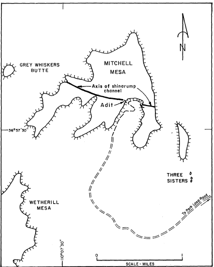
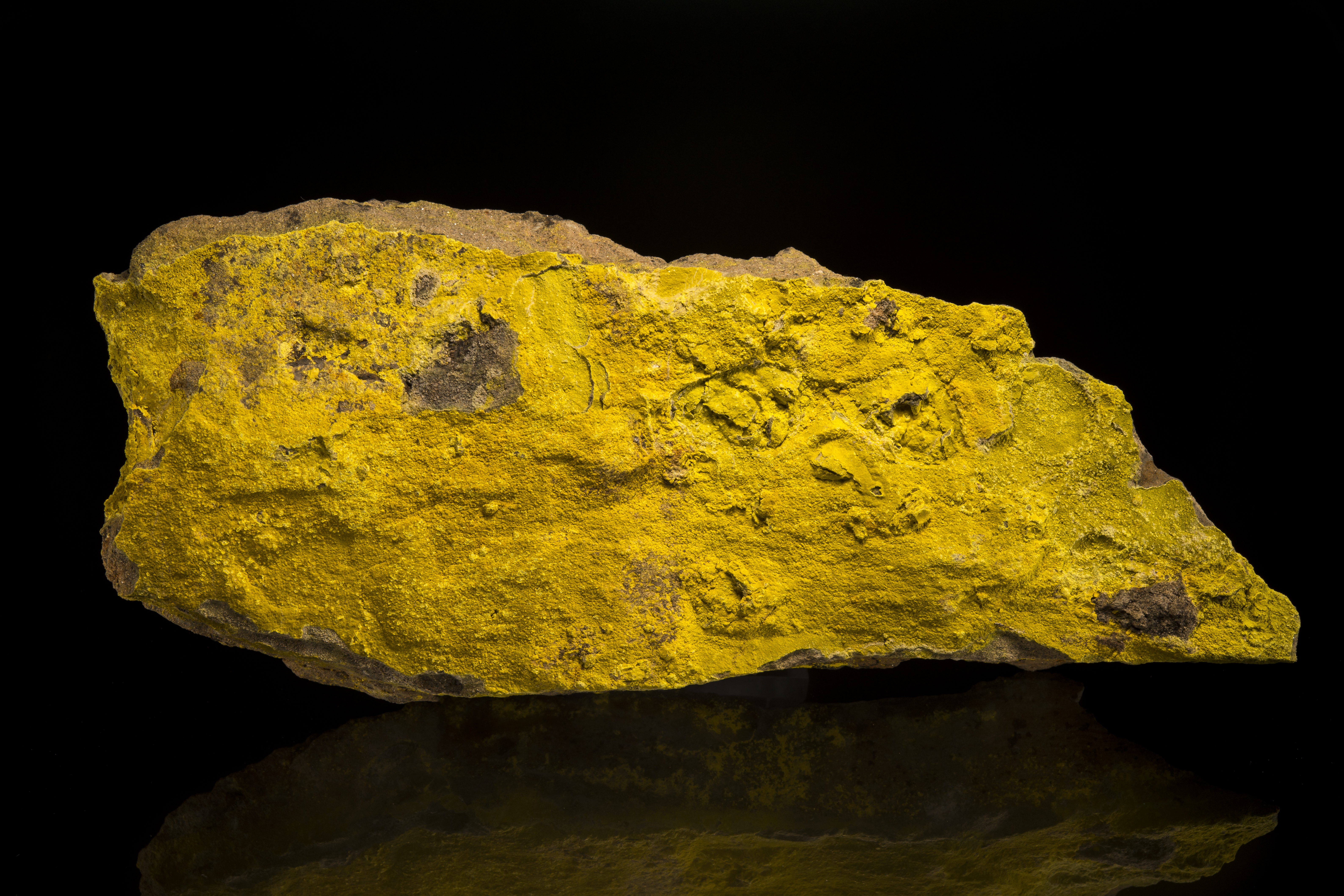
When rock blooms yellow and Geiger counters rattle – uranium! From a National Geographic Society publication, 1953. Click on any figure for a larger version.

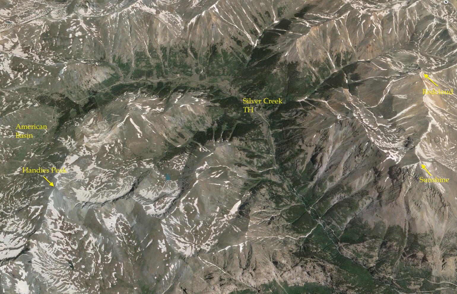
The theme of the 2015 Denver Gem and Mineral show is “Minerals of the American Southwest”. The theme evokes images of colorful copper minerals from Arizona, gold and silver from Colorado, red beryl and champagne topaz from Utah, and perfect fluorites from Bingham, New Mexico. The four states have a rich mining heritage with boom towns, barons, and villains. The influence of the American Southwest on the modern mineral collecting hobby is also outsized – from personalities of famous collectors and mineral dealers to mega mineral shows, perhaps no geographic region is more influential. The southwest was also the site of the greatest mineral rush in history, but is largely unremembered – the great uranium rush of the 1950s.

My father and I visited many of the uranium mines – mostly the abandoned ones in Utah – in the early 1970s, and I collected a boat load of  “yellow smears”.  I learned how to read the x-ray diffraction films from studying samples I prepared for identification.  I was cautioned to store these treasures in the barn rather than my bedroom because of issues with radon or radioactive decay.  I never really built a systematic collection, and my specimens were eventually disposed of for environmental reasons, but I was fascinated by the story of the uranium minerals.  In 1974, I read Edward Abbey’s book Desert Solitaireand was deeply affectedly by his descriptions of the joy of  isolation and the beauty of the canyon country and mountains around Moab. I also saw in this book the tremendous loss that we experience when we destroy wilderness.  I was asked to talk at the 2015 Denver show on minerals of the southwest, and it was assumed I would wax on and on about the silver minerals…but I decided to revisit uranium!

carnotite.utah

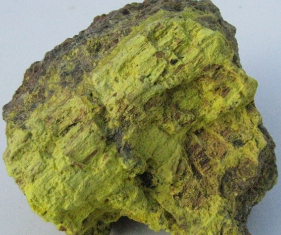
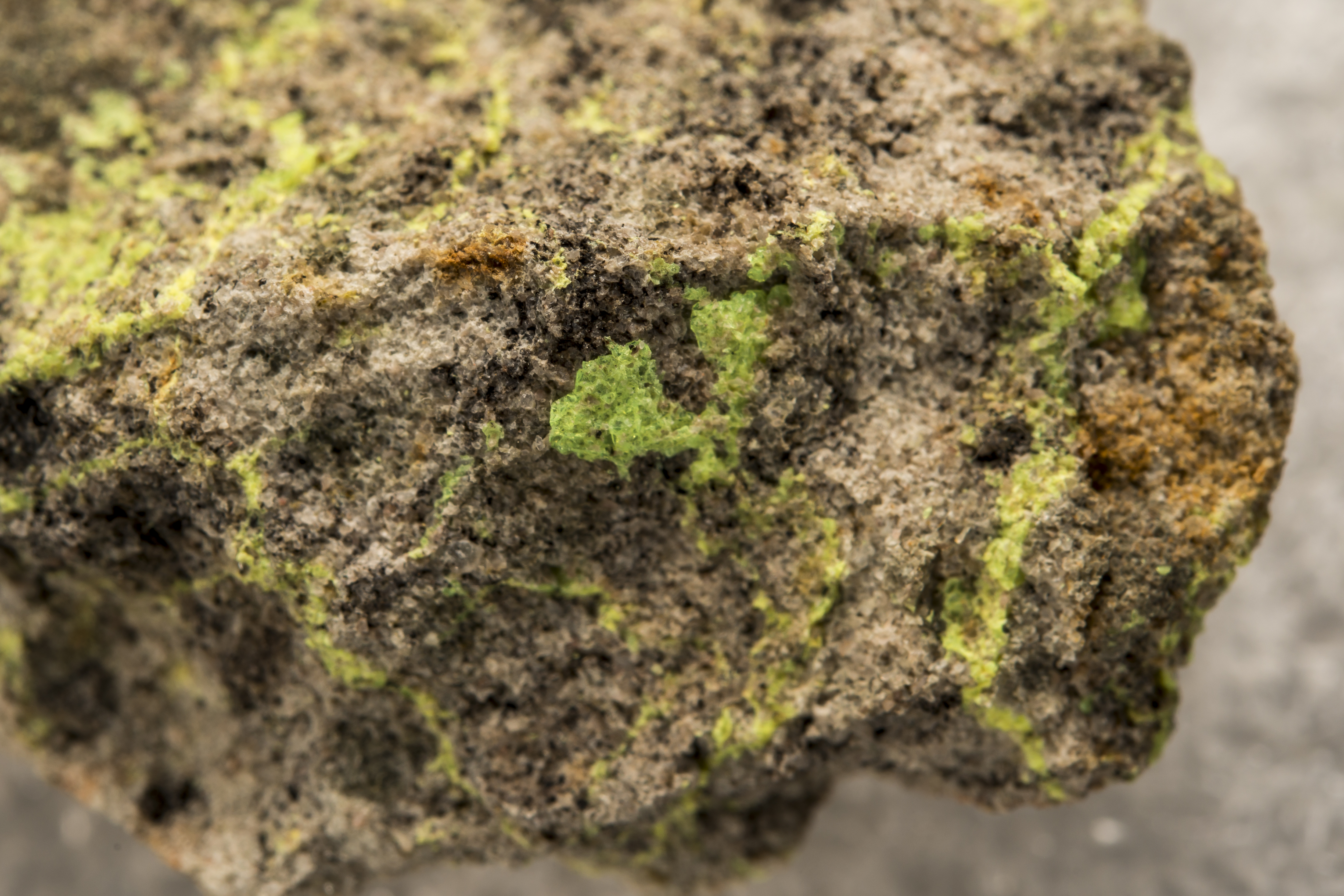
Small crystal clusters of carnotite, largest cluster is 0.7 mm across. San Juan Co., Utah

The launch of the Manhattan Project in 1939 suddenly made uranium a valuable commodity, but established mines were few globally; in the US only a few mines in western Colorado were producing any uranium (mainly as a byproduct of vanadium mining). Leslie Grooves, director of the Manhattan Project secretly purchased the entire stockpile of  Vanadium Corporation of America, which was stored at Uravan, Colorado – but that was only 800 tons of ore. Once the war was over the US had less than 100 pounds of enriched uranium (U235), and development of domestic uranium mining became a government priority. The newly minted Atomic Energy Commission announced remarkable incentives for new uranium discoveries: a price of $3.50 per pound of uranium oxide, and a $10,000 bonus paid on the delivery of 20 tones of ore that assayed 20 percent uranium oxide. By the early 1950s there were more prospectors looking for uranium on the Colorado Plateau than ever mined gold in the history of California – in fact, there were 30 uranium “rushers” for every 1 ’49 rusher to the Sierra Nevada.

xlg_uranium_rush_0

Hundred’s of articles appeared in the early 1950s publicized the “rush” for uranium. Many of these articles were funded by the AEC and suppliers of geiger counters.

The AEC incentives worked — by the mid-1950s there were about 800 major uranium ore producers on the Colorado Plateau, and ore production was doubling every 18 months.  The rush made more millionaires than the great Colorado silver rushes of the 1870s or the Arizona copper rushes of the 1880s.  Moab, Utah was dubbed the “Uranium capital of the World”, and had 20 millionaires for every 250 citizens.  The AEC cancelled the bonus for uranium production in the early 1970s, and eventually the mining industry declined to a subsistence level.  However, the rush to the Colorado Plateau had a huge impact – from 1949 to 1971 the mines produced about 400 million tons of ore that yielded 200,000 tons metric tons of uranium metal.

Coincident with the great uranium rush, mineral hobbyist clubs and minerals shows exploded – the American Federation of Mineralogical Societies (AFMS) was founded in 1947.  Although it is a stretch to directly connect the great uranium rush with the rise of mineral collecting as a hobby, it is obvious that the heavy promotion of uranium prospecting peaked the interest of many Americans, and rock hounding entered a golden age.  Many collectors purchased or collected uranium minerals from the Plateau, and these prizes sat in places of honor in the collector’s cabinets.  However, as the hazards of uranium mining became understood in the 1970s, collectors began to dispose many of their specimens.  Today, it is almost impossible to find a fine Colorado Plateau uranium mineral specimen – and the heritage of an amazing American event has faded from the public memory.

uraniummines

Map showing the location of uranium mines in the US. The data is from a EPA data base, and does not show the size of the mine. However, the density of the mines is a good indication of the richness of the deposits.

A Brief History of the Colorado Plateau Uranium

The history of uranium on the Colorado Plateau begins a half century before the Great Rush when prospectors were looking for the more valuable commodities of radium and vanadium.   Settlers in the Paradox Basin in southwest Colorado knew of a yellow, powdery material found in sandstones before 1880; it is likely that Ute and Navajo Indians collected this same material as a pigment for hundreds of years. By the late 1890s various prospectors had collected a few hundred pounds of the material, but did not know what it was, nor could they find a market. In 1881 Tom Talbert discovered the same yellow material in Montrose County, and eventually this material found its way to Gordon Kimball in Ouray. Kimball sent samples to Frenchman Charles Poulot (residing in Denver) in 1898, who determined it contained both uranium and vanadium. Poulot gave the material to M. M. C. Friedel and E. Cumenge (of Cumengite fame) who determined an approximate formula: K2(UO2)2(VO4)2·1-3H2O  Also in the samples were significant amounts of radium – which is a decay product of U238.  This coincided with Curie’s discovery of the element radium, and she began to purchase carnotite from Colorado for research.  Radium became the vanguard material for worldwide research on radioactivity, and a number of mines were staked along the Colorado Plateau.

coradium_1

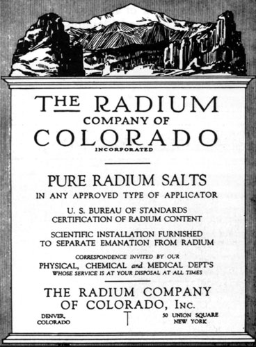
Colorado radium played a very significant roll in the lab of Madame Curie, and was essential to define the unit of radioactivity, the Curie.

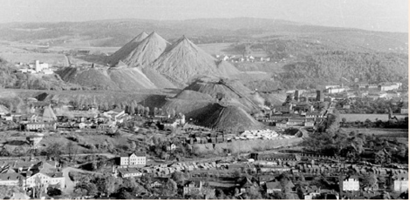
Aside from staking claims, nothing of substance happened in carnotite mining until 1910 when a new medical market for radium developed — it appeared to have a dramatic effect on certain cancerous tumors — and southwestern Colorado became a major supplier.  However, the outbreak of WWI completely quashed the demand. As the demand for radium dried up, the demand for vanadium increased rapidly. It was discovered early in the 20th century that adding a small amount of vanadium increased the strength of steel. In 1905 Henry Ford was introduced to a vanadium rich steel, and was so impressed with its characteristics, he used it in the chassis of his Model-T.  By the end of WWI the carnotite mining shifted from the focus on recovering radium to vanadium, and by 1922 radium recovery ceased all together.  Although the demand for vanadium was cyclic, by about 1935 it had become an important enough metal that Vanadium Corporation of America purchased most of the former carnotite mines, and founded the town of Uravan (contraction of uranium and vanadium).

carnotite.early

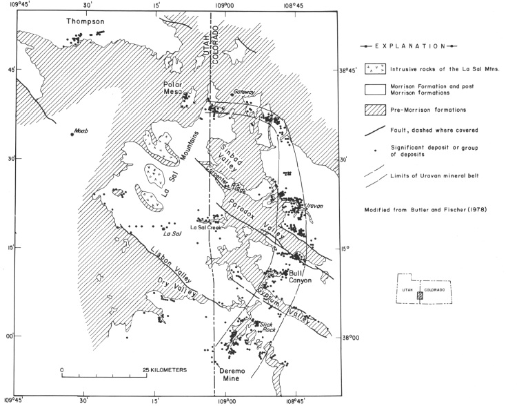
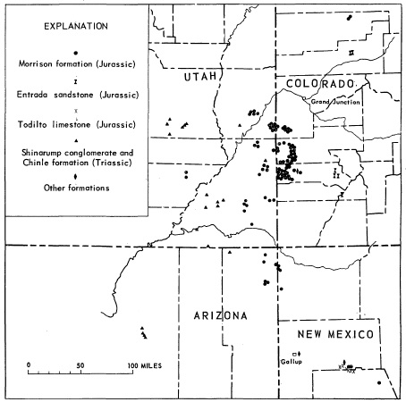
Location of the carnotite deposits mined for radium and then vanadium before WWII. From Chenoweth, 1981.

After 1936 there was a steady increase in prospecting and development of properties along the Utah-Colorado border targeted the Morrison Formation (Jurassic age), in particular, a fluvial sandstone/mudstone unit called the Salt Wash Member.  With the outbreak of WWII steel became essential; vanadium was declared a strategic metal, and more than 600,000 tons of vanadium ore with a 2% grade was produced.

uravan1935

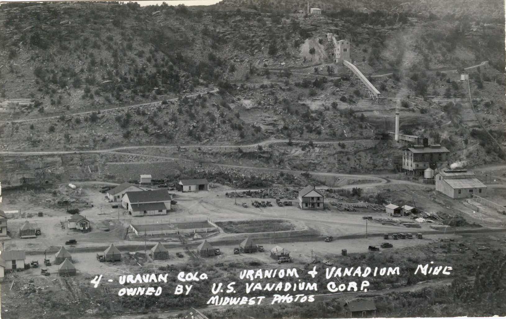
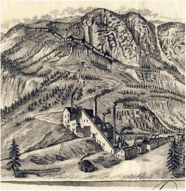
Mine and mills at Uravan, ca 1935

The modern era of uranium exploration and mining on the Colorado Plateau began when the Atomic Energy Commission was established by the Atomic Energy Act of 1946.  All  functions of the Manhattan Project, including the acquisition of uranium, were transferred to the ACE at mid-night, December 31, 1946. The AEC set up a procurement shop in Grand Junction, Colorado and begin devising schemes for securing uranium. At the time there were only 15 mines operating on the Colorado Plateau, and uranium was still considered a lesser product than vanadium. The AEC was the only buyer of uranium, and thus, set a price they thought would incentivize production; it soon became apparent that the AEC also had to be involved in the milling of ore, and provided bonuses for uranium oxide concentrations. The very first procurement contract was signed with Vanadium Corporation of American on May 28, 1947. The AEC demanded a rapid expansion of exploration and mining efforts, and provided assistance by undertaking geologic surveys and providing free assay services.

Between 1948 and 1956 the AEC and the USGS tasked several hundred geologists to scourer the Colorado Plateau and make their maps and drilling core results freely available to prospectors. The AEC also built more than a thousand miles of roads across the plateau to promote access to the most remote regions. Prospectors and weekend treasure hunters flocked to Utah and Colorado, and later to New Mexico and Arizona.  Some of these prospectors struck it rich, and lived life higher than the biggest copper or silver baron of the 19th century.  One of these “lucky” prospectors was Charlie Steen.

For two years Steen roamed the area around Moab, Utah and “barely” subsisted with his family in a trailer and tar paper shack. Using his experience in the oil industry, he was certain the uranium would collect in anticlines – sort of like an oil trap – and he drilled haphazardly. On July 6, 1952, Steen drilled into an incredibly rich deposit of “pitchblende” (uraninite) at 200 feet depth, and over the next year developed the Mi Vida mine. The fact that the ore was uraninite – not carnotite-  in a rock type previously not shown to carry uranium, and at a depth that similarly unexpected, caught the government geologists by surprise. Steen became a multi-millionaire, and his find electrified the country – and greatly accelerated the rush to the plateau!

charlie-mark-dog

Charlie Steen underground with his son at the Mi Vida Mine, ca 1955

Geologists began to understand the nature of the Colorado Plateau uranium deposits in the late 1950s. Garrels and Larsen (1959) published USGS professional paer 320, Geochemistry and Mineralogy of the Colorado Plateau Uranium Ores, and it became clear that hydrology was the most important factor in localizing the uranium in vast  columns of sedimentary rock.

bigdeposits

Uranium deposits on the Colorado Plateau in 1959 with a size of more than 1000 tons.

Uranium is found in more than a dozen sedimentary strata on the plateau but the Morrison formation of late Jurassic age and Chinle of Triassic age account for 95% of the produced uranium. The Morrison was formed from the erosional sediments derived from a highlands called the Elko that existed along what today is the Utah-Nevada border. These sediments were deposited in floodplains, river channels and swamps, not unlike the Mississippi delta today. The Chinle is dominated by eolian (wind-driven dunes) deposits with smaller river channels cut during intervals of more precipitation. The uranium appears to have mobilized by ground water; dissolving and moving sparsely concentrated uranium and precipitating and concentrating that uranium when structural or chemical boundaries are encountered. The deposition of the uranium occurred millions of years after the deposit of the sedimentary rocks — perhaps 100 million years later.  The deposition is most signifiant where the sediments contained trapped organic materials – logs in river channels or organic ooze in swamps. In fact, there are many examples of petrified logs that have been completely replaced by uraninite or coffinite.

The real key to the Colorado Plateau deposits is the long term stability of the sediment column.  This stability has allowed dilute solutions to build these diffuse deposits.  This is not the best environment to grow beautiful crystals, but small variations in chemistry has allowed for a wide range of uranium minerals.  Through 2010 the Colorado Plateau has produced more than 600,000 tons of uranium oxide – and today contains 15% of the worldwide uranium reserve.

uraniummetal

High purity uranium “biscuit”. Uranium metal is not known in nature.

Colorado Plateau Uranium Minerals

The mineralogy of uranium is a fascinating and complex topic – the nearly ubiquitous presence off U in the environment, its large atomic radius, strong affinity for oxygen (lithophile), and high solubility in certain valence states leads to large number of secondary uranium minerals. The lithophile nature of U also means that 4.5 billion years of Earth evolution has concentrated the element in the crust; the statistic abundance of U in the crust is 2.7 ppm, as compared to 0.075 pm for silver and .004 ppm for gold. In other words, there are 675 atoms of uranium for every atom of gold in crustal rocks!

Figure1_OriginEarth

Relative abundance of elements from cosmology, normalized to the abundance of Si. Note that uranium, as expected with its large Z, is much rarer than lighter elements. It is a few orders of magnitude less common than gold. However, uranium is strongly lithophilic, and has been concentrated in the Earth’s crust to the point that it is more common on the surface than either gold or silver.

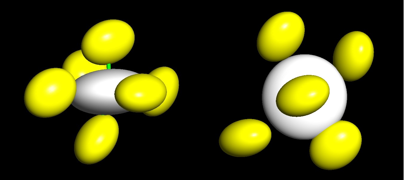
The fact that uranium has been so strongly enriched in the crust is also one of the reasons it is so ubiquitous – traces can be found in every rock type, soils and water. Uranium is a “5f electron” element, which controls much of the way it behaves in the environment. 5f refers to the electron configuration, or the distribution of electrons about the atom; uranium is an electron donor and has four different valence states depending on environmental conditions. Two of these states, U4+ and U6+, are stable in geologic environments. In igneous environments the +4 valence state prevails, and uranium is one of the last elements to form minerals in a magmatic or hydrothermal fluid. By far, the most common mineral to form in igneous environments is uraninite (UO2).  However, once that uraninite is exposed to a humid and oxidizing environment the surface of the uraninite undergoes oxidation and the U4+ → U6+; the higher valence state is incompatible with the uraninite structure, and the uraninite decomposes, releasing the U6+, which rapidly binds with two oxygen atoms to form the uranyl ion [UO2]2+

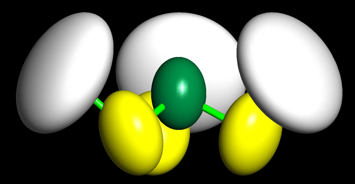
The uranyl ion has a linear structure, with very strong bonding between the uranium and oxygen, and it is highly soluble in ground water.  This high solubility leads to extraordinary mobility of uranium, and a key contributor to Colorado Plateau deposits.  The uranium mined today in Grants or Paradox Basin did not originate anywhere near those locations; it likely was deposited in minor uraninite deposits during the billions of years of mountain building in what has become the North American Plate.  Decomposed, oxidize, and transported through great distances, the uranium was concentrated when subtle encounters with ground water chemistry changes.

changingvalence

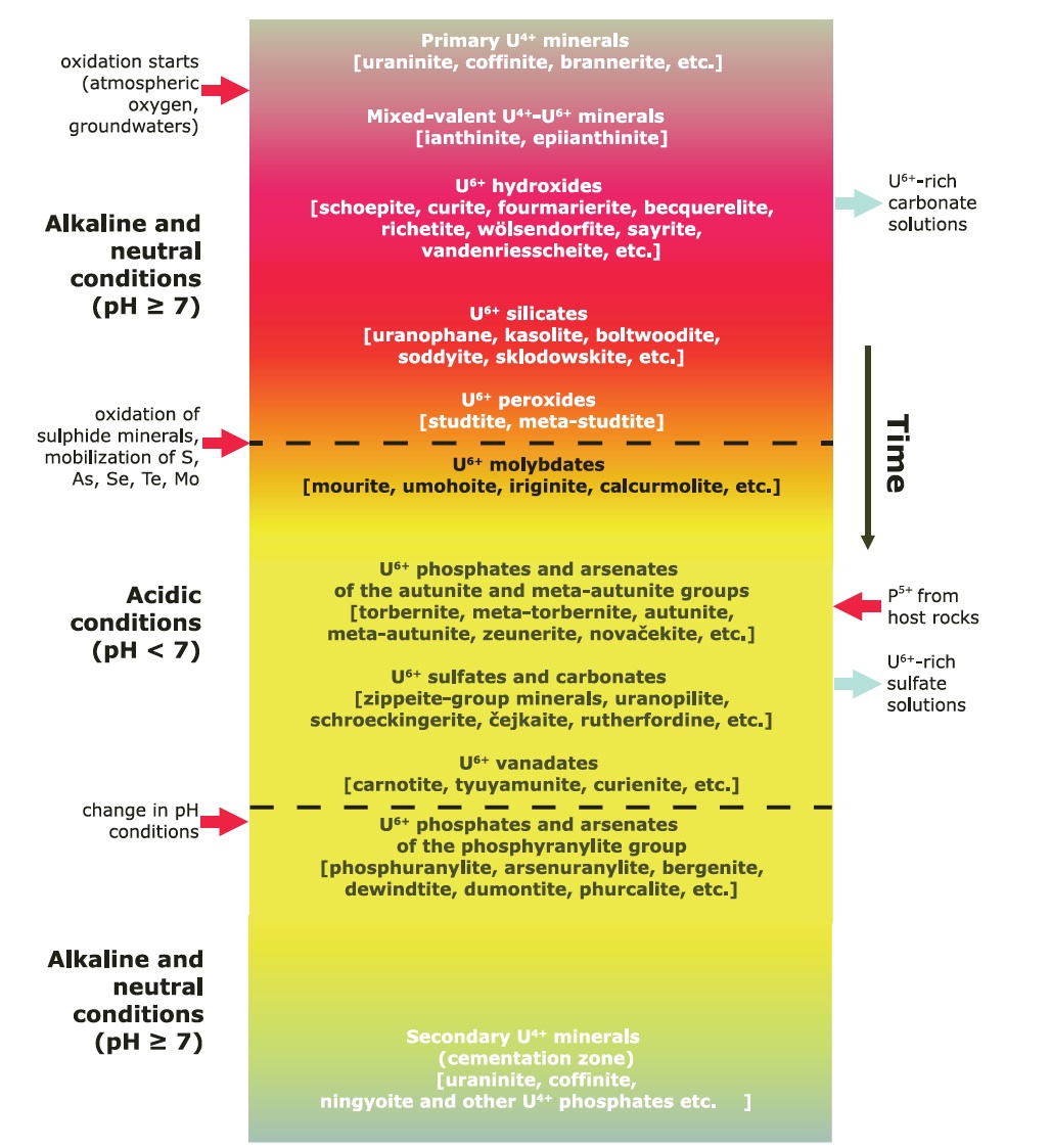
Paragenetic sequence of uranium minerals — from primary uraninite with a +4 valence to hundreds of uranium minerals with a +6 valence (from Plasil, 2014).

The mineralogy of U6+ is very diverse because of the uranyl ion; it has a linear, dumbbell shaped structure that cannot be easily substituted by other high valence cations. The uranyl ion will most commonly attach to tetrahedral anion groups; SO4, PO4, AsO4, SiO4. Any charge balance is then accommodated by other cations. The figure above is a generalization of the paragenes of uranium minerals; at the top is the primary oxides and moving down the chart shows the minerals that form as uranyl migrates away from the primary source. Typically uranyl carbonates form first, and vanadates – like carnotite – form far from the original source and after many generations of mineral growth and decomposition.

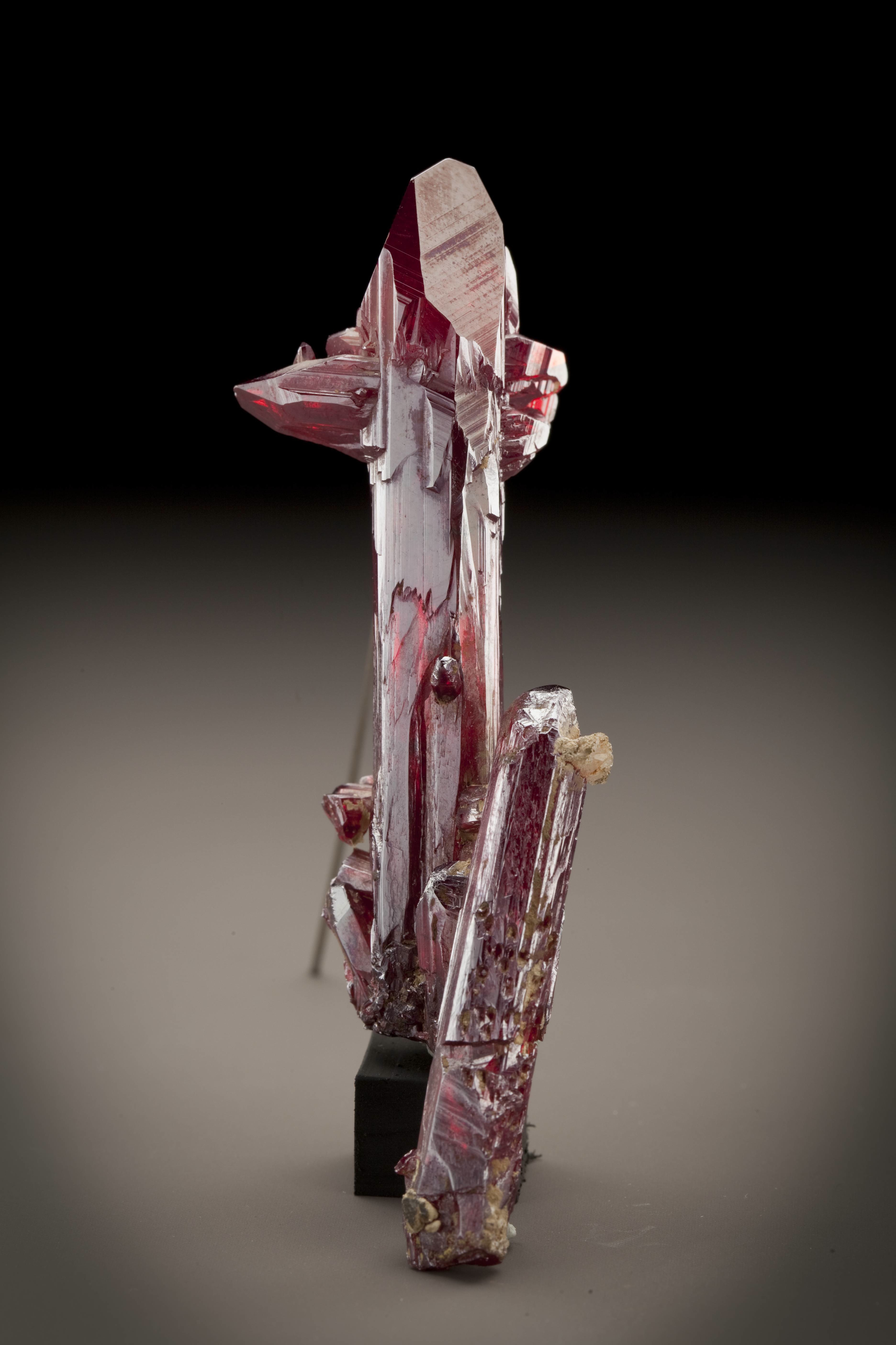
There are about 160 different uranium minerals known, and 61 have been reported as coming from the Colorado Plateau, and 12 have the Plateau as their type locality (there are dozen uranium minerals yet to be characterized for the Plateau deposits).  The names are mostly unfamiliar to collectors – things like Becquerelite Ca(UO2)6O4(OH)6 · 8H2O,  Schrockingerite, NaCa3(UO2)(CO3)3(SO4)F · 10H2O and Rabbittite, Ca3Mg3(UO2)2(CO3)6(OH)4 · 18H2O.  They have colors that span the rainbow, although bright yellows and deep greens are favored.  Those minerals that contain the uranyl ion all fluoresce (although U4+ minerals do not), and differences in hydration – and loss of water with alteration – changes the fluorescence. Unfortunately, the sedimentary deposits of the Plateau do not lend themselves to environments in which large, distinct crystals grow.  Below is a gallery of some of the more important uranium speciemens:

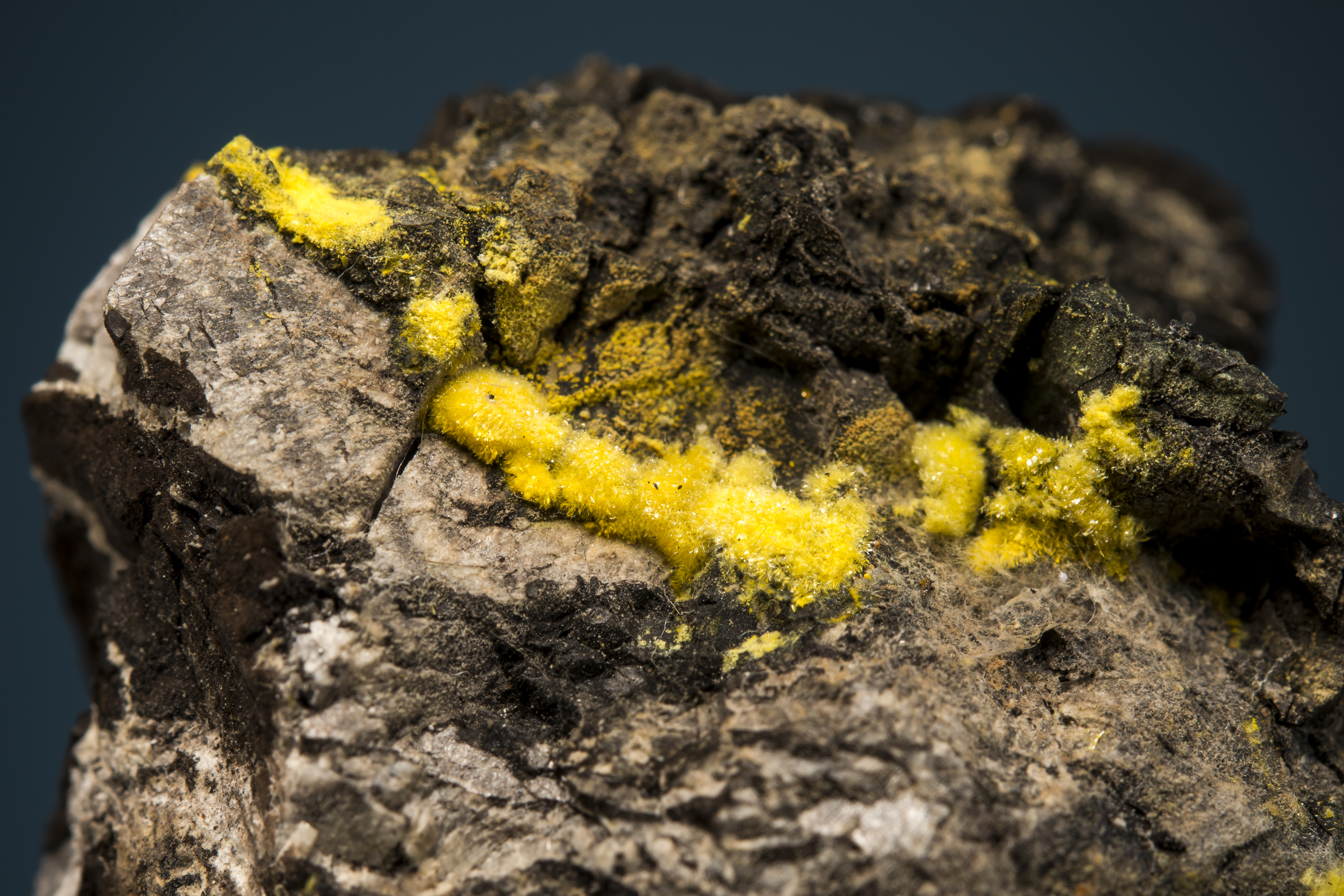
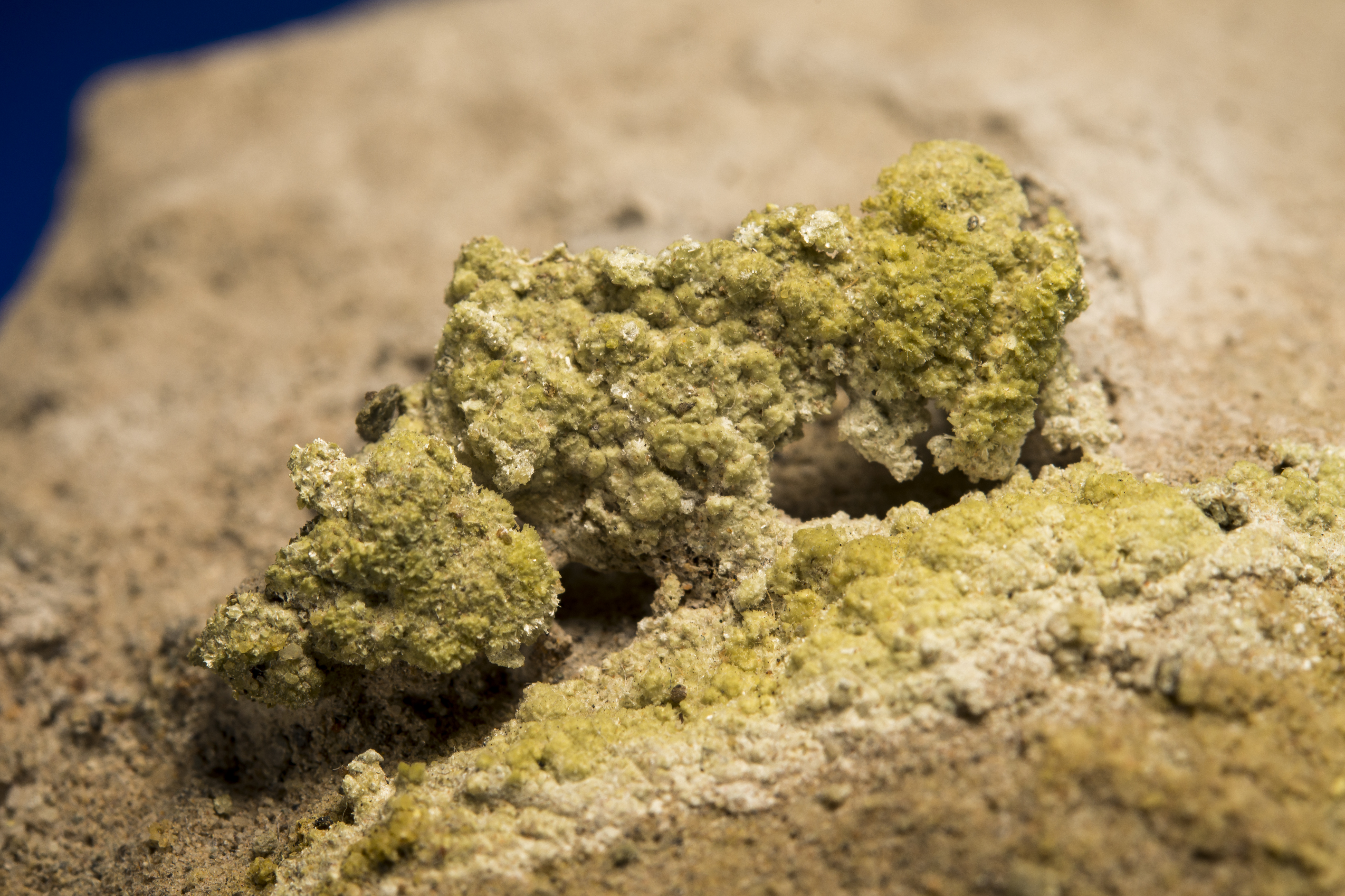
Carnotite K2(UO2)2(VO4)2 · 3H2O

Carnotite.HappyJack(BYU)

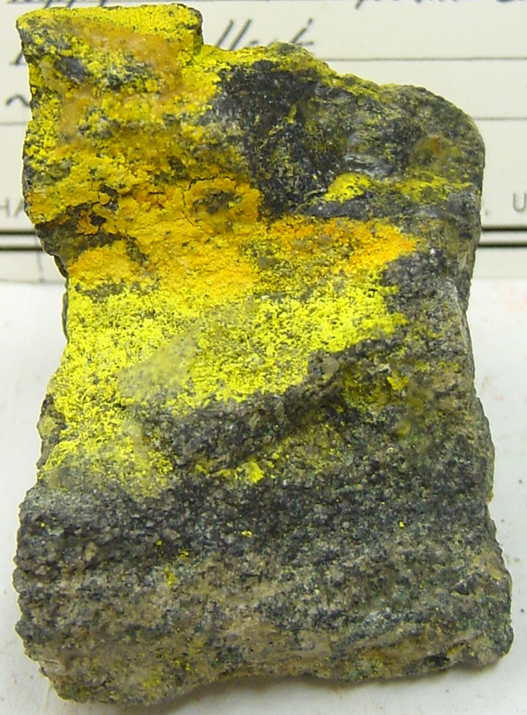
Carnotite, Happy Jack MIne, Utah. BYU collection.

carnotite.monumentvalley.arizona

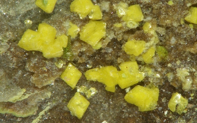
Carnotite crystals, to 2 mm. Monument Valley, Arizona. Stephan Wolfsried photograph and specimen.

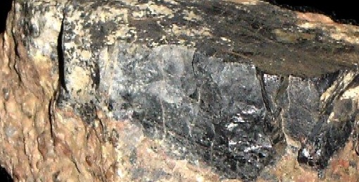
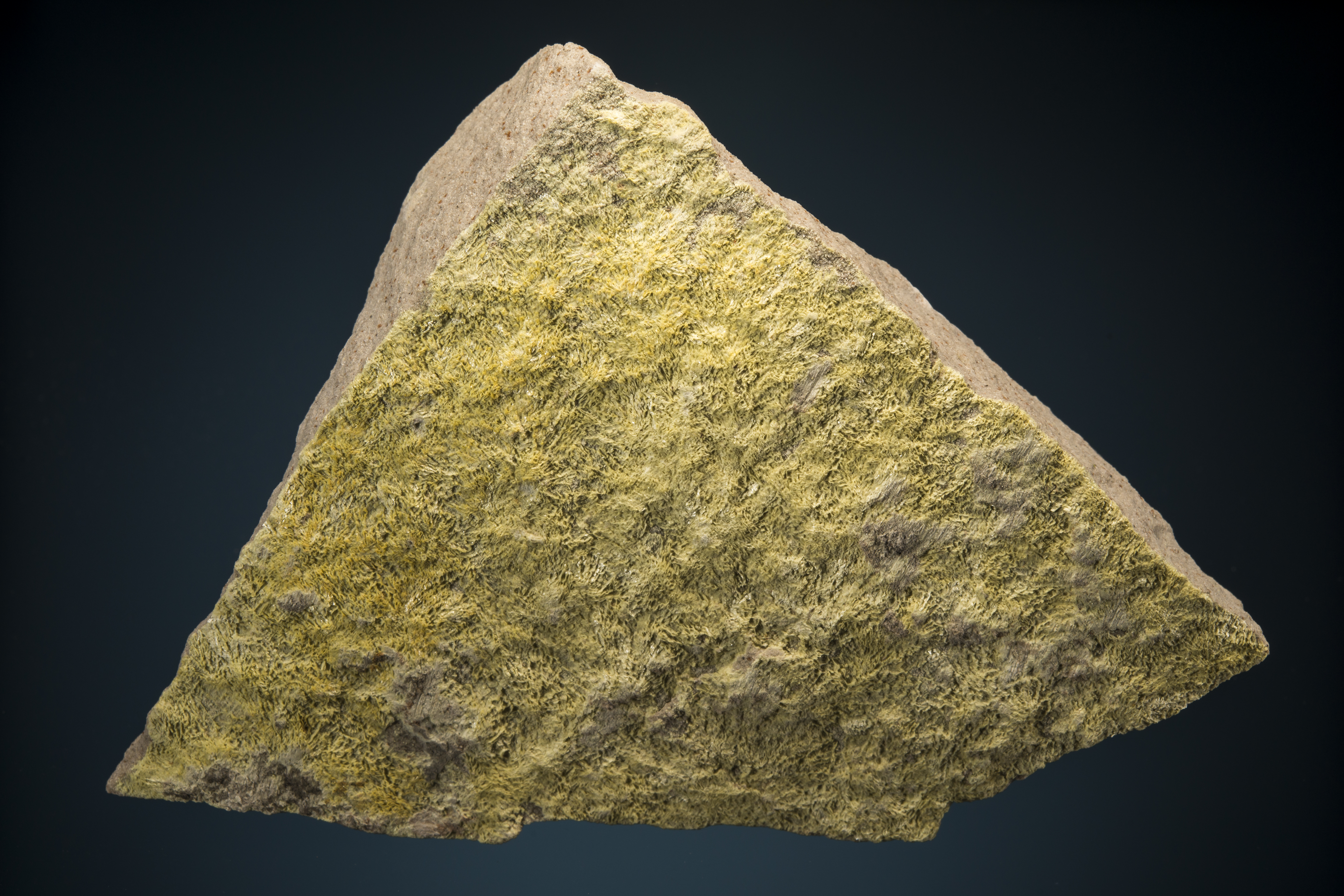
Coffinite U(SiO4)1-x(OH)4

coffinite.1

Coffinite, Mount Taylor deposit, Ambrosia Lake area, Grants District, McKinley Co., New Mexico. Field of view is 3cm.
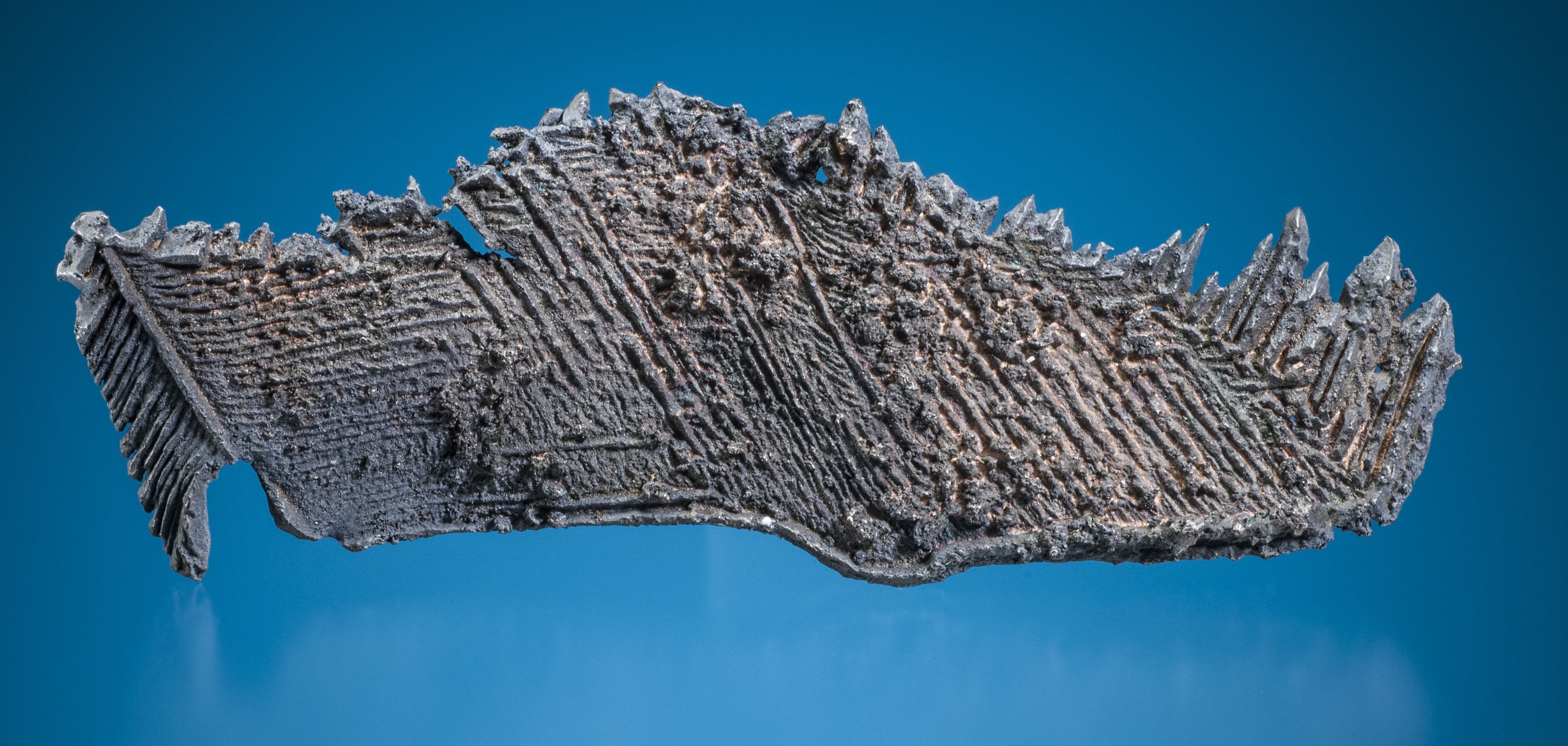
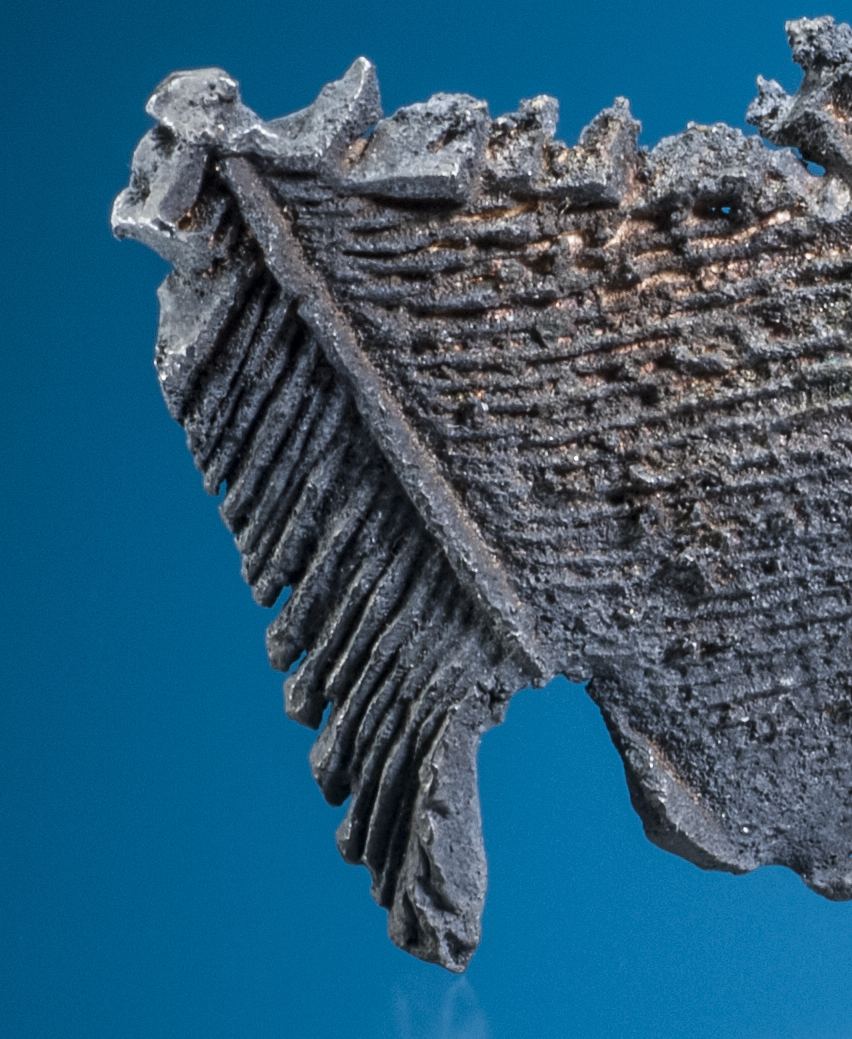
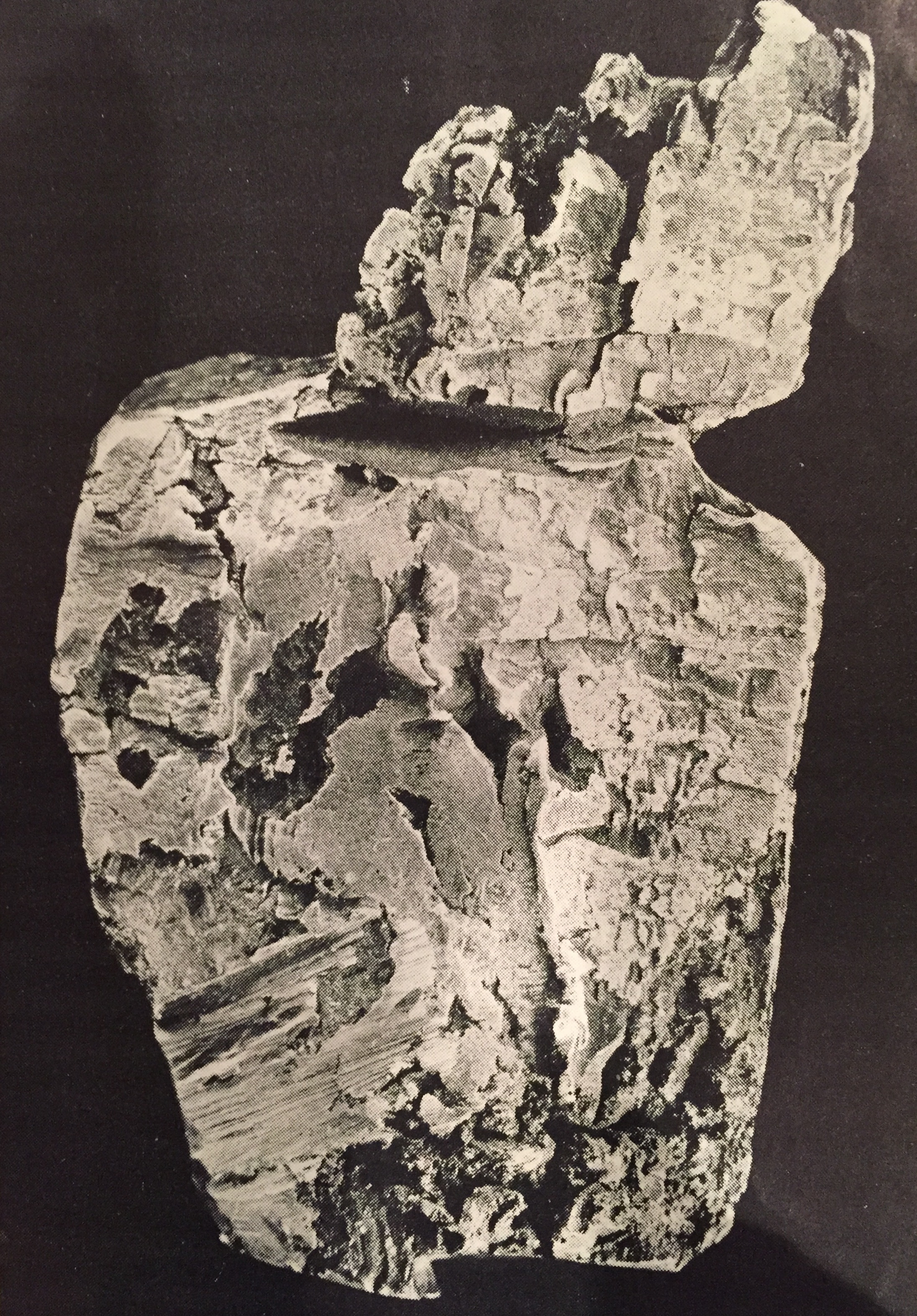
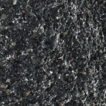
Uraninite UO2

uraninite.bigindiandistrict.sanjuanco.utah

Uraninite, Big Indian District, San Juan Co., Utah.

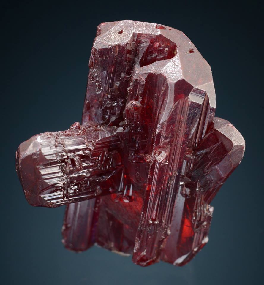
Tyuyamunite Ca(UO2)2(VO4)2 · 5-8H2O

Tyuyamunite.paradoxvalley

Tyuyamunite, Paradox Valley, Montrose Co., Colorado. Dave Bunk collection, Jesse La Plante photograph.

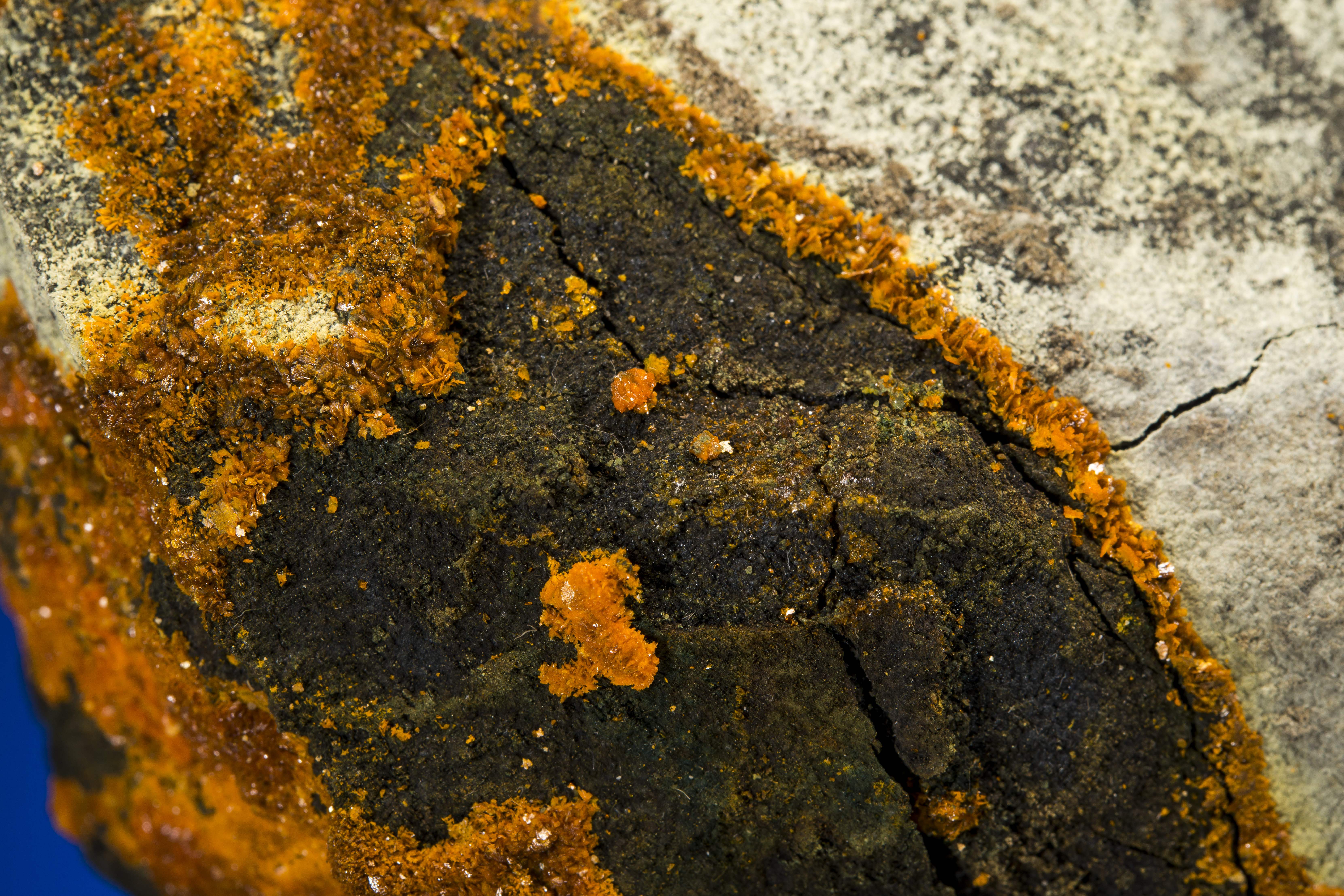
Zippeite K3(UO2)4(SO4)2O3(OH) · 3H2O

zippeite.biggypsumvalley

Zippeite, Big Gypsum Valley, San Miguel Co., Colorado. Dave Bunk collection, Jesse La Plante photograph.

Unknown Uranium Carbonate

amazing

Slick Rock, San Miguel Co., Colorado. Dave Bunk collection, Jesse La Plante photograph.

The uranium minerals were intimately associated with vanadium minerals – often these carried some amount of the uranyl complex.  The Colorado Plateau vanadium minerals are as unique as their uranium counterparts, and often even more colorful and unusual.  A few are featured below:

Schrockingerite NaCa3(UO2)(CO3)3(SO4)F · 10H2O

schrockingerite.monogrammesa

Schrockingerite, Monogram Mesa, Montrose Co., Colorado. Dave Bunk collection, Jesse La Plante photograph.

Metamunirite NaVO3

metamunirite.burromine.slickrock.sanmiguel

Metamunirite, Burro Mine, Slick Rock, San Miguel Co., Colorado. Dave Bunk collection, Jesse La Plante photograph.

Metahewettite CaV6O16 · 3H2O

metahewetite.hummermine.uravan

Metahewettite, Hummer Mine, Uravan, Montrose Co., Colorado. Dave Bunk collection, Jesse La Plante photograph.

Pascoite Ca3(V10O28) · 17H2O

pascoite.biggypsumvalley.sanmiguelco

Pascoite, Big Gypsum Valley, San Miguel Co., Colorado. Dave Bunk collection, Jesse La Plante photograph.

Metarossite Ca(V2O6) · 2H2O

metarossite.arrowheadclaim.sanmiguelco

Metarossite, Arrowhead Claim, San Miguel Co., Colorado. Dave Bunk collection, Jesse La Plante photograph.

Hewettite CaV6O16 · 9H2O

hewettite.hummermine.uravan

Hewettite, Hummer Mine, Uravan, Montrose Co., Colorado. Dave Bunk collection, Jesse La Plate photograph.

Paradise Lost

The Great Uranium rush was over by the early 1960s.  Many lone prospectors roamed some of the most desolate and beautiful country in the world in search of radioactive treasure.  Uranium mining in the 1960s was controlled by large corporations, and huge open pit mines like Jackpile east of Grants, New Mexico supplied tons of uranium.  By 1971 the government had more uranium than it could possibly use, and cancelled the incentives.  By 1980 the world market drove the prices for the silver-colored metal to prices that shut down even the largest producers.  Today the prices occasionally spike, leading to much discussion about reviving mining on the Colorado Plateau.  However, the heavy environmental toll has a very dark legacy.  It is unlikely that there will ever be another uranium mine in the Triassic and Jurassic sandstones that make the plateau look like the landscape of Mars.

Running the Heart of the Caldera; It’s about joy not genetics

I am glad I will not be young in a future without wilderness — Aldo Leopold, scientist and author, New Mexico Forester, and architect of the modern Environmental Ethics movement.

RunningPeaks

A romp through the San Juans – three 14ers and a collapsed caldera. The run started at the Silver Creek Trailhead, up to Redcloud, over to Sunshine, back to the Trailhead and then looped around Handies Peak. A figure-8 course of high altitude bless. click on pictures to make them large format

“Why do you like to run?” – a question I often get asked. I usually make up some answer to steer the conversation back away from emotional strands to more comfortable analytic themes. In fact, I don’t like to just “run” – I am not really very good at it (if being good is measured by being speedy), and although I run most every day, my joy is found ON the run, especially along rough and rocky wilderness trails where the enormity of nature overwhelms prosaic modern life. The irresistible forces of geology, the incredible delicate touch of nature that can make even the smallest flower bloom with perfectly symmetry, winds that carry no smells made by man – these are the things that unleash astounding joy. At the end of the day I like having accomplished something difficult in a run, but that is more about being a driven personality; it is the joy of nature that makes running so essential to me.

Most any trail can unleash nature, but there are some very special places for me that are beyond the pale.  The San Juan Mountains are my personal enchanting wilderness; not only are the mountains and geology stunning, but rich history of minerals and rugged miners are backdrops to a place that I have visited for more than a half century.  The wilderness here is stark – miles and miles of exposed ridges and peaks far above timberline.  But surprisingly, there is evidence everywhere that prospectors touched and turned over rocks in the most inhospitable places; nature is supreme, but the San Juans have been a siren for hundreds of years for people like me.

Covershot

Top of Handies Peak (9/6/15) looking north after a brief storm. The San Juan Mountains have miles and miles of rugged peaks above tree line. Near Lake City, the Red Cloud Wilderness Study Area is nearly 40,000 acres with 34 peaks above 13,000 ft.

Despite my motivation of joy of running in nature and an espoused aversion to “racing”, I do seek out and enjoy organize ultra trail runs.  I choose interesting places – mostly based on geology or history – and toe the line on a half dozen 50+ km races per year. I try to run fast, but in reality, I am a jogging geoscientist.  I am happy with that, but hate failure nevertheless.  Earlier this year I stumbled and fell during a glorious race in the San Juan Mountains known as the San Juan Solstice 50 miler (SJS50).  I have unfinished business with this race, and have focused training around next year’s event.  Of course, this means “training” by returning and running often in the San Juan Mountains.

HC2

Summiting Red Cloud, day II of the Heart of the Caldera. This picture is about 35 minutes after first sunrise, and about 13,500′ in elevation. Fantastic terrane!

The Runs:  Familiar mountains, but a long journey

I decided to set up a trail run(s) within the Lake City Caldera and enjoy the high San Juans before winter once again shroud the peaks in impassable snow.  Labor Day weekend traditionally marks the change in session in the San Juans – although it is quite common to have great weather into mid-October, it is also not usual to get freakish September snows, making running above 13,000 feet a Darwin-Award type event.

Day I of the Heart of the Caldera was a modest 16 miler in the northeast part of the Lake City Caldera.  The route was inspired by the San Juan Solstice 50 M; the path follows Alpine Gulch (a major north-south drainage into Henson Creek) to a pass between Red Mountain and a peak known as 13,881 (many unnamed peaks are only denoted by their elevations).  From the pass, which has an elevation of approximately 11,770 ft, the route climbs and then follows a ridge line to 13,811.  It is a scrabble of about 700 feet to the smooth summit of 13,881 – it is also incredibly peaceful and isolate.  No trail, no people!  From the summit of 13,881 the route is a backtrack with a side scrabble up another prominent peak, Grassy Mountain (elevation 12,821 ft).

The weather forecast for September 5, called for significant rainfall starting at about 11 am.  There had been plenty of rain the previous couple of days in the area, and when I started the run at 6:30 am it only took 1 mile or so before I was soaked to the bone from the dew provided by the heavy growth of the underbrush.  Compared to the SJS50 in late June, the Alpine Gulch Trail was barely passable (or even visible!) due to the summer growth.  The stream was running with less volume than in June, but the 7 crossing required during the climb still meant wadding in ankle deep water.  About 2 miles up Alpine Gulch the drainage splits into an East and West Fork; the East Fork leads to the pass and peaks beyond.  Somewhere around 10,000 ft elevation, there is no sign of the trail, but a runner knows that you must keep heading upward.  There are a number of mines (mostly small spoil mounds) along the valley that I did not notice during the SJS50.  The stream meanders through the spoils, and obviously collects discharge from the old underground workings.  The water is crystal clear, but the channel has a thick orange mud coating.

waterEF

East Fork of Alpine Gulch. The water is clear, but there is a mud that probably represents iron minerals that flow out of the old underground workings of mines in the area.

Above 11,000 feet elevation it is possible to rediscover the trail, and running is easier (actually that is a mis-statement, running is never easy above 11,000 ft).  Clouds begin to roll in, and I fear that storm is due any moment (my fear is for lightning, not rain – I can get no wetter…).  A mist descends, and lowers the visibility, but no heavy showers or hail. I pass the saddle, which serves as the first aid station in the SJS50 at 1 hr and 40 minutes (4.8 miles).  I had hoped for views, but all horizons look gray and wet.

RedMtn

A view of Red Mountain, home of some of the richest mines near Lake City. The view is from the ridge line on 13,881 looking due north. The iron stains are eponymous hero – signaling that hydrothermal solutions surged through the collapsed Lake City Caldera 5-8 million years ago.

The mists – or clouds – temporarily rose about 13,000 ft as I climbed up the ridge to peak 13,881.  Still no great views, but I could at least gaze upon Red Mountain to the north (and know that Lake City was only a couple of thousand feet below).  The picture above is taken about 5.5 miles into the run, and sense of isolation settles on me with great comfort.  The clouds soon dropped to surround me with a thick gray curtain.  It remained with me even as I summited 13,881 – I think the visibility was less than 20 yards.  I quickly retraced the path way back, and headed for Grassy Mountain (or where I thought the peak was!).  This is beautiful running county – all above timberline, and alpine grasses.

Grassymtn

A few hundred ft below the summit of Grassy Mountain. The clouds shrouded the peak, giving the sense that perhaps this was Mt. Doom in Mordor.

I climbed up Grassy Mountain – sort of strange name for a peak in the San Juans.  On the flanks are alpine grasses, but in the clouds I only see crags.  When I reached the summit I was surprised to find a peak register.  I opened the log, and saw only 4 people had signed the register in the last 3 years.  I guess Grassy Mountain is not on the beaten path.  I was now at mile 9.2, and decided to eat some food before running back down the Gulch.  I was rewarded with a temporary rise of the cloud, and captured a panorama of 13,811 and the ridge line defining its northern shoulder.

13,881.ridge

Panorama from the crest of Grassy Mountain towards peak 13881 (on the left hand side of the photo). The distance from Grassy to 13,881 is about 1.3 miles as the crow flies.

The descent back to the Alpine Gulch Trailhead was uneventful;  for day one the mileage was just over 16 miles, and the elevation gain was 4,200 ft.  I finished in 5hrs and 50 minutes, assuring that I could brag about a trail run with an average pace of under 3 miles and hour…but that would seem fast compared to day II of the Heart of the Caldera!

The second day I had advertised through the Mountain Trail Series, an excellent resource for trail runners in Northern New Mexico.  I had proposed a run to the top of 3 14ers in the western edge of Lake city Caldera: Red Cloud (14,041 ft), Sunshine (14,006 ft) and Handies (14,058 ft).  The trails connecting these peaks are straight forward, and is quite “runnable” although there is major elevation gain along the 24 mile route.  Labor Day weekend is a great time for a trail run – but that also means there are LOTS of trail runs, and the interest in what I call the “Figure 8 of fun” was mostly cheer leading.  We started and finished the run at Silver Creek Trailhead, which is located in the center of the “figure 8”.  Silver Creek TH is at an elevation of 10,400′;  we started the run at 5:45 am on September 6, and quickly run (an exaggeration…) up the first couple of miles of Silver Creek in the dark.  The temperature at the start was 34 degrees, which is pretty nice when it is dry and there is no wind.  We pass about 10 groups of hikers that had an even earlier start on the day than we did.  Silver Creek gets its name from the stain it leaves on the rock – not from any great silver deposits in the surrounding peaks.  There are some molybdenum deposits in the valley, and these deposits carry some easily dissolved aluminum which precipitates out on the stream boulders giving them the look of the moon when it is full.

sunrise.redcloud

1000 ft below the summit of Red Cloud. The sun has risen in the east (the left hand side of the photograph), and there is a fresh dusting of snow barely visible on the summit. This photo reminded me very much of my last visit to Red Cloud with my good friend Dave Bunk, who made his first 14er summit. He was carrying an old school backpack, and plowed up the steep trail with grit and determination!

There is nothing difficult about the trail to Red Cloud, but the last mile is quite steep, and our pace slows to 40 minutes per mile.  The previous days clouds had dusted the top of Red Cloud with snow, and the trail rocks was coated with ice.  Hoka running shoes and ice are a comical mix, but with care and luck, we arrived at the summit in 1 hr 50 minutes (the distance is 4.5 miles).

RedCloud.summit

Dave Dogruel at the summit of Red Cloud at about 7:30 am. View is to the north.

It is only 1.5 miles running along a ridge to the south to reach Sunshine Peak. However, the icy conditions meant it was a bit of slog.  Sunshine peak is the lowest of Colorado’s 14ers, and the prominence along the ridge line is only 450 feet. However, this in no way diminishes Sunshine, and in fact, is one my very favorite peaks.  Once a runner arrives at Sunshine the views in all directions are stunning; but most hikers and runners just stop at the summit – a little further journey, perhaps 30 yards, leads to a most amazing view.  Sunshine towers above the Valley of the Lake Fork of the Gunnison River.  There is a nearly vertical drop of 4500 feet!

townofsehrman

View from the summit of Sunshine into the Valley of the Lake Fork of the Gunnison. The path of green in the left-center of the photo is the former sight of the mining town of Sherman – only 1.1 miles away as the crow flies, but 4500′ lower in elevation!

The view down to Lake Fork of the Gunnison River spies a flats at the intersection of two drainages.  It is green from vegetation, but even from this elevation, it looks like a great place for flash floods.  Never to be deterred by geologic disasters, miners built on that exact spot when a rich silver deposit was discovered in 1876.

Blackwonder

The Black Wonder Mine and Mill, from a stock certificate issued in the late 1890s. The mine was high up on the ridge, and ore was transported down via a tram to the mill built on the river.

There is not much to be seen at Sherman today, but I did spend time in my youth picking over the dumps of the Black Wonder.  I don’t have anything to show for it today, but the view from Sunshine floods my mind with happy memories.

townofsherman.new

Photograph of the Black Wonder Mill, and the general store next door in the late 19th century. It was totally destroyed in a flood shortly after this photo. Today this is the site of an aid station in the Hardrock 100.

The total distance from the TH to Sunshine is 6 miles, and we made the summit in just under 3 hours.  The views in all directions are wonderful, but we see lots of clouds building, and know that time is short to assure a safe Handies summit.

day1today2.x

A view from Sunshine to the northeast. The highest ridge-peak in the center of the photograph is peak 13,881. The right of 13,881 is a lower peak in the very center of the photograph, which is Grassy Mountain. Day I of the Heart of the Caldera meets Day II.

The sun has melted the ice on the rocks, and the descent back to the trailhead is pretty fast.  We retrace our steeps are reclimb Red Cloud.  One of my favorite views is to the west, and looking across the southern fork of Silver Creek.  Some hikers choose to bush whack down the steep talus, but it is strongly discouraged – both for safety reasons, and also the erosion that it promotes.  The picture below shows the steep walls of the valley and the long stringers of rockslides.

rockslides

Looking across the South fork of Silver Creek.

We arrive back at Silver Creek TH in 5 hours, and have the lunch of trail running champions – cold pizza and cheetos.  12 miles into the run, and about 12 to go. Right across from the Silver Creek Trail is the Grizzy Basin Trail, heading west-southwest up Handies.  This 4 mile trail is on the Hardrock 100 course, and is a relentless climb that averages 18% grade.  Not really runnable by the likes of me – I am in total awe of my friends like Dave Coblentz and Blake Wood that run this in the Hardrock year after year.

Grizzly.to.Handies

Mile 2 on the Grizzly Gulch trail looking up towards the summit of Handies. The trail follows the ridge on the right shoulder of the peak.

The climb up Grizzly brings our first taste of real weather.  We have hail and wind, intermixed with sunshine.  The trail is nearly empty of hikers – most day hikers chose the much shorter route from west side of Handies (which will be our descent route).  We arrive at the summit and the wind is spectacular.  Handies is a broad summit, and there is little cover from the wind.  The summit is 16.5 miles into the run, and we arrive at 7 hrs elapse.

summitinghandies

Summiting Handies – the last push before getting to the broad top.

I have been to the top of Handies many times, but never I have been there with not another hiker/runner in sight.  All around is wilderness, and although I can see the road to Cinnamon Pass far below I feel far removed from “civilization”.  Many people see marvelous vistas from Handies, but when you ask about the rocks, they shrug and mention that they are all gray and not descript.  That is not what I see – I see exploding volcanoes, the mid-Tertiary ignimbrite flare-up that shaped Colorado and New Mexico, and collapsed calderas that would someday host some of the richest mines in America.

HandiesPeak

Geology of the area around Handies Peak. Most people see gray nondescript rock, but I see the colors of dozens of volcanic eruptions and the erosion of those rocks.

I don’t see grays – I see colors of the different flows and episodes, like a geologic map.  the picture above is the geologic map of the area around Handies, and the colors represent rocks that came from different volcanoes.  A collage of violence.

back.to.sunshine

View back down Grizzly Gulch towards Sunshine – which is behind the vail of moisture falling in the distance. As a crow flies the distance is about 3 miles, but much longer when you run!

The descent down Handies is one of the best runs known to trail lovers – about 3 miles of pretty smooth trail, only a few rock glaciers crossing, and a drop of 2500 feet.  We run those three miles in about 50 minutes, and fell great coming into the upper TH in American Basin.

americanbasin

View from Handies into American Basin. In the center of the photo is Sloan Lake, a cirque basin.

We arrive at the TH in a little less than 8 hrs total elapse time.  However, all the fun is now gone.  We have 4 miles of running along Hinsdale County road 30 to get back to the Silver Creek TH.  It should be fast because in that distance it there is an elevation drop of more than a thousand feet.  We spend about 30 minutes talking to various people in American Basin – a surprising number saw us on Red Cloud and after their climb had driven over to American Basin.  I was shocked that they recognized us, but most said it was easy to remember the crazy guys running at 14,000 ft.  One person said that they remembered my shoes (Hokas) and wondered if I had a foot problem…

roadbacktoTH

Hinsdale Co. RD 30 back to the Silver Creek TH. 4 miles of hard packed rumble….

We left the American Basin TH having run 19.5 miles in 8 hrs and 30 minutes – about 30 minutes slower than I expected.  We still had 4 miles to go, and realistically, it should have taken us an hour.  However, all the chatting – and even more likely the running 16 miles the day before – meant that I was not really able to convince my body to get going.  It took an hour and 20 minutes to get to the finish line.

The Heart of the Caldera runs were a great adventure.  The solitude of the first day was perfectly blended with the challenge and struggle of the climbs of three 14ers on the second.  The total distance covered was just under 40 miles, and the elevation gain was about 12,500 feet.  But, the benefit of breaking the ultra into two days meant that I got to eat at Bruno’s in Lake City between runs!  Bruno’s is a fantastic restaurant run by Frederika & Chef Bruno with some of the best food I have ever eaten.  We always go to Bruno’s and it is so unexpected in a remote corner of the San Juans like Lake City, that it brings joy to my heart.  The downside of multi-day events – several days of 4 am starts!

readytoroll

4 am starts are the norm. Not sure if this is evolution or illness.

Running Fast?

The Redcloud-Sunshine-Handies loop is a challenging run – a geologist’s dream to be sure, but still, it is a true physical test. I have many friends from Los Alamos that have done this loop and I am always amazed how fast they can cover this geologic gauntlet.  I can’t help but wonder why are my friends and colleagues so much faster?  Do I have a poor training regiment?  Am I even less coordinated than I appear in everyday conversation?  Or, am I genetically predisposed for last place in a trail run?  Mostly on a lark I decided to have a genetic analysis based on a blood sample for “athletic genes” a few years ago.

Beginning in the 1960s a group of physicians began to look at genes as indicators of human performance – either in the classroom or on the athletic pitch.  There have been huge data bases complied that provide a statistical framework to investigate the “nature vs nurture” arguments of why some excel in particular fields.  Athletics is one of the richest data basis; there are about 20,000 human genes, and through statistical analysis there are approximately 100 that seem to be related to athletic performance.  I say “seems” because although we can understand the rudimentary functions of genes the complex interplay between all the genes is not even poorly understood.  However, in the last 4 Olympic Games, every single male medalist in distance running races shared some specific alleles!  An allele is a variant form of a gene – inherited – and there can be specific variations that are quite rare.

I had analysis done on 30  genes;  I had some strange vision that a secret would be unlocked by having this analysis.  However, I was mostly unsurprised.  I found a genetic makeup that statistically suggests I have a higher BMI and less VO2 max than endurance athletes (I am slightly stocky, and not quite as good a delivering oxygen to my blood as I would hope), Further, I have a “more efficient deposition of fat leading to higher BMI when consuming a high fat diet”, meaning my love for cheese should be reflected in my choice of swim ware.  But I also found a statistical cadre with powerful muscles, and a quick recovery time.  All my indicators of endurance fell in the vast middle of expected performance – I guess pretty much what I show in every race.

What the genetic markers don’t measure is will power.  Nor do they measure joy.  The lesson learned from this academic excursion – which I am prone to do – is that the mind is the organ that matters.  It is complex; but it is our mind that lets us truly experience joy and happiness.  For me, trail running unleashes something in my soul (mind), that makes life an adventure.

San Juan Solstice 50M; A most beautiful run cut way too short

“Joy to you, we’ve won”, the final words uttered by Philippides upon running from Marathon to Athens to announce the victory over the Persians, circa 490 BC.  Philippides was a professional day-long runner delivering urgent messages.  He is an inspiration for ultra runners — he ran first to Sparta to plea for help (240 km over two days), and then ran the 40 km from Marathon to Athens before expiring.

14000feetandlookingsw

Top of Handies Peak, San Juan Mountains, early June, 2009. The view is to the southeast, and you can see above timberline for 35 miles.

Calderas, collapse, karats, and cannibals, oh my!  The tiny town of Lake City in southwestern Colorado is the home to a magnificent mountain ultra, the San Juan Solstice 50 miler (SJS50).  Lake City is the epicenter of unbelievably beautiful high mountains, amazing geology, mineral and mining history, and only a few miles from the most infamous episode of cannibalism in the old wild west.  In my opinion the San Juan Mountains are the most beautiful in the world, and the mining history has drawn me to the range for 50 years; the opportunity to run a long race through the mountains I have known was something incredibly special that I just had to do (even if I was only marginally qualified for the extreme course!).

michelleonhandies

Michelle Hall, my wife, on her first 14er Handies Peak. Over her shoulder Uncompahgre and Wetterhorn (more 14ers) are visible. Handies is a couple of miles southwest of the SJS50 course.

I first visited the San Juans with my father on a mineral collecting expedition in the early 1960s.  Although I have no real memory of that adventure, I know that it was the first of more than 50 trips we would take before I left home for college.  I visited every mining camp, large and small, across the San Juans looking for mineral treasure.  I found silver, gold, rhodochrosite, great quartz crystals, galena, hubnerite, and artifacts galore. But mostly, I found a place that inspired and thrilled me, and connected with my soul.  The San Juans are no longer a “hidden gem”; they are visited by more than 150,000 people every year.  Telluride has become a major ski resort and playground of the rich.  There are dozens of companies that provide jeep tours to some of the most remote and rugged corners of the range, and sometimes in the summer there are more than 500 ATVs ferrying people to vistas they could barely imagine before they got to the San Juans.  However, despite its growing popularity, the San Juans are still a wilderness, and there are ample opportunities for solitude and reflection — along with climbing, camping, running, and yes, even mineral collecting.

lookingforsilver

Collecting minerals. My grandson’s first mineral collecting trip was to TomBoy located in the San Juans above Telluride. He was 2 and half years old, and found lots of rocks…and a taste of the world’s most beautiful mountain range.

The San Juans are where I took my then-to-become wife on our first “very serious” date.  Once she camped above timberline, and pounded on rocks looking for silver, and had to purify water before breakfast, we knew that we were right for each other.  She saw Cement Creek, Cinnamon and Stoney Pass and the ghost town of Animas Forks before she met my parents.  Years later we returned for a celebration of an anniversary and she climbed her first 14er, Handies Peak.  Later my son would also climb his first 14er there, and it transformed him into a “mountain man”.

Lake City is on the north-central flank of the San Juans, and is less well known than the “big three” mining towns that brought much fame to the area:  Silverton, Ouray, and Telluride.  However, Lake City is just as historic, and is only a few miles – as the crow flies – from 5 peaks that top 14,000 feet. The San Juan Solstice 50 started as the Lake City 50 miler back in 1995.  The terrain is spectacular, but also poses challenges for snow pack and summer lightning storms – much of the course is above timberline. In the early part of last decade the race assumed its modern name, and the goal of running close to the solstice became a mantra.  The SJS50 is extremely popular, and requires runners to qualify and signup for a lottery for the 250 available spots.  The lottery and wait list adds drama to the hopeful runners, but the real challenge is waiting to see if the snow pack cooperates with the third week in June.  In 2015 it was touch and go – an amazing wet late spring kept the high country under a thick white blanket.  Snows finally began to melt in mid-June – and boy did they melt, sending roaring runoff down the drainages.  This set the stage for a true adventure – a 50 mile run with more than 12,800 feet elevation gain and loss, a low point of about 8,700 ft elevation, and an average elevation of approximately 11,000 ft, snow fields, and 9 stream crossing with churning melt waters.  What could possibly go wrong?

Well, it turns out lots can go wrong – flat tires on 4WD roads, warning for missing 25 mile/hour speed limits, and most unfortunately, a bad trip on a downhill run that ends a race early.  However,  the SJS50 is now a life challenge for me.

fromUlay

Artifacts from the Ute and Ulay mines, located just beyond Alpine Gulch. In the early part of the 20th Century there was a major struggle between newly formed unions and mine management that played out across the mining camps of the Southwest. Pictured are two union ribbons and a ceremonial “sliver slug” stamped “Ulay” (the slug is about 2 inches across). These artifacts are from the collection of a close friend, Dave Bunk. The history of the Lake City is really about the miners and mines – and what is left today are these wonderful artifacts. Jesse LaPlante photograph.

There’s gold in them thar hills (with a shout out to Mark Twain)

I have written several articles on the San Juans – some for technical journals, and some for more popular literature.  Recently, Gloria Staebler and Lithographie published a monogramThe San Juan Triangle of Colorado; Mountains of Minerals that captures the spirit of the geology and the wonderful minerals.  From my writing in the monogram I attempt to tell the tale of the 8th wonder of the world.

san-juan-triangle-co_2

Lithographie monographie on the San Juans (http://www.lithographie.org/bookshop/the_san_juan_triangle.htm)

The San Juan Mountains are a spectacular range of towering and rugged peaks that cover an area larger than the entire state of Vermont –  25,000 sq km of alpine bliss in southwestern Colorado. The range stretches from Creede in the northeast to Durango in the southwest; the San Juans are home to 14 peaks over 14,000 feet in elevation and  hundreds of peaks that top 12,000 feet.  The topography is extraordinarily steep, and much of the range is above timberline.  The imposing landscape was shaped by some of the most violent volcanic eruptions known in geologic history.  Between 35 and 26 million years ago huge volcanic centers rose and collapsed and erupted 10s of thousands of cubic km of rhyolitic and andesitic tuffs.  The scared landscape that remained was full of factures and faults that would later localize the magmatic fluids that deposited the ore bodies of some of Colorado’s richest mining districts:  Creede, Summitville, Silverton, Ouray, Telluride, Rico, and of course, Lake City.

allthecalderas

The volcanic centers of the San Juans. The western-most center is a series of calderas that formed over a 5 million year period nearly 28 million years ago. The initials “LC” denotes the Lake City Caldera, home of the SJS50.

The extraordinary episode of volcanism that created the San Juan Mountains began at the end of the Eocene (a geologic epoch 56-34 million years ago).  More than 30 centers of volcanism formed through out southern Colorado and northern New Mexico in what is known as the Mid-Tertiary Ignimbrite Flare-Up.  These volcanoes probably looked like stratavolcanos that form above subduction zones (eg, Mount Rainier and Mount Fuji) but they produced far more voluminous eruptions.  Initially, the eruptions produced andesites and explosive ash falls, but starting about 30 million years ago huge sheets of pyroclastic flows were erupted.  The pyroclastic flows are welded tuffs known as ignimbrites. These flows are unparalleled in size; within the San Juans there are at least 22 flows that are larger than 100 cubic kilometers.  The only way to explain these flows is to assume nearly continuous eruptions for dozens of years.  The eruptive centers ultimately collapse forming large calderas. The largest eruption known in the geologic record occurred in the San Juan Mountains at the La Garita Caldera north of Creede (denoted as LG in the figure above).   La Garita produced the Fish Canyon eruption 28 million years ago; the Fish Canyon Tuff was voluminous – more than 5000 cubic kilometers!  The Fish Canyon tuff could fill Lake Michigan!  Equally remarkable, after La Garita erupted the Fish Canyon tuff, the volcanic system continued to be active for 1.5 million years producing at least 7 other major eruptions.

The reason for the Mid-Tertiary Ignimbrite Flare-Up is a subject of geologic debate, but most geologists believe that the volcanism is related to the tectonics along the west coast of North America.  The Laramide Orogeny, which resulted in the uplift of much of the Rocky Mountains along an arc from Canada to New Mexico, is thought to be related to the subduction of the Farallon oceanic plate beneath North America.  The Farallon plate was quite young geologically, and thus buoyant.  This likely resulted in a shallow angle of subduction, which caused an uplift of the entire western US.  About 35 million years ago the last bit of the Farallon plate was subducted resulting in a major re-ordering of plate tectonics on the western edge of the North America.  Without subduction, the Farallon plate began to simply sink through the mantle in a process that is known as “slab roll-back”. This allowed very hot mantle to melt large regions of the lower most crust, and created the magma sources for the ignimbrites.  The eruptions of ignimbrites lead to the collapse of the huge calderas throughout the San Juans and developed a structural fabric that would localize much younger volcanic activity, which would give rise to rich mineral districts.

LakeCityCaldera

The Lake City Caldera (from Bove et al., 2001). The high peaks between Henson Creek, which passes through Lake City, and the Lake Fork of the Gunnison River are all volcanic centers that erupted about 22.5 million years before the present.  Collapse of the volcanic center produced an elliptical depression – about 1/2 the diameter of the Valles Grande Caldera near Los Alamos.

In the area defined by the San Juan Triangle (Telluride-Ouray-Silverton, and over to Lake City) there are four collapsed calderas; the Uncompahgre, San Juan, Silverton, and Lake City.  The first three were formed during a time period of 29 to 27 million years ago.  The Lake City caldera was the last to form, at the end of the ignimbrite flare up, 22.5 million years ago.  The geologic record within the San Juan Triangle is complex and difficult to interpret due to the superposition of the calderas and their structural manifestations. The Uncompahgre and San Juan calderas are the oldest; they were active at the same time, and collapsed simultaneously with the eruption of a very large ignimbrite sheet.   The ring faults associated with the Uncompahgre and San Juan calderas form an oblong structure that is about 45 km by 15 km, trending southwest-northeast. The formation of the Lake City Caldera was the last gasp of the Mid-Tertiary Ignimbrite flare up.  The rich ore deposits in the San Juan Triangle were emplaced 5 to 15 m.y. after the calderas formed. This mineralization is classified as epithermal and is associated with minor episodes of magmatic activity.   The base metal deposits contain mainly galena, sphalerite, and chalcopyrite while the precious metal deposits are mainly native gold.  Silver occurs in a suite of exotic minerals that includes tetrahedrite/tennantite, proustite, and pyrargyrite.  Gangue minerals include quartz (most common), calcite, pyrite, pyroxmangite, rhodochrosite, fluorite, and barite.

CapitolCityminerals

Minerals from “Mr. Mesler’s Mine”, which was located in Capitol City, and short distance beyond Alpine Gulch on Henson Creek (about 9 miles from Lake City). From Dave Bunk’s collection (Jesse LaPlante photograph).

There were hints of the great mineral wealth of the San Juans in the earliest expeditions exploring the western US.  In 1848, John Fremont led a privately funded expedition into Colorado to scout a route for an intra-continental rail route along the 38th Parallel. The expedition was a disaster due to an exceptionally cold winter, but an unnamed member of Freemont’s party discovered gold nuggets and flakes near present day Lake City. The exact location of the discovery is not known, but it was probably the Lake Fork of the Gunnison River, and may well have been related to the future Golden Fleece mine, which would become Lake City’s most famous mine 30 years later.  This is the first documented discovery of gold in the state of Colorado, although it was largely ignored.

In 1859 gold was discovered along the Front Range, west of present day Denver. This coincided with the decline of gold mining along the Sierra Nevada of California and created a rush of prospectors to Colorado. This became known as the Pike’s Peak Gold Rush, although the gold discoveries had nothing to do with the famous 14er. The huge influx of prospectors far outstripped the easily won gold in the Denver area, and prospectors fanned out to other parts of the Rockies. In the late summer of 1860 Charles Baker led a party of gold seekers to the San Juans. Baker entered the San Juans along the Lake Fork of the Gunnison River – he walked along part of the course of the SJS50! His party eventually passed over Cinnamon Pass, and discovered gold along the Animas River near Silverton.  There was no putting the genie back in the bottle – mining became the heart beat of the San Juans for a century.  The early years were extremely difficult;  the San Juans were actually part of land the US government had agreed was owned by the Ute Indians, the area was so remote that it was nearly impossible to supply and provision, and the mining season was short and harsh due to the alpine environment.  In 1873 the Brunot Agreement opened the land to mining (the Utes in return received $25,000 annually in royalty, and the right to hunt), and  soon toll roads and narrow gage trains began to “civilize” the area.

1911mapofGF

Early cross-section of the Golden Fleece Mine.The upper reaches of the mine assayed at 125 oz of gold and 1250 oz of silver per ton.

The first major mineral discovery near Lake City occurred on August 27, 1871 Henry Henson discovered a rich silver deposit – to be called the Ute-Ulay – along a stream about 3.5 miles from the present location of Lake City. Later this stream would be named Henson Creek (the SJS50 follows Henson Creek for the first 2.5 miles of the course). Once the Brunot Agreement was signed, Henson returned and developed the Ute-Ulay mine, which was a major silver and lead producer (but few mineral specimens exist today – a pity).  This development attracted entrepreneurs of every type; one of these was Enos Hotchkiss who came to build a toll road but instead discovered gold above Lake San Cristobal, a couple of mines south of Lake City.  Hotchkiss did not find much gold at first – in fact his claim was largely based on the obvious color of the rock – anyone with a sprinkling of geologic knowledge just has to gaze up Red Mountain and see the beautiful color of an oxidized cap, and know that there is gold in them thar hills. However, the claim was enough to commit to prospecting, and Lake City was founded on this promise. Eventually the Hotchkiss claim was renamed the Golden Fleece Mine, and became one of Colorado’s most famous.  The early years of the Golden Fleece relied on telluride ores, and there are reports of individual mining carts assaying 50,000 dollars of bullion.  I have been underground at various adits associated with the Golden Fleece looking for rumored veins of hessite, one of my favorite minerals. Alas, like most old San Juan mines, the conditions are deplorable, and one is actually just lucky to get out alive.

goldenfleecestock

Stock certificate from the Golden Fleece mining and milling company dated 1896. Although the Golden Fleece produced silver, and thus was impacted by the 1893 silver crash, the steady production of gold helped the property make it through the “silver crisis”. Dave Bunk collection.

The news of the Golden Fleece started a “Lake City” rush. By 1880 there were dozens of mines in Carson (along the SJS50 course), Argentum and Capitol City.  The population of Lake City swelled to 2500, and the boom times were full steam.  However, silver soon ran into the buzz saw of politics.  The rich deposits of the San Juans began to push the price for silver bullion down, and western mining barons demanded action.  In 1890 Congress passed the Sherman Silver Purchase Act, which required the US government to purchase $4.5 million dollars worth of silver every month.  This proved to be as unpopular among the Republicans of the day as the Affordable Health Care act today, and was repelled in 1893 – and the price of silver plummeted.  In a few week period the price dropped from $1.50 per oz to 63 cents.  At the time, Colorado produced about 2/3 of all the silver in the country; within 2 years more than 1/2 the silver mines in Colorado – including those near Lake City – were shuttered.  Although the mining industry would eventually recover, the heyday had passed.  Today there is some mining in the Lake City area – for example the Golden Wonder Mine located at the head of Deadman’s Gulch – but mostly there is history of an incredible tough breed of pioneer that has long passed.

rhodochrosite.bunk

Rhodochrosite, Champion Mine, Dave Bunk collection.  The Champion Mine is located near Cinnamon Pass – the road over Cinnamon Pass was built by Enos Hotchkiss. Jesse LaPlante photograph.

In 1911 Irving et. al published Geology and Ore Deposits near Lake City, Colorado.  In the text is a haunting statement: “Secondary enrichment…led to the formation of the rich bonanzas of ruby silver found here and throughout …”  Oh, to find a pyrargyrite or proustite from Lake City! I have not in 50 years, so I suppose I am happy to run the San Juan Solstice instead.

googleLC

Google Earth Image of various points along the SJS50. The course starts in Lake City and head west on Henson Creek, then south up, way up, Alpine Gulch. The course turns towards Redcloud Peak, a 14er, but before arriving there descends into the Lake Fork valley. After crossing the valley the course climbs steeply up to the continental divide, and has 15 miles above timberline.

50 Miles, a clock ticking, and then a trip

Lake City is a small town, and every resident seems to be involved in the race.  The Lake City of my youth was a decaying frontier mining town; like nearly all Colorado mountain mining communities it has been gentrified and is now a destination for outdoor enthusiasts of all sorts. Gentrification came decades later than to Aspen or Telluride, so it is still has the rustic flavor of the early part of the 20th Century.  But make no mistake, expensive vacation homes and a very fine French Chef are now part of the Lake City landscape.  The SJS50 checkin is most of the day before the race – lots of hard core trail runners from all around are wandering the small town park that serves as the start and finish to the race.  It does not take insightful self awareness to immediately recognize that I am not really “like” most of the runners.  However, that is not why I run, and I am truly excited to be in the San Juans.

The final checkin for race begins at 4 am on Saturday, June 27.  I put my drop bags into the piles for a couple of the aid stations, and begin to get nervous.  Visiting various parts of the course the day before I know that it will be wet and muddy, so I have a couple of extra pairs of shoes, lots of socks, and of course, my special energy supplies tucked into my drop bags that proudly displace my name and bib number.  In ultras your bib number is aways assigned alphabetically, so my bag is pretty easy to find (although not as easy to find as my friend Dave Zerkle from Los Alamos….).  At 4:55 a soft bull horn announces that the race will start in 5 minutes.  I hustle into position, but it seems strange to me that runners are still milling around the park or standing in line at the port-a-potties.  Suddenly I hear, with no warning, a growled “GO”, and people are off running.  There are also runners running from the port-a-potties.  I realize that 13 or 14 hours running will not rely on a punctual start.

startinginthedark

The glint of reflective tape and headlamps at 5 am start of the San Juan Solstice. A bit of a chaotic beginning, but a perfect morning.

The first 2.6 miles of the race are up a gravel road along Henson Creek.  There is not much chit-chat, and the sounds I hear are the crunch of 500 feet on the road gravel and mixed with the turbulent roar of Henson Creek bringing snow melt down from the high country.  Dave Zerkle and I settle into a very agreeable pace of a little better than 11 minutes per mile (the specter of 50 miles looms large).  When we arrive at Alpine Gulch we start the real race.  Although we have climbed 500 feet thus far, in the next 6.5 miles we have nearly 4000 feet elevation gain.  The sun is still an hour from lighting the narrow canyon, but there is enough glow to switch off the headlamps.  The creek in Alpine Gulch is churning, but the water is much lower than just a week before. At mile 3.75 we come to the first of 7 (or 8, 9, or 10, but who is counting) crossings of the creek.  The crossing has a rope for assistance, and a number of volunteers to offer advice.  The runners stack up waiting for their chance to jump into the frigid waters…the first step is a doozy, although the water is only a bit above my knees.  Cold, but I am surprised how good it feels!

river.crossing

The first river crossing along Alpine Gulch. This photo was taken the day before the race, scouting the various segments. The picture does not give a great sense of the water depth, but it is about 2.5 feet here. At some of the higher crossing the water is definitely crotch level.

The course criss crosses the gulch many times, and at each water entry there are volunteers and a rope.  Some crossing are more challenging than others, but every time the runners emerge with soaked shoes, socks and compression sleeves.  I really enjoy the crossings, except they continually bunch the runners.  Dave Zerkle and I are trying to maintain a 20 minutes per mile or better (the average grade on most of the climb is 17%).  For the most part, the running dynamics are such that we can pass the slower runners, and get passed by the occasional faster runner (probably the people that were in the port-a-pottie when the race started).  However, around mile 6 I become quite impatient with the “group-pace” and ask to semi-sprint past a dozen runners.  It is hard work, but rewarded with open trail. A downside is that I lost Zerkle.  The first aid station is located at a small saddle at mile 7.6.  The cutoff time for this station is 7:45 am – in other words, 2hr45min from the start.  Sounds easy, but the climb is tough.  I planned on arriving at 7 am, and I am 6 minutes early.  I feel fantastic, and have visions of a sub-13 hr race.

redmountain

View of the south side of Red Mountain from Aid Station #1. The red color that is usually so distinctive is muted in the early morning sun. However, on the ascent up the gulch there are many old mines and the cabins of prospectors past.

Although the aid station is at a saddle, the climbing continues.  I am still moving well, not really tired, and hypnotized by the scenery.  I feel like I am home.  Shortly before summitting at the high point of the first part of the course I catch up to another runner from Los Alamos, Sarah Thien.  She has been battling an injury, and is not her usual rapid self.  We do get to chat a bit, and both marvel that the mountains surrounding us.

terryontop

The first climb is nearly over – a pass on the shoulder of an unnamed 13,600 foot peak visible over my left shoulder. The day is spectacular! In the distance I can see Handies and Sunshine Peaks.

Once on the divide I know that the course is going to descend nearly 3500 feet in the next six miles.  All those hard earned feet and inches of elevation gained are soon to be lost, and gravity wins again.  I always have a difficult time shifting gears from climbing to running downhill.  I suppose it is the stiffness of age, but my hips always have to be convinced that it is okay to have strides longer than 10 inches.  After a mile or so I am beginning to hit a stride of 11:30 minutes per mile;  I had hope for 10 minutes per mile, but I am ahead of schedule never the less!

sarah.top

Sarah Thien running across the divide. The view is towards the west, and the high peaks of Uncompahgre and Wetterhorn can be seen in the distance.

There are a number of snow crossing, but the elite runners have post holed a pathway.  The snow is soft and wet — and slippery – but mostly enjoyable.  At mile 10.5 the snow is behind me, and the steep descent begins.  I am excited and begin to try and sprint.  Disaster strikes at mile 11 – I trip.  I am on a steep trail section and tumble head-long downhill. I land hard on my artificial knee and my right forearm.  The trail is rutted, and I am facedown, feet above my head, unable to get up.  I realize this is bad, but I hope that it is a typical trail run trip where the blood is always worse than the damage.  My dignity is challenged as I try and right myself – a woman runs past as I am still down and asks “did you fall?”  Oh, if only I could have actually answered that question with a response it deserved!

I get up, and start downhill knowing that the Williams Aid Station is only 4.5 miles ahead.  I can’t really run, but I am moving.  Lots of runners now pass me, reminding me that hubris is a nasty sin. I am worried about my knee – being an artificial joint I imagine some horrific breakage.  Hardly likely, but a concern nevertheless. My right foot (below my artificial knee) is totally numb.  Every step feels like I am swinging a club attached to my knee.  Before the fall I was on pace to arrive at the Williams Aid Station at 9:05 am.  Instead I arrive at 9:32.  I check in, and then very reluctantly, drop the race.

cuts

After clean up – once the blood and grim is removed, it does not look so bad. Well, at least the knee. Unfortunately, the day is done.

The medical staff help clean up the wounds, and I get bandaged up.  My wife is at the aid station, and provides the sad sag-wagon ride back to Lake City.  After only finishing 16 miles I am quite depressed.  I look up on the ride in and see two parts of the course I very much looked forward to: Slumgullion and Vickers.

slumgullion

Michelle standing at the Slumgullion pass point of interest. Over her head is the scarp of the repeated Earthflows.

The Slumgullion Earthflow is one of the most interesting and odd geologic features on the entire run. In the 1870s this strange tongue of yellow chalky debris was identified as a landslide off Mesa Seco (the map below shows the geography of the slide).  It was later recognized that the Slumgullion was not “a landslide” but a series of large scale debris flows that have been active for hundreds of years.  About 1200 years ago the competent rocks on the top of Mesa Seco began to slide down towards the river valley because the underlying rocks, which are heavily altered ignimbrites from the Lake City Caldera complex, were exposed and rapidly eroded.  The first flow damned the river and formed a prototype Lake San Cristobal.  Eventually the river cut through this old debris flow and drained the lake, only to see two other episodes of mass wasting, one 700 years ago, and most recently, 300 years ago (and this flow is still active). The distance from the head of the flow – the scarp on the cliffs of Mesa Seco – to the toe is about 7 km, and 170 million cubic meters of material are contained within the scarp.

fig1

The Slumgullon – a large landslide due to the collapse of steep cliffs of decomposing volcanic tuff.

There is a section of the slide that remains active.  At one time it was a standard geology student training exercise to measure downward movement with seasonal surveys.  Today the movement is measured with SAR (synthetic aperture radar).  The image below is from a pair of NASA overflights, and is colored to show the motion over a one week period in 2011.  The red/purple colors show the most rapid motion, about 4 inches per week.

675939main_Slumgullion-UAVSAR

SAR image of the Slumgullion Earthflow. The slide is outlined in red, and the colors are constructed from the fringes of the differences between two radar images. The slide a few hundred meters above the SJS50 crossing is slowly moving downhill.

Although the Slumgullion slide is strange, it pales in weirdness to the last section of the course – the climb up Mesa Seco.  The SJS50 course is very close to the Alferd (sometimes written Alfred) Packer cannibalism site – in fact we are probably running on the very ground that Packer’s victims camped on at back in 1874. Packer – with no real experience, but a gift for tall tales – guided 5 men to the area in February (the middle of winter!) to look for gold.  It seems they were prospecting very close to the future Golden Wonder Mine (it is in Deadman Gulch, named for the Packer victims), but they became snow bound and quickly ran out of supplies.  There are many versions of what happened next, but it is clear that Alferd killed and ate his companions to survive.  For this reason I believe that the final aid station, named “Vicker’s” for the nearby ranch should actually be called Packer, and there should be bacon there…. I ponder what it must have been like to be in the San Juans 140 years ago.  I often think I was born 100 years too late, and could have been a naturalist.  Then I recall the amusing tale of the Hinsdale County Judge that presided over the trial of Packer and sentenced him to be hanged (the sentence was eventually overturned because Alferd ate his victims while Colorado was still a territory, and cannibalism was not a crime in the territory….really!); was reputed to have said: “Stand up yah voracious man-eatin’ sonofabitch…. When yah came to Hinsdale County, there was siven dimmycrats. But you, yah et five of ’em, goddam yah….Packer, you Republican cannibal, I would sintince ya ta hell but the statutes forbid it.”  Ah politics, they have not changed in 140 years.

After I get cleaned up and rebandaged, I go to the finish line and wait for all my friends to finish.  As the first runners come in I am struck how most look very different than runners after a 50K race.  Here they are far more tired, looking thankful for the finish instead of happy.  Nearly every runner I know tells a tale of how difficult the conditions were this year and how hard, very hard, the run was.  I think of Philippides who’s legend inspires ultra runners — giving it all, raising their arms in victory as they cross the finish line, and crumpling to the ground in exhaustion.  I suspect even Philippides would find the SJS50 challenging.

theend

A butterfly at Alpine Gulch. Simple beauty everywhere.

My morning after the race I have come to grips with my race-interupted.  I have decided that this is something I can not leave undone. I will return in 2016 – in fact, it will be the focus of all my training for the next year.  I also wonder how I can make the San Juans my home.

The Riff of the Rio Grande Rift: Running in the Pecos Wilderness and up Santa Fe Baldy

Both the man of science and the man of action live always at the edge of mystery, surrounded by it – J. Robert Oppenheimer, who was appointed the Director of Los Alamos Laboratory in November 1942.

stormoverSangre.post

View of a late spring storm over the Sangre de Cristo mountains viewed from Los Alamos (photo by Jim Stein, Los Alamos photographer extraordinaire, May 26, 2015). The peak in the center-left is Santa Fe Baldy (elevation 12,632 feet).

The town of Los Alamos sits high above the Rio Grande River on the Pajarito Plateau.  The location of the town will always be associated with the Jemez Mountains and the spectacular Valles Caldera; however, the view from the town is always to the east, across the Rio Grande Rift, and towards the Sangre de Cristo Mountains.  The Sangre are the southern most range of mountains that are part of the Rockies, and the view from Los Alamos is dominated by a series of rugged high peaks – Truchas, Jicarita, Sante Fe Baldy Peaks all top 12,500′ – these rocky spires guard the Pecos Wilderness, one of the Jewels of unspoiled New Mexico.

The creation myth of the Los Alamos often casts J. Robert Oppenheimer as selecting the isolated and rugged Pajarito Plateau for the project Y laboratory because of a connection with the Los Alamos Ranch School, a boy’s college prep school. However, that is incorrect – indeed, Oppenheimer recommended and lobbied for a laboratory in New Mexico because of his affection for the area.  But that attachment was with the area that would become the Pecos Wilderness Area.  In 1922 Oppenheimer and his brother Frank visited the Pecos Valley and loved it – so much so, that the brothers first rented, and eventually bought, a ranch along the Pecos River which they named “Perro Caliente” (the legend is that when Oppenheimer found the land for sale he shouted “hot dog”, and the name seemed logical for the new ranch).  When General Groves and Oppenheimer visited New Mexico to locate project Y the preferred site was near Jemez Springs.  However, Oppenheimer convinced Groves that the high cliffs would make the scientists claustrophobic, and thus, unproductive.  The next site visited was the Los Alamos Ranch School, and Oppenheimer beamed with joy at the view towards the Sangre de Cristo mountains, and exclaimed that the scientists would be inspired by the vast vista.  Of course, to the is day, the scientists — at least this one — remain inspired by the magnificent mountains.

attheranch

J. Robert Oppenheimer and E.O. Lawrence at the Oppenheimer Ranch along the Pecos River in the Sangre de Cristo Mountains. Oppenheimer often rode a horse from his ranch up to Lake Katherine just below Santa Fe Baldy.

The high mountain peaks of the Sangre are accessible by a number of trails that are only 35 miles from Los Alamos.  These trails allow great entry into the high country for trail running (and hiking!); several of the trailheads are located at the Santa Fe Ski Basin, and are gateways to runs of 20, 30, and even 50+ miles at elevations that never drop below 10,000′. This is a perfect training ground for the ultras like the San Juan Solstice 50 Miler (June 27, only 2 weeks away) — so off went about 10 runners from Los Alamos and Santa Fe on June 13 to get some quality high altitude climbing and descending, and tasting the ever changing alpine weather.

Zerkle.done

Dave Zerkle, at the Sante Fe Ski Basin after a wet run up Santa Fe Baldy.

The geologic story of Santa Fe Baldy

New Mexico is an arid state. In fact, it has the lowest water-to-land ratio of any of the 50 states in the US, and more than three quarters of the few lakes that exist are actually man made reservoirs. Despite this lack of water, or perhaps because it is so scarce, the human history of the state is dominated by a narrow ribbon of water that bisects New Mexico, the Rio Grande River.  The Rio Grande is long, but not wide, and only in New Mexico would the name “Grande” be applied to this river.  The stream gauge at Otowi Bridge — on the hiway route from Los Alamos to the Sangre de Cristo Mountains – read 2500 cubic ft per second the morning of June 13, 2015 (the Mississippi River flow was 220 times larger at St Louis this morning).  However, this modest flow supports the state, and 75 percent of the state’s population lives within 50 miles of the Rio Grande.

The Rio Grande River is also a remarkable geologic marker. The headwaters are in the San Juan Mountains of Colorado, and entire course of the river through New Mexico follows a topographic depression that traces the Rio Grande Rift (RGR).  The RGR is relatively uncommon geologic phenomena, a continental rift (there are only three others in world), and it represents a stable continental plate slowly being torn apart; or more correctly, stretched apart.  The RGR stated about 25-30 million year before the present, and represents the end stages of extensive crustal extension throughout the southwest. The crust between the California-Nevada border and the Tucson, Arizona extended by as much as 50% during this time. The RGR is presently opening at less than 2 mm per year, but integrated over millions of years this has created a “hole” where the crust has been stretched apart. This hole is instantiated by a series of basins that have been filled with the sediments transported down the Rio Grande River.

Basins

The trace of the Rio Grande Rift is marked by a deep graben, which is mostly filled with sediments that have washed down the Rio Grande River over the last 25 million years. Los Alamos sits on the western margin of the Rift, and the Sangre de Cristo Mountains are along the eastern margin. Between Los Alamos and Sante Fe Baldy is the Espanola Basin.

The figure above shows the largest of these basins, including the location of the Espanola Basin which sits between Los Alamos and Santa Fe, and is more than 10,000 ft deep and filled with ancient river sediments.  The flanks of rifts are almost always elevated relative to pre-opening of the rift.  This may seem counter intuitive given that the opening of the rift creates a “hole”.  However, the opening of the rift is usually associated with ascending hot mantle material, which “lifts” the region overall.

riftdynamics

Conceptional cartoon for continental rift dynamics. Ascending hot mantle materials raise the elevation, and as the crust is extended a rift valley forms. The flanks of the rift are often uplifted high mountains with steep faces sloping into the rift valley.

This is the case for the entire eastern flank of the Rio Grande Rift in northern New Mexico.  The present topography of the Sangre de Cristo Mountains owes its existence to the opening of the RGR.  The Sangres are an ancient mountain range and certainly were part of a proto-Rocky Mountains.  However, studies of erosional surfaces indicate that 35 million years ago the prominence of the Sangres was only a thousand feet.  Opening of the rift allowed the rocks of the range to rise to their present elevation and develop and prominence of over 7,500′.

pecosmapRobertsonMoench1979

Geologic map of the Pecos Wilderness Area. The western margin is a block of plutonic granitic rocks that have been uplifted during the opening of the Rio Grande Rift. This block contains all the high peaks of the Sangre de Cristo range (from Robertson and Moench, 1979).

The core of the Sangre de Christo Mountains in the Pecos Wilderness area are Precambrian plutonic granites (and granitic gneiss).  In the figure shown above, the large elongate block on the western side of the map shows the extent of this plutonic rocks which are approximately 1.6 billion years old.  They are fragments of the original North American crust that were probably formed 5 to 10 km beneath the surface of the Earth.

The topography from the Jemez Mountains to the Sangre de Cristo Range are due to the dynamics of the Rio Grande Rift.  In fact, the entire landscape of the New Mexico has been influenced and shaped by the RGR.  As a geologic architect, the rift is Frank Lloyd Wright.

lookinguptobaldy

Looking up at Santa Fe Baldy from the Winsor Trail just beyond the Rio Nambe crossing. 2000 feet to climb in about 2.5 miles. Steep and sweet.

Sky running in the Sangre 

The Mountain Trail Series group (meaning Dave Coblentz from Los Alamos) organized a trail run for the high country of Pecos Wilderness.  The run (route shown below) climbed several of the peaks, and included some cross-country (no trails).  Several of the less ambitious (I am actually always ambitious, but my athletic ambitions do not match my actual skill) chose to run a section of the course.  The IDEA was to run up Santa Fe Baldy and then loop back over Lake Peak.

Coblentz.map

Map of the “course” for Beyond Baldy, a Mountain Trail Series Event. A group of us chose a slightly less ambitious versions that topped Santa Fe Baldy and Lake Peak without venturing cross country to Redondo Peak.

The forecast called for rain, but gave a glimmer of hope that the precipitation would hold off until noon.  However, at the start of the run at 7 am it was clear that a storm was brewing.  The Winsor Trailhead has an elevation of about 10,200′, and that is the low point of the run. The trail starts with a steep, switchback climb – about 500 feet in the first half mile – and by the top of first segment the fast runners have baked me off the end of the group.  This is good because it gives me time to look at the rocks and not feel pressure.  The trail is soft and not particularly rocky, but there are ample outcrops to see large blocks of granitic gneiss/schist glistening in the morning light.  The schist is rich in mica – and it is a marvel to imagine that this delicate mineral could last for over a billion years!

Once the trail enters the Pecos Wilderness boundary it is fairly flat for about 4 miles.  Easy running, along with a couple nice stream crossings.  When you arrive at the Winsor-Nambe trail fork the serious business of climbing begins.  However, today is a training run, so the pace is steady and easy. About 1/2 hour from the summit of Baldy we can see the fast runners along the ridge nearly to the top.

terryontop

Standing on the summit of Santa Fe Baldy. Behind me is the silhouette of Truchas Peak and ridge, about 30 miles north. There is no sunshine this June morning.

The views from the summit of Santa Fe Baldy are usually breathtaking.  However, today, hanging clouds at the front edge of a storm surround the ridges and obscures any distant vistas.  There is a fine view down to Katherine Lake, which still has some ice!  Lake Katherine is within a cirque on the northeast side of Baldy.  This cirque was formed by alpine glaciers that were extensive about 11,000 years ago.  Based on the number and character of the cirques on Baldy and Lake Peak the annual average temperature of the region must have been about 10 degrees F less than today. Katherine Lake is the largest alpine lake in the New Mexico (although small), and has an unbelievable connection to J. Robert Oppenheimer – he named it.  The lake is on maps that were produced before 1930 with no name, but in 1933 a map was produced that included the name “Katherine Lake”, and a reference to Oppenheimer as the namer.  It turns out that on J. Robert’s first visits to Pecos he became infatuated with a young woman of an old New Mexico family, Katherine Chaves.  His affections were apparently unreturned (it would appear that Oppenheimer was a nerd as far as the opposite sex was concerned, and he may have never even approach Chaves), but on his many trips riding horses in the Pecos came to love the small lake beneath Baldy, and wistfully named it Katherine Lake.

lookingatkatherine

a view from Santa Fe Baldy down to Katherine Lake. There was still a thin covering of ice on most of the lake, extremely unusual for June!

After a short break at the summit it was clear that it would soon start storming, and we began the descent down Baldy back towards Lake Peak.

zerkle

Dave Zerkle on the flank of Santa Fe Baldy. Over his right shoulder is Lake Peak and the cirque that contains Nambe Lake.

Soon there was grapple falling – then hail – then rain – then hard hail.  All those things are just an enjoyable part of trail running.  However, they were accompanied by thunder and lightning, and it was prudent to get off the exposed ridge lines as fast as possible. At this point I am reminded that being an old, slow runner has advantages – feet close together makes for less potential drop during a close-by lightning strike!

lightning

Most lightning fatalities are NOT from direct strikes. Rather, they are from close by strikes and the fact that humans make a grounding loop. Strangely, if your feet are together the potential drop from one foot to the other is much lower than if you have a wide stance….So, run with a shuffle.

The down pour dictated a change of plans, and we had to delay the run up to Lake Peak for another day.  Nevertheless, the run up Baldy is a great adventure!

moonrise

Moonrise over Santa Fe Baldy seen from Los Alamos. Another outstanding photo from Jim Stein. Full moon, mid-April, 2015.

The 10th Anniversary of the Jemez Mountain Trail Run: Surviving or thriving during a mountain ultra run

One thorn of experience is worth a whole wilderness of warning, James Russell Lowell, 19th Century American Poet

LosAlamos.morning

Sunrise in Los Alamos, New Mexico a few weeks before the running of the Jemez Mountain Trail Runs.

The May 23rd running of the Jemez Mountain Trail Runs marks the 10th anniversary of a wonderful group of trail runs hosted by the High Altitude Athletics Club and staffed by a most enthusiastic group of volunteers. 50 miles, 50 km, and a very “heavy” ½ marathon bring 600 runners to be challenged by steep climbs and descents traveling along the volcanic ruins of a magnificent caldera complex around Los Alamos, New Mexico. In the decade since the event was conceived as a modest local ultra event, much has changed in the world of long distance trail running; but the original goal of the JMTR – celebrating the joy of running in the mountains, is very much in evidence in Los Alamos in late May 2015.

Los Alamos has always been a unique community.  It is best known as the home of Los Alamos National Laboratory (and indeed the community would not exist without the Lab), and has a high concentration of world class scientists and engineers;  however, there are other national laboratories spread across the country, and it fair to say that in many ways the residents of Los Alamos are rather different. I grew up in Los Alamos, went away to be an academic for two decades, and had the privilege to return 13 years ago and work at the Lab.  There is a character to the town and it’s residents — lab employees or not — that embraces the rural mountain lifestyle.  People here love the outdoors and in general, they are likely to run, bike, hike, camp, hunt, swim, ski – most anything that celebrates nature.  The Jemez Mountain Trail Run is a good example of this romance.  The German website Deutsche Ultramarathon Verengung (DUV) tracks statistics for ultra trail runs, and although there is no doubt that some races are missed, it is a good measure of worldwide ultra (50 km races and beyond) participation.  In 2014, 34,954 Americans (unique names) ran in ultras.  There are 200 million adults in the US (between ages of 18 and 65);  assuming all adults could run an ultra, only .0175 percent of this population choses to do so.  The adult population of Los Alamos is approximately 12,000, which would imply that if the town was “like” the rest of the US, then about 2 of the residents would run an ultra.  In fact, in 2014, 49 Los Alamos residents ran at least one ultra — DUV and Ultrasign report that Los Alamos residents ran no less than 71 ultras, including 5 or 6 runners that entered and finished 100 mile races.  Applying bulk statistics is always fraught with danger, but it is clear that there is much Jemez love for being on the trail for long periods of time!

may21_27

Aaron Goldman, the force behind the original Jemez Mountain Trail Run in 2006. Photo from Sue Norwood, at the pre-race dinner in 2009.  Goldman passed away a short time before the 2010 JMTR.

In 2006 Aaron Goldman, a Los Alamos ultrarunner (and extraordinary humanitarian) called a friend Kristen Kern (coincidentally, the race director of the Valles Caldera Runs) and broached the idea of running a trail-based ultra.  There had always been a strong running community in the town, but access policies to land and roads adjacent to the 40 square miles of Los Alamos National Laboratory changed dramatically after 9/11.  This eventually spelled the end of long road races, and Goldman wanted to revive the racing scene on the spectacular trails in the adjacent Santa Fe National Forest.  Aaron and Kris thought about a 50 miler, a marathon and a long-distance relay race.  The marathon eventually morphed into a 50 km ultra, and the relay was dropped for logistic reasons (relay runners would actually have to travel further to their hand-off stations than they would actually run).  Goldman expected about 20 or 30 runners total – when he had an interview with the local newspaper to drum up support he stated “any weekend jogger can run our 50 mile course”.  The original race was successful beyond all hopes – about 100 runners started, although only 50 finished (apparently the non-finishers had not been jogging on weekends enough).  The next year there were two hundred runners, and the JMTR became a fixture.

Thecourse

The JMTR 50k course (made in 2014, so there are minor variations in 2015). The course starts and ends at the Posse Shack, on North Mesa in Los Alamos. The low point is at mile 9 at the bottom of Los Alamos Canyon, and the high point is at mile 17 on the top of Pajarito Mountain. Click on figure to make full size.

The course for the various races has changed a number of times over the decade.  The 2011 Las Conchas fire devastated much of the high country in the eastern reaches of the Jemez Mountains, and later trail improvements by the Forest Service made for an improved pathway, but the theme has always been “a couple of long steep climbs, and spending time above 10,000 elevation”.  The run(s) are wonderful because of the courses, but the most amazing feature of the JMTR are the volunteers.  A core group of more than a dozen work year long on the event, but as the the third saturday in May approaches dozens more join in;  seems there are at least a hundred enthusiastic volunteers on race day manning the aid stations, coordinating the tracking of the runners and providing first aid, staging the best ultra party at the end, and making sure that JMTR is an ultra to remember. I am both both happy running, and proud of my community as I prepare to slog the 33 miles from the Pajarito Plateau to Pajarito Mountain, and race down Guaje Ridge.

Surviving the JMTR

I have run the JMTR 50 km several times, and I run the trails that comprise the course pretty much every week. I would not rank the course as overly difficult, although it is challenging. However, most of the people that come to run the JMTR are from outside New Mexico (Texas and Colorado are state most commonly represented), and many are from home bases that are at a much lower elevation. In addition, informal surveys of the runners indicate that 15 to 25 percent identify the JMTR as their first trail ultra. In fact, this year my wife (who is an outstanding marathoner) and two colleagues from the Washington DC area ran the JMTR as their first trail ultra.  Elites and runners that routinely race in the Rockies don’t need any advice on the JMTR.  However, there are some simple things to be aware of if you are coming from lower elevation, or are a novice distance trail runner.  The single biggest issue is attitude – the race starts at an elevation of 7280′ and has a short dip down to 7190′ in Los Alamos Canyon, and tops out at 10,440′ on Pajarito Mountain.  The average elevation during the 50k is about 9100 feet (the average is determined by time spent running the different sections of the courses – the steep, high elevation climbs take a couple of hours for most runners).

altitude550

Altitude zones, and the reduction of atmospheric pressure (and available oxygen) as a function of elevation.

The largest environmental factor limiting human performance is access to oxygen. Over the range of athletic performance (from sea level to the top of Mt. Everest) the percentage of the atmosphere that is oxygen is constant (about 20% of atmosphere is O2); however, the amount of the atmosphere decreases rapidly with elevation.  At sea level the pressure of the atmosphere by definition is 1 atm.  Climb to 8000 feet and the atmospheric pressure decreases to about 3/4 of that at sea level, and thus the available O2 decreases the same amount.  The effects of decreasing O2 pressures have been studied extensively – especially after the 1968 Mexico City Olympics. Although many world records were established in events like the high jump, NO records were recorded in “endurance” events at Mexico City.  Coincidentally, the elevation of Mexico City is nearly identical to the starting line of the JMTR.  The figure below shows a generalization of performance based on the duration of a particular event.  For all runners of the JMTR the expectation is that oxygen debt will translate to a race time that is somewhere between 15 and 25 percent slower than if the JMTR was run in Orlando, Florida.  That is a huge difference, and there is no way to “change” that value.  Arrival a day or two in Los Alamos before the JTMR will allow acclimatization so some high altitude effects (like dehydration), but it has nearly zero effect on athletic performance.  It typically takes 6 weeks to adjust endurance performance, and even then the high altitude performance will be significantly reduced from expected sea level performance.  I routinely visit Washington DC at least twice an month, and I have a standard running workout that allows me to compare this elevation effect.  I run a flat 6 miles with intervals; in Los Alamos my overall pace is about 10:20/mile, and in DC it is 9:00/mile.  No fooling mother nature!  This does not really make the JMTR “harder” than sea level ultras, just slower.  Expect slow, and accept the joy of running high.

performance

Generalized athletic performance as a function of elevation (from xxxx, 1998). Click on figure to see a larger version. Very short duration races – like the 100 m dash – benefit from the lower air pressures by reducing drag. However, long duration events – like an ultra run – see performance degradation due to lack of oxygen.

There are other effects of elevation in addition to lower oxygen pressures.  The lower atmospheric pressures mean lower water content also — relative humidity is not a great comparison between sea level and Los Alamos because it takes much less water content to saturate the high altitude atmosphere.  25% relative humidity in Los Alamos translates to the water content of a relative humidity of about 15% at sea level.  In addition, the higher elevation means lower temperatures, which additionally reduces the ability of the atmosphere to “hold” water.  It is a certainty that when you run the JMTR every expelled breath will contain much more water than the return inhaled breath.  The dry air has the advantage that sweat evaporates quickly, and it is easier to stay cool.  However, this also leads to dehydration – drink much more that you are use to!

Another effect of altitude is the intensity of UV radiation, the cause of sunburn.  The strength of UV radiation is directly proportional to the amount of atmosphere the photons pass through (UV is mostly absorbed by ozone).   The UV index is a standardized scale that relates UV intensity to “time to sunburn” for an fair-skinned person (the scale was invented in Canada, where fair skin = alabaster).  On a clear, sunny day the UV index at sea level might be a value of 8 — at 9000 feet a similar sunny day would have a UV value of 12.  The value of 12 translates to expected sunburn within 10 minutes for unprotected and exposed skin.  Sun screen is a must for the JMTR!

costofhill

The energy cost of climbing a hill — both running and walking.

The final challenge of the JMTR is the steep climbs – and to some extent, the fast descents.  The figure above shows the energy cost for climbing a hill (the y axis is Joules per kg-minute, and x axis is the gradient, as measured in feet climbed divided by horizontal feet traveled).  The graph shows two sets of curves – one for walking (Cw) and one for running (Cr).  The biomechanics of running and walking are different, and the energy cost of running is higher – it takes twice as many calories to run a minute as it does to walk a minute.  A gradient of 20 percent (~climbing 1000 feet in a mile) takes twice as much energy as compared to running a flat course.  Between mile 13 and 17 on the JMTR the gradient is approximately 10 percent, and the energy penalty is 50%!  This will tire even seasoned runners.  Although relative penalty for walking is about the same (50%), the energy used while walking is much lower, and therefore, walking some or most of this this long ascent of Pajarito Mountain will significantly increase your energy reserve for running the last section of the JMTR.  By the way, there is a slight energy penalty associated with running downhill also due to the pounding motion on the legs.  However, this is small – the body is most efficient running down a 10% grade.

summitpajarito

I have much experience in walking the race course to the top of Pajarito Mountain – over a dozen races along this course has taught me that power walking a few miles improves my overall race time significantly. Picture from the 2014 Pajarito Trail Fest on a beautiful fall day.

All the best advice for running any ultra can only go so far.  On race day many factors – health, sleep, injuries, etc. will actually determine the outcome.  I was reminded of this lesson this year – flu like symptoms and dehydration forced me to drop the JMTR at the 18.2 mile point.  It was my first DNF in an ultra, but it was clear that my body was not in tune with my hopes!  All ultras are a struggle, and runners go through physical and mental cycles of feeling well.  Sometimes the troughs are deeper than the crests.

Trying to run the 2015 JMTR

The starting and ending point for the JMTR is a historical log-cabin known as the “Posse Shack”.  The Los Alamos Sheriff’s Posse – a group of equestrian enthusiasts for the most part – built the shack as a meeting place and social center in 1958.  The Posse Shack is located on North Mesa (although many locals call it “Horse Mesa” because of the stables), one of a dozen mesas that make up the Pajarito Plateau.  The mesa is an erosional remanent and is composed of Bandelier Tuff – volcanic ash that was erupted in two mega eruptions about 1.4 million years before the present from volcanic vents that were above the Valles Caldera.  The tuff was laid down as a hot ash cloud, and “welded” by internal heat.  Despite the moniker of welded tuff, the rock is quite soft, and easily eroded.  The course takes off due east and then drops into Bayo Canyon, and runners, hikers and horse riders of the past have carved a narrow track in the tuff.

EarlyPosse

The Posse Shack, shortly after it open 57 years ago. The modest building still serves as a gathering point for events in Los Alamos.

It has been an unusual spring in Los Alamos, and for five weeks in a row before race there has been snow and rain on the town.  This moisture is most welcome even if it generated endless discussion about the consequences for the JMTR.  Last year (2014) a noon time snow squall ended up chasing a hundred runners off the course.  However, this year the weather is perfect at race time – the temperature was 47 degrees, and there was almost no chance of rain.  I awoke at 4:00 am, but had a heart rate of 41 beats per minute.  I would love to claim that this was due to extraordinary conditioning, but alas, this low heart rate means that the lack of a thyroid is “acting up”. I fixed the heart rate by downing several cups of strong coffee – got it up to 50 by race time, but knew running 50 k was going to be difficult.  2015 has been a tough year physically for me, and the latest challenge started as a toothache about 4 weeks before the JMTR.  10 days before the race it degenerated into a full blown abscess, and I awoke to a swollen face that caused one of my eyes to be shut.  The swelling was remedied by a regiment of penicillin, and after a week (3 days before the race) my face was normal, and the tooth(s) although dead did not bother me.  However, the penicillin also killed all the useful bacteria in my digestive track.  I knew that there was a chance of dehydration during the run because of digestive issues (that is a “delicate” euphemism), but prepared for the long run.

startline

Starting line at 5:50 am, May 23, 2015. Note that the white chalk line is more like a gathering point than anything else.

The start of the 50 k is always strange.  The race director and staff are mellow, and the  “ready, set, go” is decidedly informal. However, once the start is announced the runners sprint away. Sprint!  There is 33+ miles to cover and thousands of feet to climb, but the emotion of the start catches up even the most jaded runner.  I always resist the urge to sprint – for about 10 seconds, and then I am stampeding with everyone else. As the course dips down into Bayo Canyon I always feel like a lemming that follows the pack to certain doom.

lemmings-at-the-cliff.2

The start of the 50 km race is always crazy. It very much reminds me of lemmings running as fast as they can off a cliff – no return!

The first five miles of the run is deceptively easy, and although the there is some steady climbing it is pretty easy to roll into the first aid station in under an hour.  Of course, the fastest runners have past the aid station in 45 minutes or less, so the field of runners is spread out. I arrive at the aid station at 55 minutes, but I am not feeling great.  Fortunately, for the next 10 miles or so I have great company and discuss everything from basketball to lab politics.  Mile 9 really defines the beginning of the JMTR – that is the low point elevation wise in Los Alamos Canyon.  Over the next 9 miles the climb is steady and unrelenting.  Conversation makes the miles seem pretty easy, and we arrive at Aid Station 2 (10.2 miles) about 2hrs and 15 minutes from the start.  That time is 10 minutes slower than I have ever covered on this course, but does not seem alarming yet.

Right before the aid station there is a very tough climb – short, but steep.  It is associated with the scarp of the Pajarito Fault.  The fault is related to the Rio Grande Rift and has been active (at least in a geologic sense) for at least 5 my.  The offset of the Bandelier Tuff approaching the aid station is 100m. This short climb sends alarm bells off in my head about my state of health.

dacite.geology

Once Aid Station 2 is passed, the trail is out of the Bandelier Tuff, and the rocks become much harder and angular.  For the next 8 miles the geology is dominated by grey dacite – there are little white flecks of plagioclase, and sometimes you can find tiny biotite crystals. Today the rocks just seemed grey. The dacite was not formed by a massive eruption, but by a series of lava flows and injections of dikes.  The map above shows the Pajarito Mountain Dacite, and the surprising location of a 3 million year old vent that extruded the dacite.  Yes, Pajarito Mountain is an ancient volcanic vent, and that vent is located just east of high point of the JMTR.

Although I am feeling punkish, we are making pretty good time on the trail.  By mile 14 we still only 10 minutes off my typical pace.  However, I have to get off the trail fast here – I urge my companions on, and by the time I am able to resume the run I am far behind.  Unfortunately, no amount of water drinking can cure the stomach maladies that now have me in their firm grip.  By the time I top out near Pajarito Mountain, I have no real control over my body.  I usually love the run from the mountain top down to the ski lodge – a drop of 1200 feet in 1.3 miles – today I am limited to a slow trot.  I make it to the ski lodge in 5 hours, but I make the very painful decision that I have to drop, and declare a “Did Not Finish”.

Only 18 miles covered on the 10th Anniversary JMTR.  Bummer.  However, the incredible volunteers at the ski lodge aid station have me pseudo hydrated soon after I drop, and arrange a ride for me back to the Posse Shack.

The JMTR was a great event despite my pitiful journey.  I was most fortunate to have a couple of guests in my home that traveled from Washington DC to race in the JMTR.  BethAnn Telford is an amazing and inspriational woman – she was diagnosed with brain cancer in the Winter of 2005 and has dedicated her life to raising awareness of the illness and constantly inspiring others that suffer from this killer.  BethAnn is an amazing runner and came out to experience the JMTR as training for a Rim-2-Rim run this October to highlight HOPE that no disease should stop the joy of life.  With BethAnn was a young woman, Sarah Domnarski, that is a running partner.  My wife ran with BethAnn and Sarah for their first ultra, and they were far more successful than I.

IMG_0368

The HOPE team at standing in front of the JMTR quilt honoring ten years of running in Los Alamos Mountains. From left, Michelle Hall, Sarah Domnarski, and BethAnn Telford.


Super Volcano in the Backyard: The Valles Caldera Marathon

Some things will never change. Some things will always be the same. Lean down your ear upon the earth and listen…..All things belonging to the earth will never change–the leaf, the blade, the flower, the wind that cries and sleeps and wakes again, the trees whose stiff arms clash and tremble in the dark, and the dust of lovers long since buried in the earth–all things proceeding from the earth to seasons, all things that lapse and change and come again upon the earth–these things will always be the same, for they come up from the earth that never changes, they go back into the earth that lasts forever. Only the earth endures, but it endures forever – Thomas Wolfe, in You Can’t Go Home Again (1940).

fromtheplane

Ariel view of the Valles Caldera and Jemez Mountains. This view is taken from a small plane at an elevation of 14,000′ looking south-southeast across the Valles Caldera. Photo by L. Crumple. (Click on pictures to get full sized view)

There are numerous influences in my childhood that propelled me to a career in the Earth sciences;  a father that loved to prospect and collect minerals, hundreds of family camping trips to the most interesting geologic province in the world (the Rocky Mountains!), and a progressive high school that offered a rich course in geology.  In hindsight, one of the most important influences was the fact that I grew up on the flank of a huge volcanic complex, the Jemez Mountain Volcanic Field.  The terrain of deep canyons, flat mesas, and a beautiful grass valley, the Valle Grande, surrounded by ponderosa pine covered peaks frame my childhood memories and help define home for me. The Jemez Mountains rise some 5000′ above the Rio Grande River and are remnants of a massive volcanic system that experienced two “super” eruptions about 1.4 million years ago.  The Jemez don’t really look like a volcano today if one’s idea of an active volcano is Mt. St. Helens or Kilauea – it is a large circular depression surrounded by the high peaks that once where the steep slopes of a series of craters that spewed forth hundreds of cubic km of hot ash. The figure at the top of this column is an aerial view of the Jemez, and the depression and surrounding peaks protect a series of valleys that once were filled with rain water after the great eruptions.  These valleys, or valles in spanish, are a unique feature of the Jemez. These mountains shaped me in many ways.  Out my back door was a riveting geologic panorama that provided an open invitation to explore nature.  Although most of the Valle Grande proper was off limits during my youth – it was a working cattle ranch that we just called “The Baca” in recognition that it was part of a old Land Grant called Baca Location Number 1 –  the surrounding mountains and forest lands were our play ground.

vallesgrande

View from within the Valle Grande to the west. The high peak is Redondo Peak, and the smaller rise on the righthand shoulder is Redondito Peak. The Valles Caldera marathon traverses around the base on Redondo on the edge of the Valles.

I learned about hiking, camping, wildlife, and calm call of nature.  I even learned some things about mineral collecting; in general, there is not much “mineral wise” in the Jemez, with the one exception. My first vehicle was a hand-me-down four wheel drive Toyota Land Cruiser.  Not many things worked on it (including the gas gauge which more than once left me stranded), but it did afforded me the freedom to explore the Jemez on my own.  My favorite trip was to the ghost town of Bland, a short-lived gold mining center located a few miles south of the Valles Caldera.  The mineral deposits were not formed by the volcanic processes that built the Jemez Mountains, but were from an earlier epoch of magmatic activity that injected quartz dikes into surrounding bedrock.  The Jemez volcanics covered these dikes, and later, through the randomness of erosion, were exposed in a narrow canyon (Bland Canyon).  In 1893 the first of a dozen claims was staked on these dikes for gold and silver.  A rush ensued, and soon a town was built and the population grew to more than a 1000 people.  The town was named Bland in honor of Richard Bland who had advocated for the governmental purchase of silver, and in turn, that bullion was minted into silver dollars.  The Bland act, and further requirements for the government to purchase silver (in particular, the Sherman Silver Purchase Act) were repealed in 1893 causing a collapse in silver prices — just as the mines in Bland were being discovered.

bland.1900

The boom town of Bland, circa 1900. Many of these same building were identifiable in the early 1970s when I searched for artifacts (with some success) and traces of gold or silver (without any success!). Unfortunately, all traces of Bland were destroyed in the 2011 Las Conchas fire – it is even impossible to find most of the old mine dumps.

I drove to the ghost town of Bland every chance I got in the early 1970s.  There was a “back way” in that required delicate 4WD navigation;  I was rewarded with a harrowing journey through the Jemez Mountains, and a chance to search through all the old building looking for artifacts and the mining dumps for some sign of gold or silver.  Mostly my searches were unsuccessful, but I had taste of the treasure hunter.

insulator

An insulator I collected near Bland in the early 1970s. The screw on glass has a patent date of 1893.

In the year 2000 the Federal Government purchased the “Baca” and it became the Valles Caldera Natural Preserve.  The charge of the Preserve was to remediate the effects of logging and cattle/sheep grazing, and eventually make the Valles Caldera a multi-use facility.  Although access is still carefully controlled to the Valles it has become the home to several special events.  In 2006 it became the site of a trail run – first a marathon, and later a half marathon and 10 km run were added.  The course has changed over the years, and a fire in late May of 2013 forced a change to a partial out-and-back route. The chance to run in a certified super volcano, only a few miles from my house is a huge draw – the Valles Grande Caldera Runs are a geologist’s dream.

IDL TIFF file

A recent NASA satellite image of the Valles and Jemez Mountains (click on the map to get a large, and clearer view). The circular depression of the caldera is obvious; left of the depression (east of the caldera) is Los Alamos. The brown-gray color is due to the denudation of the ponderosa pine and other vegetation after the 2000 Cerro Grande and 2011 Las Conches fires.

The volcano in my backyard

The Jemez Mountains and Valles Caldera are a spectacular sight from space. The satellite image above shows the circular depression that is about 13 miles across that formed after a series of very large eruptions of ash-flow tuffs emptied a large, shallow magma chamber.  Nearly 800 cubic km of ash were propelled from various volcanic vents, and the “hole” left by this erupting ash caused the volcanic edifice to collapsed back into itself producing a broad valley. Later, renewed magmatic activity pushed rhyolitic magmas up through the fractures formed during the collapse, producing a ring of domes breaking up the original valley into smaller, isolated valleys.  The largest of these magma extrusions, known as resurgent domes, is Redondo Peak, which has an elevation of 11,258′ and towers some 2500′ above the valley floor.  Redondo Peak is not a volcano – it was not “erupted” but extruded from the magma chamber beneath the Valles much like tooth paste would be extruded from a tube as it is slowly squeezed.

Vallea cauldera section 700

Geologic evolution of the Valles Caldera. The Valles volcanic center was active for 12 to 13 million years before a pair of major eruptions (1.5 and 1.2 million years before the present) caused the edifice of the volcanic system to collapse forming a large circular depression. Eventually this depression was dotted with a number of volcanic plugs or domes, forming the mottled landscape of Valles Caldera today (Image from the New Mexico Museum of Natural History).

The Valles Caldera remarkable symmetric, and incredibly well preserved — there were no major eruptions after the last collapse a million years ago to obscure the valley, resurgent domes and ring fractures that were formed during that collapse.  These qualities attracted geologists from around the world, and it has become the archetype volcanic caldera referenced in hundreds of studies and textbooks.  Although the Jemez Mountains were recognize being volcanic by the later part of the 19th century, it was not until the 1920s when C.S. Ross of the USGS visited, and later teamed with R.L. Smith in 1946 that the area was mapped in detail.  This mapping was done in part to understand the potential for supplying the new Los Alamos Scientific Laboratory with fresh water, and whether it was possible to bring a large natural gas line across the Valles to provide energy for my home town.  In 1970 Smith, Bailey and Ross published a beautiful geologic map of the Jemez Mountains and the Valles Caldera (figure below), and was the first map to grace the wall of my bedroom (I wish I could find that original wall hanging, but alas, it was packed away when I left for college and no doubt is today been composted and returned to the soil…).

jemez.htm_txt_smithmapjemez2

A section of the Smith, Bailey and Ross map (1970) showing the geology of the Valles Caldera. The yellow domes circling Redondo Peak (the brown color in the center of the figure) are the post collapse rhyolite resurgent domes.  The olive green color is the Bandelier Tuff – the base rock beneath Los Alamos.

The colors of the map hint at the extraordinary history of the Jemez Mountain Volcanic Field (JMVF).  The exact reason that the JMVF exists remains a bit of a mystery; it is located at the intersection of the western margin of the Rio Grande Rift and a trend of volcanic fields called the Jemez Lineament that has been postulated as a ancient “zone of weakness” that allows magma generated in the mantle to rise up into the crust.  I think that it is far more likely that the Jemez Lineament is the lucky connection of dots on a map, and that a more plausible explanation is that marks the boundary between a thick and stable crust (the Colorado Plateau) and thinner, more tectonically active crust.  Irregardless, it is clear that the opening of the Rio Grande rift caused volcanic activity to began about 13 million years ago in the vicinity of present day Los Alamos.  For about 10 million years the volcanism was dominated by basaltic lava flows.  Black Mesa, near Espanola, is one of the most famous landmarks representing this period of volcanism (Black Mesa is about 3.7 million years old).  About 3 million years ago eruption of more silica rich magmas commenced and the Jemez Mountain began to grow — there were probably 6 to 10 major volcanoes that tapped interconnected magma bodies.  These volcanoes conspired to create a major eruption about 1.5 million years ago that erupted what is known as the Otowi Member of the Bandelier Tuff.  Nearly 450 cubic kilometers of ash was erupted over a short period (probably a few years, but certainly less than a few decades).  This resulted in a collapse of the volcanic system, and the creation of the Valle Toledo Caldera.  This caldera is obscured by a similar sized eruption about 1.2 million years ago that ejected about 350 cubic kilometers of ash, the Tshirege Member of the Bandelier Tuff.  On the eastern margin of the Valle Toledo is the highest peak in the Jemez, Tschicoma Peak (elevation 11,561′), an remnant that survived both collapses.  The second eruption, and subsequent collapse created the now familiar Valles Caldera.

ashfall

Extent of ash fall from the second major Jemez Mountains Volcanic field eruption (1.2 million years ago). Ash has been identified in Kansas and Wyoming, and a large volume of the ash was transported down the Rio Grande (the blue streak in the map down the center of New Mexico).

The widely popular phrase “super volcano” has its roots in the 20th century, but mostly it is a phrase invented by the media around 2002 to dramatize the power of big volcanoes.  By 2003 the phrase appeared in more than 100 stories that covered everything from global warming and cooling to mass extinctions.  The USGS tied the phrase to the Volcano Explosivity Index (VEI), a measure of “explosiveness of eruptions”, and a VEI value of 8 became the definition of a super volcano, and implies a volume of material erupted that is at least 250 cubic km.  There have been 3 super volcanic eruptions in the US in the last 1.2 million years; the Jemez, Long Valley, California and Yellowstone in Montana/Wyoming.  All three of these eruptions resulted in the creation of a caldera.  Of course, our human centric view of geologic time — i.e, a million years is a long time — distorts the sense of “super” volcanic eruptions. Although Yellowstone was a large eruption, it was dwarfed by an eruption 28 million years ago that created the La Garita Caldera near Creede, Colorado.  Over the same time that it took the Jemez to erupt the Tshirege tuff, the La Garita erupted the Fish Canyon Tuff — all 5,000 cubic km of it (more than 15 times larger!).  Despite the size of La Garita,  Los Alamos is perched on the shoulder of a real super volcano.

VCC.copy

Comparisons of volumes of eruptions – Yellowstone and the Valles are “super volcanoes”, while more recent eruptions like Crater Lake and Krakatau have to settle for being “big” and Mt. St. Helens is just puny.

The relative tranquility of the Valles Caldera belies its violent history and magnificent history.  The most recent significant volcanic activity in the Jemez is the Banco Bonito rhyolite flow, which is located smack dab in the middle of the Jemez Caldera marathon.  The Banco Bonito is a very silica-rich rhyolite, and filled with large blocks of obsidian.  Although most everyone recognizes obsidian, and thinks arrowheads and black shiny pebbles, the geologist thinks about very rapid cooling of a volcanic rock.  Obsidian is silica glass – same material as a chunk of quartz, but it has no crystalline structure due to the rapid quenching of the hot lava. The Banco Bonito rhyolite was extruded (probably not erupted) 40,000 years ago.  Although the Jemez Mountain Volcanic Field will be active again in the future, it is mainly showing signs of exhaustion, and the likelihood of a future, large scale eruption is extremely small. Running through the Valles Caldera on a marathon is a unique experience.  Laid out along the course is every aspect of a few million years of violent tectonic history.  Ash fall, resurgent domes, ancient lake beds that filled with water in cooler and wetter times.

Vallesroute

A view from the southeast to the northwest across the Valle Grande, Redondo Peak, the the Colorado Plateau on the horizon. A little over 1/2 of the marathon course is an out-and-back from El Cajete to Cerro Pinon – right through the heart of the Valles Caldera. Also shown is the head of Bland Canyon, home of the ghost town. Picture from 2011 Nature article on Southwest drought.

The Valles Caldera Marathon

The Valles Caldera runs – there is a marathon, half marathon, and a 10 km – are not classic trail runs per se.  Most of the courses utilize dirt roads that once were used to move cattle or cut timber, and only some short segments are single track.  However, this does not diminish the spectacular setting of the race. It does mean that most people run the distances much faster than a typical trail run (I say “most” because single track versus tire rutted roads has nearly zero impact on my speed – sadly).  The races start at Banco Bonito Staging Area within Valles Caldera National Preserve.  The name “Banco Bonito” is applied to a modest plateau that is composed of the rhyolite-obsidian conglomerate that goes by the same name.  It is easy to find very attractive pieces of obsidian at the starting line — just look down.  There are more than 300 people signed up for the half marathon and 10k, but only about 45 of us toe the line for the full marathon at 7:30 in the morning.

start

Gathering of the runners for the start of the Valles Caldera marathon. Temperature at the start was 34 degrees, and throughout the day the weather alternated between sun, clouds and occasional grapple. Perfect.

The course for the marathon heads due east, climbing up the Banco Bonito lava flow along a logging road.  The lava flow is probably not obvious to most of the runners as it now is forested, and only along certain sections are there stratigraphic sections exposed.  But the topography of the lava flow is evident;  over the first three miles we climb about 450 feet (not much elevation gain, but enough to slow old runners down).  The pack of runners sorts out pretty rapidly, and good runners like Dave Coblentz disappear with a doppler shift over the horizon.  At the three mile mark the course comes to an aid station on the edge of a large bowl shaped depression — El Cajete.  This is a very significant geologic formation (but not such a significant aid station).  El Cajete is the crater that last had significant volcanic activity in the Valles Caldera.  It is responsible for the Banco Bonito lava flow 40,000 years ago, as well as a massive eruption of pumice sometime after the lava flow.  The pumice fell close to the El Cajete, and dammed the Jemez river creating a lake in the Valle Grande.

Cajete.elk

Aid station at mile 3 – looking out on El Cajete. If you click to enlarge the photo you can see a herd of elk scurrying across the crater on the right hand side — the crater is big, so the elk look small.

From El Cajete the course drops off the plateau and the run is downhill for 2 miles.  Fast and easy.  Unfortunately, the elevation lost is a penalty for the next part of the race.  At mile five there is a steep climb up a pass between Redondo Peak and another resurgent dome called South Mountain.  In a little bit more than a mile we climb 550 feet to the high point of the race, 9150′.  The top of the pass is a reward, but also a harbinger of things to come since we have to repeat this climb on the return from the Valle Grande.

profile

Course elevation profile. By my watch the course of 25.8 miles long.

From mile 6 to mile 12 the course is in the Valle Grande – well, strictly speaking, skirting around the edge of the Valle.  The grass “meadow” of the Valle Grande is due to the fact that it was a reoccurring lake bed in the last million years, and it is not particularly friendly nutrition wise to trees.  The last time the lake had a significant extent was after the El Cajete pumice eruption, and probably lasted for 4 to 7 thousand years (there have been smaller lakes during damp cool periods usually associated with glacial epochs).  The picture below is a view across the Valle towards Pajarito Mountain.  That summit, all 10,400 feet of it, is the high point of the Jemez Mountain Trail Runs — which will be run a month from now.

ValleGrande

A view across the Valle Grande to Pajarito Mountain. The weather alternated between sun and dark clouds through the entire run. The temperature was mostly in the high 40s, perfect for running a marathon.

Running through the Valle is always wonderful.  It is sensational scenery, and mostly flat topography.  At mile 9.4 I get passed by the leader of the pack returning towards the finish.  This means that the leader is about 4 miles ahead of me already.  Once the first runner passes by me it is a steady stream;  strangely, all the runners that are ahead of me look like they are strong and running very easily.  I, on the other hand, am beginning to lose focus and daydreaming of the geology.  Dave Coblentz passes me with a group of 5 or 6 runners at mile 9.7. The course “turns around” is at a point just beyond another resurgent dome — Cerro Pinon.  The milage here is just about 12 miles; there is a mental boost knowing that the “out and back” is done, but I also realize that there are 14 miles to go.  For the next 5 miles I pass by a few runners (a very few) that are slower than me, but mostly see no one.  I am alone – happy, but alone.  The climb back up the pass at South Mountain is brutal, but once that is done I am certain that I will finish the race largely unscathed.  The run down from South Mountain is fast, but as I expected, hard on my legs. The run between miles 18 and 22 is a descent of nearly 800 feet.  It should be fast, but my legs are tired.  There is a great aid station at mile 19, and I stop for way too long to eat oreo cookies.  The descent ends at a broad meadow called Redondo Meadow.  This meadow is an wildlife experiential station, and there are lots of people working in the area.  The course route is always confusing here because there is no real trail across the meadow, and there are meandering streams.  The course is marked, but that means you actually have to pay attention to the flagging (not my best skill – however, I have memorized the maps, so I don’t get detoured).  Once across the meadow the home stretch begins.  A steep climb up the Banco Bonito lava flow, and then a lonely run back to the finish.  I pass a couple of slowest runners of the 1/2 marathon, and try to encourage them (however, they are really tired).

finishline

Crossing the finish line – photo curtesy of Petra Pirc. I finish in a little over 5 1/2 hours. Long after the good runners, but happy for the experience.

I rambled into the finish line in a little over 5 1/2 hours.  It is a nice marathon – not exactly a trail run, but much harder than a street run.  The total elevation gain is about 3000 feet and the average elevation along the course is 8400′.  However, it is the geology that makes this run so great.  The Valles Caldera is truly a marvel….

101 spinel twins: symmetry and beauty in silver

The universe is built on a plan the profound symmetry of which is somehow present in the inner structure of our intellect, Paul Valery, 19th century French Poet

michigan.silver.2

Silver, Kearsarge Mine, Houghton Co., Michigan. The specimen is 3.5 cm across. This native silver is a lustrous example of a “weave” of sliver crystals exhibiting spinel twinning. Photograph by Jeff Scovil. Click on any photo in the article to get a larger view.

When I first started building a mineral collection — back about 1960 — the single most compelling criteria for determining if a specimen was a “keeper” or just something for the beer flats filled with colorful, yet, unworthy rocks, was whether there was a euhedral crystal.  My fascination with the perfection of a sharp crystal face is not at all uncommon for beginning collectors.  The fact that nature could take time to construct something so perfect strikes a deep chord; the vast universe created by the ultimate act of violence – the big bang – and ruled by entropy, and inevitable decay, still values symmetry.  I recall an early discussion with my mother on the beauty of spring flowers – I asked her why she thought they were beautiful, and she responded with a joyful exposition on the bright and varied colors and the delicate nature of the pistil, and remarkable symmetry of the petals.  I told her that the petals were exactly like crystals since they are always alike, and must be following some sort of “rules”.

The English word symmetry comes from the Greek symmetria;  in turn, symmetria is a concatenation of  Greek words sun and metron, meaning “together” and “measure”. There is a substantial body of Greek literature that refers to symmetry as  “harmonious and beautiful proportion and balance”.  This philosophical definition of symmetry deviates from the strictly mathematical definition, but still projects the power of something that is predictable and has a geometric balance to be pleasing to the eye.  This “pleasing to the eye” is a euphemism for beauty — hard to define exactly, but beauty excites our aesthetic senses.

To me, there is nothing more pleasing to the eye than a silver specimen exhibiting spinel twinning – repeating patterns of crystals that produces a highly geometric weave.  The photograph at the top of the column is a silver from the Kearsarge Mine, Houghton Co., in the Upper Peninsula of Michigan. The specimen is defined by a central rib — an elongated stack of silver octahedrons, and branches intersecting the this rib at angles of approximately 60 degrees.  In turn, these branches have secondary branches exiting at similar angles.  The repeating geometry yields a specimen architecture that is clean and sharp – an exemplar of what the Greeks meant by symmetry.

china.silver

Silver, from a locality near Tongchong, Yunnan Province, China. Specimen height is 6cm. The wires are the result of decomposition of acanthite.  Jeff Scovil photograph.

Silver:  a special element

Silver is a remarkable element that can form an array of minerals; about 180 different species.  Thankfully, elemental silver is sufficiently inert to occur in nature and is widely distributed throughout the world.  Native silver is a metal of bright white color; it has the highest reflectivity of any metal.  Silver is also the best metallic conductor of heat and electricity and extremely malleable and ductile. These properties are, of course, a result of crystal and atomic structure, which is a face-centered cube with metallic bonds.  The atomic radius of silver is nearly identical to that of gold – and gold commonly substitutes into the silver crystal lattice.

Goldschmidt.figure

Native silver crystal forms, from Goldschmidt (1913). The octahedron is most common, although cubes are much coveted by collectors. The bottom 3 figures show spinel twinning.

Silver crystallizes in the isometric system, and although individual, sharp macro crystals are rare, the octahedron and cube forms are most common.  The largest individual crystals are from Kongsberg, Norway, where some octahedrons 3-5 cm on a side grace a few fortunate collections.

silvercubes

Cubic silver in calcite; Kongsberg, Norway.Each of the large cubes are approximately 1 cm on a side.  Jeff Scovil photograph.

As a rule, crystals of silver are equi-dimensional or platy. The platy nature comes from the propensity from silver to twin (this is similarly seen in gold and copper) on octahedral faces {111}.  This twinning is known as spinel twinning and is described below.  The conditions for when spinel twinning occurs appears limited – although silver masses of spinel twins are known from hundreds of locations, there are only three or four localities where this type of silver crystallization is common.  The two most famous localities are Batopilas, Mexico and Chanarcillo, Chile.

By far, the most common form of silver in a mineral collections is the wire – which is a secondary growth from the decomposition of silver sulfides and sulfosalts. Any silver deposit that undergoes supergene enrichment inevitably has silver wire specimens.  The picture at the top of this section of the article is a fine silver wire mass from Tongchong in China.  The wires in this specimen are attached to a very small piece of acanthite, no doubt the host material that provided the silver.  All silver sulfides and most silver sulfosalts will produce silver wire upon disassociation — especially promoted by heating.  Although wires can be extremely interesting and coveted specimens for collectors, there are been numerous cases where the wires were “grown” by unscrupulous collector/dealers and passed off as “natural” specimens.

Beauty in Nature

When I hear the word “beautiful” used to describe minerals by collectors I often ask what they mean.  More often than not, the answers seem wanting to me.  Mostly, it is about color — pink and red minerals are always “beautiful”, but black and brown minerals are “interesting”.  Although color can transfix, and certainly evoke emotion, I can not relate to it as the primary metric of natural beauty.  I am also looking for structure in my surroundings – a window into the soul of nature, order out of the chaos all around me.

A seminal event for me was attending “math summer camp” during the summer between 7th and 8th grade.  The instructor was an outstanding teacher named Jack Gehre, and his focus was geometry and trigonometry. Early in the class Mr. Gehre introduced Euler’s formula; for any normal polyhedron, the sum of the number of faces plus the number of vertices, minus the number of edges always equals 2.  I spent the rest of the summer camp trying to understand why.  I suddenly had a “rule” in nature that I could apply to my mineral collection — a rule mysterious and powerful, but incredibly simple.  It was beautiful.  I did not know much about Euler then, but later in college I was introduced to another “law” by Leonhard Euler — an incredible 18th century Swiss mathematician — that has to be the most beautiful equation in all of nature.  I was in a class on series analysis, and the professor, Alan Sharples, walked in the first day of the semester and wrote the following on the black board:

theidentity

Sharples said, “this is Euler’s identity, a remarkable assertion.  Prove it.  That is all for this first day of class.”  Turns out that this is pretty easy to prove, but when I viewed this on the blackboard I was transfixed — it was pure beauty.  Imagine three essential mathematical constants – e, pi, and  – combined to equal -1.  Wow – simple, brief, and exact.  To this day I view this as a definition of beauty (Euler’s identity is routinely identified as the one of the most beautiful equations in science).

Euler’s identify may seem a long ways from realm of beauty in the mineral kingdom.  However, to me, they are very much related.  Simple, surprising, and an expression of natural symmetry.

Batopilas.silver

Herringbone silver mass, Batopilas, Chihuahua, Mexico. The Specimen is 3.75 cm across. Jeff Scovil, photograph.

Respect the Spinel Twin

Crystal growth in nature is quite complex; the crystal form, crystal size, crystal chemistry all are expressions of the paragenesis. Crystallization for most geologic materials involves the precipitation of a solid (the crystal) out of a solution or solvent (usually hot thermal fluids, although solutions of nearly any temperature can carry dissolved loads of ions and cations).  Crystals start with nucleation of a few molecules from the solution, and then growth occurs by pulling the necessary ionic components out of solution.  The rate at which individual crystals grows depends strongly on the saturation level of the ions of interest – supersaturated solutions appear to be able to grow crystals at extraordinary rates (at least compared to geologic time!), sometimes at several cubic cm per hour.

It is not clear who first recognized twinning in crystals, but it was first written about in detail by Rene-Just Haüy in his epic tome Traité de Minéralogie, published in 1801. In the beginning part of the 20th century there were a number of studies to understanding twinning in minerals. The classic definition was introduced by Friedel in 1926: A twin is a complex crystalline edifice built up of two or more homogeneous portions of the same crystal species in contact (juxtaposition) and orientated with respect to each other according to well-defined laws. The “well-defined laws” all are based on some simple ideas, the most important of which is that within a crystal core that a least one lattice row (i.e., a crystal edge) is common to two different crystals. The figures below illustrate this concept — the lattice of a cubic crystal is defined by four points, and a plane can be drawn through these points that allows a second crystal to share lattice points but have a rotated orientation. Twinning adds symmetry to a crystal aggregate, most commonly about a rotation axis or reflection across a plane. In the metals copper, gold and silver, a particular type of twin is common, called the spinel twin.

twinning planespineltwin2

Spinel twins are so-named because it is a very common habit seen in the mineral spinel. They are contact twins, meaning that have a planar composition surface shared by two individual crystals; this surface is along an octahedral face (written as {111}), and means that there is a rotation of 180o about the contact plane. This is illustrated by the lower figure above – there are two octahedrons joined along a contact plane, but the top terminations “point” in directions and are separated by 120o. The figure below shows how spinel twins can be flattened, and give the characteristic triangular faces that are seen on platy crystals of silver (and gold).

triangularface

Notional relationship between an octahedron and a spinel twin producing a triangular type crystal face. This is “notional” in that this is NOT how the spinel twin evolves with time, but rather, a visual guide to compare an octahedron (left) and triangular face (right).

In silver, spinel twinning almost always repeats itself with regularity, producing a pattern that resembles a weave of wires.  The silver at the top of this section of the article is from Batopilas, Chihuahua, Mexico, and is an example of a mass of spinel twins.  Through the middle of the specimen is a series of parallel elongated crystals, and growing “off” these strands are regular strands oriented at 60 degrees (or 120 degrees, strictly speaking). These are all spinel twins – repeating some natural frequency that is due to a long lost geologic condition.  Once assembled, the spinel twins from an aggregate of crystals that has been called a “herringbone” silver in reference to the similarity to the shape of the rib cage of the smelly game fish beloved by the peoples of the Baltic.

Why do spinel twins form in silver?  Under certain ideal conditions, a single large crystal represents a “minimum” energy condition, and thus is due to an important thermodynamic rule — a chemical system will stabilize at state of least energy.  If individual crystals are a minimum energy state, then twinned crystals are by necessity at state of higher energy, and thus should be rare. However, environmental conditions tend to localize energy states; for a supersaturated solution, the crystal growth is extremely rapid, and twinned crystal allow more ions to join a crystallize aggregate faster, thus minimizing a local energy state.  For all “herringbone” silver specimens it appears that the conditions of formation require a supersaturated solution, low in concentrations of sulfur, and extremely rapid crystal growth.  These conditions are relatively rare in most epithermal vein deposits; it is very uncommon to find a spinel twinned silver specimen from the great silver deposits of Colorado, Ontario or Freiberg!

favorite

Large silver plate (7.5 cm from side-to-side) from Chanarcillo, Chile. The specimen is a weave of spinel twins – and is my favorite silver specimen in my collection. Jeff Scovil photograph.

The silver pictured above is my favorite native silver in my entire mineral collection.  This is a large “herringbone” plate with a three dimensional repeating pattern of twins.  The specimen represents something remarkable in turns of crystal growth.  The tiniest variations in chemistry or temperature during growth would have truncated the growth of this silver weave.

spineltwin.closeup

Close up of the Chanarcillo specimen shown above. The central rib is an elongated chain of octahedrons. Field of view is 3 cm. Repeatedly, silver crystal “twin” off the octahedral face(s). At the very top of the specimen there are identifiable octahedrons.

A close examination of the Chanarcillo herringbone yields views of spectacular detail – endlessly repeating, and shouting the fundamental rules for symmetry in crystals. Along the edges of the crystalline mass you can see individual octahedrons – the termination of various elongated crystals.

Beauty and the pretenders

Rapid growth in silver often produces crystalline masses that are complex.  However, spinel twins are distinct, and uncommon.  Rapid growth often leads to dendritic masses – mostly silver feather patterns or strings of stacked cubes. These dendrites are not spinel twins; in fact, instead of fundamental order, they represent chaotic growth.  Although there is some sense of beauty in the randomness of dendrites, it is mostly through “self-similarity” – various patterns that appear to scale with size.  This is fundamentally different than ordered spinel twins – and in many ways points to disordered processes.  I am always shocked (okay, probably an overly harsh expression of emotion) when I find dealers selling “herringbone” silvers that are in fact dendrites.  That is like marketing hamburger as Filet Mignon.  Similarly, silver wires can certainly be attractive; however, they are products of mineral destruction not construction.  To me, beauty in silver spinel twins is about construction, order, and symmetry.  Defining beauty will allows be in the eye of the beholder — it is just better when there are rules involved.

Tsé Biiʼ Ndzisgaii: A trail run in the Valley of the Rocks with a nod to John Wayne

Monument Valley is the place where God put the West. John Wayne, American Actor, circa 1950.

the-mittens

Post card from the 1950s, part of a series celebrating the icons of the United States. This scene of the Mittens and Merrick Butte in Monument Valley defined the American West for a generation. The Monument Valley ultras follow a course around these iconic sandstone buttes. Click on photos for large versions.

The southern half of the Colorado Plateau stretches from Lake Meade in the west, to Cuba, New Mexico in the east, and is a stunning desert highland of pastel colored bluffs, and exotic wind sculpted rocks. The land is both beautiful and desolate; in more than 80,000 square miles there are only 250,000 inhabitants (more people live around Lake Meade and Flagstaff that the rest of the southern plateau combined), but there are 10 National Parks and 17 National Monuments, 10 Wilderness areas, along with another half dozen parks in the Navajo Nation.  It is also the land that American geologists wandered in the 1860-1880s and their observations shaped modern thoughts about geologic time and the extraordinary patient, but always persistent, force of erosion which eventually grinds even the highest mountains to dust. John Wesley Powell navigated the Colorado River through the Grand Canyon and Clarence Dutton mapped the geology with remarkable insight; these geologic giants were the vanguard of the American contribution of “the second age of discovery” that transformed the mystery of nature into a science.  I love visiting these desert lands; in a crowded and noisy world the Colorado Plateau imposes it’s will of solitude and reminds one of man’s temporary significance. Ulta Adventures runs a series of ultra runs across the southern Colorado Plateau that they call the Grand Circle.  Last year I ran the Ultra Adventures Bryce Canyon 50k – and it was a spectacular run!  The geology was great, the UA staff are wonderful, and course was challenging.  This year I decided I wanted to run the UA ultra in Monument Valley held in mid-March.  No other piece of real-estate has defined the American psyche of “the old west” than Monument Valley.  You would be hard pressed to find any baby boomer that would not immediately recognize the “Mittens” — sandstone bluffs in Monument Valley — as the movie backdrop to scores of films.

stagecouch2

Scene from the 1939 production of the film Stagecoach. John Wayne played the Ringo Kid – a criminal that makes good, vanquishes the real bad guys, and of course, gets the girl.

Monument Valley is a tract of canyon lands located about 100 km west of the Four Corners along the Utah-Arizona border. Within the valley there is a 140 square mile park – the Navajo Nation’s Monument Valley Park — that was “discovered” by film director John Ford in 1939 with the release of the classic western Stagecoach. Ford chose Monument Valley because, to his mind, the desolation and isolation of the bluffs and red sandstone captured the essence of the hardscrabble life of the wild west. Ford cast John Wayne as the Ringo Kid, a gunslinger. This roll is largely credited with making Wayne a film superstar – and forever he is pictured across from the Mittens.  There is a creation myth about how John Ford found Monument Valley — it starts with Harry Goulding, a sheep herder and owner of a trading post in Monument Valley packing up and heading to Hollywood with photographs of the scenery as an act of desperation during the crushing poverty of the great depression.  Goulding showed up at Ford’s offices and somehow, against all logic, convinced Ford that he should film his upcoming western in the corner of Arizona that was hundreds of miles from the nearest train station and only accessible by a dicey dirt road.  Ford eventually filmed parts of 6 of his most famous movies there;  other directors followed, and Monument Valley has appeared in more than 100 movies!

forrest-gump1-1200x1920_f_improf_446x253

Forrest Gump ends his epic run back and fore across the US at Monument Valley. This scene, as Forrest stops, and his followers are baffled, was shot on Hiway 163 looking south to the bluffs of Monument Valley.

It is only appropriate that the rich movie heritage of Monument Valley would collide with ultra runs. The 1994 movie Forrest Gump is the tale of a man’s life that serendipitously criss-crosses 40 years of tremulous American history. I saw the movie in Flagstaff, Arizona when my wife was working on the geodetics of volcanoes at the USGS field office – we loved the movie and it remains one our top ten favorites ever. In the movie, Forrest starts running on October 1, 1979 to ease the pain of rejection by his true love. He ends up running for 3 years, 2 months, 14 days and 16 hours, and covered 15,248 miles (crossing America at least 4 times) – no ultra runner has ever equaled the trail brazed by Forrest. Forrest ended his run at Monument Valley – he just stopped, and decided the run was over, and it was time to go home.

What a perfect setting for an ultra run; geology, history, and the termination point for the greatest ultra run ever.

racestart.ls

View from the start of the race — the day before. The west entrance to Monument Valley is guarded by three erosional remnants. From the left, West Mitten, East Mitten and Merrick Butte.

Running on Ancient Sand Dunes Monument Valley refers to a large swath of landscape along the Arizona-Utah border, but most people associate the name with a modest 3 by 5 mile drainage basin. This basin stretches from the world famous Mittens in the north to Wetherill and Hunts Mesas in the south. The name “Monument Valley” first showed up on maps in 1917.  Who exactly was responsible for that moniker is lost to history, but the name is appropriately descriptive; the view down the valley is filled with monoliths and buttes that are the erosional remnants of a thick layered cake of sedimentary rocks that were deposited by water and wind nearly 200 million years ago.  The Navajo name for the valley is Tse’Bii’Ndzisgaii, which translates approximately to Valley of the Rocks (at least my Navajo friend tells me this – others have slight variations).

monumentvalley1

Satellite image of Monument Valley. This is not a false color image – the land is reds and browns, colored by the strained sedimentary rocks that were deposited on an ancient continent during Permian times.

The Colorado Plateau is one of the most unique geologic provinces on the globe. A huge, broad plain or basin was formed at the margin of the primal landmass that today we call the North American Continent. This “basin” captured the cobbles and shards that resulted from the erosion of the ancient continent. Sometimes the basin was beneath a shallow sea filled with corral reefs and marine life. Other times it was at the edge of an uplifted and rejuvenated continent and was covered by a system of deltas cut by meandering rivers – not unlike the Mississippi delta today. Still other times it was a massive wasteland covered by sand dunes. Over a period of 500 million years this broad area we now call the Plateau accumulated a lithic layer cake; thousands of feet of alternating sandstones, limestones, shales and conglomerates. About 20 million years ago this layered rock cake was uplifted, and subjected to the same erosional forces – wind, water and ice – that had ground ancient mountain ranges to dust.

strat.ls

The stratigraphy of Monument Valley laid bare in Merrick Butte. The lower apron is the Organ Rock Shale, which gives the Valley the ubiquitous red dust. The steep cliffs are the sandstones from the DeChelly formation, and the butte is topped by the Shinarump conglomerate.

The slice of this great lithic cake that is exposed in Monument Valley dates from the Permian Age. The rocks exposed on the Valley floor are the oldest – and are known as the Organ Rock shale (about 280 million years old). This shale was deposited as muddy clays in deltas and swamps. Above the shale is the rock that builds the monuments, the DeChelly sandstone.  The DeChelly is an amazing rock – it is a nearly pure quartz grain sandstone, that is tough and strong, and can maintain vertical cliff faces hundreds of feet high.  The DeChelly was formed from wind blown sand dunes.  The modern day analogy for these type of sand dunes is the Namib Desert along the southwestern coast of Africa.  The desert that made the DeChelly sandstone was long lived — probably 25 million years of blowing dunes. Finally, that desert yielded to a more hospitable environment and rivers returned depositing sandstones and shales, which we call the Moenkopi formation.  About 230 million years ago the last of the rocks exposed at Monument Valley were deposited on top of the Moenkopi, the hard cobbles and boulders of the Shinarump conglomerate. The Shinarump is the “cap stone” on the mesa in Monument Valley, and reason that the softer rocks below have not completely eroded away.

makingbuttes

Carving Monument Valley. (from Abbot and Cook, 2007)

The landscape of Monument Valley today is only a shadow of what it most have been a few million years ago.  In a few more million years, there will be no sign of DeChelly sandstone, and all the steep cliffs will have been reduced to rubble.  The unique monuments are a result of the layered cake geology; the Shinarump conglomerate is a difficult rock to erode, and for millions of years protected the “softer” rocks below.  However, joints and zones of weakness in the Shinarump eventually yielded to the relentless rains, frost, wind and gravity, and began to erode forming small washes exposing the DeChelly sandstone below.  The DeChelly is relatively easily eroded, but forms steep cliff faces, making for spectacular canyons.  Eventually these canyons cut down to the soft Organ Rock shale which is rapidly washed away.  The canyons then begin to undercut the DeChelly, and the stout sandstone collapsed in rock falls and avalanches. What is left are isolated buttes, mesas, and rock towers. When you run through Monument Valley your view is one of the distant past.  The vertical cliffs demand your attention; they tell a story of time when huge sand dunes moved slowly across the edge of a continent.  There not many fossilized bones in the DeChelly, but there are numerous fossilized track ways of Permain Age creatures (both vertebrate and invertebrate).  The ultra runner today may find the course difficult, but the arthropod racers of 260 million years ago had it much worse.

startoftherace.ls

Sunrise over the Mittens, moments before the start of the race. The runners started the run with a traditional Navajo prayer, facing east to the rising sun and the start of a new day.

Race Day The Monument Valley Ultras — 100 miles, 50 miles and 55 km — all start near the Monument Valley visitor center that sits on the lip of a small cliff overlooking the iconic Mittens.  The runners gathered at 6:45 am for a traditional Navajo prayer welcoming the new day. The prayer, the approaching sun rise, a perfect temperature of 39 degrees, and the energy of the runners creates an emotional aura.  Two weeks before the race, Monument Valley received a record snow fall during a late season storm.  There was some question as to whether the race would follow the traditional course as flooding from the melting storm closed much of the Valley.  However, everything reopened days before the race;  the 55 km course followed a quick descent along a sweet single track that looped around the West Mitten before joining the main Monument Valley tour road.  For the first couple of miles I run a pace of about 9;45 minutes per mile – a little faster than I want given the long day ahead, but there never is any way to calm the emotion! One of the biggest surprises to to me in the first couple of miles is seeing the Mittens from all angles.  Although they look like large buttes, they are actually very thin monuments.  Viewed from the start of the race the West Mitten is a couple of hundred meters across, but  when I pass the western extreme I see that the West Mitten is only a few 10s of meters wide. Although the race started in the glow of pre-sunrise, soon the sun is lighting up the cliffs of DeChelly sandstone.  The reds and browns glow – the promise for a great run.

sunriseonmitchell.ls

The rising sun lights up Mitchell Mesa – the runners will have to climb that Mesa later in the day. Picture is from the main Monument Valley tour road, about 3.5 miles into the run.

There are a few tour vans on the Valley road, and tourists are busy taking pictures in the early morning light.  I roll into the main aid station, called Hogan, at 58 minutes.  The total distance covered is 5.75 miles, so I am feeling pretty good.  The 55 km course is shaped like a 4-leafed clover with the Hogan aid station at the center – I will pass through it four times today.  I am trying to run the course today with minimal aid station support – I only want to refill my water bottles, and I carry all the food I will need.  Turns out this is not a great idea – the food looks pretty good at Hogan!

thehub.ls

Running into the Hogan aid station — the hub of the 55 km course. I end up visiting this aid station four times during the run.

After a quick fill of my water bottles (and longing gazes at the food – I decide to stick to my plan, and eat a lemon wafer I am carrying), I start the second clover leaf, a relatively short 5 mile loop, almost all on a wonderful single track.  I roll back into the Hogan aid station at 2 hours (10.5 miles), and began a much longer loop towards Hunt’s Mesa.  The first couple of miles are along the Valley road, and pretty easy.  However, the course then begins to follow a very sandy trail/road route.  I had hoped that the recent snowfall would have made the sand semi-compact and easier to run.  Wrong.  The fine grained sand does not hold moisture, and it is a leg burner!  The course passes a series of slender monuments – the tallest of which is called the Totem.

totempole.ks

Standing in front of the Totem – a slender monument, about 14 miles into the run.

I ponder the fate of the Totem; it is an inverted pendulum, and will eventually fall.  It is clear that there has not been any significant earthquake activity for a couple of thousand years near Monument Valley, or the precarious nature of Totem would most certainly have caused it to tumbled.  I guess it will stand for a few thousand more years.  Assuming there are ultra runners in a few more millennia, they will not experience the Totem. Miles 14-18 are sandy.  The cliffs of the DeChelly sandstone are rounded by the abrasion from the winds.  Today is a rare and fortunate day – little wind.  The wind of Monument Valley picks up the fine gains of sand and silt that had eroded from the Permian sediments and slams them into the cliff faces.  This constant assault eventually carves the rocks into bridges and arches.

winderosion

Wind is a very powerful erosion agent, and its effects are well represented in Monument Valley along the race course. I first was introduced to modeling saltation (the lifting of particles by bouncing along a surface) 35 years ago in graduate school.

The route takes us to an amphitheater-arch call the “Big Hogan”.  It is a wonderful example of the power of saltation.  The wind has carved an amphitheater, and at the top has cut an arch – like the smoke hole in a hogan, hence the name.

arches.ls

Approaching the Big Hogan – an amphitheater that has a small arch in its ceiling. Sandy running, but the scenery is great!

The route eventually loops back to the Hogan aid station.  The mileage for the third visit is almost exactly 20 miles.  My time is 4 hrs and 6 minutes.  A little slower than I planned, but considering the sand and all the time I took out to take pictures, I am pretty much on schedule.  Once again, I look at the great selection of food laid out at the aid station and regret my stubborn dedication to minimal support.  Out of the Hogan aid station the last loop is an out and back to the top of Mitchell Mesa — before me is the most difficult climb in the run. The trail leads west along a road cut to support a uranium mine on the the top of Mitchell Mesa back in the 1960s.

mitchellmine.1

The location of Mitchell Mine, a uranium mine that operated between 1962 and 1965. The last push of the Monument Valley utra is a climb up to the top of Mitchell Mesa on the road built to service the mine.

During the uranium frenzy of the 1950s, amateur and professional prospectors fanned out across the Colorado Plateau in search of the metal that fueled the nuclear age.  There are numerous small uranium deposits located in old river channels within the Shinarump formation.  These old channels captured carbon debris – trees, branches, decomposing leaves, etc. – which in turn served to precipitate uranium out of circulating ground waters.  One of these ancient river channels cuts across Mitchell Mesa, and was mined briefly in the period 1962-1965.  The mine’s operation came to an abrupt end when the operator, Robert Shiver, accidentally backed the ore hauler he was driving over a cliff, and tumbled more than 450 feet into the valley.  The same cliff that took Shiver’s life is the one that we have to climb to get to the top of Mitchell Mesa!

Tyuyamunite

A sample of the uranium-vanadium mineral tyuyamunite from the Monument #2 mine – located across the valley from the Mitchell Mesa mine, and located in the same ancient river red. The tyuyamunite is replacing a log that had become stranded in the river channel.

The ore from the mine on Mitchell Mesa was primarily Tyuyamunite – a rare uranium-vanadium oxide (chemical formula: Ca(UO2)2V2O8·(5-8)H2O).  Like many uranium minerals it is colored canary yellow.  The picture above is a sample of Tyuyamunite that was found across the valley on Hunt’s Mesa.  I don’t see any sign of mineralization as I grind my way up the mesa…. The climb really begins at mile 23; there is a rocky and relentless pitch that ascends 1200 feet in only a mile.  I had visions that I would bound up the winding trail – wrong.  It takes me 30 minutes to get to the top, and my quads are burning.

mitchellmesaclimb.ls

Top of the climb up Mitchell Mesa, looking back at the narrow canyon that the trail runs up. You can see the faint track of the trail along the Organ Rock Shale in the center of the photo. It is hard to do the difficulty of the climb justice with a photo.

The run to the northern end of Mitchell Mesa is physically easy – but the views into the valley are breath taking, and I find myself drifting into tourist mode.  Mitchell Mesa and Merrick Butte are named after a pair of prospectors that were murdered in the Valley in December, 1879.  Charles Merrick had supposedly found three crude smelters built by Ute Indians to recover silver.  Merrick recruited Henry Mitchell to help him find the source of the silver; legend has it that they indeed did find a rich deposit, and the prospectors were heading home with ore samples when they met their untimely demise.  For years treasure hunters have searched for the lost Merrick-Mitchell mine, but it remains lost.

westmitten.mitchell.ls

West Mitten and Merrick Butte from the top of Mitchell Mesa. The views from the mesa are spectacular.

The run along the top of the mesa is only about a mile long, but it is difficult after the long climb.  There are patches of snow in the shade of trees, and I stop twice and fill my hat with a couple of handfuls of snow.  It is now about 64 degrees (at least according to my weather app), and I am really overheated.  The melting snow cools my hot head, and steels me for the last 9 miles of the run.

mitchellpoint.ls

The end of Mitchell Mesa and the turn around point, mile 25. The view looks down to the starting and ending point of the race – only about a mile away, and 1000 feet below. Unfortunately, I have to turn around, run a little under 9 more miles to get to the finish.

The turn around point is the end of the Mesa.  There is a hole punch that you apply to your bib, and turn around and retrace your steps back to the Hogan aid station.  The view from the turn-around point is down to the finish line — so close, yet so far.  I am pretty tired at this point, and my pace is slow.  I pass lots of runners still making their way to the turn-around point, and I realize that although I have been pretty much running alone for hours, there are people that are going to finish several hours after I do.  The descent off Mitchell Mesa is much more difficult than I expect – no springy legs hoping from rock to rock for me!  I get to the Hogan aid station for the final time about 7 hours and 14 minutes.  There is still a little less than four miles to go – argh. The last part of the run is completely along the Valley tour road.  Unlike earlier in the morning, the road is now heavy with traffic.  The speed limit is 15 miles per hour, and many of the cars and tour vans honor the limit, which minimizes the dust.  However, every fourth or fifth car comes zooming by, and stirs up a chocking cloud of red dust.  I really hate this part of the run, and curse at drivers that are obvious to the runner’s fate.  The last two miles of the run are a steep climb back up to the lip of the cliff where the race started at dawn.  I finish at 8 hours and 10 minutes by my watch – 40 minutes slower than I planned, but I am just happy to done!  My watch says 33.5 miles, so it is just short of 55 km. Within a few minutes of rest I begin to think about how great the run was, and even the dust of the tail end begins to seem not so bad.  A wonderful place to have a trail run.

forrestgump.ls

Homage to Gump: Standing near the point north of Monument Valley where Forrest Gump decided he had run enough.

My Forrest Gump Moment I discovered trail running late in life.  Not mountains, geology, the solitude of towering peaks and deep canyons – those have been with me since my earliest memories.  But trail running is a too recent passion, but has allowed me to experience calm even as my muscles ache and I experience true exhaustion.  I am not a competitive runner – oh sure, I wish I was fast, but my age and athletic ability preclude even the allusion of “competitive”. So, why run as hard as you can during an ultra run if you have no chance of being competitive?  Because it is a grand challenge – ultra train races are hard, and pushing your limits are rewarded with the knowledge that you accomplished something difficult.  That sounds a bit trite, but doing difficult things, accomplishing goals, are a reality check on realizing one’s potential.  Like most everyone, I have much grander goals in life than just running long distances on dusty trails;  I want to make a difference in the world, I want to discover, I want to make right.  Those goals are pretty hard to evaluate except post-mortem, and once I am dead I don’t much care.  But doing difficult things allows me to center; accomplishments are mileage posts along the way.

This past January I had my annual physical (I will soon be 59).  Once you pass the half century mark the ritual of the annual physical is aways approached with trepidation.  Most American medial studies define “old age” as an onset of a plethora of symptoms, usually beginning sometime between 60 and 70 years.  The most frightening of these symptoms is the decline of cognitive abilities – slowing down of the brain and gradual memory lose, for example.  Everyone is different, and the decline is certainly a broad spectrum, but just as erosion will eventually wear down Mt. Everest to a nub, brains do wear out.  So, at each annual check up I listen attentively to my doctor hoping to hear that I am amazingly young for “my age”.  My check up in January started more or less as always – I have great heart function, good cholesterol, I seem to have good hearing except when my wife asks me to do something, still have most of my hair, etc.  However, when the final part of my blood test was discussed my doctor said that my thyroid was pretty much kaput.  I was diagnosed with hypothyroidism – an under active thyroid – a little over a decade ago.  I have been taking levothroxin everyday for that decade.  This is a synthetic hormone replacement;  over the years my dose of levothroxin has been increased, so it was clear my thyroid was declining.  I did not receive the news of “kaput” well – I was assured that this is okay, but I needed increase my medication, and monitor it closely.  Hypothyroidism is not particularly rare – a few percent of Americans experience it, and both my parents had it.  But it does have consequences – the thyroid helps regulate many functions in the body (including hair loss, which I appear to be immune to), but to athletes it is the key to fatigue, and to recovery from endurance events.  In fact, there is a mini-scandal in world of endurance racers with the suggestion that some elite runners are using levothroxin to enhance performance.  That has never been my case! But now I began to question if I would be able to truly run, bike or swim anymore.  Was this the onset of old age for me?

The Monument Valley ultra was my first race since my new medicine regime. As I lined up on the start line I could not help but wonder if I could actually do the race.  However, I ran it just fine (well, my legs are not so sure it was just fine).  Unlike Forrest Gump, I am not ready to stop running.

goosenecks.ls

The Goose Necks – meanders on the San Juan River about 20 miles north of Monument Valley

Seeing Red: The Addictive Allure of Proustite

Beauty of whatever kind, in its supreme development, invariably excites the sensitive soul to tears, Edgar Allan Poe, 19th century American Poet.

proustite

Proustite, Chanarcillo, Chile (3.8 cm tall).  Wendell Wilson photograph.  This is the first very fine proustite I obtained for my collection in 1983 from Simon Harrison. Click on photographs to get full-size versions.

There are certain minerals that hypnotize the collector – some with their monetary value, some with their art esthetics, and others with their specimen fame and history. A few appeal to a most primal attraction, a fascination with a rich and distinctive color.   Perhaps no species in the mineral kingdom has a more unique and appealing hue and chroma than proustite; vermillion-scarlet red, appearing to glow under moderately bright light, yet fleeting and fading with time. In Mexico and Chile, miners use the phrase “Sangre de Toro” – the Blood of the Bull – when they encounter freshly broken rock that exposes proustite (or the closely related mineral pyargyrite). These miners celebrated the rock bleeding with rich silver ore.

A “great proustite” is prized in any mineral cabinet, and is considered an essential in a great mineral collection.  However, proustite is enigma to most collectors — beautiful, but it poses very special challenges in terms of curation.  Proustite is well known to darken on exposure to light – mainly sunlight, but also on exposure to the light from most electrical bulbs found in mineral cases. Proustite is probably the only mineral that is proudly advertised as “stored away in a dark box for the last 100 years”. A great mineral that no one every gets to observe? By far, proustite is the mineral I get questioned must intensely about; Can you reverse the darkening? Why does my proustite that I leave boxed up develop a white coating? Can I find display glass for my mineral case that will block damaging light? Unfortunately, the same chemistry and physics that endows the mesmerizing color to proustite leads to its ultimate demise.

I bought my first fine proustite in 1983 at the Tucson Gem and Mineral Show — or more correctly, I bought it late one evening in a dingy hotel room in the Desert Inn located a few blocks west of the TGMS show. The crystal is about 3.8 cm high, and distinctive in its habit; there is no question that it was from Chanarcillo, Chile.  I was introduced to an English mineral dealer named Simon Harrison, who was reported to have a fine proustite.  Simon took me into the bathroom to show me the piece — I recall that the bathtub was filled with ice and cans of beer, and there were mineral flats stacked high — and as I opened the box I was incredibly excited (the crystal is shown at the top of this article).  Inside was a perfect prismatic crystal, fantastic color, and an retired British Museum of Natural History label.  Reality splashed over me as I realized this piece was probably out of my meager means — having just completed my PhD, and was only notionally visualizing what a “paycheck” was.  He told me the price was 3000 dollars – cash, no stink’in checks.  I quickly said yes, but had no clue where I was going to find 3k.  I had three flats of pretty good material in my car out front, and I hoped to sell them in the next couple of days.  I was incredibly lucky that I was able to cajole a dealer to take them all for 3,800 dollars, and I became the proud owner of a piece of ruby silver.

proustite.label1

Labels from the Chilean proustite pictured above. The label on the left is from the British Museum of Natural History, and documents that the specimen was purchased in 1865 from Steve’s Sales Room.

I showed my treasure to a number of friends and colleagues and the everyone told me it was great, but that I had to keep it closed up tight in a box, and make sure it never saw the harsh and bright Tucson sunlight (I recall thinking that perhaps everyone was confusing the proustite with a miniature vampire…).  I stored it away, and was happy.  Two years later I opened up the box to show a friend, and I was dismayed to see a white powder near the base of the crystal.  The color seemed as great as ever, but what the heck was the white powder, and what did it portend for the demise of my great specimen?  I removed the white powder with a tooth brush and x-rayed it;  I found it was arsenic oxide.  This seemed mysterious to me, and started me down a path of understanding the complex chemistry and physics of proustite.

Since that first purchase long ago, I have added about 15 proustites to my collection.  I love the species, and even occasionally show the pieces.  I have also probably been asked a hundred times on how to reverse the aging of proustite; sadly, just like the human body, a grand chemistry experiment is going on all the time, and although it is possible to delay the darkening of the crystal, the majestic color will eventually change.  It is not a mystery, but a testament to the wonderful properties of the element silver.

newfirst.proustite

Proustite crystal, 3.1 cm high, Schneeberg, Germanay. This piece is reported to be from Shaft 207, and was probably mined in the 1950s. Jesse La Plante photograph

The next two sections of this post are about the structure and color of proustite – they require some faith in quantum mechanics, and for some readers it is best to just jump to the section on The World’s Great Proustite Localities.

The structure of proustite; silver sulfides and sulfosalts all die and go to heaven

The color of proustite, and the fact that it fades and decomposes on exposure to sunlight, is a result of its chemistry and crystal structure. The chemical formula for proustite is Ag3AsS3, which represents the arsenic end-member of a solid solution series with the “dark ruby silver” pyrargyrite (Ag3SbS3). From a chemical point of view, the proustite-pyrargyrite series is one of the simplest silver-bearing sulfosalt systems. “Simple,” however, is relative when dealing with anything that contains silver. For example, in the laboratory it is possible to make antimony-rich proustite; yet in natural proustite, only a tiny fraction of the arsenic is actually replaced by antimony.

crystalstructure

Crystal structure of proustite; shown on the left is the unit cell and in the center is the packing of molecules in a typical crystal shape.  Most proustite crystals are prismatic terminated by the scalenohedron and the obtuse rhombohedron.

The crystal structure of proustite contains covalently bonded As-S3 pyramids, which are stacked in a spiral parallel to the c-axis of the crystal. The silver atoms are situated between the As-S3 pyramids, and link the over and underlying pyramids via S-Ag-S bonds. The figure above shows the packing, and the resulting crystal symmetry. The stack of the unit cells gives a hexagonal structure (in the ditrigonal pyramidal class). Proustite crystals are typically highly modified scalenohedrons – often they resemble “dog-tooth” calcite crystals.

prism.best

Prismatic proustite crystals, St. Andresberg, Harz, Germany. The cluster of crystals is 1.6 cm across. Jesse La Plante photograph.

The classical representation of the atomic interactions in the unit cell does not capture the complexity of proustite very well;  it is important to take a quantum view, more fully appreciating that the silver atoms are fickle with their attachment to a given sulfur atom.  Below is an individual proustite molecule presented using Einstein’s model for the harmonic displacement of atoms. The ellipsoids represent an envelope of space with a certain probability that the atom is inside; in the figure sulfur is shown in yellow, arsenic in green, and silver is the in silver (of course!).  The silver atoms have the largest ellipsoids — in fact, larger than the entire As-S3 pyramid dimension — reflecting the fact that silver wanders within the structure.

proustite_Structure

Einstein’s model for the harmonic displacement of the atoms within a proustite molecule. The sulfur atoms are shown as yellow and arsenic as green, and the silver atoms are the large ellipse on the outside. This figure was made by Robert Downs, UofA mineralogist, a structural guru.

In the classical description of the proustite structure a given silver atom interacts with two sulfur atoms (on the over and underlying As-S3 pyramid).  However, if you consider the interactions of a given Ag atom with the neighboring six sulfur atoms, it is possible to define a very distorted AgS6 octahedral group.

electronic.density

Interaction of silver atoms in proustite with neighboring sulfurs. On the left image, there are two bonds which are vertical and the four non-bonded S are in the horizontal plane. In the right image, the view is down the direction of the vertical bonds; the image shows the flat pancake shaped displacement ellipsoid which “cages” the silver. Figure courtesy of Bob Downs.

In this representation two of the S atoms are much closer to the silver atom as compared to the other four (making the silver 2-coordinated). The other 4 sulfur atoms form a plane around the Ag, defining a “cage”.   When the silver atom experiences thermal motion it bounces back and forth between the four sulfur atoms undergoing short periods of being bonded to each of them. This can lead to strong silver migration within the proustite structure — and this is the root cause of the deterioration of proustite on exposure to light!

proustite.silver

Figure from the 19th century showing the growth of silver wires from proustite crystals. These wires were produced by spot heating — and look very much like the silver wires from acanthite.

The mobility of silver in sulfides and sulfosalts is described as a thermal effect, which usually leads one to the conclusion that physical heating is required. In fact, the thermal motion of the silver atoms can be excited by radiation, including visible light. When light shines on proustite the unit cell increases in volume; this volume is accommodated in the c lattice parameter, meaning that the distance between the As-S3 pyramids in adjacent layers increases, promoting a reaction that liberates the arsenic which reacts with the atmosphere to produce As2O3 – the white powder that is sometimes seen on proustite. The light also mobilizes the silver, which typically combines with the sulfur to form acanthite. The “darkening” of proustite on exposure to light is actually the surface growth of acanthite and silver.

proustite.silver.best

Proustite cluster from Schneeberg. Specimen is 3.1 cm across. There are a number of silver outgrowths on the proustite. Jesse La Plante photograph.

The chemical changes associated with light degradation of proustite are irreversible. Once the silver migrates and reforms on the surface as a new sulfide, the host proustite is forever changed. The “darkening” of the proustite is in fact a surface coating, and it can be removed with silver cleaner, although this “cleaning” leaves a pitted and damaged surface.

The mobility of silver in proustite is hardly unique; in fact, all silver sulfides and sulfosalts are temperature sensitive. The classic example is the growth of silver wires out of acanthite. Recently, there have been a large number of “constructed” silver wire specimens from Morocco and China where acanthite crystals have been blow-touched to liberate bright curls of silver. The same thing happens to proustite when point heated, something that has been know since the 19th century when the figure above was published (criminal, blow-touching a proustite crystal!).

The color red – band gaps

The structure of proustite is also responsible for its marvelous color. It also requires a detour through quantum mechanics to understand how electrons behave with energized.  Proustite is a semiconductor, and thus its color is controlled by the energy of electrons and the “band theory of metals”.  The main tenet of band theory is that the outermost electrons of the atoms within the mineral belong to the crystal as a whole. For pure metals, such as silver and gold, each atom contributes the electrons in their outer orbits to a “pool”; these electrons are free to move throughout the crystal, and this results in high thermal and electrical conductivity, and metallic luster.  For semiconductors – like proustite – there is a prevalence of covalent bonding, or electron sharing.  This limits the mobility of electrons, and there are gaps in energy between the covalence band and a band that would be required for the true electronic sharing (the conduction band).  The size of this energy gap controls the color of the semi-conductor.

energybands

Energy gaps, or bands, in minerals and metals. If the gap is nonexistence, there is no band, and the material behaves as a conductor. If the gap is small, the material is a semi-conductor. The size of the gap controls the perceived color of the material.

For metals, the electron pool absorbs energy from incident light and the electrons are excited to higher energy levels; the electrons return to their native lower energy state and emit a photon of energy proportional to the difference between the excited and native levels.  For gold, the electrons have a strong absorption of energy at 2.3 eV, which we observe as yellow.  For silver, the absorption peak is at about 4 eV, which is closer to the ultraviolet – so all the visible spectra is returned and the metal acts like a mirror. Hence the shiny, nearly white color of the metal.

redcolor

Color table for semi-conductors. The visible light spectrum covers a range of energies, and absorption is possible at all energies above the band-gap of the material, but not below. If the gap is very small (<1.5 eV) then all the light energies are absorbed and a black color is observed.

For semiconductors, it is only possible to absorb the energies of incident light at all energies above the band gap, but not below. If the gap is very small, the color appears black.  If the gap is very large, no absorption occurs, and the mineral appears colorless.  Diamond has an energy gap of 5.5 eV, well beyond the spectra of visible light. Proustite has an intermediate gap – about 2 eV — and therefore only red light is transmitted; all other colors have energies larger than Eg and thus, are absorbed. Pyrargyrite has slightly smaller gap (the difference between a covalent bond with antimony vs arsenic) and therefore is slightly darker.

The unique hue of proustite is a product of silver-sulfur bonds competing with the arsenic-sulfide pyramids.  Since most silver sulfides and sulfosalts are similarly constructed, they all have a red color.  We tend to think of minerals like miargyrite and polybasite as “black”, but in fact their streak is red.

The World’s Great Proustite Localities

Proustite is known from thousands of localities, but only a paltry half dozen have produce collector specimens of note.  Proustite and pyrargyrite are generally late forming minerals in hypogene (high temperature and pressure fluids) environments, although occasionally there found in supergene (near surface, and typically controlled by meteoric waters) environments.  Proustite is considerably rarer than pyrargyrite; both minerals are typically dispersed in smallish grains within vein systems. The abundance of proustite in world-wide silver localities portends that there should be exceptional crystals from many localities.  However, macro-crystals are quite rare except at Chanarcillo, Chile and near Schneeberg, Germany.

Chanarcillo: The undisputed heavy weight champion of proustite localities is Chanarcillo, Chile.  Between 1850 and 1875 an extraordinary number of terminated, undamaged proustites were recovered in veins of calcite.  The largest of these crystals is reported to be more than 9 cm in length, and hundreds of specimens are known in museums and private collections across the globe that are long prismatic candles of red in excess of 5 cm length.

Proustite (121829-00)

Proustite, Chanarcillo, Chile. This specimen was originally in the Vaux collection, and is now in the National Collection at the Smithsonian Institution. The main crystal is a little longer than 7 cm. Photograph provided by Paul Powhat.

The Chanarcillo deposits are located south of Copiapo, about halfway between Antofagasta and Santiago, Chile, in the Atacama Desert.  In May 1832 a freight hauler and prospector named Juan Godoy was hunting Ilamas when he tired and decided to rest under the shade of an outcrop.  Godoy noticed a waxy vein and began to pry the vein material out with his knife – he later described it as “soft as cheese”. He loaded up two mules with the ore — chlorargyrite — and headed to the nearby town of Copiapo to have it assayed.  Godoy entered into partnership with a friend, Juan Callejos Miguel Gallo, and founded the Descubridora mine.  Rumors of the richness of the strike started a rush to Chanarcillo, and by 1850 there were 1,750 mires in the district.  Unfortunately, the story of Godoy ends sadly, in the way of many prospectors;  Miguel Gallo became immensely wealthy, but Godoy squandered his share of the Descubridora and died a beggar.

Proustite-Vaux-1-LOWRES.wilson

Vaux proustite, National Collection, Smithsonian Institution. This specimen, thought to be from the Dolores Mine, is about 4 cm high, and cherry red. The photo was taken by Wendell Wilson in 1972 – at the very beginning of his illustrious career as a mineral artist, photographer, scholar, and editor.

The Descubridora Mine produced the largest and best native silver specimens from Chanarcillo.  Much of the silver occurred as thick wires encased in calcite, but the most characteristic habit is arborescent “flags” or herringbone plates of crystals.  Two other mines produced specimens of note: the Mina Dolores Tercera and the Bolados.  The Dolores is perhaps the most famous to mineral collectors, and during the 1850s the lower levels of the mine encountered a series of vugs filled with proustite, acanthite and chlorargyrite.  The Bolados (named after four brothers who discovered it) contained huge masses of native silver — one of these weighed an estimated 1,360 kilograms, and had to be hand-chiseled from the mine because black powder blasts only dented and bent the lode.  Another Bolados bonaza pocket contained chloragyrite and silver weighing 20,450 kilograms!

chlorargyrite

Chlorargyrite from Chanarcillo, Chile, about 6 cm across.  I obtained this from Cal Graeber in 1999, and although it is just labeled as “Chanarcillo”, the date of the original label and form suggests it was from the Bolados Mine.

There were 18 major mines in Chanarcillo that produced more than $90 million (as measured in 1875 dollars) worth of silver in aggregate.  Most mining was abandoned by the end of the nineteenth century due to the exhausting of the ore. There were periodic attempts to revive the camp in the camp in the 20th century, but this only resulted in all the dumps being hauled away for processing.  Every trace of mineralization has been chipped away from the tunnels and open workings.  I visited Chanarcillo in 2001, and was amazed how little remained.  The value of the proustite is not lost on the locals; if you travel to Copiapo and inquire about buying proustite, someone will show up at your hotel room with red-colored rock and asking price of thousands of dollars.  Sadly, no new proustite has been recovered in more than a century.

fettelite

Fettelite crystal group, Chanarcillo, Chile. The largest crystals are 0.7 cm across. Jesse La Plante photograph.

However, there are plenty of Chanarcillo proustites stored away in museums, and occasionally returned to the collector world.  About 12 years ago a large proustite was traded out of the Harvard Museum;  as traded it was an ugly clod. It was a mass of calcite with glimmers of proustite.  The dealer made the trade with the hope that the removal of the calcite would reveal a masterpiece.  In fact, it revealed many masterpieces!  During the cleaning it also revealed some material that looked like red mica.  Testing confirmed it was fettelite, a rare silver-mercury sulfosalt (Ag16HgAs4S15).  Fettelite was only described in 1994, and all the known material was flakes less than .2 mm across.  However, the “cleaned” Harvard piece yielded crystal books to .7 cm!  I was fortunate to acquire the very best of these (before others decided that these should be really expensive since they were the world’s best!).

schneeberg.large.best

Proustite, Schlema, Germany. Specimen height is 5.0 cm tall. Jesse La Plante photograph.

Schneeberg/Schlema: The Erzgebirge — translates as the ore mountains – is a fault block mountain range that forms the border between southeastern Germany and the Czech Republic.  For mineral collectors, The Erzgebirge is a mineral locality of mythical proportions;  Freiberg, Marienberg, Annaberg, Jachymov, Johanngeorgenstadt, Pöhla and Schneeberg.  These mines operated for centuries, and gave birth to modern mining geology, engineering and mineralogy.  These mines produced a larger volume of world class silver minerals than any where else on the globe – and  so many of these specimens are preserved because of the rise of gentlemen naturalist that were ravenous collectors in the 18th century had access to these marvels.

Silberstr

The “silver road” – a journey through the most amazing silver mineral localities in the world. The yellow line traces the route from Dresden to Schneeberg. I had the privilege to make this pilgrimage in 1991, shortly after the fall of the Berlin Wall.

Proustite is found throughout the Erzgebirge, but a series of mines in the Schlema valley produced the very best specimens. The town of Schneeberg sits at the western end of a small valley — about 5 km long — that drains into the Zwickau Mulde (river).  Within this modest strip of land sits the Schlema-Hartenstein and Schneeberg mining districts.  Silver was known to have been mined in the area from at least since the beginning of the 15th century, and the first major discovery occurred in 1470.  Within 4 years there were 176 mines recorded to be producing silver.  The most famous of the early mines was the St. Georg; in 1477 a large lode of native silver and various silver sulfides was discovered which is said to have contained 20,000 kg of silver. A large slice of this lode exists today in the Senckenberg Natural History Collections, in Dresden.

schneeberg.slab

A piece of the 20,000 kg silver lode discovered in 1477 in the St. Georg mine in Schneeberg. Photograph by Barbara Bastian.

The mines in the Schneeberg-Schlema area exploit a network of hundreds of veins that vary in size;  the most important are over 2 km in length and 3 meters wide.  The character of the mineralization within in the veins is complex which is the result of the superposition of multiple hydrothermal events over a long period of time — from the Permian to the Cretaceous.  The complex mineralogy is characterized by the metals C0-Ni-Bi-Ag-U.  In fact, the variety of metals also explains the long mining history of the region.  Within 25 years of the first major discovery most of the silver mining had ended, but the region was revitalized in 1520 when cobalt became an important commodity to produce blue glass.  In the early part of the 19th century the focus of the mining shifted to nickel, and by 1830 the uranium became a main mining target.

bright.proustite

Proustite, Schneeberg, Germany. Crystal 2.7 cm tall. Jesse La Plante photograph.

After the conclusion of World War II the Soviets invested heavily in the region to mine uranium for their nascent nuclear weapons program. By the end of the 1950s East Germany was the fourth largest producer of uranium, and the Schneeberg-Schlema area is now recognized as the largest vein-style uranium deposit in the world. By the time the mines shut down in 1990 the total uranium production was more than 96,000 tonnes.

schlema.1960

Waste dumps from the mining of uranium above Schlema. Photo was taken in 1960 (from the German government agency responsible for remediation).

Although the Schneeberg-Schlema mines had a complicated history in terms of the target metal, a constant through time was the occasional encounter with rich pods of silver ore. Proustite specimens were documented as being recovered from the mines for over 500 years. Many of the best specimens were recovered in the 20th century, and preserved.  Unfortunately, the names of the specific mines are often obscured — in fine Soviet tradition the mines operated post WWII were donated by numbers assigned to the adits or shafts.  The most famous of these shafts was “207” located in Niederschlema.  WISMUT, the uranium mining enterprise, made a gift of several dozen stunning proustites from shaft 207 to the Technische Universität Bergakademie Freiberg (the Frieberg Mining Academy).  These proustites reside in a drawer – hidden from light, but when the proustite drawer is brought out the reaction from collectors is always one of disbelief!

last.best

Proustite, Schneeberg, Germany. Crystal height is 3.2 cm. Jesse La Plante photograph.

To Show or Not to Show

Proustite is a marvelous and complex mineral – to quote Winston Churchill, it is “a riddle, wrapped in a mystery, inside an enigma”.  The unique color of proustite demands attention, but each flash of attention under the display lights inevitably permanently changes the specimen.  There is no simple solution to delaying the darkening of proustite — the short wavelength end of the spectra causes the reaction to occur more rapidly, but the lattice will swell with exposure to any part of the visible light spectra. Thus, it is not possible to just install UV glass on a mineral case and assume your fine proustites will glow red for a generation.  On the other hand, a brief exposure to light for an occasional display has little consequence.  Judicious displays — both in frequency and out of direct sunlight – can make poustites objects to behold for at least a hundred years.

El Tour de Tucson: Riding bikes with 8,400 friends

A man on foot, on horseback or on a bicycle will see more, feel more, enjoy more in one mile than the motorized tourists can in a hundred miles – Edward Abbey, in Desert Solitaire 

tucsonmap2

Looking north across the Tucson Basin in southern Arizona. The El Tour de Tucson is one of the largest biking events in the country – nearly 10,000 riders circle around the “Old Pueblo”.

I moved to Tucson  late in the summer of 1983 to become an Assistant Professor of Geosciences at the University of Arizona.  I spent 20 years in the “Old Pueblo” and lived the academic life, became curator of an outstanding mineral museum, worked on the greatest mineral show in the world (the Tucson Gem and Mineral Show), met my future wife, raised my family and saw my son become a third generation Eagle Scout.  The Sonora Desert is like a cactus in bloom – beautiful but also deadly.  I hated the summers that seemed to stretch from May 1st to the end of October, but the months of November and February are so extraordinary that heaven is the only description that is sufficient.

A few years after I arrived in Tucson I began to ride a bike to recover from knee surgery, and discovered that long rides in the Sonoran Desert were therapeutic both for the body and soul. In the 1990s Tucson was a very bike friendly community, and you could choose rides of any flavor; climb 6500 feet up Mt Lemmon along the Catalina Highway, ride the frontage road near I-10 to the north and easily average 22-25 miles an hour, group rides, and daily commutes.  My first “serious” bike was an aluminum framed Cannondale, and in 1990 I purchased a sweet steel lugged Serotta Colorado.  I entered a number of the centuries, and in 1991 I signed up for one of the premier long rides, the El Tour de Tucson.

ETT-1991

The official poster for the 1991 El Tour de Tucson. The route was 109 miles and traversed the perimeter of the Tucson Valley.

The El Tour de Tucson, which had its inaugural event in 1983, is one of the nation’s largest single day cycling events. The father of the Tour, Richard DeBernardis, wanted an epic event that captured the challenge of “riding the perimeter” of a landmark, and circling the Tucson Basin fit the bill perfectly.  In 1991 the event attracted around 3000 cyclists – which seemed immense to me when I pushed my bike to the start line at the Sheraton El Conquistador on the north side of Tucson.  It was  a cool Saturday morning just before Thanksgiving, and riders were segregated in “corrals” based on ability – I was in the massive public corral.  It took me a little less than 5 hours and 20 minutes to ride the 109 mile course that included some iconic peculiarities of the El Tour (there were two “water” crossing that require the cyclists to dismount and carry or push their bikes – mostly the crossings are about getting off the bike, but sometimes they are wet!).  Cyclists that finished the course in times between 5 and 6 hours received a “gold medal”, and I only regretted that I totally bonked the last hour and imagined I barely missed out on a “platinum” medal (it is really unlikely I could have made up the 20 minutes, but that is the power of positive thinking!).  I rode the El Tour again in 1994 when the temperatures at the starting time were much less than 40 degrees and froze, but still did the ride in less than 5 1/2 hours.

rainfallduringrace

Rainfall totals around Tucson for 8 hrs beginning at the start of the El Tour de Tucson on November 23, 2013 (figure made at Rainlog.org click on the image for a full size image to see the rainfall totals). The three day storm dumped nearly 3 inches on the Old Pueblo.

When I left Tucson in 2003 I always thought I would return to ride the El Tour often — I did not find the time until 10 years later when a couple of friends from Los Alamos and I entered the 31st version of the El Tour.  We headed out from New Mexico on Friday, November 22, and by the time we got to Tucson it was raining.  It is not unusual to get some precipitation in Tucson in November, but the storm forecast called for a significant chance of rain during the race.

It rained overnight before the race, and was lightly sprinkling at the start of the race.  Cold and wet, I waited at the start line with high expectations — how bad could it be?  Well, it rained nearly continuously for 4 hours.  The map above shows the rainfall totals at stations across the Tucson Basin during the race – many recorded more than 1.5″ during the race.  I never had a more miserable ride – between the rain fall, the spray from other riders, and road grim that comes with big storms, the ride was a major challenge! I did the first 75 miles on pace for a 5:50 finish, but cramped up and limped home in a time of 6 hr 21 minutes, and placed 521 out of 1626 riders (the race officials pulled a large number of riders off the course because the Sabino Creek crossing became too dangerous – and thus there was a much smaller finishing cadre than usual).  After a few hours of recovery, my friends and I vowed to return and conquer the El Tour in 2014 and simply celebrate the most ridiculous and wet ride we just experienced.

sabinocreek

Crossing Sabino Creek in the rain in 2013. The organizers closed this crossing about 40 minutes after I crossed over.

The 2014 El Tour de Tucson

The line up for the El Tour begins before sunrise and the sky has a faint red glow associated with the sunlight diffracting from beyond the horizon. 3200 cyclist mill around the starting line in Armory Park near the center of old Tucson just before 7 am start time for the 104 mile race/ride (the distance of the course changes from year to year depending on road construction).  It is always clear that the cyclist come in all varieties — there are expensive bikes, mountain bikes, tiny people, large bodies, and some just strange sights like the fellow in a hot pink body suit.  The Armory Park area dates from the the civil war when Union troops from California established a military camp here, and today it is the heart of one of the oldest Tucson neighborhoods.  It is cool — 38 degrees — as the starting count down begins.  I know I am pretty far back in the corral, right behind a group of riders that are wearing jerseys advertising bicycle accident lawyers (Hurt in a Biking Accident? Call xxxx).  I am not sure if this is some sort of message from father fate, but I am reminded that I really have to be careful over the next 30 minutes.  The countdown from 10 signals the start — and I don’t move for 3 minutes as the mass of cyclist in front of me slowly start up;  it takes another 1 1/2 minutes until I pass the official start line.   The mass of cyclists is amazing.  Finally, I am rolling along and hugging the far left side trying to pass as many of the cyclist as possible within the first 5 minutes.

startingline

Starting line corral at 6:45 am. The official starting line is on the horizon of the photograph, and I am in a sea of some 3500 riders get ready for the 104 mile event. A total of about 8400 riders competed in an El Tour Event and 5122 crossed the finish line at Armory Park.

Tucson sits in a broad valley (with an average elevation of about 2600 ft above sea level) surrounded by tall mountains in all directions.  To the east and north are the Rincon and Santa Catalina Mountains, to the west are the Tucson Mountains, and to the South are the Santa Rita Mountains.  Despite the high mountains, the El Tour de Tucson is a relatively flat course – rolling hills, but less than 3000 feet elevation gain/loss for 104 miles.  Of course, this is because of geology!  It is a little hard to examine geology from a bike, especially during a fast moving century, but I have the advantage of knowing about the geology and that makes the ride much more interesting.

tucson.geology

Simplified geology map of the area surrounding Tucson (from the Arizona Geological Survey). The red colors are granitic batholith rocks (although sheared). The Tucson Mountains, on the west side of the basin, were once located some 30 km to the east above the batholitic rocks. The Tucson Basin is an alluvial filled down-drop basin and range graben.

The Tucson Basin separates the crystalline cored mountains in the east (the Rincon and Santa Catalina mountains) from the mostly andesitic volcanics in the Tucson Mountains.  Before about 1975 it was assumed that the Catalina-Rincon mountains were simply an uplifted batholith (granitic roots that represented large, mid-crustal depth magma chambers), but there was a perplexing rock fabric that was exposed with the granite that hinted at much more complex geologic pedigree.  Around 1980, Peter Coney (an extraordinary geologist from the University of Arizona) proposed that this fabric was the result of extensive “stretching” of the crust and denuding of the deep seated rocks along low angle detachment faults.  The fabric in the rock is a metamorphic (recrystallization due to extreme stains due to the crustal extension) overprint on the granites.  The Catalina-Rincon mountains became the “type” locality of what geologist coined as metamorphic core complexes (MCC).  When I was a young faculty member at the University of Arizona there was an intense debate on how low-angle detachment faults could form – in fact, to this day, their origin is hotly – and emotionally – contested.  What makes the MMC model so significant for the Tucson Basin is that it provides an mechanism to connect the Tucson Mountains to the Catalina-Rincons;  the Tucson Mountains once set on top of the Catalina Mountain rocks!

corecomplex

A model for the MMC based on the Catalina-Rincon Mountains (from a paper by Spencer and Reynolds, 1996). Around 30 million years ago the crust began an episode of extraordinary extension and the upper crust was transported to the west along a detachment fault. As this detachment fault “uncovered” deep seated rocks, these rocks uplifted creating a large domal structure, which is defined by the crest of the Catalina and Rincon mountains today. The rocks that were “pulled” to the west eventually traveled some 30-50 km.

The start of the El Tour sends the riders for a short jaunt to the south before ending east and crossing the Santa Cruz River.  The Santa Cruz River is a misnomer today – it is a dry ribbon of sand that only comes alive when there a large rainstorms that run off the parched desert landscape.  The Santa Cruz River drainage basin covers a large area in southern Arizona, and eventually empties into the Gila River just south of Phoenix.  Two major tributaries of the Santa Cruz — again, dry sandy washes most of the time – are also crossed by the El Tour.  These are the Rillito River which drains the southern Catalina Mountains, and the Canada Del Oro which drains the northern Catalina Mountains.  Last year all three washes were flowing with brown, churning water; this year they are sandy hiways.

Officalmap

Official map for the 104 mile El Tour de Tucson. In red are a couple of landmarks in the text.

The first 5 miles of the El Tour is all about survival – avoiding accidents and falling water bottles, getting ahead of wandering cyclists, and making a couple of sharp turns with cyclists of mixed experience. There is lots of shouts of “hold your line” – mostly in vain, but survive I did!  After about 15 minutes the rider field is beginning to spread out, and the course turns back east; almost immediately we have our first “river crossing” — a run through the sandy Santa Cruz channel.  The riders have to dismount and wade/walk/trot about 150 yards.  This crossing seems crazy, but it actually spreads out the rider field.

santacruz

Riders crossing the Santa Cruz — I am in there somewhere. Once you come up the east bank the riders are pretty spread out, and the real cycling begins. Photo from the Arizona Daily Star.

Once I climb out of the wash I quickly get back on my back on my bike knowing that the real ride begins now.  The vistas to the east are spectacular (although, in truth, my glances towards the Rincons are very brief as I mostly worry about other cyclist’s wheels).  The detachment faulting that beheaded the Catalina-Rincons occurred between 30 and 20 million years before the present.  Around 10 million years ago Southern Arizona was subjected to another episode of crustal extension, characterized by fairly steeply dipping faults (in opposed to the shallow dipping detachment faults) and a whole series of down dropped grabens were developed to accommodate the extension.  In the Tucson area a series of high angle faults down dropped the area west of the Catalina-Rincons producing a deep basin.  Subsequent erosion of the mountains has filled the basin with sediment, and the relatively flat topography of the developed area of Tucson belies the 1000s of feet of sediments filling the basin. The fast flat track of the El Tour more or less follows a contour line circling the basin.

DesertMuseum.origins

A notional model for the formation of the Tucson Basin and surrounding areas (from the Arizona Sonoran Desert Museum). Looking from the north to the the south, the sequence begins 30 million years before the present with the eruption of a large andesitic volcano.

The first hour of the bike ride is mostly uneventful; I averaged 21 miles per hour and pass at least a 1000 riders. The course loops around Tucson International Airport, and eventually turns along the frontage road of I-10. Finally, we turn north off the  I-10 frontage road on to Kolb Road and cross over the massive freeway.  A few minutes after the peddling along Kolb the riders pass through a unique Tucson landmark — the Bone Yard.  Kolb road slices across property associated with Davis-Monthan Air Force Base that is home to the Air Force Materiel Command’s 309th Aerospace Maintenance and Regeneration Group (AMARG) – an organization charged with “dealing” with excess military and government aircraft. In reality, “dealing” with excess aircraft means miles and miles of out of service planes parked in the dry Tucson desert. As I cycled along Kolb I can see planes to the left of, planes to the right (and I am stuck in the middle with a bunch of jokers on bikes). One of my favorite planes in the line up are a few hundred B-52s that have their wings chopped off – all in the name of the START I treaty that required the US and Russians to remove a large number of delivery systems for nuclear weapons.

boneyard

A 2014 google image of the Bone Yard. The vertical stripe is Kolb Road, the route of the EL Tour, and the line up of decommissioned aircraft stretches for miles.

At about mile 29 the already huge mass of riders merges with the riders that have chosen to ride the 75 mile tour.  The merger is more than vaguely related to a stream being captured by a river; the 1200+ riders that are starting the 75 mile course flow in from the left, but are slower than the passing mass of the 104 mile cyclists, so they tend to form a strip of cyclists that keeps its “identity” for at least a half a mile.  The organizers plan the start times of the shorter routes such that all but the elite riders can arrive at the finish line within about a 2 hour window.  This means that although the long stream of riders gets thinned out by cycling ability and speed it gets repopulated 3 times (for the 75, 55 and 40 route starts) and you never are cycling alone – you get 8400 friends joining you!

A few miles after the merge of the 75 milers the course turns north on to Freeman Road, and begins a 3 mile climb up Freeman Hill, the high point along the El Tour.  The climb is only a few hundred feet, but it serves to break up the pack into much smaller groups.  Freeman Road is the western boundary of Saguaro National Park East, and home to one of the largest saguaro cactus forests.  Saguaro are only native to Arizona and a very small region of California in the US (despite showing up in advertisements for salsa from Texas, Oklahoma, and even New Mexico — sigh), and are a remarkable sight.  The cactus can grow to 70 feet in height, and typically live for more than 200 years.  For the first 70 years or so of life, a saguaro is a solitary green thumb; after 70 years the cactus might grow arms, giving the saguaro an anthropomorphic silhouette.  Riding along Freeman road my state of exhaustion causes me to image the saguaro are a marching army of green aliens.

Saguaro National Park East, ca. 1935. NPS 3423

Image circa 1935 of what will become Saguaro National Park East, right along the El Tour course. The cactus in the foreground about about 55 feet tall.

At mile 47 (and 2hr 21 minutes into the race for me) the El Tour arrives at the Sabino Creek crossing – an event in its self.  Sabino Creek travels through Sabino Canyon which is a deep incision into the southern flank of the Catalina Mountains, and has its headwaters just below Mt. Lemmon, the high point in the mountain range. Sabino Creek is an ephemeral stream, but is usually flowing in the winter months due to the high mountain precipitation.  The average stream flow at the Creek during the tour is usually on the order 10-50 cubic feet per second (a fire hose is about 1-2 cfs).  During last years El Tour the flow reached a few thousand cfs, which meant that the water was calf deep when I waded through – this year the stream flow is more like a garden hose, channel through a culvert. I dismount to run along the dirt crossing and use the porta potty.  There is a Mariachi  Band playing, and scores of volunteers cheering the riders on and refilling rider’s water bottles.  I pause and listen to the music and look at the dry stream boulders at the crossing – and they are fantastic.  You can see large blocks of light colored granite as well as boulders of dark banded gneiss.  The gneiss was created by the strains associated with the detachment faulting 30-20 million years ago; because I am dismounted from my bike I can actually see the geology!

sabinocrossing

Sabino Creek Crossing – dry in 2014, but still have to dismount. The Mariachi Band was great, and the volunteers here are fabulous.

Once we pass through the Sabino Creek aid station there is about 57 miles to go.  The first stretch of the remaining route is through the Tucson Foothills – a mostly swank and newer group of neighborhoods and resorts located on the Santa Catalina Mountain alluvial fan. After about 60 miles the El Tour turns north on Oracle Road; this is where the change in Tucson since my arrival in 1983 becomes overwhelmingly apparent.  In 1983 there were about 550,000 people in Pima County, mostly residing in the area around Tucson proper.  There were essentially no homes along Oracle Road – even when I rode my first El Tour in 1991 this section of the course was largely rural mesquite chaparral.  Today it is developed and most of this section of the course is through neighborhoods.  By the time I left Tucson in 2003 the population of greater Tucson had grown to about 900,000 and today it is nudging 1.2 million.  As typical of southwestern cities and communities this population growth translates to suburban sprawl; the population of Tucson proper has not grown much, but all the open desert around the Old Pueblo is vanishing.  Given the scarcity of water this population push is unsustainable, but likely to continue.  I suspect that when I return to ride the El Tour in 2026 – I will be 70 year old – the entire ride will be urban/suburban.

pimagrowth1_3

When I arrived in Tucson in 1983 the population of the greater Tucson area was a bit more than 550,000. By the time I left it was 880,000 and today it is just a little less than 1.2 million. Most of this population has settle on the fringes of Tucson in places like Oro Valley and Marana — when I rode the tour in 1991 there were no houses along the northern part of the route. Today it is becoming crowded.

Cycling along through the foothills and on to Oro Valley I am now in a group that will be with me until the finish.  We work together — although we are rank amateurs everyone takes a pull, and we maintain a nice pace. I am pretty sure by mile 65 that I am going to easily finish under 6 hours.  I feel very strong, and have been sticking to my fueling and drinking plan. What a difference a year makes!  Last year in the rain this part of the course was littered with riders shivering with hypothermia at the aid stations, but today everyone seems like they are part of a schooled peloton.

paceline

The pace line coming down Tangerine Road. I found a group of about 7 that worked together for 20 miles,

After the quick descent from the Tortollita alluvial fan the El Tour course passes under I-10 and does a hard left on to the frontage road along the bank of the Santa Cruz River.  The course is a relatively straight 22 mile shot back to down town Tucson, and a steady, gentle climb.  However, I am tired, and know that this is slog time. It should take me about 1hr and 15 minutes. The real reason it is a slog is is not the gentle uphill but that there is a pretty strong head wind.  However, I am with the same group of riders, and we continue to work together (although slower, as our average pace is more like 17 miles per hour compared to 20 miles per hour earlier in the race).

tonysvanadinite

Vanadinite from the Old Yuma Mine, in the collection of colleague Tony Potucek.

10 miles into the homeward stretch the El tour crosses over a road named El Camino Del Cerro.  If I turned right here I would reach the home I built in the Tucson Mountains.  I was single during the construction and lived in basic camping conditions for the year 1986.  The house was definitely on the outskirts of Tucson at the time (not so much today!), and was located only a short mile from one of the most famous Arizona mineral localities, the Old Yuma Mine. As I noted earlier, the Tucson Mountains are a volcanic complex that once was located above the Santa Catalina Mountains.  That old volcanic complex was moderately mineralized, and the transport along the detachment fault left the mineral riches intact. There are four mines of significance in the Tucson Mountains, and the Old Yuma was the largest and most successful. The Old Yuma was mined for gold, but it also was rich in colorful secondary lead minerals.  It was a favorite locality for collectors that occasionally found seams covered with deep read vanadinite or yellow wulfenite; these specimens now grace mineral collections world wide.  I visited the Old Yuma many times, but never found anything of note.  After I left Tucson the Federal government purchased the mine from my friend Richard Bideaux and cemented the shafts and removed all the mine dumps — it is a locality no more.

inthebooks

The 2014 El Tour de Tucson is in the books.

Finishing the 32nd El Tour de Tucson

5 miles from the finish any pretense of working together with my group falls apart.  Everyone can taste the finish line, and we are at a time of just under 5 hours.  I am peddling comfortably, trying to save a little reservoir for the last mile which can be a sprint.  I round the corner to the last mile before the finish line, and stand to sprint.  However, I seem to have encountered some sort of gravitational well and my bike simply stands still!  I beg my wheels to turn faster, but they don’t.  I cross the line at a clock time of 5 hrs 24 minutes and 20 seconds; the chip time, which takes in account that I did not even reach the start time for over 4 minutes, is 5 hrs, 18 minutes, 56 seconds (this is my garmin time!).  I average 19.5 miles per hour, and am pretty happy for an old guy. The deluge of 2013 suddenly becomes a fond memory!  Michelle, my wife, entered her very first cycling race in this El Tour, riding the 55 mile version of the course.  She finishes in under 3 hrs, and looks fresh like she could have done the 104 miles event.  The furthest that she ever has cycled before the El Tour was 42 miles, so her’s was a fantastic ride.  All told, about 8400 riders participated in El Tour de Tucson — covering difference distances, but all ending together at Armory Park.  The finish line park is a festival, and unlike the finish line of an ultra run, every body type in the human race is represented — and everyone is smiling.

michelleterry.finish

Michelle Hall and Terry Wallace at the finish line with our gold medals!

The 2014 El Tour did not turn out as well for some of my other Los Alamos companions because of tire troubles, but over all, we all feel the disappointment of 2013 vanquished.  I don’t know for sure when I will be back, but the event is one of those “great challenges” that one just needs to experience.  Besides, expending 5500 calories in a race means you are free to indulge in one of Tucson’s iconic restaurants, El Charro and feast on the world’s best carne seca.  Who says bikes, geology and chile don’t mix?